Tourist attractions near Lupeni (Lupeni, Harghita county, Romania)
Photos of nearby places

The Rock with a Hole - Corund (6 photos) 8 km away. The Likas Stone (The Rock with a Hole) is located near Corund, on a meadow next to the road and four graves. In the middle of the conglomerate rock block, there is a perfectly drilled, heart-shaped hole.

Rák lake - Porumbenii Mari (15 photos) 12 km away. The Rak lake is located 2 km north of the village Porumbenii Mari, at 600 m altitude. The circumference of the lake is 800 m, the length 250 m, width 150 m, maximum depth 7 m, and the surface is 28000 m2 (10 ha together with the joined area).


Small Pine Stone - Gurghiu Mountains (8 photos) 20.5 km away. Small Pine Stone (Kisfenyős Stone) - Gurghiu Mountains.

Shepherd Stone - Gurghiu Mountains (8 photos) 23.3 km away. Shepherd Stone (Pakulárkő, Piatra Pacurarului) - Gurghiu Mountains.


Harghita Bath - Harghita Mountains (15 photos) 31.5 km away. Harghita Bath (Harghita-Bai) - Harghita Mountains.

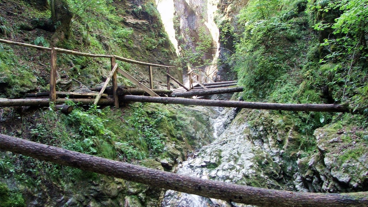
Isuica Valley - Becheci Peak (12 photos) 33 km away. Isuica (Iszulyka) Valley - Becheci (Bekecs) Peak.

Table Rock - Gurghiu Mountains (10 photos) 33 km away. Table Rock (Asztal-kő, Stanca Mesei) - Gurghiu Mountains.

Hollow Stone - Gurghiu Mountains (5 photos) 38.6 km away. Hollow Stone (Likas Stone) - Gurghiu Mountains.

Ruins of the Harom fortress - Jigodin Bath (10 photos) 43.6 km away. The Harom Fortress was built around the beginning of the 12th century and was part of the system of fortifications that protected Transylvania from the east. It is located south of Miercurea Ciuc, east of Harom Peak, which has an altitude of 1079 m, near the southwestern limits of Jigodin Bath (Baile Jigodin).

Cavities in Tipia of Ormenis - Persani Mountains (24 photos) 44.3 km away. Cavities in Tipia of Ormenis - Persani Mountains (Muntii Persani).

Thieves Cave - Persani Mountains (20 photos) 47.2 km away. The Thieves' Cave at Apata is located in the valley of the Tepeu creek, renowned for its outcrop of red clayey limestone, which is very rich in ammonites. A tributary of the stream is formed by the waters of a spring fed by the watercourse coming from the cave's gallery.

Sugo Cave - Giurgeu Mountains (60 photos) 47.9 km away. The Sugó Cave is located at the western foot of Sipos Stone (1566 m) at an altitude of 1064 m above sea level. It consists of a system of passages with four levels, totaling 1021 m in length and a level difference of -60 m.


The Old Women of Gurghiu stone mushrooms, Batrana Peak (16 photos) 53 km away. The Old Women of Gurghiu (Babele Gurghiului) stone mushrooms, Batrana Peak (Varful Batrana). In the Gurghiu Mountains, 10 km from Toplita, near the peak Batrana, there are several groups of strange rocks.

Watchstone and the Lonely Stone in March (18 photos) 57 km away. Watchstone (Stanca La Panda) and the Lonely Stone (Piatra Singuratica) in March.

Lonely Stone - Hasmas Mountains (9 photos) 57 km away. Lonely Stone (Piatra Singuratica) - Hasmas Mountains.

Brother Mountain - Hasmas Mountains (15 photos) 57.1 km away. Brother Mountain (Fratele, Ecem, Ecsém) - Hasmas Mountains.

Brother Mountain - Hasmas Mountains (11 photos) 57.3 km away. Brother Mountain (Ecsém-tető, Muntele Fratele, Muntele Ecem) - Hasmas Mountains.


[ Top ↑ ]
Videos of nearby places

The Heart of Jesus look-out - Lupeni 2.7 km away. Through the mud on Gordon Mountain, above Farkaslaka (Lupeni commune, Harghita county, Transilvania), on a cloudy afternoon, at the end of February. The destination is the Heart of Jesus lookout, nicknamed as Pléhkrisztus (The Tin Christ).

Iron path - Harghita-Madaras 27.3 km away. Amateur filming in Harghita-Madaras, holding the camera by hand in the car, and helmet-mounted on the via ferrata. I climbed an iron path for the first time in my life on the Nyerges cliffs (Stancile Seii), I didn't have the right equipment yet.

Iron path in winter - Harghita Madaras 27.3 km away. This is already the sixth time I've climbed the via ferrata route set up on the rocky cliffs of Seii Peak near Harghita Madaras. Although the forecast suggests that the weather should be nice, I am greeted by a sky covered in clouds.

Jumping waterfall - Harghita Mountains 29.7 km away. Jumping waterfall (Cascada Saritoarea, Szökő) - Harghita Mountains.

TV-radio amplifying station - Harghita Ciceu 30.4 km away. The hiking trail marked with a blue stripe starts at the Uz Bence shelter and runs from Harghita-Bai to Harghita Madaras. Our destination today is the Harghita Ciceu plateau.
Other places
Devils Mill Gorge Campulung Moldovenesc 125.2 km away. The Devil's Mill Gorge is relatively short, measuring only 60 to 70 meters in length. It was formed in yellowish-gray-white dolomite by the work of a stream that crosses the gorge, as a result of erosion and the dissolution characteristic of limestone.

Stan Valley Canyon 122.7 km away. The Stan Valley is located near Lake Vidraru, southwest of it, in the Fruntii Mountains. Those who have visited the Seven Ladders Waterfall will appreciate this canyon, outfitted with infrastructure for tourist accessibility.

Belogradchik fortress 366.2 km away. Belogradchik is located in the northwestern part of Bulgaria, in the Vidin Province, at the foot of the Balkan Mountains, near the Serbian border. Its name means little white town.

Winds iron path Baia de Fier 174.6 km away. The Wind's iron path (Via ferrata Vanturilor, D) is the via ferrata route number 11 in the Baia de Fier - Polovragi area. The sign at the base of the route was installed on February 9, 2020.

Crystal Cave at Farcu Mine 219.5 km away. In the Padurea Craiului Mountains, near Rosia, in the Farcu bauxite mine, in 1987, the miners accidentally discovered a cave. It was filled with crystal-shaped limestone formations.
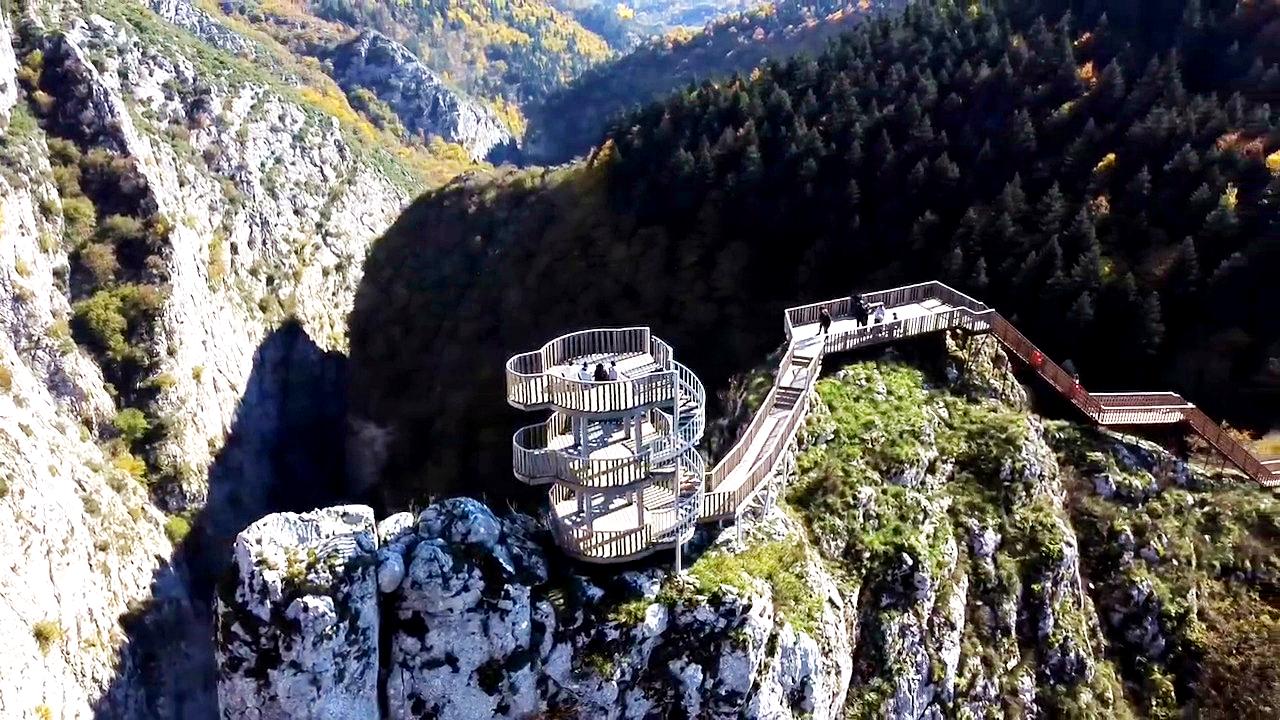
Valla Canyon Observation Deck Küre Mountains National Park Situated within Küre Mountains National Park, the Valla canyon is one of the deepest in Turkey, with a depth of 800 meters. The 12 kilometer long canyon was formed by the Devrekani Stream, which cuts through the Küre Mountains.
Roman bridge Nenkovo Along the Borovitsa River, near the village of Nenkovo, there is a Roman Bridge. It connects the two banks of the Borovitsa River.
[ Top ↑ ]
Copyright © 2003-2026 Trekkingklub and friends. Reproduction of any text, picture or video from this website, either in printed or electronic form, is prohibited without prior written permission. Website made with love  in Miercurea Ciuc.