Aninei Mountains - Photos and videos
Videos and photos. Which places are worth visiting and what is nearby?
Select language: Hu - Ro - De - Fr - It - Es
Recent photos


Beusnita waterfall (8 photos)
Cascada Beusnita, located in the Caras-Severin county, is one of the most impressive waterfalls in the Anina Mountains. The water falling from a height of approximately 15 m, into a clearing in the middle of the forest, creates a uniquely picturesque landscape.


Other videos
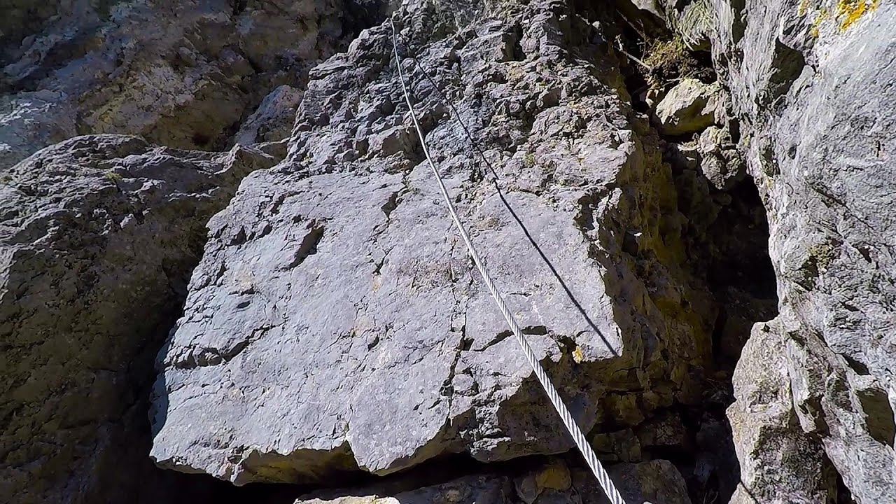
The Bear's Jump iron path Baia de Fier
The Bear's Jump (Saritoarea Ursului) is a fantasy-named via ferrata that opened in May 2018 near Baia de Fier, alongside the Middle Belt (Spirala Medie). Both routes begin from the G zone of the rock face that conceals the Women's Cave (Pestera Muierilor).
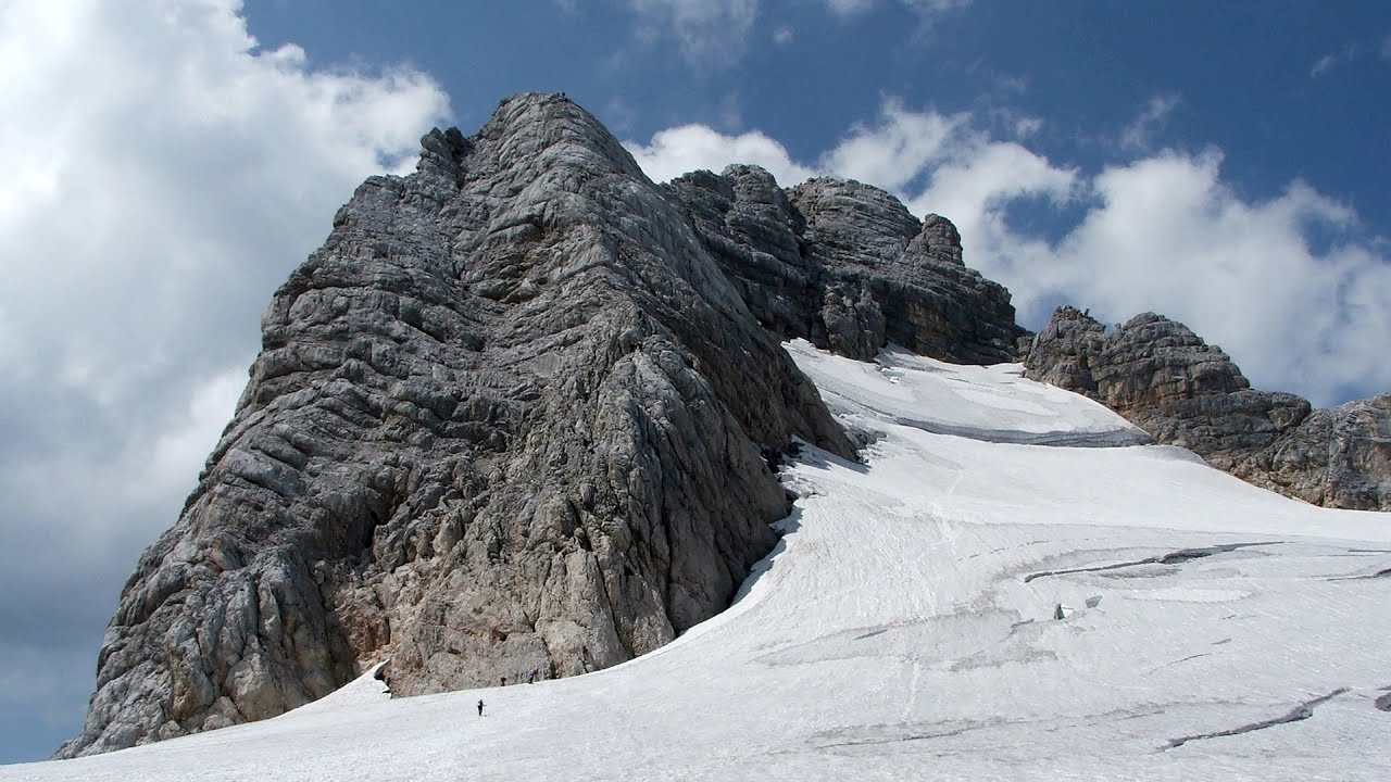
Schulter Anstieg klettersteig Hoher Dachstein
Two routes lead to the top of the Hoher Dachstein. The Randkluft is shorter, but can only be reached through a glacier with cracks.
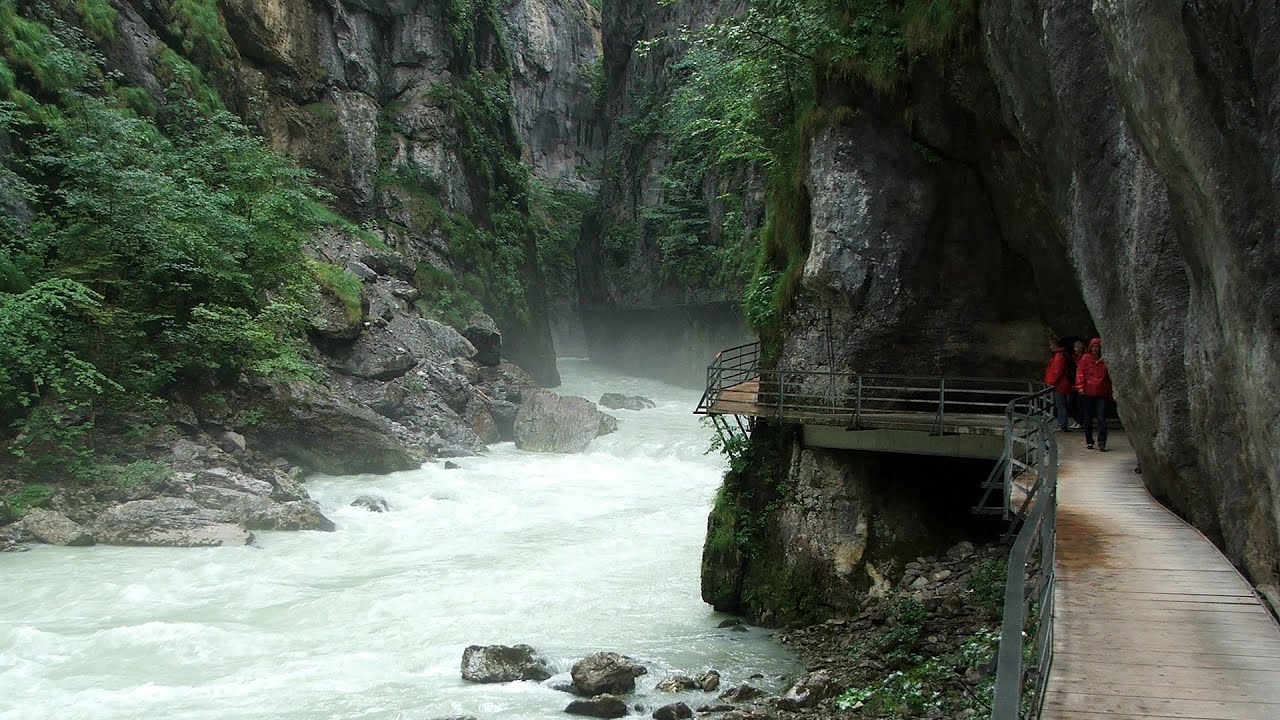
Aareschlucht Meiringen-Innertkirchen, Switzerland
The Aareschlucht is a 1400-meter long, 200-meter deep gorge of the Aare river, near Innertkirchen, Switzerland. It has two entrances, one from Meiringen in the west, and one from Innertkirchen in the east, which lead into the narrow, but stunning gorge.

Via ferrata Bear Cave adventure and climbing zone Borsec
The Bear Cave in Borsec is a vast natural formation, scattered with rocks and deep crevices. Access to the cave's cavities is through a series of narrow formations resembling canyons, surrounded by giant fir trees and rocks with interesting shapes.
Loreley and Pink Panther iron path Baia de Fier
The Loreley via ferrata (graded B/C, with an elevation difference of approximately 100 m and a length of about 100 m) is located on the rock wall on the opposite side of the road. A branch from its upper section leads to the Pink Panther (Pantera Roz, graded A/B/C, approximately 200 meters long, with an elevation difference of about 50 meters).
[ Top ↑ ]
Copyright © 2003-2025 Trekkingklub and friends. Already published 8804 photos and 139 videos. Reproduction of any text, picture or video from this website, either in printed or electronic form, is prohibited without prior written permission. Website made in Miercurea Ciuc  .
.