Iron chain ladder route - Drakensberg | Video
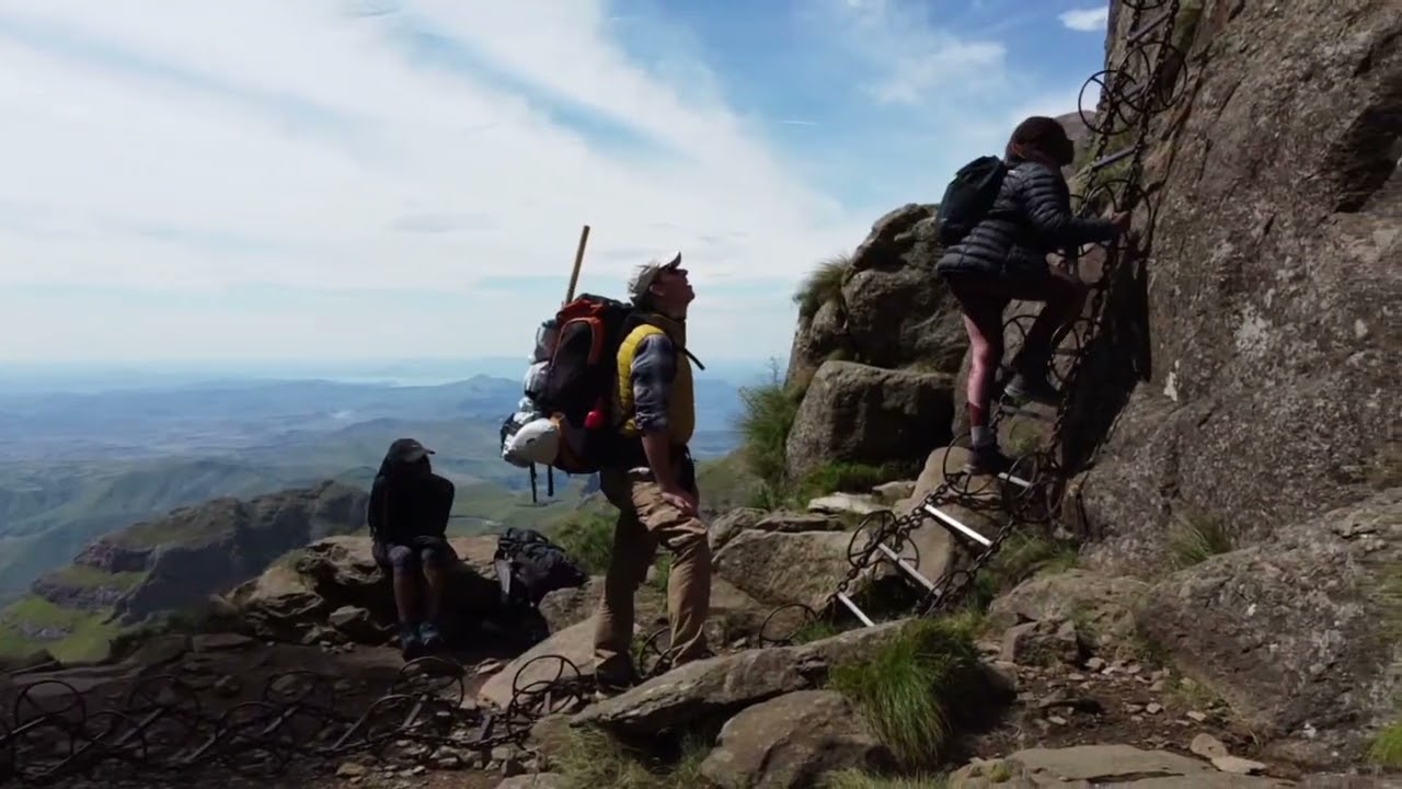
Iron chain ladder route - Drakensberg (Dragon's Mountains), KwaZulu-Natal.
Login (register) for the full descriptions, and access to the photos and videos.
Airport nearby Harrismith Airport (HRS - Harrismith, Za), 61 km away from Iron chain ladder route - Drakensberg.
Photos of nearby places

Canyon of Waterfalls eco-trail - Smolyan (8 photos) The Soskovcheto Reserve was established in 1968 and covers an area of 177 hectares. It is situated in the Perelishko-Prespanski region of the Rhodope Mountains.


The Old Pier - Rezovo (16 photos) The Old Pier (Stariat_Kei) is a historic structure that has served as a point for fishing and transportation. Today, it is a destination for visitors seeking tranquility, beautiful natural surroundings, and picturesque sea views.

Rezovo, Bulgarias Southeasternmost Coastal Village (14 photos) Located in southeastern Bulgaria on the Bulgaria-Turkey border, Rezovo is a picturesque seaside village and resort at the southernmost tip of the Bulgarian Black Sea Coast. It is notable for its position overlooking the Turkish bank of the Rezovo River.

The rocky coast of the Black Sea - Rezovo (23 photos) The coast of Rezovo village, which includes the Smooth Rocks (Gladkite Skali) and the Old Pier (Stariat Kei), is one of the most stunning rocky coastlines along Bulgaria's Black Sea coast.

Smooth Cliffs - Rezovo (12 photos) Smooth Cliffs (Smooth Rocks, Gladkite Skali) - Rezovo. Uniquely polished and smooth, these rocks near Rezovo stand out among the rough, sharp-edged rock formations along Bulgaria's Black Sea coast.


Stone bathtub - Small Kastrich Beach (10 photos) Stone bathtub (Kamenna Vana) - Small Kastrich Beach (Plazh malak Kastrich).


The Rock Gate and the Red Bay - Rezovo (8 photos) The Rock Gate (Skalnata porta) and the Red Bay (Cherveniat zaliv) are located at the southeastern end of Silistar Beach. Here, two massive rock formations rise from the water, forming a gate.

Silistar Beach - Rezovo (4 photos) Located 5 km south of Sinemorets, on the way to Rezovo, you'll find the turn-off to the last beach before the Turkey border. After approximately 1 km of dirt road winding through a forest, you'll arrive at a parking area.

Listi bay and wild beach - Sinemorets (15 photos) The Listi bay (Zaliv Listi) and wild beach (Plazh Listi) is located between Lipite Beach and Silistar Beach. In the past, pirates hid on these shores.

Split Cliff - Sinemorets (10 photos) The Split Cliff (Razdelenata kanara), also known as Divided Rock, is an interesting rock formation located south of Sinemorets and north of Listi Beach. There is a trail along the plateau, starting from either Listi or Lipite Beach.

Where the sea meets the rocks - Sinemorets (10 photos) Just about 300 meters away from the southern end of the Lipite beach, the sea meets the rock in a strange way. The roles are reversed, above the relatively calm water the cliff curves out in the form of fossilized waves.

Wild beach of Lipite South - Sinemorets (14 photos) Wild beach of Lipite South (Iuzhen Plazh Lipite) - Sinemorets.

Wild beach of Lipite North - Sinemorets (8 photos) Wild beach of Lipite North (Severen Plazh Lipite) - Sinemorets.


The Pharaoh and The Sphinx rock formations - Veleka Beach, Sinemorets (12 photos) The Veleka beach is located northwest of the village of Sinemorets, at the mouth of the Veleka River, which it bypasses from the west. At the southeastern end of the seaside beach, there is a cliff, which, when viewed from the west, resembles a human head profile, and from the east, resembles a pharaoh's mummy.


North Beach - Arapya beach resort (12 photos) Arapya is a coastal resort area in Burgas province, Bulgaria, located between Tsarevo and Lozenets.

[ Top ↑ ]
Videos of nearby places

Tugela Falls - Drakensberg 1.5 km away. Tugela Falls - Drakensberg (Dragon's Mountains), KwaZulu-Natal. It is very likely that Tugela Falls is the tallest recorded waterfall in the world.
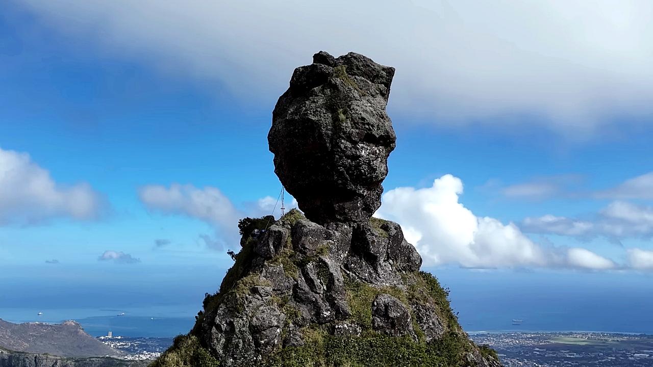
Pieter Both peak - Creve Coeur Pieter Both peak - Creve Coeur village, Pamplemousses district, Mauritius. Pieter Both stands as one of Mauritius's most recognizable landmarks.
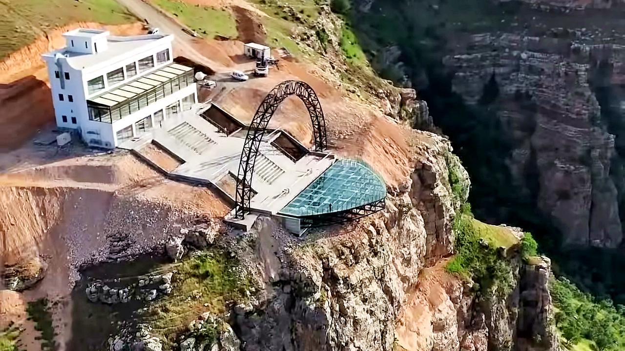
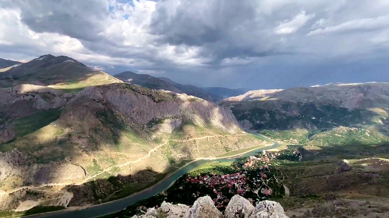
Via ferrata Egin - Kemaliye Via ferrata Egin (Gate to Eden) - Kemaliye, Erzincan. It is Turkey's first and only via ferrata route.
[ Top ↑ ]
Copyright © 2003-2026 Trekkingklub and friends. Reproduction of any text, picture or video from the Iron chain ladder route - Drakensberg website, either in printed or electronic form, is prohibited without prior written permission.
The given distances are to be understood as straight line distances, and are approximate. Website made in Miercurea Ciuc  .
.