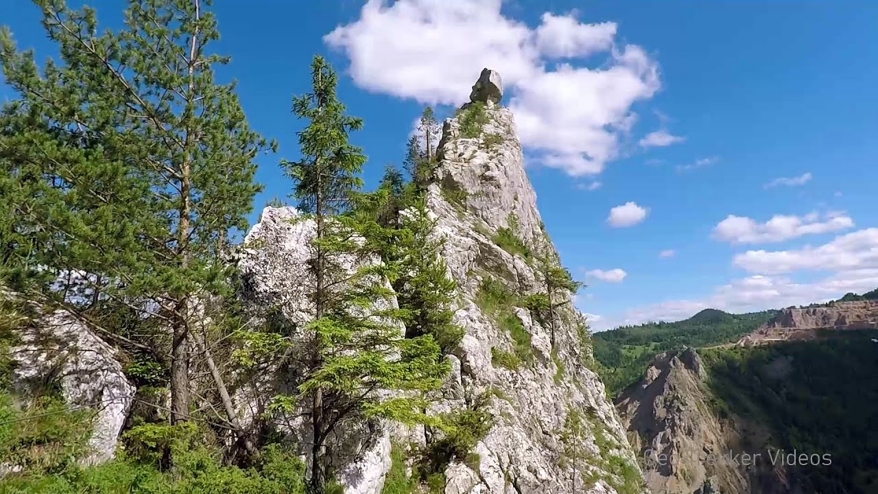
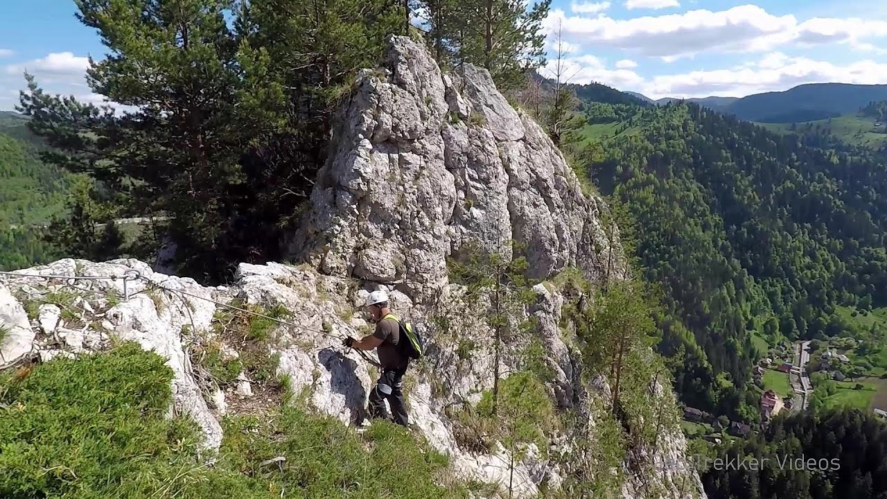
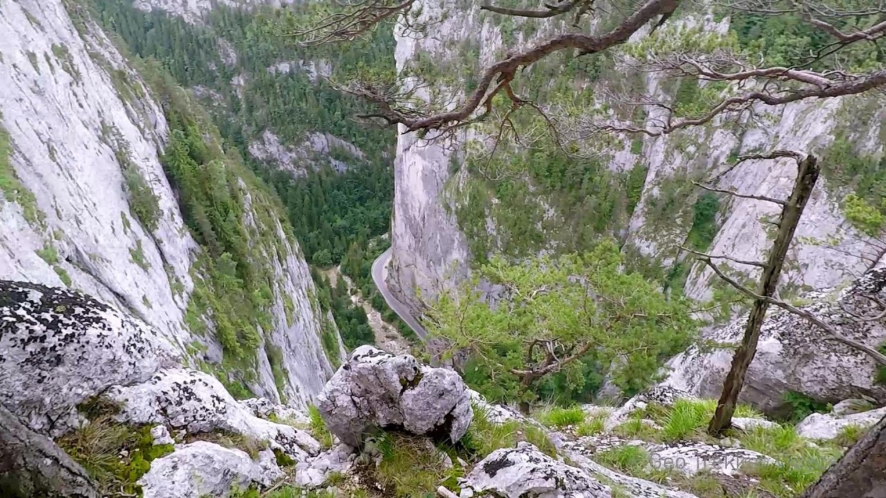
Sugau Stone lookout point and iron path (B/C), Sugau Gorge - Munticelu Nature Reserve | Video
Hiking photos and videos Login Register
Select language: - Magyar - Romana - Deutsch - Français - Italiano - Español -
Select language: - Magyar - Romana - Deutsch - Français - Italiano - Español -

Music: When We Found The Horizon by Late Night Feeler. Filmed with GoPro HERO5 Black. Copyright © 2020 - 2025 Geo Trekker Videos.
Already published 8983 photos and 180 videos. Please register for full and ad-free access.
Photos of nearby places


[ Top ↑ ]
Videos of nearby places
Sugau Rock lookout point and iron path (B/C) 0 km away
Sugau Rock lookout point and iron path (B/C). Sugau Gorges - Munticelu Nature Reserve, Hasmas Mountains.

Astragalus iron path in winter - Glod Stone, Munticelu 0.35 km away
The official website of the Sugau Gorge published information about a new via ferrata climbing route named Astragalus. Sugau Gorges - Munticelu is a nature conservation area part of Natura 2000 located in Neamt County, which borders Harghita County.
Bicajel Gorge, Bicajel Waterfall, Stone of the Gorge 2.09 km away
Bicajel Gorge (Cheile Bicajelului), Bicajel Waterfall (Cascada Bicajel), Stone of the Gorge (Surduc Stone, Piatra Surducului) - Hasmas Mountains.

Other places
Loreley and Pink Panther iron path Baia de Fier 243.08 km away
The Loreley via ferrata (graded B/C, with an elevation difference of approximately 100 m and a length of about 100 m) is located on the rock wall on the opposite side of the road. A branch from its upper section leads to the Pink Panther (Pantera Roz, graded A/B/C, approximately 200 meters long, with an elevation difference of about 50 meters).
The Loreley via ferrata (graded B/C, with an elevation difference of approximately 100 m and a length of about 100 m) is located on the rock wall on the opposite side of the road. A branch from its upper section leads to the Pink Panther (Pantera Roz, graded A/B/C, approximately 200 meters long, with an elevation difference of about 50 meters).
Sheepdogs Govora sheepfold Retezat mountains 271.94 km away
On the second day of my weekend Retezat hike, I visited a sheepfold on the Lancita Ridge. To my great disappointment, they didn't make cheese or curd here.
On the second day of my weekend Retezat hike, I visited a sheepfold on the Lancita Ridge. To my great disappointment, they didn't make cheese or curd here.
Preacher's Rock Bodoc Mountains 90.34 km away
In the Bodoc Mountains, west-southwest from the Henter peak, we find a rock formation shaped like a mushroom by erosion, called Preacher's Rock. This 2-meter high rock probably got its name from the pagan Hungarian priests, who preached here in the past.
In the Bodoc Mountains, west-southwest from the Henter peak, we find a rock formation shaped like a mushroom by erosion, called Preacher's Rock. This 2-meter high rock probably got its name from the pagan Hungarian priests, who preached here in the past.
Womens Spiral, Cave Ridge, and The Great Crack iron paths Baia de Fier 243.28 km away
Perhaps the most interesting via ferrata among the routes in the Baia de Fier area is the Womens Spiral. After completing it, I can say that it is the second most thrilling via ferrata in Romania, following the Big Via Ferrata at Rasnov.
Perhaps the most interesting via ferrata among the routes in the Baia de Fier area is the Womens Spiral. After completing it, I can say that it is the second most thrilling via ferrata in Romania, following the Big Via Ferrata at Rasnov.
The palm of God and the Heaven's door Fundatura Ponorului mountain village 250.25 km away
One of the most picturesque places in Romania, one of the most beautiful mountain villages, and a photographer's paradise. Fundatura Ponorului is located in the Ponor Stream Valley, part of the Gradistea Muncelului - Cioclovina National Park, in the Sureanu Mountains.
One of the most picturesque places in Romania, one of the most beautiful mountain villages, and a photographer's paradise. Fundatura Ponorului is located in the Ponor Stream Valley, part of the Gradistea Muncelului - Cioclovina National Park, in the Sureanu Mountains.
[ Top ↑ ]
[ Top ↑ ]
Copyright © 2003-2025 Trekkingklub and friends. Reproduction of any text, picture or video from this website, either in printed or electronic form, is prohibited without prior written permission.
The given distances are to be understood as straight line distances, and are approximate. Website made in Miercurea Ciuc  .
.