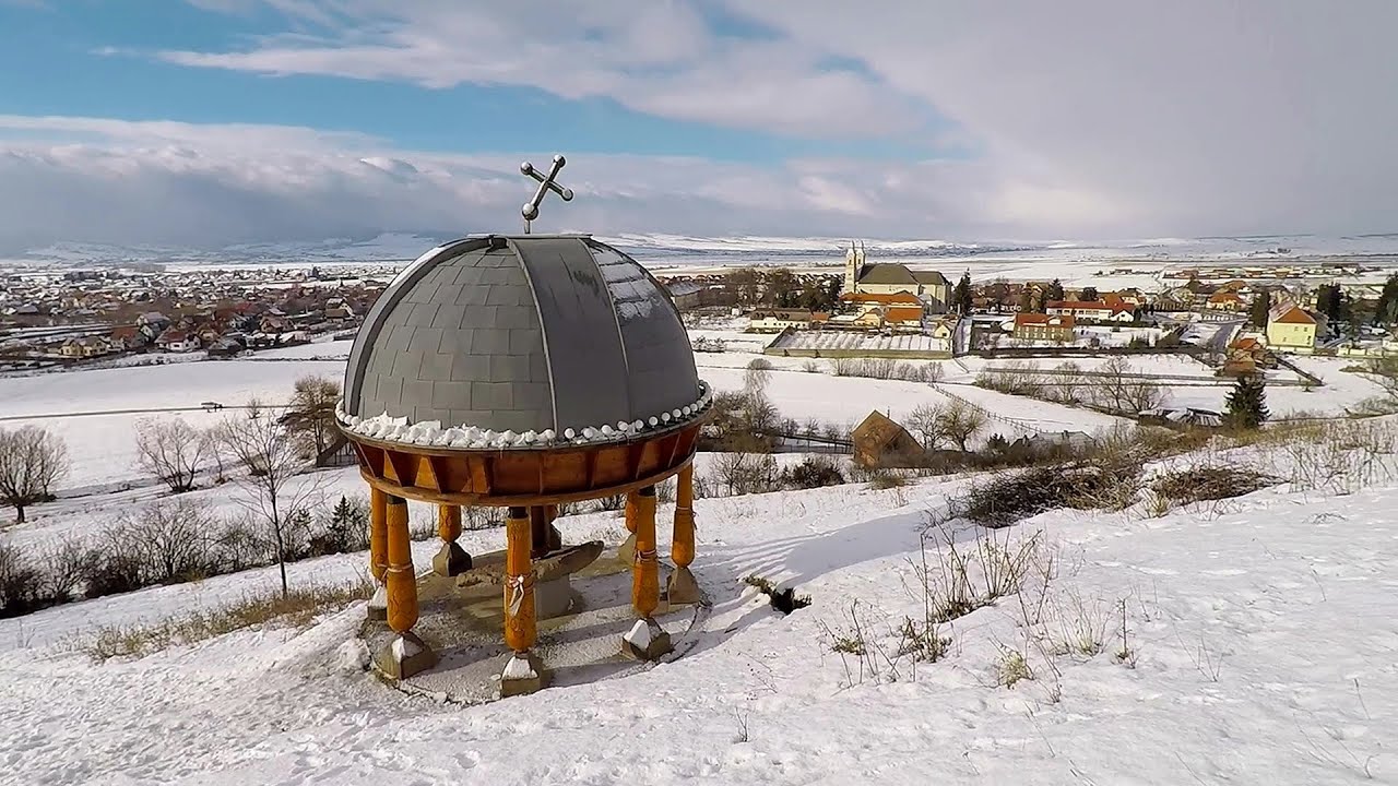
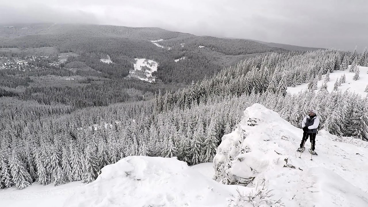
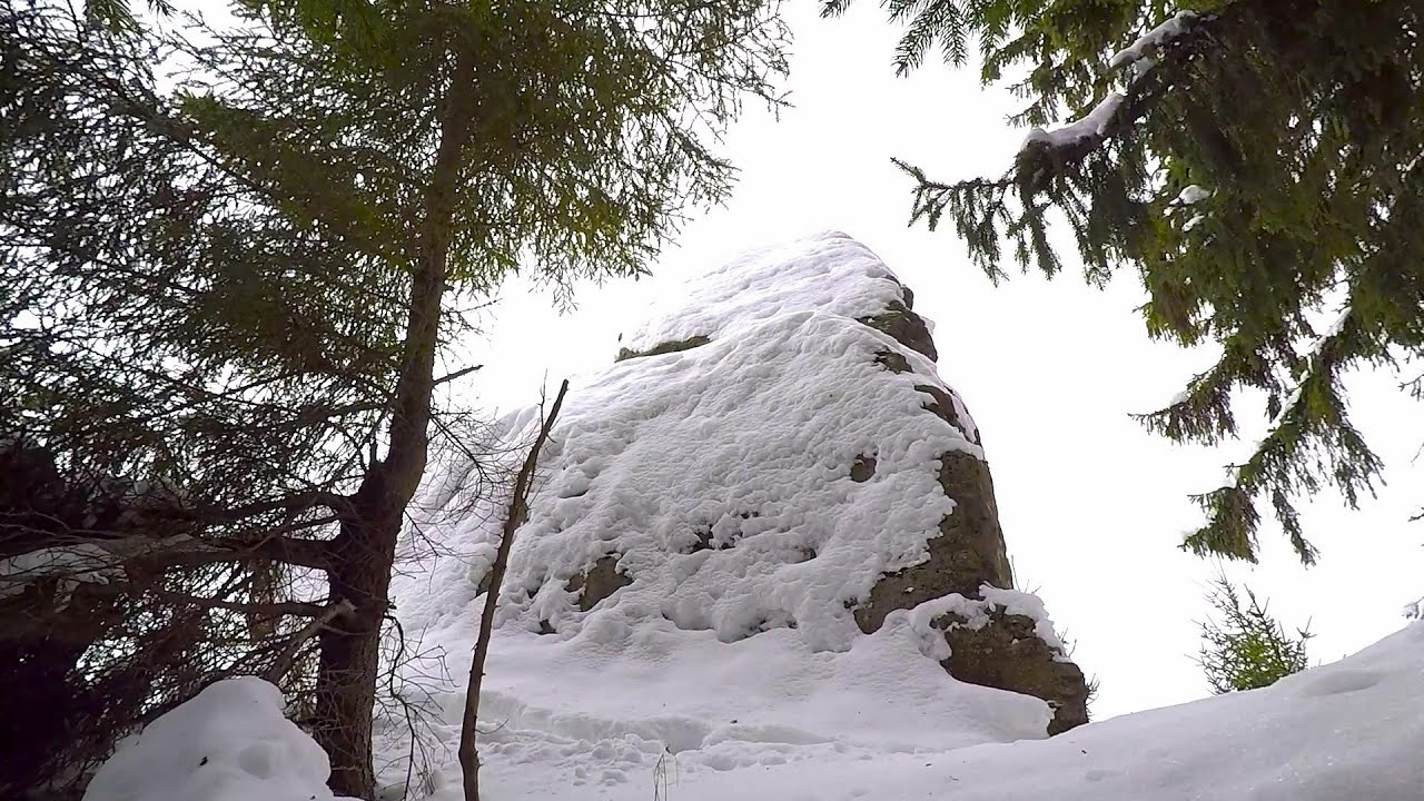
Walking to the top of Sumuleul Mare - Sumuleu Ciuc | Video


This was my first attempt at shooting a video.
Music: Warm of Mechanical Heart by Kai Engel, Attribution 4.0 International (CC BY 4.0) license. Filmed with SJCAM SJ5000 Plus. Copyright © 2015 - 2025 Geo Trekker Videos.
Already published 8983 photos and 180 videos. Please register for full and ad-free access.
Photos of nearby places

Ruins of the Harom fortress - Jigodin Bath (10 photos) 7.23 km away
The Harom Fortress was built around the beginning of the 12th century and was part of the system of fortifications that protected Transylvania from the east. It is located south of Miercurea Ciuc, east of Harom Peak, which has an altitude of 1079 m, near the southwestern limits of Jigodin Bath (Baile Jigodin).


[ Top ↑ ]
Videos of nearby places


Nobody's lake - Miercurea Ciuc 6.45 km away
The passage of time (time lapse), dusk at Nobody's Lake. Miercurea Ciuc and the Sumuleu mountain can be seen in the background.
Other places
Doabra Stones Brezoi, Lotru Mountains 167.36 km away
The DN7A road branches off west from the Olt Valley, from the main road between Sibiu and Ramnicu Valcea, leading towards Voineasa and Lake Vidra. The first settlement is a small town, Brezoi, which is located at the confluence of the Lotru and Olt rivers.
The DN7A road branches off west from the Olt Valley, from the main road between Sibiu and Ramnicu Valcea, leading towards Voineasa and Lake Vidra. The first settlement is a small town, Brezoi, which is located at the confluence of the Lotru and Olt rivers.
Tureni Gorge iron path (Via ferrata Cheile Tureni) 165.36 km away
Tureni Gorge iron path visiting route (Via ferrata Cheile Tureni), Trascau Mountains.
Tureni Gorge iron path visiting route (Via ferrata Cheile Tureni), Trascau Mountains.
Snow-covered valley of Balea and the Transfagarasan in winter The ascent 125.44 km away
The Fagarasi Mountains can be easily approached from the north, mainly by using the Transfagarasan Road. This high altitude mountain road is only accessible during the summer months (throughout its entire length), but from the Balea Waterfall station (Statia Balea Cascada) you can also reach the Balea Lake by cable car.
The Fagarasi Mountains can be easily approached from the north, mainly by using the Transfagarasan Road. This high altitude mountain road is only accessible during the summer months (throughout its entire length), but from the Balea Waterfall station (Statia Balea Cascada) you can also reach the Balea Lake by cable car.
Pricske peak Giurgeu Mountains 50.46 km away
If we want to reach Pricske (Prisca) peak, which rises above Gheorgheni and Lazarea, we start from the valley of the Güdüc (Ghidut) stream. Our path leads us past the ruins of a building known as the White House.
If we want to reach Pricske (Prisca) peak, which rises above Gheorgheni and Lazarea, we start from the valley of the Güdüc (Ghidut) stream. Our path leads us past the ruins of a building known as the White House.
Meziad cave Padurea Craiului Mountains 260.8 km away
The Meziad Cave is located near the village of Meziad, 22 km north of Beius, in the Padurea Craiului Mountains. It is one of our first tourist caves, its exploration is associated with the name of Gyula Czárán, cave researcher and writer.
The Meziad Cave is located near the village of Meziad, 22 km north of Beius, in the Padurea Craiului Mountains. It is one of our first tourist caves, its exploration is associated with the name of Gyula Czárán, cave researcher and writer.
[ Top ↑ ]
[ Top ↑ ]
Select language: - Magyar - Romana - Copyright © 2003-2025 Trekkingklub and friends. Reproduction of any text, picture or video from this website, either in printed or electronic form, is prohibited without prior written permission. The given distances are to be understood as straight line distances, and are approximate. Website made in Miercurea Ciuc