Varghis Gorge in winter | Photos


Page no. 1, photos: 1-10, 12 photos in total. >>>

Copyright © 2008 - 2025 Trekkingklub.com.
Already published 8983 photos and 180 videos. Please register for full and ad-free access.
Photos of nearby places


[ Top ↑ ]
Videos of nearby places

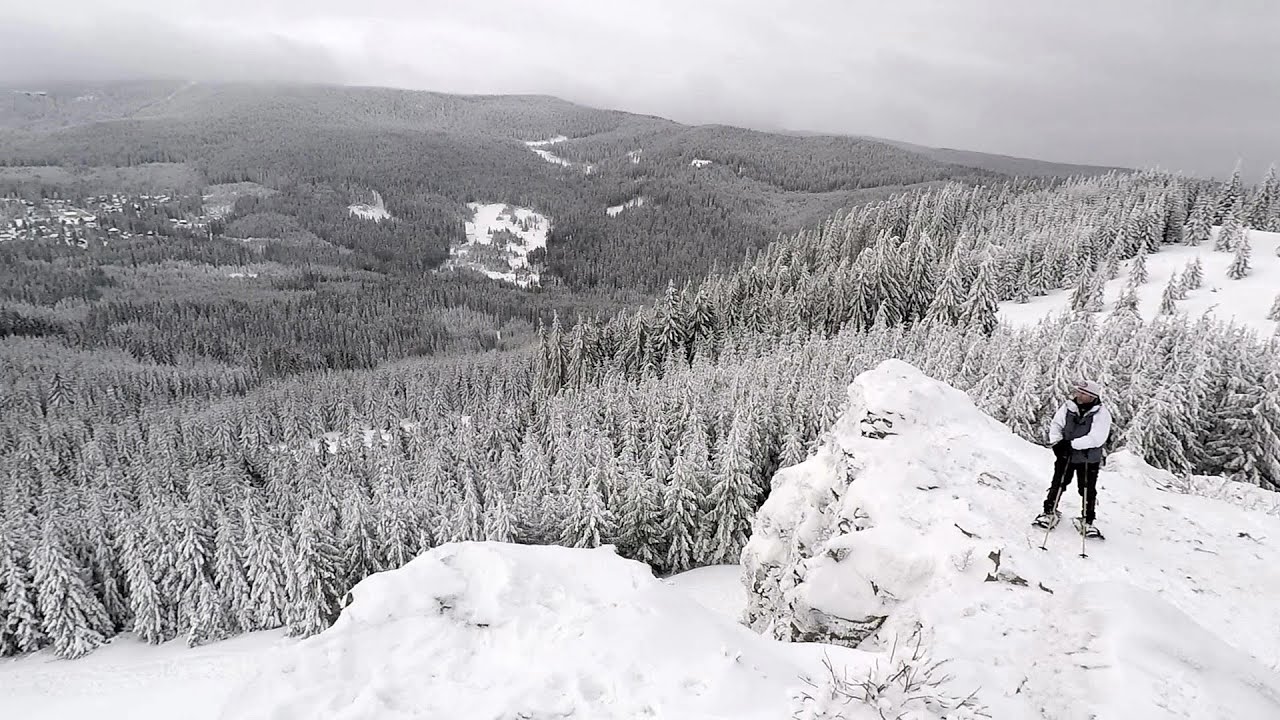
Varghis gorges in winter 0.12 km away
I went out to admire the ice stalagmites (standing icicles) in the Varghis Gorge. Anyone arriving here at the end of winter can observe meter-high ice stalagmites in the entrance area of Meresti Cave (now known as Orban Balazs Cave).

TV-radio amplifying station - Harghita Ciceu 20.55 km away
The hiking trail marked with a blue stripe starts at the Uz Bence shelter and runs from Harghita-Bai to Harghita Madaras. Our destination today is the Harghita Ciceu plateau.

Nobody's lake - Miercurea Ciuc 22.32 km away
The passage of time (time lapse), dusk at Nobody's Lake. Miercurea Ciuc and the Sumuleu mountain can be seen in the background.

Other places
Via Ferrata Fairy Castle (Castelul Zanelor, Casa Zmeului, The House of the Dragon) Vadu Crisului 246.22 km away
South of Vadu Crisului, in the Padurea Craiului Mountains, lies the Vadu Crisului Gorge, a section of the Crisul Repede river that narrows between rocky walls. In the Middle Ages, there was intense log transportation activity here, and the transport of salt and timber to Hungary passed through this area.
South of Vadu Crisului, in the Padurea Craiului Mountains, lies the Vadu Crisului Gorge, a section of the Crisul Repede river that narrows between rocky walls. In the Middle Ages, there was intense log transportation activity here, and the transport of salt and timber to Hungary passed through this area.
Loreley and Pink Panther iron path Baia de Fier 179.7 km away
The Loreley via ferrata (graded B/C, with an elevation difference of approximately 100 m and a length of about 100 m) is located on the rock wall on the opposite side of the road. A branch from its upper section leads to the Pink Panther (Pantera Roz, graded A/B/C, approximately 200 meters long, with an elevation difference of about 50 meters).
The Loreley via ferrata (graded B/C, with an elevation difference of approximately 100 m and a length of about 100 m) is located on the rock wall on the opposite side of the road. A branch from its upper section leads to the Pink Panther (Pantera Roz, graded A/B/C, approximately 200 meters long, with an elevation difference of about 50 meters).
The Bear's Jump iron path Baia de Fier 179.93 km away
The Bear's Jump (Saritoarea Ursului) is a fantasy-named via ferrata that opened in May 2018 near Baia de Fier, alongside the Middle Belt (Spirala Medie). Both routes begin from the G zone of the rock face that conceals the Women's Cave (Pestera Muierilor).
The Bear's Jump (Saritoarea Ursului) is a fantasy-named via ferrata that opened in May 2018 near Baia de Fier, alongside the Middle Belt (Spirala Medie). Both routes begin from the G zone of the rock face that conceals the Women's Cave (Pestera Muierilor).
Crivadia Gorge 199.59 km away
The Crivadia Gorge is located next to the village of Crivadia, which belongs to Banita. Access is difficult, and the hike is made through the streambed, with water up to the waist at its narrowest point.
The Crivadia Gorge is located next to the village of Crivadia, which belongs to Banita. Access is difficult, and the hike is made through the streambed, with water up to the waist at its narrowest point.
[ Top ↑ ]
[ Top ↑ ]
Copyright © 2003-2025 Trekkingklub and friends. Reproduction of any text, picture or video from this website, either in printed or electronic form, is prohibited without prior written permission.
The given distances are to be understood as straight line distances, and are approximate. Website made in Miercurea Ciuc  .
.