Piatra Mare peak - Piatra Mare Mountains | Photos


Page no. 1, photos: 1-6, 18 photos in total. >>>

Copyright © 2005 - 2026 Trekkingklub.com. Please register for full and ad-free access.
Airport nearby: Ghimbav International Airport (GHV - Brașov (Ghimbav), Ro), 19 km away.
Photos of nearby places


Piatra Mare peak and surroundings (24 photos) 1 km away. Piatra Mare hut - Piatra Mare peak - Stone Mushrooms - Stone Barn.


Seven Ladder Waterfall - Piatra Mare Mountains (12 photos) 1.9 km away. The Seven Ladders are located in the middle-western part of the Piatra Mare Mountains, at an average altitude of 980 m, not far away from Valea Timisului (Dambu Morii), on the Seven Ladders River, the left-side affluent of Sipoaia creek. These are the greatest and the most spectacular gorges of the whole Piatra Mare Mountains.


[ Top ↑ ]
Videos of nearby places

Seven Ladder Canyon and Waterfall - Piatra Mare Mountain 1.8 km away. The Seven Ladder Gorge is the largest and most spectacular gorge in the Piatra Mare massif. The narrow canyon has a length of 160 meters, and over a drop of 58 meters includes 7 bigger and several smaller waterfalls.
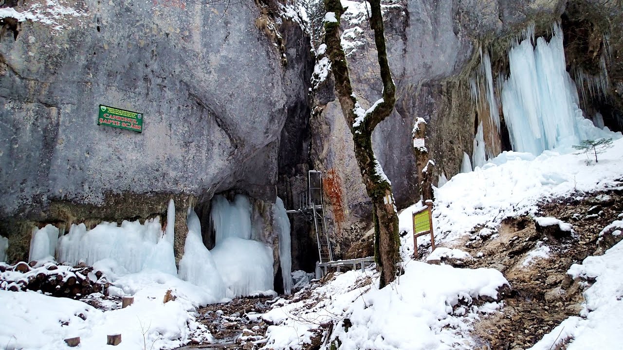
Seven Ladder Canyon in Winter - Piatra Mare Mountain 1.9 km away. Seven Ladder Canyon and Waterfall in Winter - Piatra Mare Mountain

Ski resort - Poiana Brasov - Postavarul Mountains 6.9 km away. Shining sun and an Austria-feeling on the impeccable slopes of the ski paradise Poiana Brasov above Brasov. Sunbathing, coffee and refreshing drinks on the terrace of Julius Römer chalet.

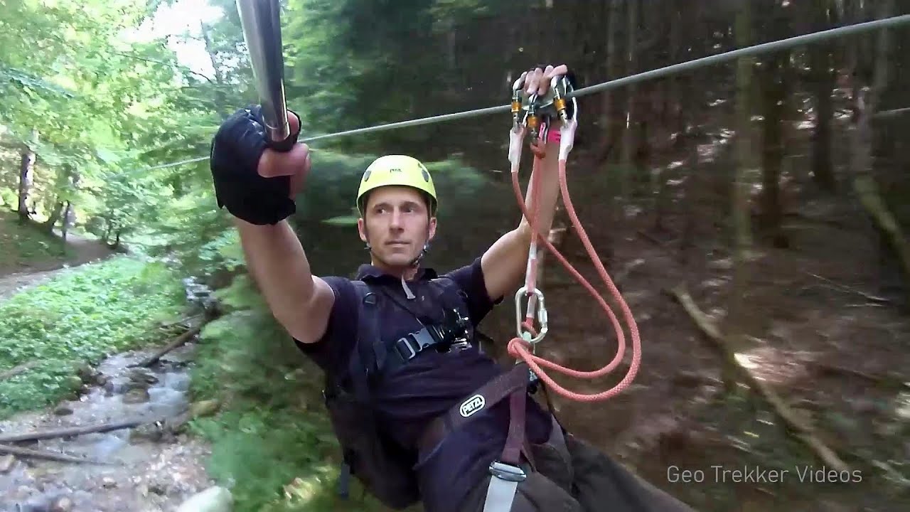
Big Via ferrata Rasnoavei Gorge 9.4 km away. The most dangerous Eastern European iron path, and also one of the most beautiful via ferrata routes in Romania, is in the Rasnoavei Gorges, Postavaru Mountains.The route is 450 m long, with a level difference of 220 m.
Other places
The Wooden Ladders The villages of Scarisoara and Inelet, Cerna valley 249 km away. Scarisoara and Inelet are small, isolated villages located in the mountainous region of Banat. They are situated on the right bank of the Cerna River, approximately 19 km away from the Baile Herculane resort.
Crystal Cave at Farcu Mine 284.7 km away. In the Padurea Craiului Mountains, near Rosia, in the Farcu bauxite mine, in 1987, the miners accidentally discovered a cave. It was filled with crystal-shaped limestone formations.
Astragalus iron path in winter Glod Stone, Munticelu 142.8 km away. The official website of the Sugau Gorge published information about a new via ferrata climbing route named Astragalus. Sugau Gorges - Munticelu is a nature conservation area part of Natura 2000 located in Neamt County, which borders Harghita County.
Blasted Rock hanging path Cerna Valley 248.2 km away. The Blasted Rock (Piatra Puscata) hanging path is located on the geographical right bank of the Cerna River, near the confluence of the Iuta stream, approximately 20 km from Baile Herculane. In this area, the presence of limestone formations has caused the valley to become narrower.
Roman Baths Cetea, Trascau Mountains 179.1 km away. Roman Baths (Baile Romane) - Cetea, Trascau Mountains. Among the valleys of the Trascau Mountains, the Cetea Gorge best deserves the name of a crevice valley.
Saeva Dupka cave Brestnitsa 301.4 km away. The Saeva Dupka Cave is located 2 km south of the village of Brestnitsa. In its five chambers and 400 meters of passageways, you can see the most beautiful cave formations in Bulgaria.
Suspension bridge Aries river, Salciua de Sus 199.7 km away.
Ladys Stones Rarau Mountains 210.9 km away. The Lady's Stones represent the heart, the mind, and the soul. The first two only help to understand the world when one possesses knowledge (they can be climbed with rock climbing gear), as emotions and thoughts (the two rock towers) obscure reality (the view).
Amazing Bridges Zabardo 423.5 km away. The Amazing Bridges (Chudni Mostove, Wonderful Bridges) are natural stone bridges. They are located in the Rhodope Mountains, in the Smolyan Province of Bulgaria, within the valley of the Erkyupriya River, at an altitude of 1,450 meters above sea level.
Devils Mill Gorge Campulung Moldovenesc 214 km away. The Devil's Mill Gorge is relatively short, measuring only 60 to 70 meters in length. It was formed in yellowish-gray-white dolomite by the work of a stream that crosses the gorge, as a result of erosion and the dissolution characteristic of limestone.
Ski Gyimes ski slope Lunca de Sus 110.6 km away. The Ski Gyimes ski slope is located in Lunca de Sus, right next to the main road. It is 800 m long, the level difference is 160 m.
Waterfalls of Lapos creek Bicaz Gorge 140.9 km away. One of the lesser-known attractions of the Bicaz Gorges is the series of waterfalls along Lapos Creek. This creek flows between Cupas Stone and Bardos Stone before eventually merging with Bicaz Creek, forming spectacular waterfalls beneath the Altar Stone.
The Trovants Museum in Winter Costesti 131 km away.
Pisoaia waterfall Vidra 231.7 km away. Pisoaia waterfall (Pisoaia Vidrii, Urine of the otter) - Nemesi, Vidra.
With snowshoes in the Tihu creek valley Rastolita 176.4 km away. We met geotrekking treasure hunters from Gheorgheni, Miercurea Ciuc and Targu Mures in Rastolita. We entered the Calimani Mountains with an off-road vehicle, along the Rastolita and Tihu streams.
[ Top ↑ ]
Copyright © 2003-2026 Trekkingklub and friends. Reproduction of any text, picture or video from this website, either in printed or electronic form, is prohibited without prior written permission.
The given distances are to be understood as straight line distances, and are approximate. Website made in Miercurea Ciuc  .
.