Tourist attractions near Bocsig (Bocsig, Arad county, Romania)
Photos of nearby places


Kings Cave - Padurea Craiului Mountains (48 photos) 60.5 km away. Craiului (Kings) Cave - Padurea Craiului Mountains.


Sohodol pit cave - Padurea Craiului Mountains (10 photos) 62.9 km away. Sohodol pit cave (Avenul Sohodol) - Padurea Craiului Mountains.

Fern Cave - Padurea Craiului Mountains (9 photos) 63.2 km away. Ferigi (Fern) Cave - Padurea Craiului Mountains.


Valley of Hell - Padurea Craiului Mountains (23 photos) 65.7 km away. Valley of Hell (Valea Iadului) - Padurea Craiului Mountains.

Moanei Cave - Padurea Craiului Mountains (58 photos) 69.3 km away. The Moanei Cave (Pestera Moanei) is located on the upper course of the Misid River, on the right side of the Misid Gorge (Cheilor Misidului). The cave has two entrances, one fossil and sloped, while a subterranean stream flows through the active gallery.


The cave from the spring - Padurea Craiului Mountains (8 photos) 73 km away. Pestera de la Izvor (The cave from the spring) - Padurea Craiului Mountains.

Napistileu cave - Padurea Craiului (10 photos) 73.1 km away. Napistileu (Ungurul Mic) cave - Padurea Craiului Mountains.

Cave of Winds - Padurea Craiului Mountains (24 photos) 73.5 km away. The Cave of Winds (Pestera Vantului) is located in the Padurea Craiului Mountains, not far from Frantura meadow, near Suncuius, on the left geographical side of the Crisul Repede River. The Cave of Winds was discovered in 1957 by Béla Bagaméri and is currently (as of 2003) the longest cave system known in Romania as well as in the Carpathian Basin.


Oxen Waterfall - Padurea Craiului Mountains (12 photos) 74.4 km away. Oxen Waterfall (Cascada Boilor) - Padurea Craiului Mountains.

Dark Blue Bruises of the Ponor - Trascau Mountains (16 photos) 116.4 km away. The Dark Blue Bruises of the Ponor (Vanatarile Ponorului) is a polje-type protected area. Polje is a Slovenian word meaning plain, and it refers to a surface karst form.

Balcony Clearing - Trascau Mountains (6 photos) 116.8 km away. Balcony Clearing (Erkély-tisztás, Balconul Sipotelor) - Trascau Mountains.

Dark Blue Bruises of the Ponor, Bedeleu (24 photos) 116.8 km away. Dark Blue Bruises of the Ponor (Vanatarile Ponorului), Bedeleu - Trascau Mountains.

Goats Ledge - Trascau Mountains (10 photos) 117.2 km away. Goats Ledge (Brana Caprei, Kecskék párkánya) - Trascau Mountains .

Aries valley - Trascau Mountains (10 photos) 117.4 km away. Aries (Golden) valley - Trascau Mountains.

Stone of Cetea, Horse Pit - Trascau (16 photos) 119.7 km away. Stone of Cetea, Horse Pit (The pit cave from the Stone of Cetea) - Trascau Mountains.
[ Top ↑ ]
Videos of nearby places

Black Rocks iron path - Bihor Mountains 53.7 km away. Black Rocks is located in the Bihor Mountains, near the Vartop Saddle, to the west of it. It is interesting that the locals (if I understood correctly) do not know this name, but use the name Piatra Buna (meaning Good Stone) for this spectacular rock.

Meziad cave - Padurea Craiului Mountains 55.7 km away. The Meziad Cave is located near the village of Meziad, 22 km north of Beius, in the Padurea Craiului Mountains. It is one of our first tourist caves, its exploration is associated with the name of Gyula Czárán, cave researcher and writer.

Crystal Cave at Farcu Mine 57.2 km away. In the Padurea Craiului Mountains, near Rosia, in the Farcu bauxite mine, in 1987, the miners accidentally discovered a cave. It was filled with crystal-shaped limestone formations.

Pisoaia waterfall - Vidra 71.9 km away. Pisoaia waterfall (Pisoaia Vidrii, Urine of the otter) - Nemesi, Vidra.

Hodoaba Valley iron path - Suncuius 73.1 km away. The Hodoaba Valley iron path is Romania's shortest and easiest (official) via ferrata route. It is located near Suncuius, in the Padurea Craiului Mountains, on the left bank of the Crisul Repede River.
Other places
Big Cave Nochevo Kodzha in (Golyamata Peshtera, Big Cave) - Nochevo.
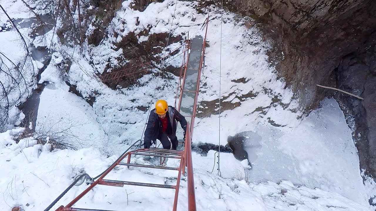
Stan Valley Canyon in winter 237 km away. The Stan Valley is a picturesque canyon, even in winter. In fact, when the stream is frozen and covered with a layer of snow, exploring the canyon becomes much quicker and easier.
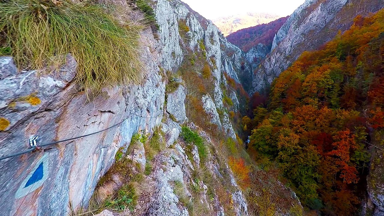
Tureni Gorge iron path 136.9 km away. Tureni Gorge iron path visiting route (Via ferrata Cheile Tureni), Trascau Mountains.
The Bears Jump iron path Baia de Fier 196.1 km away. The Bear's Jump (Saritoarea Ursului) is a fantasy-named via ferrata that opened in May 2018 near Baia de Fier, alongside the Middle Belt (Spirala Medie). Both routes begin from the G zone of the rock face that conceals the Women's Cave (Pestera Muierilor).

Shipka pass Shipka 488.2 km away. The Shipka Pass is one of the most spectacular crossings of the Balkan Mountains, and is part of the Bulgarka Nature Park. It separates the provinces of Gabrovo and Stara Zagora, and provides a connection between the cities of Gabrovo and Kazanlak.
Goats Ledge iron path Ramet Gorge 117.2 km away. Via ferrata Goats Ledge (Brana Caprei) iron path - Ramet Gorge, Trascau Mountains.

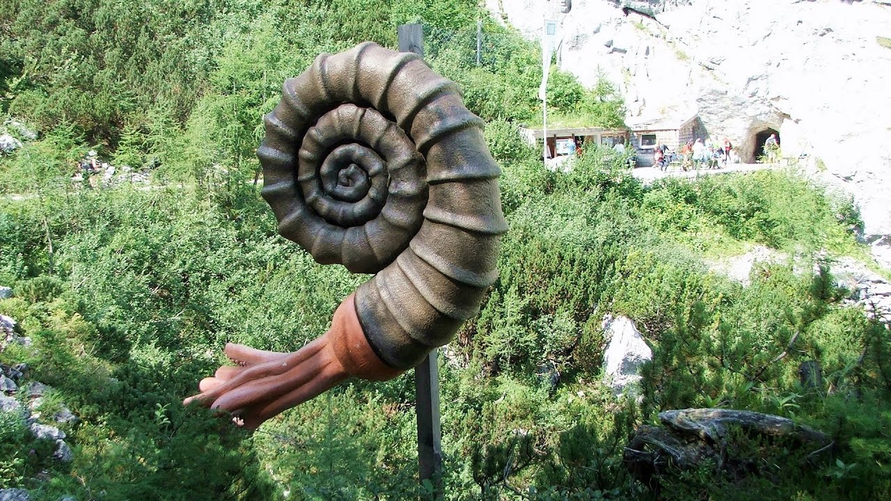
Mammoth Cave Dachstein Salzkammergut, Obertraun am Hallstättersee The first station of the Dachstein Krippenstein cable car, which starts in Obertraun, in the southern part of Lake Hallstatt, is Schönbergalm. Here you can find the Giant Ice Cave (Rieseneishöhle) and the Mammoth Cave (Mammuthöhle).
Thracian stone sharapani Nochevo Sharapani is a traditional stone container used by ancient Thracians for processing grapes in wine production. Two well-preserved sharapani containers are located about 200 meters apart.
[ Top ↑ ]
Copyright © 2003-2026 Trekkingklub and friends. Reproduction of any text, picture or video from this website, either in printed or electronic form, is prohibited without prior written permission. Website made with love  in Miercurea Ciuc.