Tourist attractions near Posoloaca (Tileagd, Bihor county, Romania)
Photos of nearby places


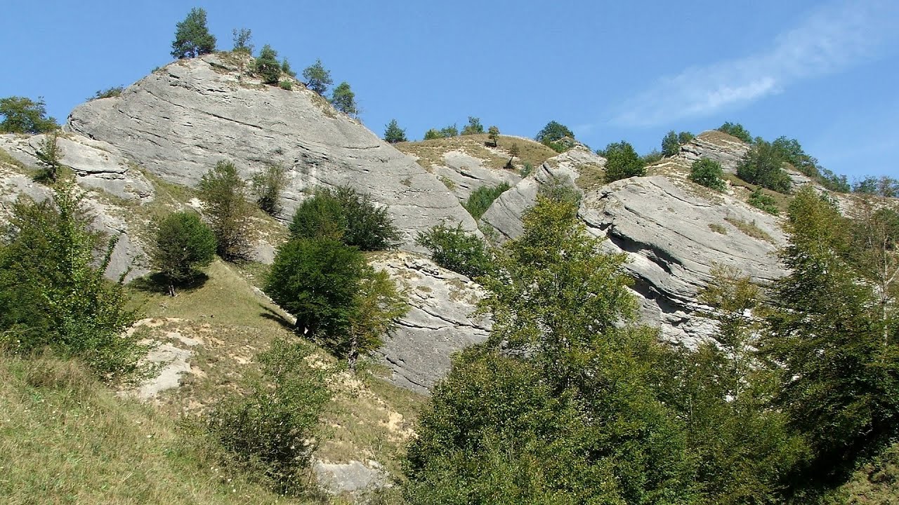
Cave of Winds - Padurea Craiului Mountains (24 photos) 26.7 km away. The Cave of Winds (Pestera Vantului) is located in the Padurea Craiului Mountains, not far from Frantura meadow, near Suncuius, on the left geographical side of the Crisul Repede River. The Cave of Winds was discovered in 1957 by Béla Bagaméri and is currently (as of 2003) the longest cave system known in Romania as well as in the Carpathian Basin.

Sohodol pit cave - Padurea Craiului Mountains (10 photos) 26.8 km away. Sohodol pit cave (Avenul Sohodol) - Padurea Craiului Mountains.


The cave from the spring - Padurea Craiului Mountains (8 photos) 27 km away. Pestera de la Izvor (The cave from the spring) - Padurea Craiului Mountains.

Napistileu cave - Padurea Craiului (10 photos) 27.1 km away. Napistileu (Ungurul Mic) cave - Padurea Craiului Mountains.

[ Top ↑ ]
Videos of nearby places

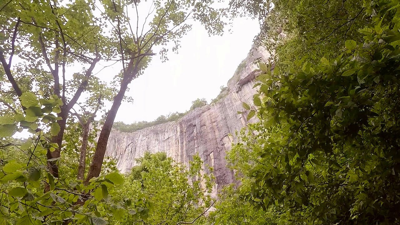
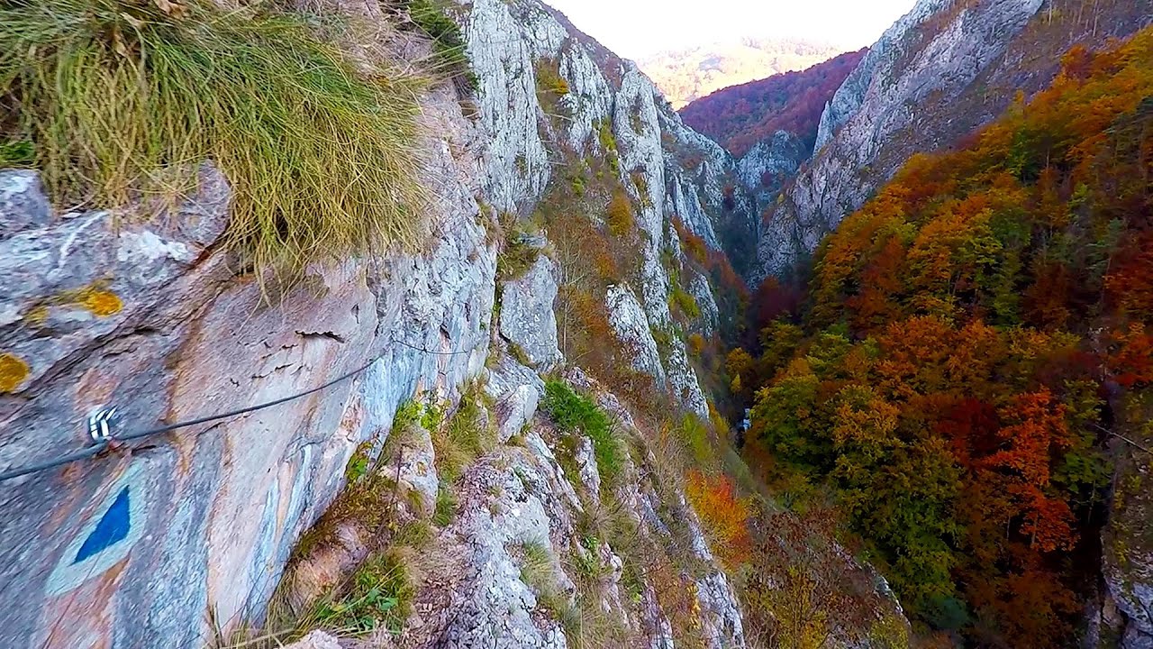
Via Ferrata Fairy Castle - Vadu Crisului 23 km away. Via Ferrata Fairy Castle (Castelul Zanelor, Casa Zmeului, The House of the Dragon) - Vadu Crisului. South of Vadu Crisului, in the Padurea Craiului Mountains, lies the Vadu Crisului Gorge, a section of the Crisul Repede river that narrows between rocky walls.

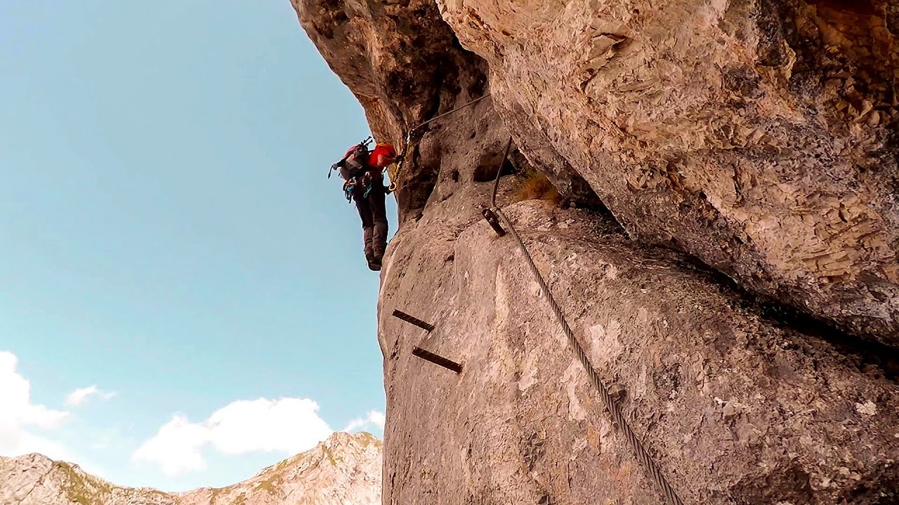
Fairy Cliff via ferrata route - Vadu Crisului 23.1 km away. Fairy Cliff (Peretele Zanelor) via ferrata route - Vadu Crisului. In Vadu Crisului, in the Padurea Craiului Mountains, on the right bank of the Crisul Repede, you can find the newest, in chronological order (2015) the fifth Transylvanian, new type of via ferrata route.

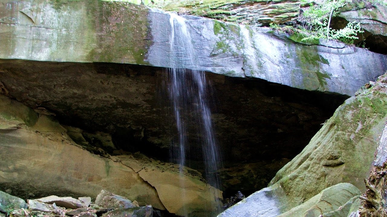
Vadu Crisului cave 23.3 km away. The Vadu Crisului Cave, with a total length of over 1000 meters, is located in the picturesque gorge of Crisul Repede creek. It consists of a gently meandering, long passage that features an active, stream level next to an upper, fossil level in its first section.


Acapulcos spur via ferrata 26.9 km away. Acapulco's spur (Pintenul lui Acapulco) via ferrata (B/C) - Montana Land, Suncuius.
Other places
Skaklya waterfall Vratsa 443.5 km away. The largest seasonal waterfall in Bulgaria plunges down from a height of 141 meters. It is located in the Vratsa Mountain National Park, just one and a half kilometers away from the city of Vratsa.

Belogradchik fortress 383.9 km away. Belogradchik is located in the northwestern part of Bulgaria, in the Vidin Province, at the foot of the Balkan Mountains, near the Serbian border. Its name means little white town.
Waterfalls of Velnita stone-quarry Targu Ocna 343.5 km away. Starting from the Velnita quarry, an adventurous nature enthusiast, accustomed to wild and rugged terrains, will discover a true waterfall paradise. At the upper part of the quarry, two streams converge.
Kaiserschild Klettersteig Eisenerzer Ramsau The 2,085-meter-high Kaiserschild peak is situated on the northern edge of the Eisenerz Alps in Styria, Austria. It forms a double summit with the slightly taller Hochkogel peak, which stands at 2,105 meters.
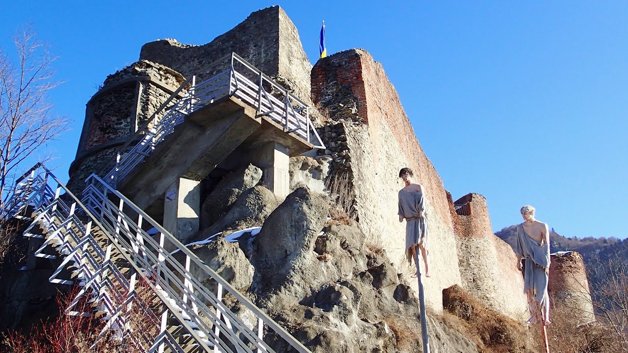
Poenari citadel Arges valley 264.6 km away. The Poenari citadel is located on the southern slope of the Fagaras Mountains, on the western side of the Transfagaras road, in the Arges Valley, about 4 km from the Vidraru Lake dam. Along a steep incline, a concrete staircase leads up to the castle, which is built atop a mountain.
Berim via ferrata Zubin Potok 480.6 km away. Difficulty level D, total length: 4 km, height difference: 520 m, year of construction: 2015. Climbing season: May 1 - October 30.
Doabra Stones Brezoi, Lotru Mountains 244.6 km away. The DN7A road branches off west from the Olt Valley, from the main road between Sibiu and Ramnicu Valcea, leading towards Voineasa and Lake Vidra. The first settlement is a small town, Brezoi, which is located at the confluence of the Lotru and Olt rivers.
Stone Beach Sinemorets Stone Beach (Kamenniat plazh) - Sinemorets.
Goats Ledge iron path Ramet Gorge 126 km away. Via ferrata Goats Ledge (Brana Caprei) iron path - Ramet Gorge, Trascau Mountains.
[ Top ↑ ]
Copyright © 2003-2026 Trekkingklub and friends. Reproduction of any text, picture or video from this website, either in printed or electronic form, is prohibited without prior written permission. Website made with love  in Miercurea Ciuc.