Skaklya waterfall - Vratsa | Video


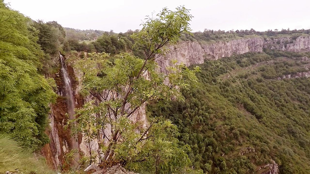
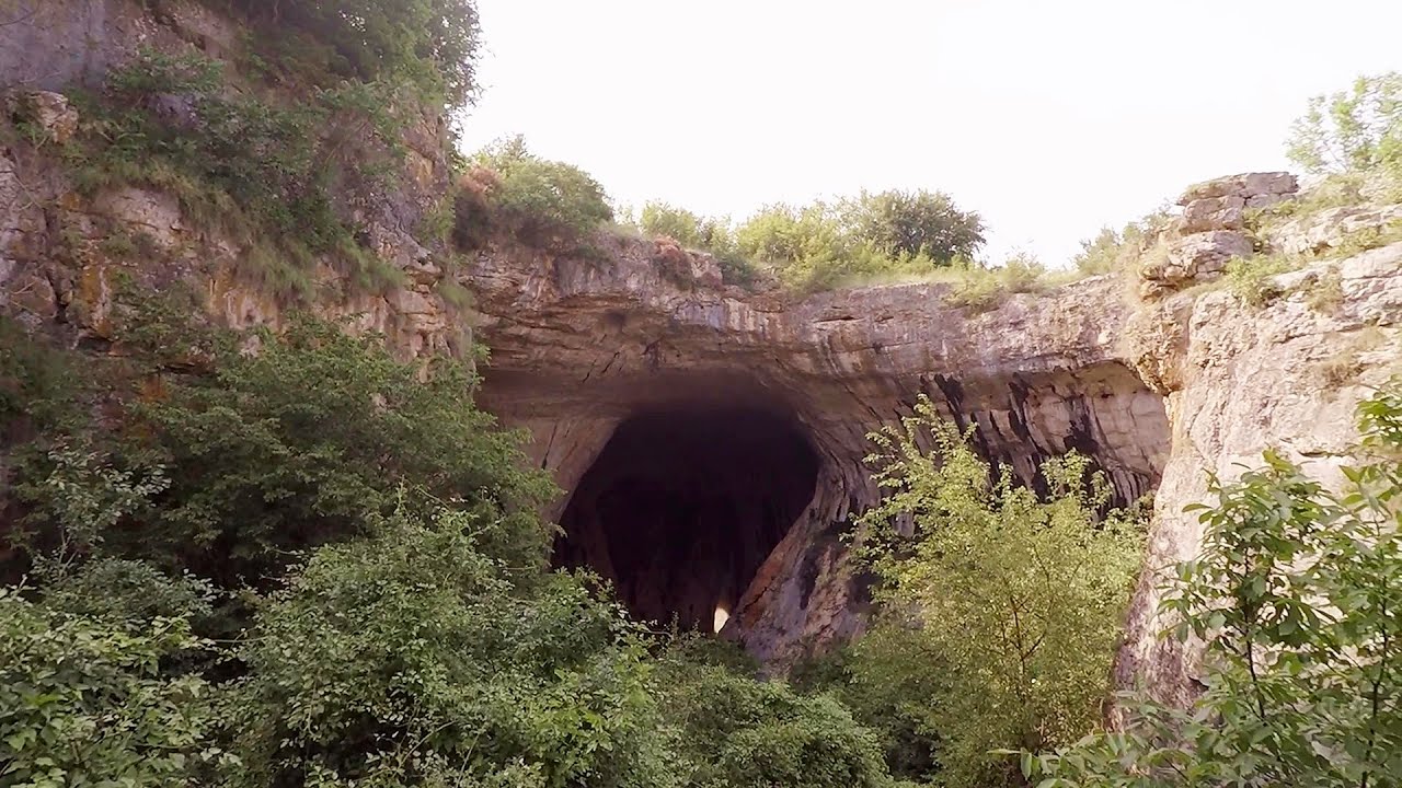
The largest seasonal waterfall in Bulgaria plunges down from a height of 141 meters. It is located in the Vratsa Mountain National Park, just one and a half kilometers away from the city of Vratsa. The waterfall can be accessed via a well-marked trail and is most stunning after snowmelt or rainfall. Climbing to the top of the waterfall offers a breathtaking view of the city.
Read more
Filmed with GoPro HERO5 Black. Music: Oecumene sleeps by Kai Engel. Copyright © 2017 - 2026 Geo Trekker Videos. Please register for full and ad-free access.
Airport nearby: Sofia Airport (SOF - Sofia, Bg), 55 km away.
Photos of nearby places


Canyon of Waterfalls eco-trail - Smolyan (8 photos) 198.6 km away. The Soskovcheto Reserve was established in 1968 and covers an area of 177 hectares. It is situated in the Perelishko-Prespanski region of the Rhodope Mountains.


[ Top ↑ ]
Videos of nearby places
Borov Kamak waterfall - Zgorigrad, Vratsa 5 km away. The Vratsa eco-trail starts from the village of Zgorigrad, located 6 km from the city of Vratsa in Bulgaria, and ends at the Parshevitza hut. It is also known as the Zgorigradska or Borov Kamak eco-trail.
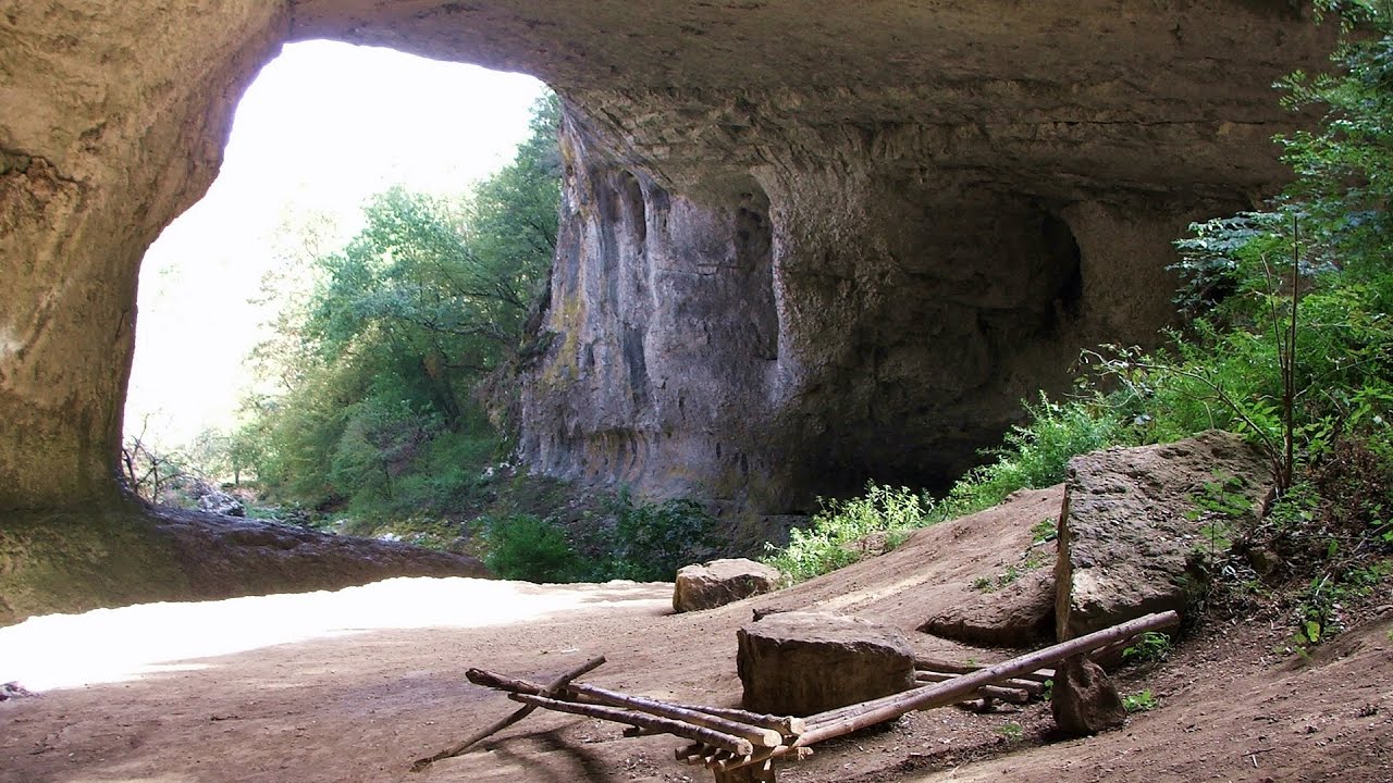
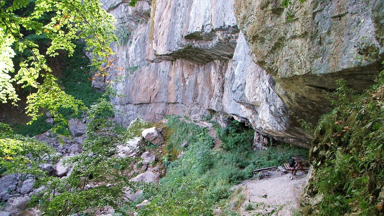
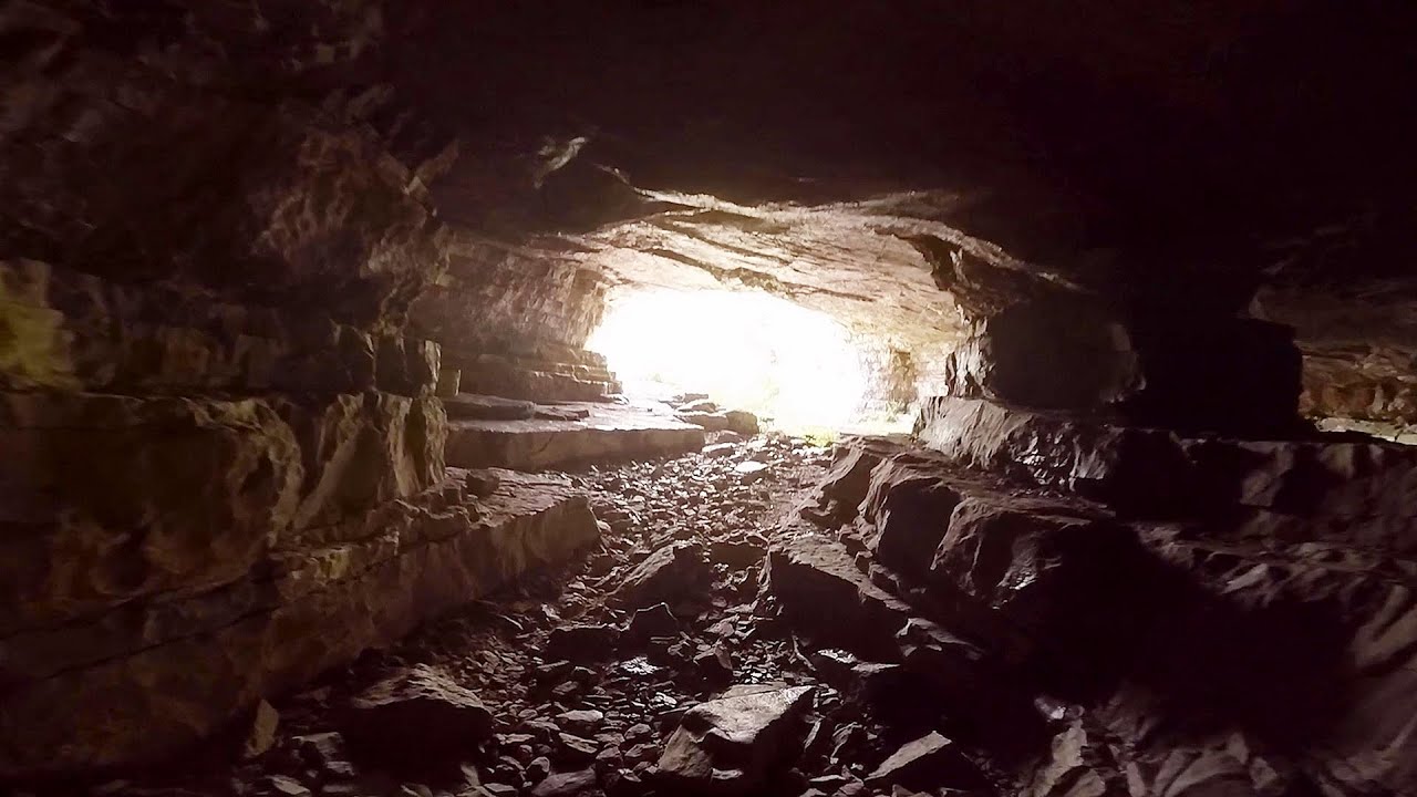
Gods bridge - Vratsa 14.8 km away. Anyone who has been to Bulgaria may be familiar with the Prohodna Cave, affectionately known as the Eyes of God; the Devetashka Cave, illuminated by seven windows in its ceiling. And perhaps they have also seen the Wonderful Bridges in the Rhodope Mountains.
Iskar gorge Lyutibrod - Temnata dupka cave Lakatnik 16.9 km away. The Iskar is the longest purely Bulgarian river, the oldest river in the Balkans, and a right tributary of the Danube. The river is 368 km long, with approximately 150 km consisting of a gorge.
Bovska Skaklya waterfall - Iskar gorge 24.1 km away. The Bovska Skaklya waterfall is located near the town of Svoge in Bulgaria. The waterfall formed on the Zaselska River has several reported heights online (120 m, 85 m).
Prohodna cave - Karlukovo 42.5 km away. The Prohodna cave nicknamed The Eyes of God is located in Bulgaria, in the Iskar Gorge, on one of the largest karst areas in Bulgaria, 2 km from the town of Karlukovo. It is essentially a 262-meter-long natural stone bridge, with a large (45 m high) and a small (35 m high) entrance.
Other places
Belintash Ridge of Dobrostan, Rhodope Mountains 188.4 km away. Belintash is a mysterious monolithic complex located approximately 50 km from Plovdiv, passing through the scenic Rhodope Mountains. It is situated southeast of the village of Vrata and west of the village of Sini Vruh.
Kossuth Rock Harghita Bath 393.1 km away. Kossuth Rock - Harghita Bath (Harghita-Bai), Harghita Mountains.
Via ferrata Mat Peja 275 km away.
Falco Peregrinus 2 via ferrata Falcons Rock, Corbu 458.9 km away. Falco Peregrinus (Peregrine falcon) 2 via ferrata (D) - Falcon's Rock, Corbu.
The Trovants Museum in Winter Costesti 221.3 km away.
Pricske peak Giurgeu Mountains 433.1 km away. If we want to reach Pricske (Prisca) peak, which rises above Gheorgheni and Lazarea, we start from the valley of the Güdüc (Ghidut) stream. Our path leads us past the ruins of a building known as the White House.
Virus and Antivirus iron paths Baia de Fier 223.9 km away. With Virus (B/C) and Antivirus (C), the number of via ferrata routes at Baia de Fier has increased to thirteen. In fact, it is a Y-shaped route that starts near the entrance of the Laura via ferrata, and the exits are located just a few meters from the Laura exit.
Roman bridge Nenkovo 211.4 km away. Along the Borovitsa River, near the village of Nenkovo, there is a Roman Bridge. It connects the two banks of the Borovitsa River.
Little Spiral via ferrata Baia de Fier 224.1 km away.
Via ferrata Marimangat Peja 277.1 km away.
Banita Gorge and Banita rock bridge 252.9 km away. They say about this place that only very few people know about it, but that's not true. In fact, most nature lovers have heard of it, seen pictures taken here, even if not everyone has been able to come here.
Oltet Gorge Capatana Mountains 225.7 km away. Oltet Gorge (Cheile Oltetului) - Capatana Mountains. That day, we had planned to ski at the Ranca resort, situated alongside the Transalpina high altitude mountain road in the Parang Mountains.
Upstream of the Izvorul Dorului creek Vanturis waterfalls 285.2 km away. Upstream of the Izvorul Dorului (Source of longing) creek - Vanturis waterfalls, Bucegi Mountains.
Fox Ears Beach Sinemorets 386.4 km away. Fox Ears Beach (Plazh Lisichi ushi) - Sinemorets.
Muierii Cave Baia de Fier 224.1 km away. We visited the Baia de Fier area, and climbed on the rock that also conceals the Women's Cave (Pestera Muierilor). Between two via ferrata routes, we also participated in one of the guided cave tours, which depart every hour.
Other destinations
Natural stone bridge Aglen 62.2 km away. Natural stone arch on the Vit river, near the village of Aglen. Crocodile shaped rock, Elephant rock.
Abandoned copper mine Tsar Asen, Pazardzhik 112 km away. The turquoise waters of this mine lake are extremely beautiful but dangerously poisonous. Do not descend to the shore or touch the water!
Lipovac via ferrata and monastery of Saint Stephen 144.8 km away. Difficulty level B, total length: 190 m, height difference: 90 m, year of construction: 2022. It is necessary to contact the PSK Brđanka club to obtain the key for the ladders at the entrance of the via ferrata.
Belintash Ridge of Dobrostan, Rhodope Mountains 188.4 km away. Belintash is a mysterious monolithic complex located approximately 50 km from Plovdiv, passing through the scenic Rhodope Mountains. It is situated southeast of the village of Vrata and west of the village of Sini Vruh.
[ Top ↑ ]
Copyright © 2003-2026 Trekkingklub and friends. Reproduction of any text, picture or video from this website, either in printed or electronic form, is prohibited without prior written permission.
The given distances are to be understood as straight line distances, and are approximate. Website made in Miercurea Ciuc  .
.