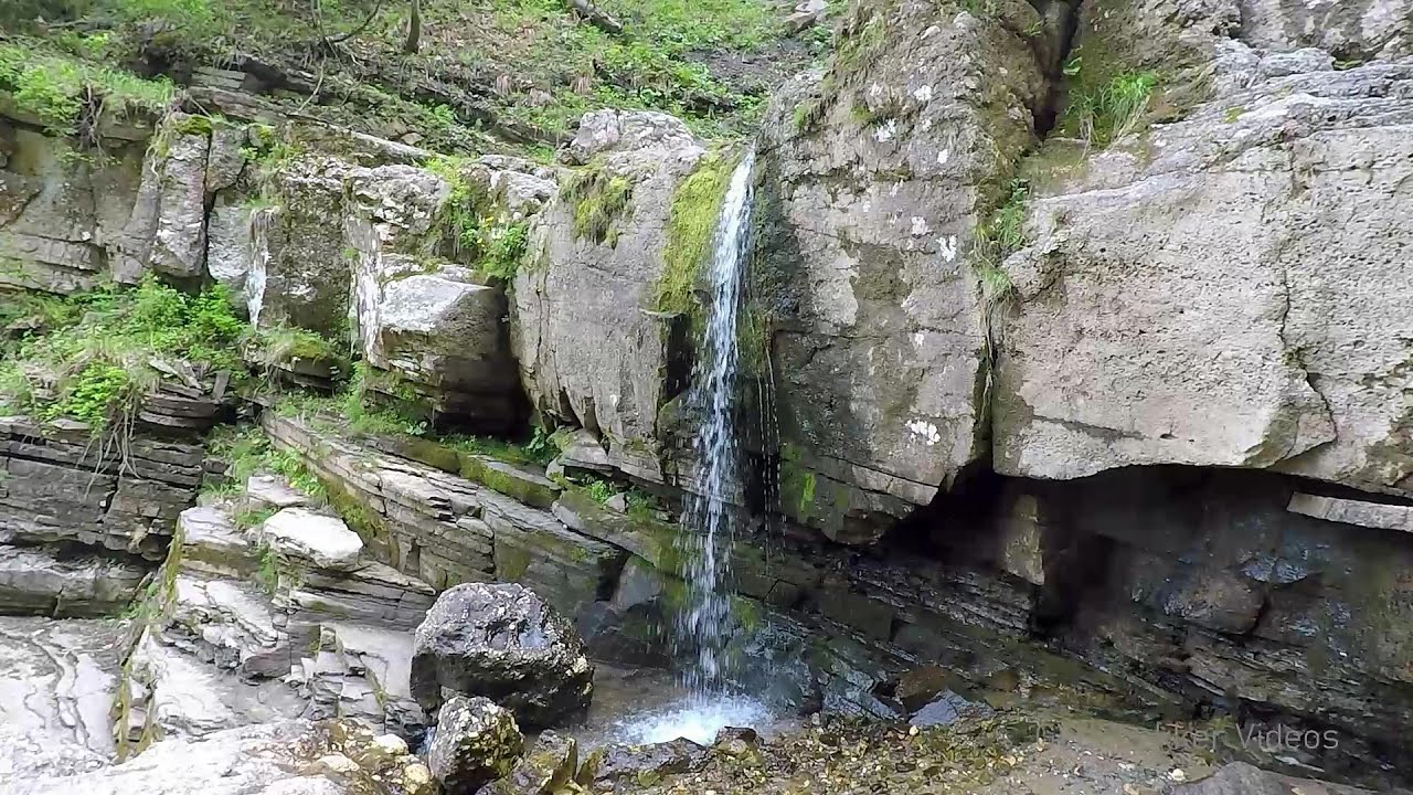
Upstream of the Izvorul Dorului creek - Vanturis waterfalls | Video


Upstream of the Izvorul Dorului (Source of longing) creek - Vanturis waterfalls, Bucegi Mountains.
Music: Turning Slowly by Ugonna Onyekwe. Filmed with GoPro HERO5 Black. Copyright © 2020 - 2026 Geo Trekker Videos. Please register for full and ad-free access.
Airport nearby: Ghimbav International Airport (GHV - Brașov (Ghimbav), Ro), 40 km away.
Photos of nearby places

Peak of Longing - Waterfalls of the Vanturis stream (36 photos) 0.7 km away. Peak of Longing (Varful cu Dor) - Waterfalls of the Vanturis stream (Cascadele Vanturisului).

Zgarbura Valley, Vanturis waterfalls - Bucegi (18 photos) 0.9 km away. Shoe Valley (Zgarbura Valley, Valea Zgarburei), Vanturis waterfalls - Bucegi Mountains.

Saint Annes Rock - Bucegi Mountains (24 photos) 4 km away. Saint Annes Rock (Stanca Sfanta Ana) - Bucegi Mountains.


Cave of Ialomita river - Bucegi Mountains (17 photos) 6.5 km away. Cave of Ialomita river (Pestera Ialomitei) - Bucegi Mountains.

Urlatoarea waterfall - Bucegi Mountains (8 photos) 6.6 km away. Urlatoarea waterfall (Cascada Urlatoarea) - Bucegi Mountains.


Valley of mountain pines - Bucegi (12 photos) 7.3 km away. Valley of mountain pines (Valea Jepilor) - Bucegi Mountains.

Ladies Valley - Bucegi Mountains (12 photos) 7.5 km away. Ladies Valley (Valea Doamnele) - Bucegi Mountains.

Costila Peak, Caraiman Mountain - Bucegi (18 photos) 8.3 km away. Costila Peak, Caraiman Mountain - Bucegi Mountains.


Valley of the Slim Figures - Bucegi Mountains (5 photos) 8.8 km away. Valley of the Slim Figures (Valea Sugarilor) - Bucegi Mountains.
[ Top ↑ ]
Videos of nearby places
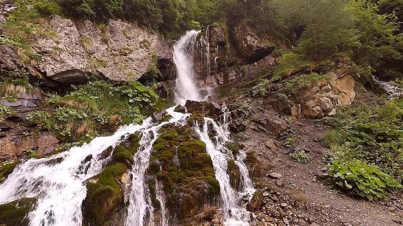
Downstream of the Izvorul Dorului creek - Vanturis waterfalls 0.9 km away. Downstream of the Izvorul Dorului (Source of longing) creek - Vanturis waterfalls, Bucegi Mountains.
Foamy valley waterfall - Bucegi Mountains 7.7 km away. Access to the Foamy valley waterfall (Cascada Valea Spumoasa) is made from the town of Busteni. The starting point is the lower station of the cable car that ascends to the Babele cabin.

Big Via ferrata Rasnoavei Gorge 22.7 km away. The most dangerous Eastern European iron path, and also one of the most beautiful via ferrata routes in Romania, is in the Rasnoavei Gorges, Postavaru Mountains.The route is 450 m long, with a level difference of 220 m.

Small Via ferrata - Rasnoavei Gorge 22.8 km away. In the past few days, it has snowed, so I climbed the two climbing routes in the Rasnoavei Gorge under winter conditions. While the lower part of the challenging Big via ferrata was dry, the upper section had patches of snow and icicles.

Ski resort - Poiana Brasov - Postavarul Mountains 26.1 km away. Shining sun and an Austria-feeling on the impeccable slopes of the ski paradise Poiana Brasov above Brasov. Sunbathing, coffee and refreshing drinks on the terrace of Julius Römer chalet.
Other places
Loreley and Pink Panther iron path Baia de Fier 135.8 km away. The Loreley via ferrata (graded B/C, with an elevation difference of approximately 100 m and a length of about 100 m) is located on the rock wall on the opposite side of the road. A branch from its upper section leads to the Pink Panther (Pantera Roz, graded A/B/C, approximately 200 meters long, with an elevation difference of about 50 meters).
Tureni Gorge iron path 196.5 km away. Tureni Gorge iron path visiting route (Via ferrata Cheile Tureni), Trascau Mountains.
Dóczi stone-quarry Jigodin 113.4 km away.
Lonely Stone Hasmas Mountains 151.5 km away. On June 1, 2003, with a small group of friends, I left Balan, walking along the valley of the Sep (Beautiful) stream towards the Lonely Stone (Piatra Singuratica). Those who were with me at the time fell behind, and then other people joined for the hike.
Byala Reka eco-trail Kalofer 301.4 km away. The Byala Reka eco-trail is situated at the foot of the Stara Planina mountain range, 8 km from the town of Kalofer. A 1,830-meter-long hiking trail has been established along the White Creek within the Central Balkan National Park.
Shiroka Laka village Smolyan 413.9 km away. Shiroka Laka is one of the most beautiful villages in Bulgaria. It is located in the Rhodope Mountains, in the Smolyan province, in the southern part of the country.
Buzludzha monument Kazanluk 290 km away. Buzludzha is a historically significant mountain located in the Central Balkan Mountains of Bulgaria. At its summit, at an altitude of 1432 meters above sea level, there is an abandoned monument.
Falco Tinnunculus via ferrata, the ascent Falcons Rock, Corbu 187.2 km away. Falco Tinnunculus (Common kestrel) via ferrata (E), the ascent - Falcon's Rock, Corbu. Over Corbu village in Harghita County, on the rocks of Falcon's Rock (Piatra Soimilor), which belong to the Bistrita Mountains, five via ferrata routes have been established.
Berim via ferrata Zubin Potok 475.4 km away. Difficulty level D, total length: 4 km, height difference: 520 m, year of construction: 2015. Climbing season: May 1 - October 30.
The Stone Path Nochevo 385.9 km away. Kamennata pateka (The Stone Path) - Nochevo.
The Amphitheater of the Dragons Baia de Fier 135.9 km away. The Amphitheater of the Dragons (Amfiteatrul Zmeilor) is the seventh (2017) via ferrata route in Baia de Fier. It was inaugurated last year, on December 26, 2017, after Christmas.
Giant fir trees Ghimes 150.7 km away. One of the lesser-known attractions of Ghimes is the two giant-sized common fir trees. They are 42 meters tall, and have diameters of 110 cm and 130 cm at chest height.
The Trovants Museum in Winter Costesti 112.7 km away.
Poienii Rock, north-eastern lookout point Bicaz Gorge 165.2 km away. From the viewpoint at the top of the northeastern wall of Poienii Rock in the Bicaz Gorges, we can look down 300 meters to the mouth of the Bicajel stream. The Bridge of the Hungarians is hidden among pine trees.
Womens Spiral, Cave Ridge, and The Great Crack iron paths Baia de Fier 136.1 km away. Perhaps the most interesting via ferrata among the routes in the Baia de Fier area is the Womens Spiral. After completing it, I can say that it is the second most thrilling via ferrata in Romania, following the Big Via Ferrata at Rasnov.
[ Top ↑ ]
Copyright © 2003-2026 Trekkingklub and friends. Reproduction of any text, picture or video from this website, either in printed or electronic form, is prohibited without prior written permission.
The given distances are to be understood as straight line distances, and are approximate. Website made in Miercurea Ciuc  .
.