Loreley and Pink Panther iron path - Baia de Fier | Video


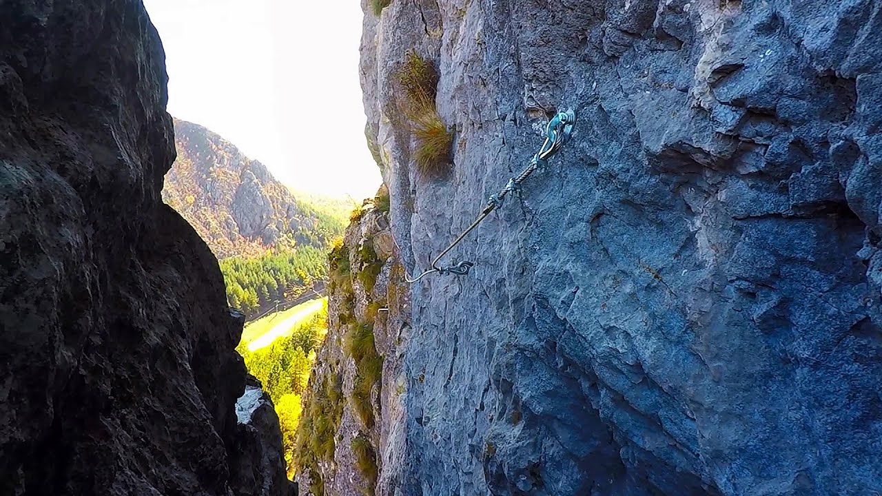
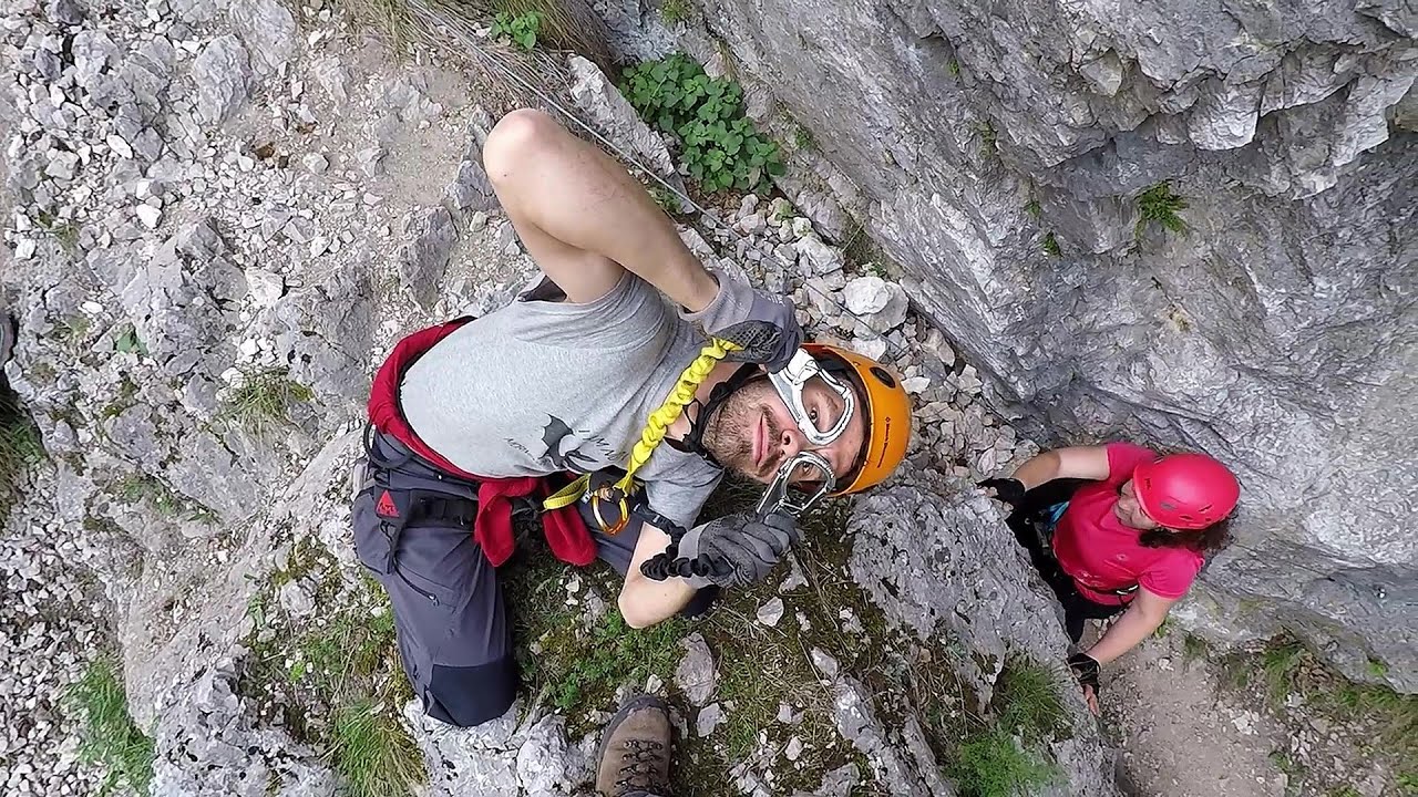
The Loreley via ferrata (graded B/C, with an elevation difference of approximately 100 m and a length of about 100 m) is located on the rock wall on the opposite side of the road. A branch from its upper section leads to the Pink Panther (Pantera Roz, graded A/B/C, approximately 200 meters long, with an elevation difference of about 50 meters).
Read more
Rock climbing and via ferrata - Parang Mountains Romania - Via ferrata and rock climbing Parang Mountains Romania
Filmed with GoPro HERO5 Black. Music: Melancholy Aftersounds by Kai Engel. Copyright © 2017 - 2026 Geo Trekker Videos. Please register for full and ad-free access.
Airport nearby: Sibiu International Airport (SBZ - Sibiu, Ro), 71 km away.
Photos of nearby places

Womens Cave - Parang Mountains (11 photos) 0.3 km away. The Cave of Women (Pestera Muierii, Pestera Muierilor) is located at the southern foot of the Parang Mountains, in the area of Baia de Fier in Gorj County. There are several climbing routes established on the rocks above the cave and on the other side of the road.


Parangul Mare peak (16 photos) 23.6 km away. Chamois saddle (Saua Caprelor), Carja mountain shelter (Refugiul Carja) - Carja peak (Varful Carja) - Stoienita peak (Varful Stoienita) - Gemanarea - Parangul Mare peak.


Ledge path of the chamois - Cheii Gorge (40 photos) 30 km away. Ledge path of the chamois (Brana Caprelor) - Cheii Gorge (Cheile Cheii).

Doabra Snail Shells - Brezoi (12 photos) 42.1 km away. Doabra Valley - Calinesti-Brezoi forest - Lotru Valley, Cozia National Park

Boli Cave - Banita (20 photos) 44.9 km away. The main cave passage is approximately 460 m long, with an entrance portal that is 10 m high and 20 m wide at its base. In the 1960s, bridges were built over the underground stream flowing through the cave.

Banita Gorge - Banita (16 photos) 45.1 km away. The approximately 250 m long gorge, similar to the Corcoaia Gorge, is truly spectacular. According to assumptions, it was formed by the collapse of a cave passage ceiling, and then the erosion formed spectacular karst formations in the limestone.


Circular hiking tour in Cozia Mountain (48 photos) 47.5 km away. Arutela - Turnu monastery - Rosiei Rocks - Turneanu ridge - Cozia peak - Stone portal - Stanisoara monastery - Gardului waterfall.

Natural bridge next to the Banita Stone Quarry (12 photos) 47.8 km away. Although the Banita Stone Bridge is not far from the road that passes through the village, it is located beyond the railway line, so its approach is a bit cumbersome. We can go around the railway line on Carierei Street, and then we have to walk a few meters from the stone quarry.
[ Top ↑ ]
Videos of nearby places
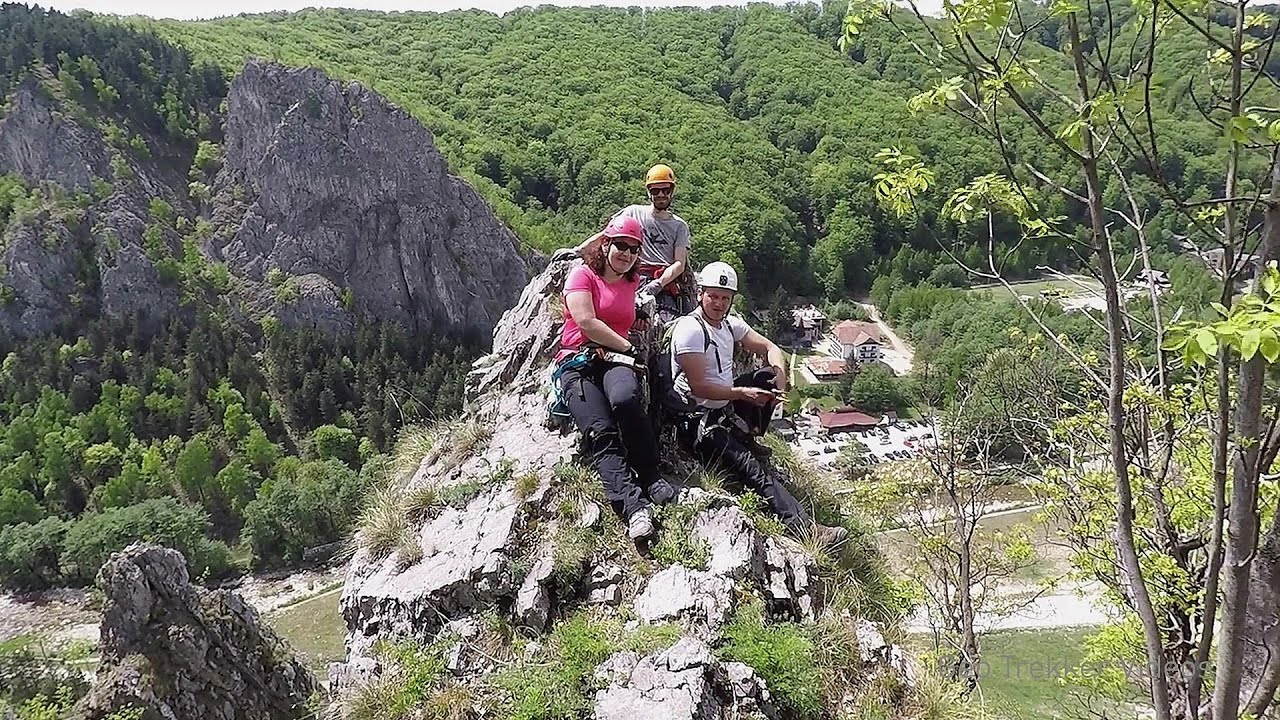
Via Ferrata Pink Panther - Baia de Fier 0.1 km away. In the area of Baia de Fier in Gorj County, several via ferrata routes have been set up on the rock above the Women's Cave (Muierii Cave) and on the other side of the road. At that time (2018), there were a total of seven.

Winds iron path - Baia de Fier 0.2 km away. The Wind's iron path (Via ferrata Vanturilor, D) is the via ferrata route number 11 in the Baia de Fier - Polovragi area. The sign at the base of the route was installed on February 9, 2020.
Middle Belt via ferrata route - Baia de Fier 0.2 km away. Middle Belt (Spirala Medie) via ferrata route - Baia de Fier. In May 2018, two new via ferrata routes were inaugurated in Baia de Fier.
Womens Spiral via ferrata, climbing fun - Baia de Fier 0.2 km away. The Women's Spiral (Spirala Muierilor) via ferrata is set up on the rock that conceals the Women's Cave (Pestera Muierii). It is one of the seven routes near Baia de Fier as of now (2018).
Other places
Zip-line near Seven Ladder Canyon Piatra Mare Mountain 152.9 km away.
Sumuleu-Ciuc in winter 208.2 km away. Sumuleu-Ciuc (Csíksomlyó) in winter.
Dalbina waterfall, Dark Blue Bruises of the Ponor 133 km away. Dalbina waterfall, Dark Blue Bruises of the Ponor (Vanatarile Ponorului).
Stone Beach Sinemorets 491.2 km away. Stone Beach (Kamenniat plazh) - Sinemorets.
Via ferrata Bear Cave adventure and climbing zone Borsec 241.5 km away. The Bear Cave in Borsec is a vast natural formation, scattered with rocks and deep crevices. Access to the cave's cavities is through a series of narrow formations resembling canyons, surrounded by giant fir trees and rocks with interesting shapes.
Ski Gyimes ski slope Lunca de Sus 225.4 km away. The Ski Gyimes ski slope is located in Lunca de Sus, right next to the main road. It is 800 m long, the level difference is 160 m.
Skaklya waterfall Vratsa 224.2 km away. The largest seasonal waterfall in Bulgaria plunges down from a height of 141 meters. It is located in the Vratsa Mountain National Park, just one and a half kilometers away from the city of Vratsa.
Falco Tinnunculus via ferrata, the ascent Falcons Rock, Corbu 252.3 km away. Falco Tinnunculus (Common kestrel) via ferrata (E), the ascent - Falcon's Rock, Corbu. Over Corbu village in Harghita County, on the rocks of Falcon's Rock (Piatra Soimilor), which belong to the Bistrita Mountains, five via ferrata routes have been established.
Giant fir trees Ghimes 234 km away. One of the lesser-known attractions of Ghimes is the two giant-sized common fir trees. They are 42 meters tall, and have diameters of 110 cm and 130 cm at chest height.
Small Via ferrata Rasnoavei Gorge 143 km away. In the past few days, it has snowed, so I climbed the two climbing routes in the Rasnoavei Gorge under winter conditions. While the lower part of the challenging Big via ferrata was dry, the upper section had patches of snow and icicles.
Big Cave Nochevo 386.5 km away. Kodzha in (Golyamata Peshtera, Big Cave) - Nochevo.
Via ferrata Shpellat Peja 397.6 km away.
Babsko Praskalo waterfall Tazha 295.4 km away. In the Central Balkans National Park, there are many rivers that cascade down spectacular waterfalls, which the locals call praskalo. One of the smallest waterfalls in the area is Babsko Praskalo, which stands at only 54 meters high.
Hot air balloon parade 2015 Campu Cetatii 190.2 km away. This year, the Hot Air Balloon Parade was organized in Campu Cetatii for the tenth time. Unfortunately, the weather only allowed for flying on Saturday morning and evening.
Piticot iron path for children Suncuius 215.4 km away.
[ Top ↑ ]
Copyright © 2003-2026 Trekkingklub and friends. Reproduction of any text, picture or video from this website, either in printed or electronic form, is prohibited without prior written permission.
The given distances are to be understood as straight line distances, and are approximate. Website made in Miercurea Ciuc  .
.