Via ferrata Bear Cave adventure and climbing zone - Borsec | Video


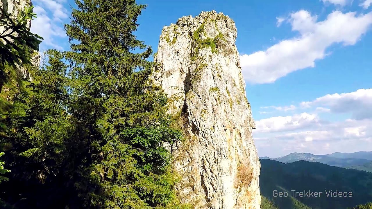
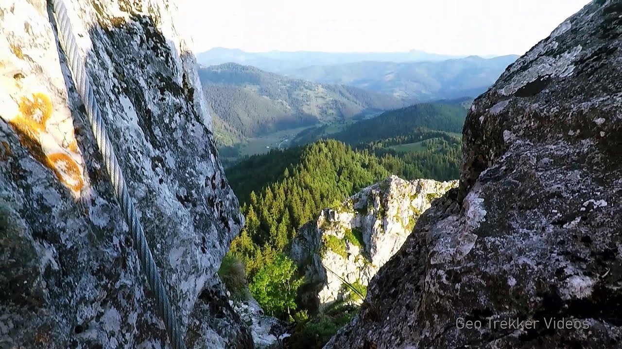
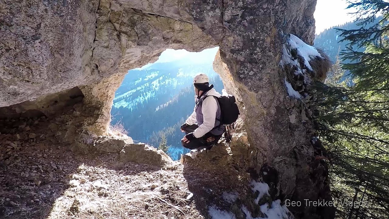
The Bear Cave in Borsec is a vast natural formation, scattered with rocks and deep crevices. Access to the cave's cavities is through a series of narrow formations resembling canyons, surrounded by giant fir trees and rocks with interesting shapes. As we approach the entrance to the cave, the air becomes cooler, a pleasant breeze replacing the summer heat after just a few meters.
Read more
Rock climbing and via ferrata - Giurgeu Mountains Romania - Via ferrata and rock climbing Giurgeu Mountains Romania
Music: Chance by Kai Engel, Attribution 4.0 International (CC BY 4.0) license. Filmed with GoPro HERO5 Black. Copyright © 2018 - 2026 Geo Trekker Videos. Please register for full and ad-free access.
Airport nearby: Suceava Stefan cel Mare Airport (SCV - Suceava, Ro), 100 km away.
Photos of nearby places

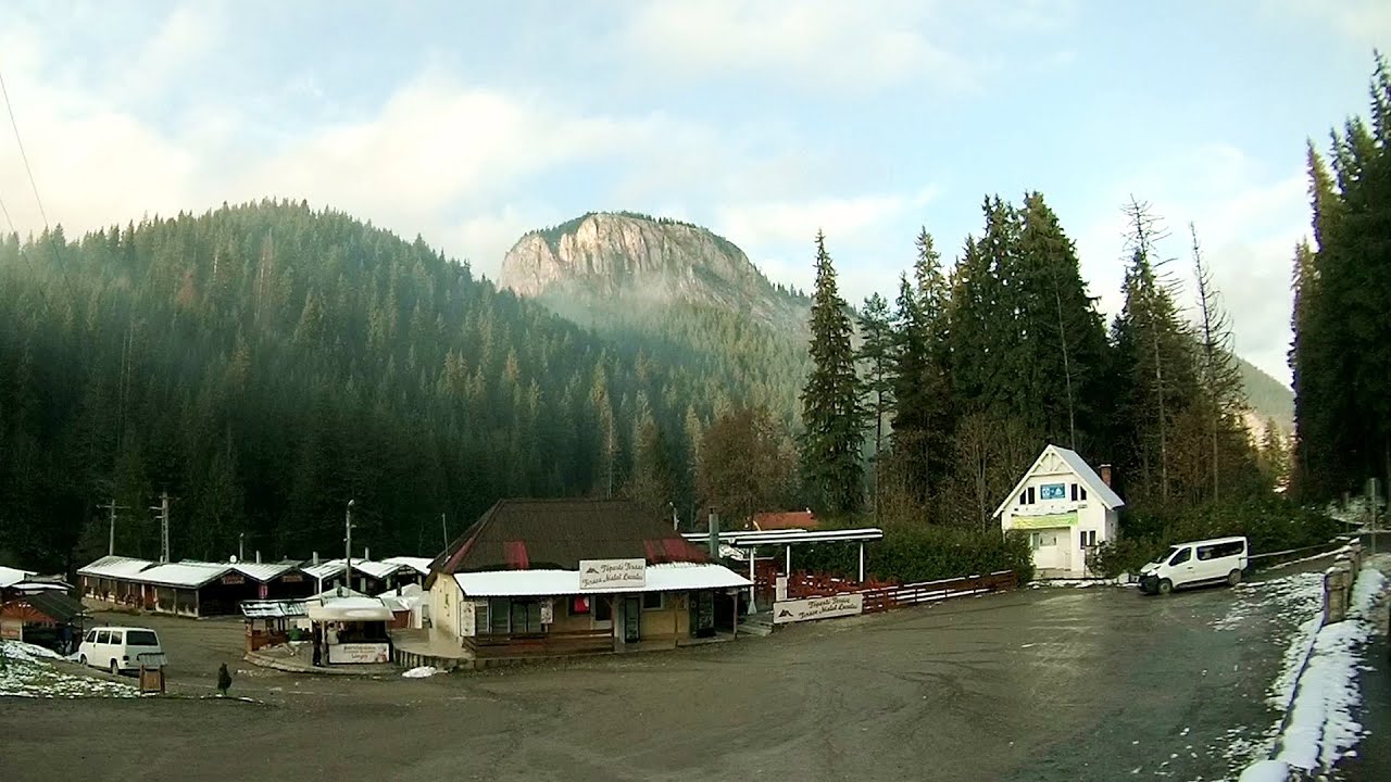
Bears cave, Ice Grotto - Borsec (12 photos) 0 km away. The Bears' cave is actually a deep rock fissure with a path leading into it. Local belief long considered it to be the habitat of bears, which is where the name comes from.

Stalactite Cave - Round Chair Hill, Borsec, Giurgeu Mountains (24 photos) 0.7 km away. The Stalactite Cave on the Round Chair Hill is the longest cave formed in travertine in the country. Its formation was mainly influenced by an open system of diaclases, which fragmented the travertine, with the contribution of infiltrated rainwater being essential in the transport and dissolution of limestone.

Borsec spa resort (9 photos) 1 km away. Borsec is one of the most beautifully situated resorts in the Eastern Carpathians. It consists of two parts: Lower Borsec and Upper Borsec, the latter being the actual resort area.


The Valleys of the Streams of the Cups and Rogozu (6 photos) 5.2 km away. The Valleys of the Streams of the Cups (Cupelor, Kupás) and Rogozu (Szacskai) - Borsec. September 7, 2003; September 14, 2003; November 10, 2007.


The Old Women of Gurghiu stone mushrooms, Batrana Peak (16 photos) 23.9 km away. The Old Women of Gurghiu (Babele Gurghiului) stone mushrooms, Batrana Peak (Varful Batrana). In the Gurghiu Mountains, 10 km from Toplita, near the peak Batrana, there are several groups of strange rocks.

[ Top ↑ ]
Videos of nearby places
Falco Tinnunculus via ferrata, the ascent - Falcons Rock, Corbu 11.7 km away. Falco Tinnunculus (Common kestrel) via ferrata (E), the ascent - Falcon's Rock, Corbu. Over Corbu village in Harghita County, on the rocks of Falcon's Rock (Piatra Soimilor), which belong to the Bistrita Mountains, five via ferrata routes have been established.
Falco Peregrinus 2 via ferrata - Falcons Rock, Corbu 11.8 km away. Falco Peregrinus (Peregrine falcon) 2 via ferrata (D) - Falcon's Rock, Corbu.
Falco Peregrinus via ferrata - Falcons Rock, Corbu 11.8 km away. Falco Peregrinus (Peregrine falcon) via ferrata (B/C) - Falcon's Rock, Corbu.
Pricske peak - Giurgeu Mountains 19.3 km away. If we want to reach Pricske (Prisca) peak, which rises above Gheorgheni and Lazarea, we start from the valley of the Güdüc (Ghidut) stream. Our path leads us past the ruins of a building known as the White House.
Wild Ferenc memorial path - Suhardul Mic 25.3 km away. In recent days, this news has been everywhere: the via ferrata route built on the southwest wall of Suhardul Mic (Little Suhard) has finally been completed and inaugurated. The new route has been named after Ferenc Wild, in memory of the former mountain rescuer, sports writer, and one of the founders of the mountain rescue association in Gheorgheni.
Other places
Piticot iron path for children Suncuius 229.3 km away.
Transalpina Ski Resort Vidra lake 224 km away.
Via Ferrata Fairy Castle Vadu Crisului 231.7 km away. Via Ferrata Fairy Castle (Castelul Zanelor, Casa Zmeului, The House of the Dragon) - Vadu Crisului. South of Vadu Crisului, in the Padurea Craiului Mountains, lies the Vadu Crisului Gorge, a section of the Crisul Repede river that narrows between rocky walls.
Bovska Skaklya waterfall Iskar gorge 471 km away. The Bovska Skaklya waterfall is located near the town of Svoge in Bulgaria. The waterfall formed on the Zaselska River has several reported heights online (120 m, 85 m).
Cherven, a medieval fortified town Bulgaria 373.3 km away. Located about 30 km south of the city of Ruse in Bulgaria, the Cherven medieval fortress can be found in the Rusenski Lom Nature Park. Originally a Byzantine fortification from the 6th century, it reached the height of its development in the 14th century.
Muierii Cave Baia de Fier 241.7 km away. We visited the Baia de Fier area, and climbed on the rock that also conceals the Women's Cave (Pestera Muierilor). Between two via ferrata routes, we also participated in one of the guided cave tours, which depart every hour.
Banita Gorge and Banita rock bridge 241.9 km away. They say about this place that only very few people know about it, but that's not true. In fact, most nature lovers have heard of it, seen pictures taken here, even if not everyone has been able to come here.
Big Via ferrata Rasnoavei Gorge 157.9 km away. The most dangerous Eastern European iron path, and also one of the most beautiful via ferrata routes in Romania, is in the Rasnoavei Gorges, Postavaru Mountains.The route is 450 m long, with a level difference of 220 m.
Abandoned Sports Hall Varna 457.1 km away. An abandoned sports hall in Varna, with an unfinished dormitory and tennis courts across three levels.
Dino Parc Rasnov 153 km away. On June 12, 2015, one of the largest dinosaur theme parks in the region opened in Rasnov, where we can see 45 life-sized dinosaurs. The facility is located directly next to the Rasnov Fortress, which is one of the best-preserved Transylvanian Saxon peasant fortresses.
Corcoaia Gorge Gorj county 301.1 km away. The Corcoaia Gorge is one of the most beautiful tourist attractions in the Cerna Valley. It can be reached by car, 43 km away from Baile Herculane, of which about 17 km is on a dusty gravel road.
Tureni Gorge iron path 146.6 km away. Tureni Gorge iron path visiting route (Via ferrata Cheile Tureni), Trascau Mountains.
Vadu Crisului cave 231.9 km away. The Vadu Crisului Cave, with a total length of over 1000 meters, is located in the picturesque gorge of Crisul Repede creek. It consists of a gently meandering, long passage that features an active, stream level next to an upper, fossil level in its first section.
Dalbina waterfall, Dark Blue Bruises of the Ponor 173.9 km away. Dalbina waterfall, Dark Blue Bruises of the Ponor (Vanatarile Ponorului).
Hodoaba Valley iron path Suncuius 229.2 km away. The Hodoaba Valley iron path is Romania's shortest and easiest (official) via ferrata route. It is located near Suncuius, in the Padurea Craiului Mountains, on the left bank of the Crisul Repede River.
[ Top ↑ ]
Copyright © 2003-2026 Trekkingklub and friends. Reproduction of any text, picture or video from this website, either in printed or electronic form, is prohibited without prior written permission.
The given distances are to be understood as straight line distances, and are approximate. Website made in Miercurea Ciuc  .
.