Giant fir trees - Ghimes | Video


One of the lesser-known attractions of Ghimes is the two giant-sized common fir trees. They are 42 meters tall, and have diameters of 110 cm and 130 cm at chest height. Their estimated age is 200-250 years.
Filmed with SJCAM SJ5000 Plus. Traditional folk music from Ghimes. Copyright © 2015 - 2026 Geo Trekker Videos Please register for full and ad-free access.
Airport nearby: Bacău George Enescu International Airport (BCM - Bacău, Ro), 77 km away.
Photos of nearby places


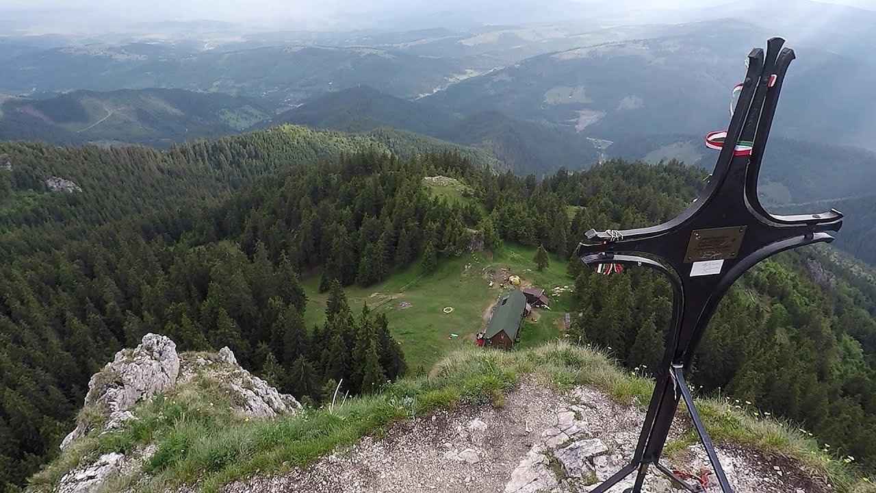
Brother Mountain - Hasmas Mountains (15 photos) 6.5 km away. Brother Mountain (Fratele, Ecem, Ecsém) - Hasmas Mountains.


Brother Mountain - Hasmas Mountains (11 photos) 7 km away. Brother Mountain (Ecsém-tető, Muntele Fratele, Muntele Ecem) - Hasmas Mountains.


Valley of the Lazarus-creek - Hasmas Mountains (15 photos) 7.6 km away. Valley of the Lazarus-creek (Valea paraului Lazar), Log Slide - Hasmas Mountains.

Watchstone and the Lonely Stone in March (18 photos) 7.8 km away. Watchstone (Stanca La Panda) and the Lonely Stone (Piatra Singuratica) in March.
[ Top ↑ ]
Videos of nearby places
Lonely Stone - Hasmas Mountains 7.8 km away. On June 1, 2003, with a small group of friends, I left Balan, walking along the valley of the Sep (Beautiful) stream towards the Lonely Stone (Piatra Singuratica). Those who were with me at the time fell behind, and then other people joined for the hike.
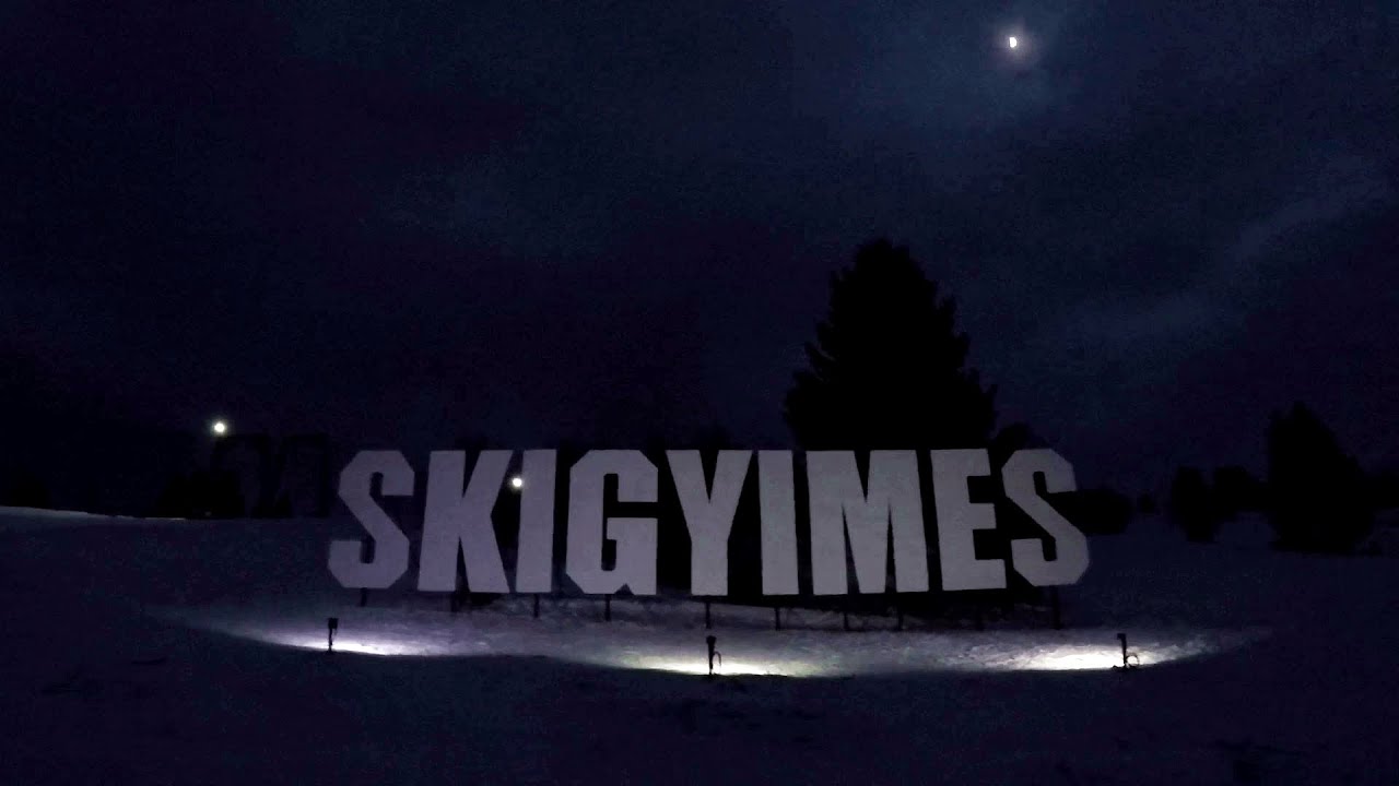
Ski Gyimes ski slope - Lunca de Sus 16 km away. The Ski Gyimes ski slope is located in Lunca de Sus, right next to the main road. It is 800 m long, the level difference is 160 m.

SkiGyimes ski slope - Lunca de Sus 16 km away. It is well-known that in Rimetea, due to the Piatra Secuiului (Szekler's Rock) mountain, the Sun rises twice. However, perhaps few know that in Lunca de Sus, the Sun sets three times.
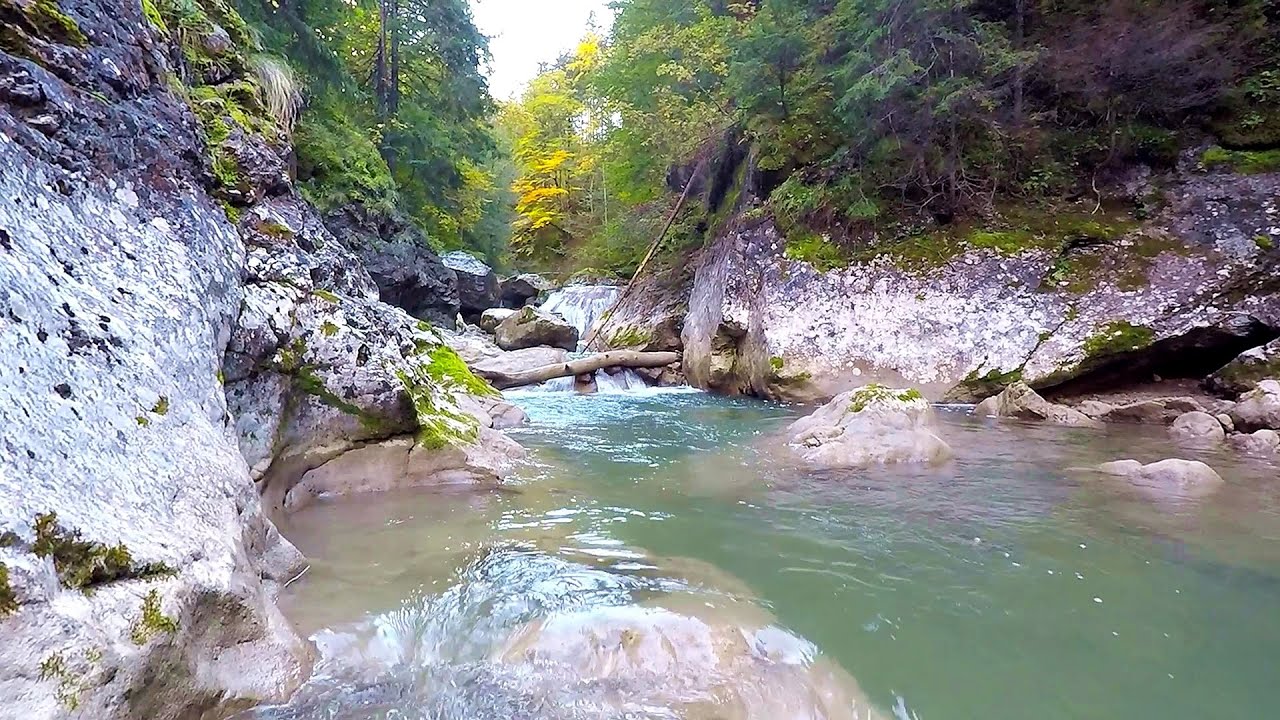
Bicajel Gorge - Hasmas Mountains 17.7 km away. Bicajel Gorge (Cheile Bicajelului) - Hasmas Mountains.
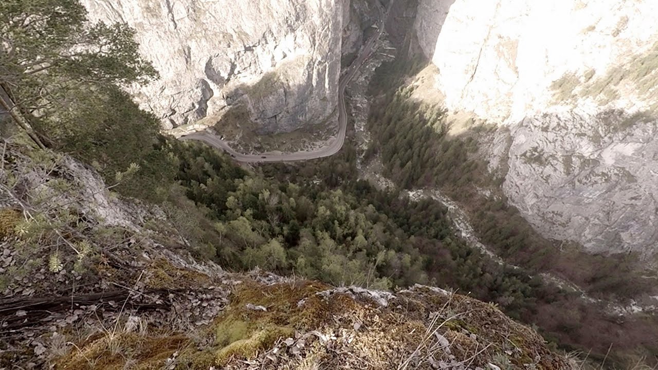
Poienii Rock, north-eastern lookout point - Bicaz Gorge 17.9 km away. From the viewpoint at the top of the northeastern wall of Poienii Rock in the Bicaz Gorges, we can look down 300 meters to the mouth of the Bicajel stream. The Bridge of the Hungarians is hidden among pine trees.
Other places
Foamy valley waterfall Bucegi Mountains 143.1 km away. Access to the Foamy valley waterfall (Cascada Valea Spumoasa) is made from the town of Busteni. The starting point is the lower station of the cable car that ascends to the Babele cabin.
Prohodna cave Karlukovo 414.2 km away. The Prohodna cave nicknamed The Eyes of God is located in Bulgaria, in the Iskar Gorge, on one of the largest karst areas in Bulgaria, 2 km from the town of Karlukovo. It is essentially a 262-meter-long natural stone bridge, with a large (45 m high) and a small (35 m high) entrance.
Goats Ledge iron path Ramet Gorge 192.9 km away. Via ferrata Goats Ledge (Brana Caprei) iron path - Ramet Gorge, Trascau Mountains.
Balea waterfall and the Transfagarasan mountain_road 152.8 km away. Balea waterfall and the Transfagarasan mountain road - blue triangle marked trail, Balea valley, Fagaras Mountains, Southern Carpathians.
Vadu Crisului cave 261.7 km away. The Vadu Crisului Cave, with a total length of over 1000 meters, is located in the picturesque gorge of Crisul Repede creek. It consists of a gently meandering, long passage that features an active, stream level next to an upper, fossil level in its first section.
Abandoned Sports Hall Varna 415.3 km away. An abandoned sports hall in Varna, with an unfinished dormitory and tennis courts across three levels.
Acapulcos spur via ferrata 258.8 km away. Acapulco's spur (Pintenul lui Acapulco) via ferrata (B/C) - Montana Land, Suncuius.
Kaya Bunar Hotnitsa 392.4 km away. The Kaya Bunar Waterfall (Hotnishki Vodopadi, Hotnitsa Waterfall) is located 20 km from the city of Veliko Tarnovo in Bulgaria. The waterfall is 30 meters high, and there are several smaller cascades above it.
Gornjak via ferrata and Kudelinovs fortress Zdrelo 433.5 km away. Difficulty level C/D, total length: 400 m, height difference: 330 m, year of construction: 2019, total length of the route to Kudelinov's fortress: 1100 m. Access to the via ferrata is free.
Shipka pass Shipka 437.9 km away. The Shipka Pass is one of the most spectacular crossings of the Balkan Mountains, and is part of the Bulgarka Nature Park. It separates the provinces of Gabrovo and Stara Zagora, and provides a connection between the cities of Gabrovo and Kazanlak.
Seven Ladder Canyon and Waterfall Piatra Mare Mountain 123.7 km away. The Seven Ladder Gorge is the largest and most spectacular gorge in the Piatra Mare massif. The narrow canyon has a length of 160 meters, and over a drop of 58 meters includes 7 bigger and several smaller waterfalls.
Stone Forest Slanchevo 406.8 km away. The Stone Forest (Stones stuck in the ground, Pobiti Kamani) of Bulgaria is located 18 km west of Varna, at the foothills of the Eastern Balkan Mountains. Its Bulgarian name, Pobiti Kamani, translates to planted stones, and it is referred to in English as the Stone Desert or Stone Forest.
Downstream of the Izvorul Dorului creek Vanturis waterfalls 150.7 km away. Downstream of the Izvorul Dorului (Source of longing) creek - Vanturis waterfalls, Bucegi Mountains.
Mine lake Megyer mountain, Sárospatak 377 km away. The via ferrata routes of the Megyer mountain mine lake. The geologists' path E 25 m, Szabó József-memorial path C 200 m, Amphitheater D 40 m, Devil's Cauldron E 70 m, Sweet aquatic life D 150 m, Velociraptor C 35 m.
Saeva Dupka cave Brestnitsa 424.7 km away. The Saeva Dupka Cave is located 2 km south of the village of Brestnitsa. In its five chambers and 400 meters of passageways, you can see the most beautiful cave formations in Bulgaria.
[ Top ↑ ]
Copyright © 2003-2026 Trekkingklub and friends. Reproduction of any text, picture or video from this website, either in printed or electronic form, is prohibited without prior written permission.
The given distances are to be understood as straight line distances, and are approximate. Website made in Miercurea Ciuc  .
.