Iavardi valley and peak | Photos


Page no. 1, photos: 1-6, 47 photos in total. >>>

Copyright © 2012 - 2026 Trekkingklub.com. Please register for full and ad-free access.
Airport nearby: Bacău George Enescu International Airport (BCM - Bacău, Ro), 78 km away.
Photos of nearby places


Brother Mountain - Hasmas Mountains (15 photos) 6 km away. Brother Mountain (Fratele, Ecem, Ecsém) - Hasmas Mountains.


Condra cross - Three rocks peak (24 photos) 6.8 km away. Condra cross - Trei Pietre (Three rocks) peak.

Brother Mountain - Hasmas Mountains (11 photos) 6.8 km away. Brother Mountain (Ecsém-tető, Muntele Fratele, Muntele Ecem) - Hasmas Mountains.


Watchstone and the Lonely Stone in March (18 photos) 7.6 km away. Watchstone (Stanca La Panda) and the Lonely Stone (Piatra Singuratica) in March.

Lonely Stone - Hasmas Mountains (9 photos) 7.6 km away. Lonely Stone (Piatra Singuratica) - Hasmas Mountains.
[ Top ↑ ]
Videos of nearby places
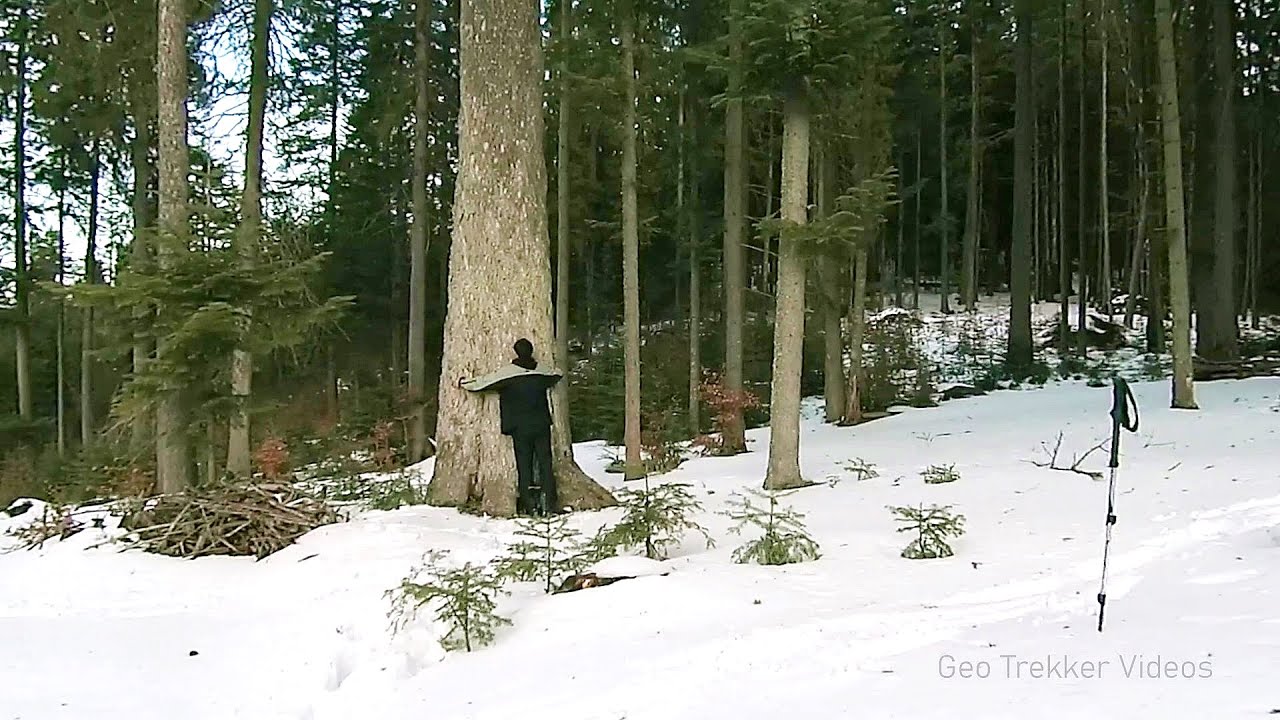
Giant fir trees - Ghimes 3.2 km away. One of the lesser-known attractions of Ghimes is the two giant-sized common fir trees. They are 42 meters tall, and have diameters of 110 cm and 130 cm at chest height.
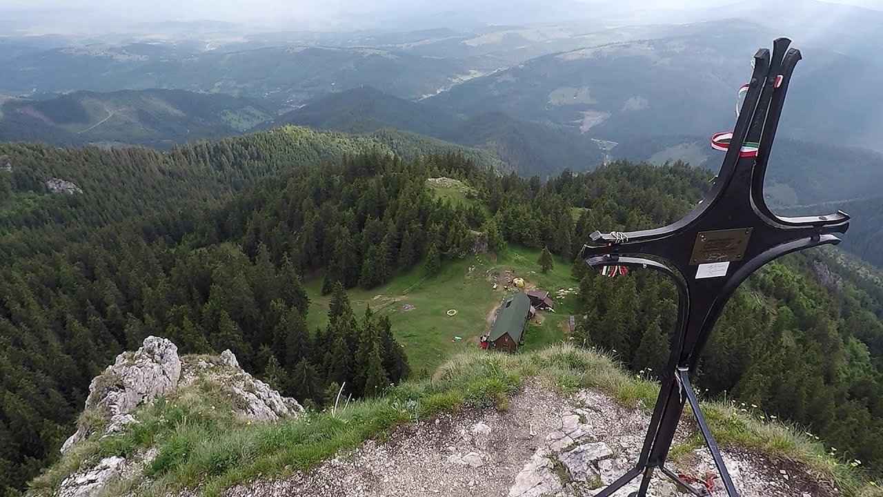
Lonely Stone - Hasmas Mountains 7.6 km away. On June 1, 2003, with a small group of friends, I left Balan, walking along the valley of the Sep (Beautiful) stream towards the Lonely Stone (Piatra Singuratica). Those who were with me at the time fell behind, and then other people joined for the hike.
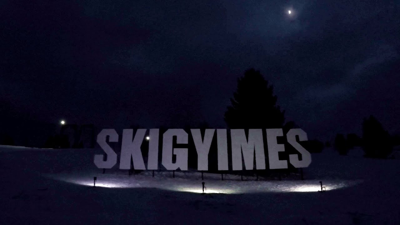
Ski Gyimes ski slope - Lunca de Sus 13.9 km away. The Ski Gyimes ski slope is located in Lunca de Sus, right next to the main road. It is 800 m long, the level difference is 160 m.

SkiGyimes ski slope - Lunca de Sus 13.9 km away. It is well-known that in Rimetea, due to the Piatra Secuiului (Szekler's Rock) mountain, the Sun rises twice. However, perhaps few know that in Lunca de Sus, the Sun sets three times.
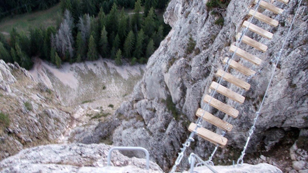
Wild Ferenc iron path - Suhardul Mic 19.5 km away. While I climbed the new iron path mostly in the dark for the first time, this time I managed to explore it during the day. But I still missed the sunset by a few minutes.
Other places
Roman Baths Cetea, Trascau Mountains 184.9 km away. Roman Baths (Baile Romane) - Cetea, Trascau Mountains. Among the valleys of the Trascau Mountains, the Cetea Gorge best deserves the name of a crevice valley.
Kaya Bunar Hotnitsa 389.6 km away. The Kaya Bunar Waterfall (Hotnishki Vodopadi, Hotnitsa Waterfall) is located 20 km from the city of Veliko Tarnovo in Bulgaria. The waterfall is 30 meters high, and there are several smaller cascades above it.
Billy-goat lake, Closed Gates Retezat Mountains 269.3 km away. The most unique ridge trail of the Retezat Mountains is the Closed Gates.Below, at an altitude of 2070 m above sea level, is the Billy-goat lake.
Little Spiral via ferrata Baia de Fier 231.1 km away.
Sterp- and White creek valleys Ciucas Mountains 129 km away.
Ramet Gorge Goagiu Creek 190 km away. Ramet Gorge (Cheile Rametului) - Goagiu Creek (Paraul Goagiu), Trascau Mountains. The Ramet Gorge is the wildest canyon in the Trascau Mountains.
Suspension bridge Aries river, Salciua de Sus 195.8 km away.
Clocota waterfall Geoagiu-Bai, Metaliferi Mountains 223.9 km away.
Snow-covered valley of Balea and the Transfagarasan in winter The ascent 149.5 km away. The Fagarasi Mountains can be easily approached from the north, mainly by using the Transfagarasan Road. This high altitude mountain road is only accessible during the summer months (throughout its entire length).
Roman Baths Geoagiu-Bai, Metaliferi Mountains 224.4 km away.
Middle Belt via ferrata route Baia de Fier 231.1 km away. Middle Belt (Spirala Medie) via ferrata route - Baia de Fier. In May 2018, two new via ferrata routes were inaugurated in Baia de Fier.
Bovska Skaklya waterfall Iskar gorge 448.9 km away. The Bovska Skaklya waterfall is located near the town of Svoge in Bulgaria. The waterfall formed on the Zaselska River has several reported heights online (120 m, 85 m).
Iskar gorge Lyutibrod Temnata dupka cave Lakatnik 441.6 km away. The Iskar is the longest purely Bulgarian river, the oldest river in the Balkans, and a right tributary of the Danube. The river is 368 km long, with approximately 150 km consisting of a gorge.
Lipovac via ferrata and monastery of Saint Stephen 467.5 km away. Difficulty level B, total length: 190 m, height difference: 90 m, year of construction: 2022. It is necessary to contact the PSK Brđanka club to obtain the key for the ladders at the entrance of the via ferrata.
Meziad cave Padurea Craiului Mountains 261.2 km away. The Meziad Cave is located near the village of Meziad, 22 km north of Beius, in the Padurea Craiului Mountains. It is one of our first tourist caves, its exploration is associated with the name of Gyula Czárán, cave researcher and writer.
[ Top ↑ ]
Copyright © 2003-2026 Trekkingklub and friends. Reproduction of any text, picture or video from this website, either in printed or electronic form, is prohibited without prior written permission.
The given distances are to be understood as straight line distances, and are approximate. Website made in Miercurea Ciuc  .
.