Circular hiking tour in Cozia Mountain | Photos


Page no. 1, photos: 1-6, 48 photos in total. >>>

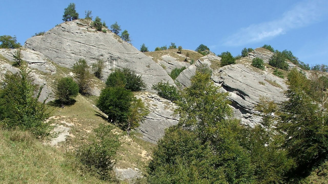
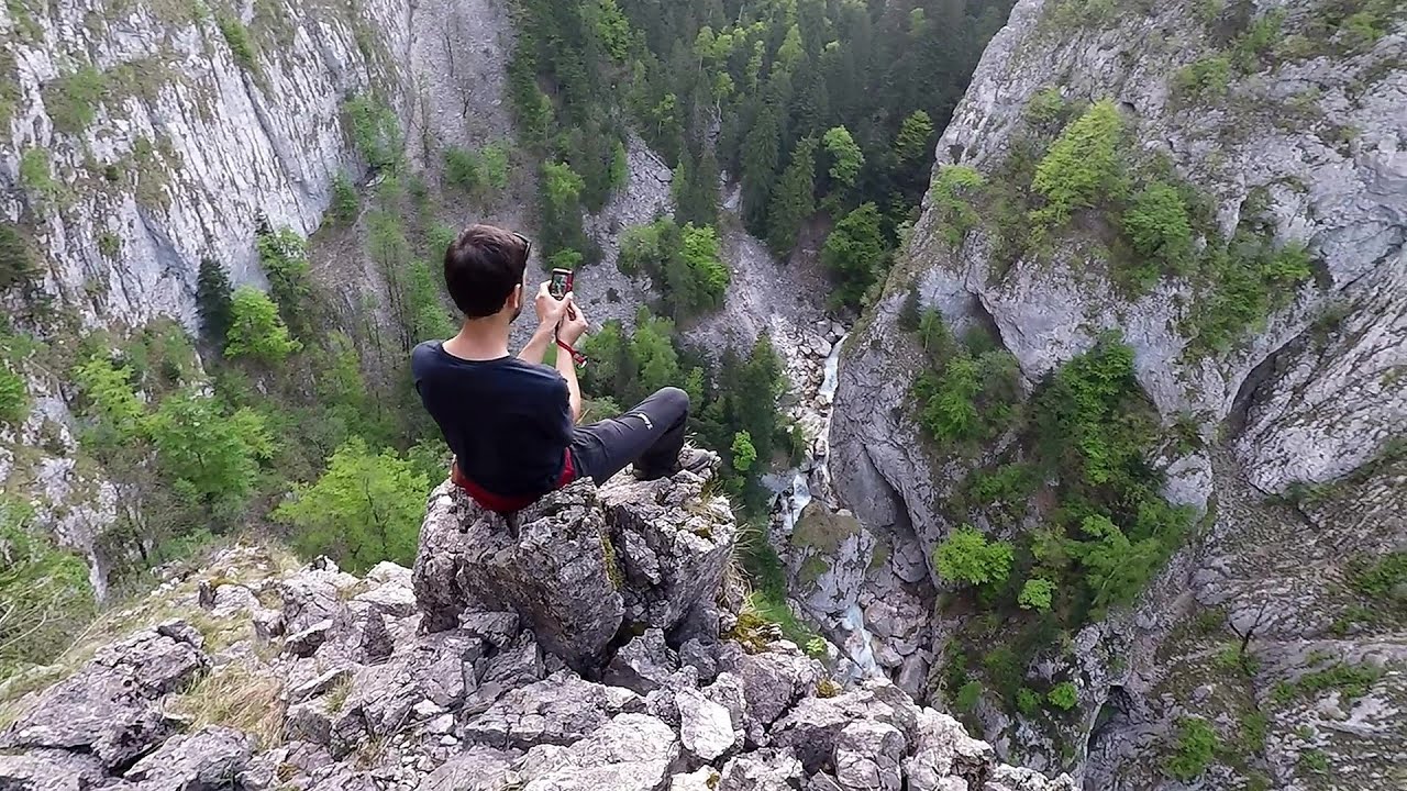
Arutela - Turnu monastery - Rosiei Rocks - Turneanu ridge - Cozia peak - Stone portal - Stanisoara monastery - Gardului waterfall.
Copyright © 2010 - 2026 Trekkingklub.com. Please register for full and ad-free access.
Airport nearby: Sibiu International Airport (SBZ - Sibiu, Ro), 55 km away.
Photos of nearby places

Doabra Snail Shells - Brezoi (12 photos) 8 km away. Doabra Valley - Calinesti-Brezoi forest - Lotru Valley, Cozia National Park

Ledge path of the chamois - Cheii Gorge (40 photos) 17.6 km away. Ledge path of the chamois (Brana Caprelor) - Cheii Gorge (Cheile Cheii).


Chamois saddle - Fagaras Mountains (12 photos) 38.4 km away. Chamois saddle (Saua Caprei) - Fagaras Mountains.
[ Top ↑ ]
Videos of nearby places
Doabra Stones - Brezoi, Lotru Mountains 8 km away. The DN7A road branches off west from the Olt Valley, from the main road between Sibiu and Ramnicu Valcea, leading towards Voineasa and Lake Vidra. The first settlement is a small town, Brezoi, which is located at the confluence of the Lotru and Olt rivers.
The Gorge of the Creek of the Gorge - Buila-Vanturarita National Park 17.5 km away. The Gorges of the Creek of the Gorge (Cheii Gorge, Cheile Cheii) is located in the Buila-Vanturarita National Park within the Capatana Mountains. It is one of the most beautiful and picturesque gorges in Romania.
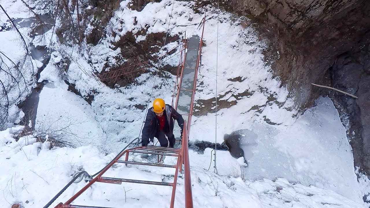
Stan Valley Canyon in winter 21.3 km away. The Stan Valley is a picturesque canyon, even in winter. In fact, when the stream is frozen and covered with a layer of snow, exploring the canyon becomes much quicker and easier.

Stan Valley Canyon 22.3 km away. The Stan Valley is located near Lake Vidraru, southwest of it, in the Fruntii Mountains. Those who have visited the Seven Ladders Waterfall will appreciate this canyon, outfitted with infrastructure for tourist accessibility.
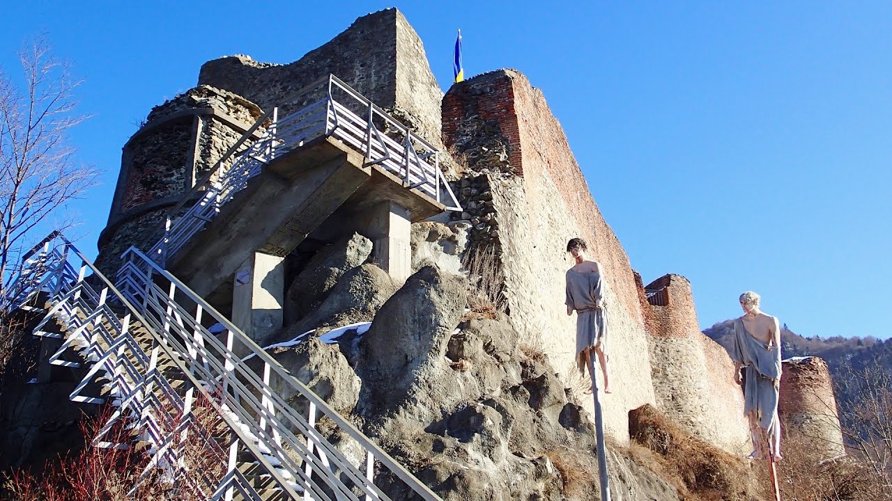
Poenari citadel - Arges valley 23.6 km away. The Poenari citadel is located on the southern slope of the Fagaras Mountains, on the western side of the Transfagaras road, in the Arges Valley, about 4 km from the Vidraru Lake dam. Along a steep incline, a concrete staircase leads up to the castle, which is built atop a mountain.
Other places
Abandoned Sports Hall Varna 371.4 km away. An abandoned sports hall in Varna, with an unfinished dormitory and tennis courts across three levels.
Varghis gorges in winter 136.8 km away. I went out to admire the ice stalagmites (standing icicles) in the Varghis Gorge. Anyone arriving here at the end of winter can observe meter-high ice stalagmites in the entrance area of Meresti Cave (now known as Orban Balazs Cave).
Zip-line near Seven Ladder Canyon Piatra Mare Mountain 105.4 km away.
Borov Kamak waterfall Zgorigrad, Vratsa 250.2 km away. The Vratsa eco-trail starts from the village of Zgorigrad, located 6 km from the city of Vratsa in Bulgaria, and ends at the Parshevitza hut. It is also known as the Zgorigradska or Borov Kamak eco-trail.
Hodoaba Valley iron path Suncuius 225.9 km away. The Hodoaba Valley iron path is Romania's shortest and easiest (official) via ferrata route. It is located near Suncuius, in the Padurea Craiului Mountains, on the left bank of the Crisul Repede River.
Buzludzha monument Kazanluk 299.7 km away. Buzludzha is a historically significant mountain located in the Central Balkan Mountains of Bulgaria. At its summit, at an altitude of 1432 meters above sea level, there is an abandoned monument.
Suspension bridge Aries river, Salciua de Sus 141.9 km away.
Devils Bridge Ardino 416.3 km away. The Devil's Bridge (Dyavolski Most, in Turkish Sheytan Kyupriya) is located in the gorge of the Arda River, just north of the town of Ardino in Bulgaria. It was constructed in the early 16th century, between 1515 and 1518, by an architect named Dimitar, on the remains of an earlier Roman bridge.
Mill of the Devils Tasna Gorge 148.5 km away. Mill of the Devils (Moara Dracilor) - Tasna Gorge (Cheile Tasnei). The Tasna Gorges are located in the Mehedinti Mountains, approximately 15 km from the resort of Baile Herculane.
Huda lui Papara cave Salciua de Jos 135.8 km away. Huda lui Papara cave (Paparas Hole) - Salciua de Jos, Trascau Mountains.
Bovska Skaklya waterfall Iskar gorge 266.6 km away. The Bovska Skaklya waterfall is located near the town of Svoge in Bulgaria. The waterfall formed on the Zaselska River has several reported heights online (120 m, 85 m).
Balázs Hill Lookout Western Mecsek 488.7 km away. The Balázs hill lookout, located at an altitude of 320 meters, offers a beautiful view of Lake Pécs and the wooded mountain ranges of Western Mecsek. The original lookout, built in 1975, was destroyed by fire, and it was rebuilt in 2001 using a metal structure, which was renovated in 2014.
Thracian stone sharapani Nochevo 389.3 km away. Sharapani is a traditional stone container used by ancient Thracians for processing grapes in wine production. Two well-preserved sharapani containers are located about 200 meters apart.
Lookout platform Kis-Tubes Western Mecsek 483.5 km away. The lookout platform at Kis-Tubes, located at an altitude of 577 meters, was built in 1959, and offers a magnificent panorama of Pécs at the foot of the hills. The concrete lookout, situated on the western side of the Kis-Tubes peak along the ridge connecting Misina to Tubes, was designed by Tibor Kiss.
Belintash Ridge of Dobrostan, Rhodope Mountains 389.6 km away. Belintash is a mysterious monolithic complex located approximately 50 km from Plovdiv, passing through the scenic Rhodope Mountains. It is situated southeast of the village of Vrata and west of the village of Sini Vruh.
[ Top ↑ ]
Copyright © 2003-2026 Trekkingklub and friends. Reproduction of any text, picture or video from this website, either in printed or electronic form, is prohibited without prior written permission.
The given distances are to be understood as straight line distances, and are approximate. Website made in Miercurea Ciuc  .
.