Via ferrata Shpellat - Peja
Login (register) for the full descriptions, and access to the photos and videos.
Photos of nearby places


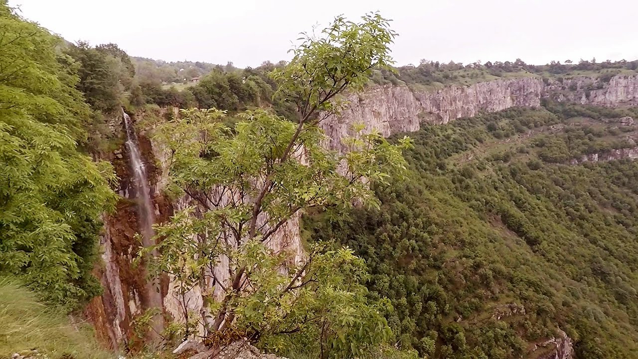
Beusnita waterfall (8 photos) 281.7 km away. Cascada Beusnita, located in the Caras-Severin county, is one of the most impressive waterfalls in the Anina Mountains. The water falling from a height of approximately 15 m, into a clearing in the middle of the forest, creates a uniquely picturesque landscape.


[ Top ↑ ]
Videos of nearby places
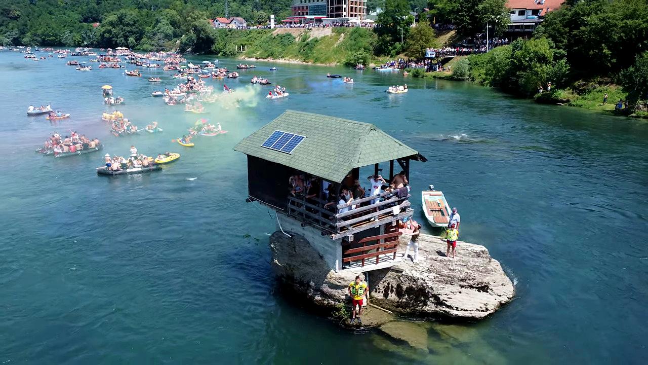
Drina river house - Bajina Bašta 156.7 km away. The house visible on the Drina River (Kućica na Drini) is a unique wooden structure built on a rock in the middle of the river, near Bajina Bašta, Serbia. The house is located on the border between Serbia and Bosnia-Herzegovina, close to the border line between the two countries.

Belogradchik fortress 224.2 km away. Belogradchik is located in the northwestern part of Bulgaria, in the Vidin Province, at the foot of the Balkan Mountains, near the Serbian border. Its name means little white town.
Bovska Skaklya waterfall - Iskar gorge 254.9 km away. The Bovska Skaklya waterfall is located near the town of Svoge in Bulgaria. The waterfall formed on the Zaselska River has several reported heights online (120 m, 85 m).
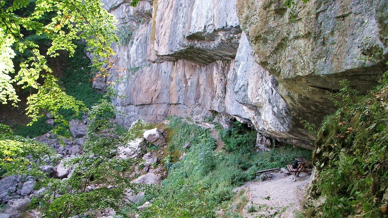
Iskar gorge Lyutibrod - Temnata dupka cave Lakatnik 260.1 km away. The Iskar is the longest purely Bulgarian river, the oldest river in the Balkans, and a right tributary of the Danube. The river is 368 km long, with approximately 150 km consisting of a gorge.
Borov Kamak waterfall - Zgorigrad, Vratsa 270.9 km away. The Vratsa eco-trail starts from the village of Zgorigrad, located 6 km from the city of Vratsa in Bulgaria, and ends at the Parshevitza hut. It is also known as the Zgorigradska or Borov Kamak eco-trail.
Other places
Belintash Ridge of Dobrostan, Rhodope Mountains 399 km away. Belintash is a mysterious monolithic complex located approximately 50 km from Plovdiv, passing through the scenic Rhodope Mountains. It is situated southeast of the village of Vrata and west of the village of Sini Vruh.
Sheepdogs Govora sheepfold Retezat mountains 374.6 km away. On the second day of my weekend Retezat hike, I visited a sheepfold on the Lancita Ridge. To my great disappointment, they didn't make cheese or curd here.
Corcoaia Gorge Gorj county 337.3 km away. The Corcoaia Gorge is one of the most beautiful tourist attractions in the Cerna Valley. It can be reached by car, 43 km away from Baile Herculane, of which about 17 km is on a dusty gravel road.
Black Rocks iron path Bihor Mountains 468.1 km away. Black Rocks is located in the Bihor Mountains, near the Vartop Saddle, to the west of it. It is interesting that the locals (if I understood correctly) do not know this name, but use the name Piatra Buna (meaning Good Stone) for this spectacular rock.
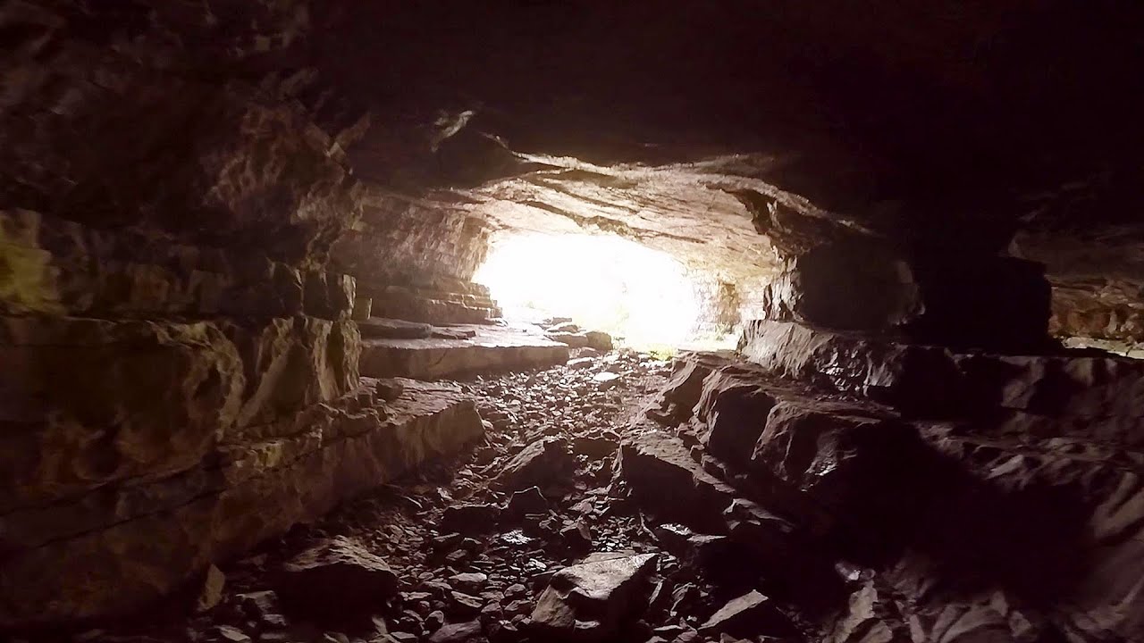
Boli Cave Banita 395.5 km away. The Boli Cave is located 6 km north of Petrosani, on the road that connects Hateg with the Jiu Valley. Here, the railway line that connects the two parts of Hunedoara County passes through, featuring a total of 66 curves and 8 tunnels.
Shiroka Laka village Smolyan 374.1 km away. Shiroka Laka is one of the most beautiful villages in Bulgaria. It is located in the Rhodope Mountains, in the Smolyan province, in the southern part of the country.
Suchurum waterfall Karlovo 373.2 km away. The 15-meter-high Suchurum Waterfall is located at the foot of the Stara Planina mountain range, 1 km north of the town of Karlovo in Bulgaria. It is situated below the Karlovo hydroelectric power plant, on the waters of the Stara Reka stream.
Vulva cave Rhodope Mountains 425.7 km away. The Vulva Cave (Peshtera Utroba) is situated near the village of Nenkovo and the city of Kardzhali, in the Rhodope Mountains of Bulgaria. It derives its name from the shape of its entrance, which resembles a vulva.
Cherven, a medieval fortified town Bulgaria 480.6 km away. Located about 30 km south of the city of Ruse in Bulgaria, the Cherven medieval fortress can be found in the Rusenski Lom Nature Park. Originally a Byzantine fortification from the 6th century, it reached the height of its development in the 14th century.
Balea waterfall and the Transfagarasan mountain_road 479.6 km away. Balea waterfall and the Transfagarasan mountain road - blue triangle marked trail, Balea valley, Fagaras Mountains, Southern Carpathians.
Transalpina Ski Resort Vidra lake 412.4 km away.
Pisoaia waterfall Vidra 460.9 km away. Pisoaia waterfall (Pisoaia Vidrii, Urine of the otter) - Nemesi, Vidra.
Eagles Eye Yagodina 356 km away. Orlovo Oko (Eagle's Eye) is a lookout viewpoint located in the Rhodope Mountains, near the peak of Saint Ilia and close to the village of Yagodina, Bulgaria. The steel structure, built at an altitude of 1,563 meters, rises 670 meters above the spectacular Buynovsko Gorge, along with the winding river and road that traverse it.
Laura iron path Baia de Fier 397.3 km away. Laura iron path (E) - Baia de Fier.
Other destinations
Via ferrata Peja 360 Peja 0.2 km away.
Via ferrata Mat Peja 0.4 km away.
Via ferrata Ari Peja 0.5 km away.
Via ferrata Marimangat Peja 1.9 km away.
[ Top ↑ ]
Copyright © 2003-2026 Trekkingklub and friends. Reproduction of any text, picture or video from this website, either in printed or electronic form, is prohibited without prior written permission.
The given distances are to be understood as straight line distances, and are approximate. Website made in Miercurea Ciuc  .
.