Cave of Ialomita river - Bucegi Mountains | Photos


Page no. 1, photos: 1-6, 17 photos in total. >>>

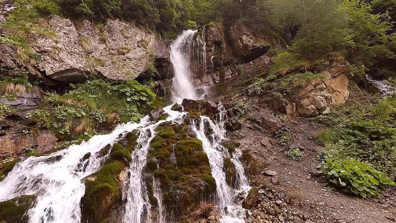
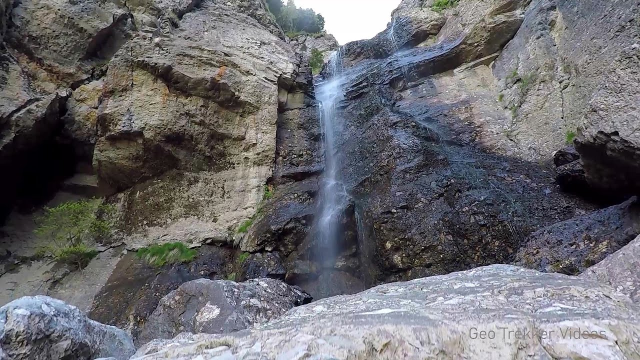
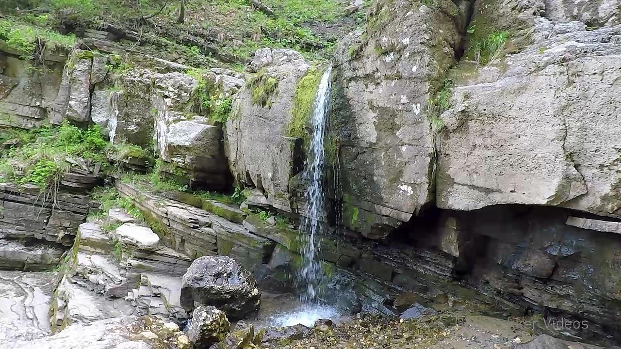
Cave of Ialomita river (Pestera Ialomitei) - Bucegi Mountains.
Copyright © 2004 - 2026 Trekkingklub.com. Please register for full and ad-free access.
Airport nearby: Ghimbav International Airport (GHV - Brașov (Ghimbav), Ro), 35 km away.
Photos of nearby places

Ladies Valley - Bucegi Mountains (12 photos) 1.4 km away. Ladies Valley (Valea Doamnele) - Bucegi Mountains.


Valley of the Slim Figures - Bucegi Mountains (5 photos) 3.7 km away. Valley of the Slim Figures (Valea Sugarilor) - Bucegi Mountains.

Valley of mountain pines - Bucegi (12 photos) 4.5 km away. Valley of mountain pines (Valea Jepilor) - Bucegi Mountains.


The source region of the Jalomita River - Bucegi Mountains (14 photos) 4.7 km away. The source region of the Jalomita River (Obarsia Ialomitei) - Bucegi Mountains.

Turkish Mosque Rock - Bucegi Mountains (6 photos) 5 km away. Turkish Mosque Rock (Mecetul Turcesc) - Bucegi Mountains.


Costila Peak, Caraiman Mountain - Bucegi (18 photos) 5.4 km away. Costila Peak, Caraiman Mountain - Bucegi Mountains.


Omu Peak, chamois - Bucegi Mountains (18 photos) 6 km away. Omu Peak (Varful Omu), chamois - Bucegi Mountains.
[ Top ↑ ]
Videos of nearby places
Foamy valley waterfall - Bucegi Mountains 6 km away. Access to the Foamy valley waterfall (Cascada Valea Spumoasa) is made from the town of Busteni. The starting point is the lower station of the cable car that ascends to the Babele cabin.
Upstream of the Izvorul Dorului creek - Vanturis waterfalls 6.5 km away. Upstream of the Izvorul Dorului (Source of longing) creek - Vanturis waterfalls, Bucegi Mountains.
Downstream of the Izvorul Dorului creek - Vanturis waterfalls 7.1 km away. Downstream of the Izvorul Dorului (Source of longing) creek - Vanturis waterfalls, Bucegi Mountains.

Big Via ferrata Rasnoavei Gorge 18.1 km away. The most dangerous Eastern European iron path, and also one of the most beautiful via ferrata routes in Romania, is in the Rasnoavei Gorges, Postavaru Mountains.The route is 450 m long, with a level difference of 220 m.

Small Via ferrata - Rasnoavei Gorge 18.1 km away. In the past few days, it has snowed, so I climbed the two climbing routes in the Rasnoavei Gorge under winter conditions. While the lower part of the challenging Big via ferrata was dry, the upper section had patches of snow and icicles.
Other places
Pietraru pottery Horezu 115.6 km away.
Devetashka cave Devetaki 244.1 km away. The Devetashka Cave is located in Bulgaria, near the village of Devetaki. After the entrance portal, which measures 30 m by 35 m, there is a vast open chamber that is 110 meters wide and 359 meters long.
Berim via ferrata Zubin Potok 475.7 km away. Difficulty level D, total length: 4 km, height difference: 520 m, year of construction: 2015. Climbing season: May 1 - October 30.
Poienii Rock, north-eastern lookout point Bicaz Gorge 160.3 km away. From the viewpoint at the top of the northeastern wall of Poienii Rock in the Bicaz Gorges, we can look down 300 meters to the mouth of the Bicajel stream. The Bridge of the Hungarians is hidden among pine trees.
Falco Peregrinus via ferrata Falcons Rock, Corbu 182 km away. Falco Peregrinus (Peregrine falcon) via ferrata (B/C) - Falcon's Rock, Corbu.
Acapulcos spur via ferrata 281.2 km away. Acapulco's spur (Pintenul lui Acapulco) via ferrata (B/C) - Montana Land, Suncuius.
Roman Baths Cetea, Trascau Mountains 174.3 km away. Roman Baths (Baile Romane) - Cetea, Trascau Mountains. Among the valleys of the Trascau Mountains, the Cetea Gorge best deserves the name of a crevice valley.
Devils Mill Gorge Campulung Moldovenesc 231.9 km away. The Devil's Mill Gorge is relatively short, measuring only 60 to 70 meters in length. It was formed in yellowish-gray-white dolomite by the work of a stream that crosses the gorge, as a result of erosion and the dissolution characteristic of limestone.
Corcoaia Gorge Gorj county 216.6 km away. The Corcoaia Gorge is one of the most beautiful tourist attractions in the Cerna Valley. It can be reached by car, 43 km away from Baile Herculane, of which about 17 km is on a dusty gravel road.
Borov Kamak waterfall Zgorigrad, Vratsa 292.8 km away. The Vratsa eco-trail starts from the village of Zgorigrad, located 6 km from the city of Vratsa in Bulgaria, and ends at the Parshevitza hut. It is also known as the Zgorigradska or Borov Kamak eco-trail.
Giant fir trees Ghimes 146.1 km away. One of the lesser-known attractions of Ghimes is the two giant-sized common fir trees. They are 42 meters tall, and have diameters of 110 cm and 130 cm at chest height.
Tureni Gorge iron path 190.2 km away. Tureni Gorge iron path visiting route (Via ferrata Cheile Tureni), Trascau Mountains.
Womens Spiral, Cave Ridge, and The Great Crack iron paths Baia de Fier 133.5 km away. Perhaps the most interesting via ferrata among the routes in the Baia de Fier area is the Womens Spiral. After completing it, I can say that it is the second most thrilling via ferrata in Romania, following the Big Via Ferrata at Rasnov.
Nobodys lake Miercurea Ciuc 109.7 km away. The passage of time (time lapse), dusk at Nobody's Lake. Miercurea Ciuc and the Sumuleu mountain can be seen in the background.
Roman Baths Geoagiu-Bai, Metaliferi Mountains 186.8 km away.
[ Top ↑ ]
Copyright © 2003-2026 Trekkingklub and friends. Reproduction of any text, picture or video from this website, either in printed or electronic form, is prohibited without prior written permission.
The given distances are to be understood as straight line distances, and are approximate. Website made in Miercurea Ciuc  .
.