Ladies Valley - Bucegi Mountains | Photos


Page no. 1, photos: 1-6, 12 photos in total. >>>

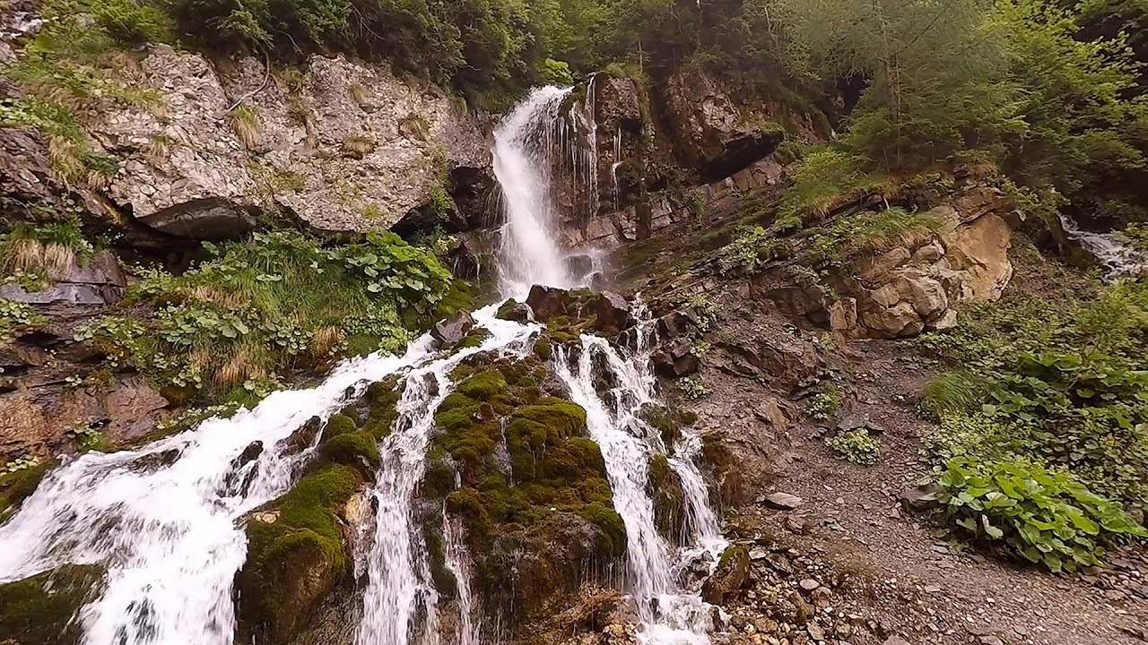
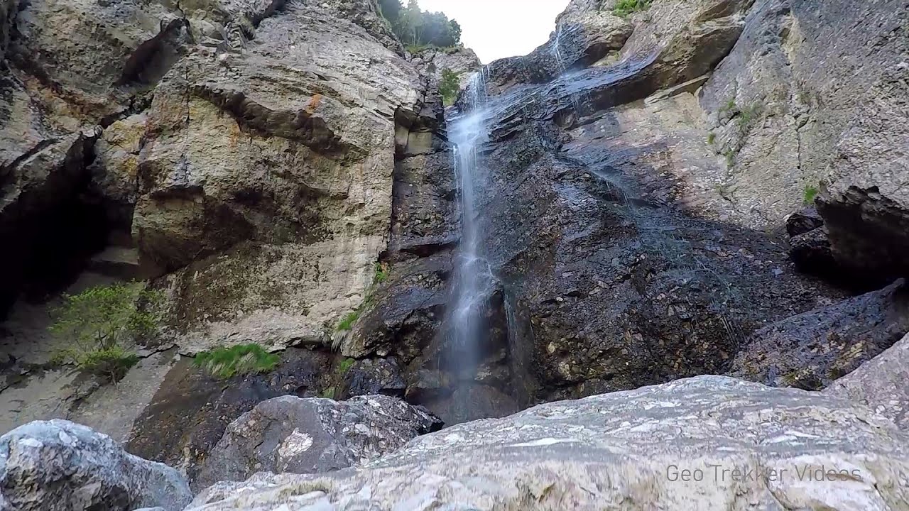
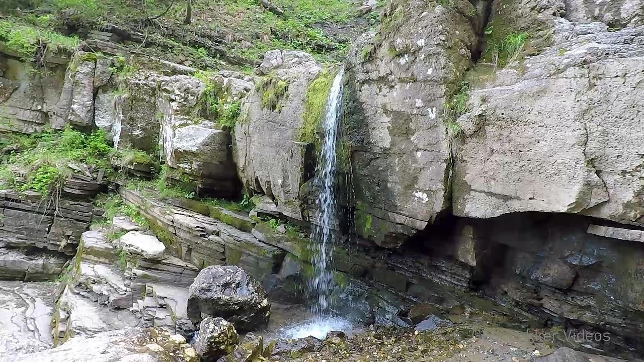
Ladies Valley (Valea Doamnele) - Bucegi Mountains.
Copyright © 2006 - 2026 Trekkingklub.com. Please register for full and ad-free access.
Airport nearby: Ghimbav International Airport (GHV - Brașov (Ghimbav), Ro), 34 km away.
Photos of nearby places

Cave of Ialomita river - Bucegi Mountains (17 photos) 1.4 km away. Cave of Ialomita river (Pestera Ialomitei) - Bucegi Mountains.


Valley of the Slim Figures - Bucegi Mountains (5 photos) 2.3 km away. Valley of the Slim Figures (Valea Sugarilor) - Bucegi Mountains.


The source region of the Jalomita River - Bucegi Mountains (14 photos) 3.3 km away. The source region of the Jalomita River (Obarsia Ialomitei) - Bucegi Mountains.

Turkish Mosque Rock - Bucegi Mountains (6 photos) 3.6 km away. Turkish Mosque Rock (Mecetul Turcesc) - Bucegi Mountains.

Valley of mountain pines - Bucegi (12 photos) 3.8 km away. Valley of mountain pines (Valea Jepilor) - Bucegi Mountains.


Costila Peak, Caraiman Mountain - Bucegi (18 photos) 4.4 km away. Costila Peak, Caraiman Mountain - Bucegi Mountains.


Omu Peak, chamois - Bucegi Mountains (18 photos) 4.6 km away. Omu Peak (Varful Omu), chamois - Bucegi Mountains.
[ Top ↑ ]
Videos of nearby places
Foamy valley waterfall - Bucegi Mountains 5.3 km away. Access to the Foamy valley waterfall (Cascada Valea Spumoasa) is made from the town of Busteni. The starting point is the lower station of the cable car that ascends to the Babele cabin.
Upstream of the Izvorul Dorului creek - Vanturis waterfalls 7.5 km away. Upstream of the Izvorul Dorului (Source of longing) creek - Vanturis waterfalls, Bucegi Mountains.
Downstream of the Izvorul Dorului creek - Vanturis waterfalls 8 km away. Downstream of the Izvorul Dorului (Source of longing) creek - Vanturis waterfalls, Bucegi Mountains.

Big Via ferrata Rasnoavei Gorge 16.7 km away. The most dangerous Eastern European iron path, and also one of the most beautiful via ferrata routes in Romania, is in the Rasnoavei Gorges, Postavaru Mountains.The route is 450 m long, with a level difference of 220 m.

Small Via ferrata - Rasnoavei Gorge 16.7 km away. In the past few days, it has snowed, so I climbed the two climbing routes in the Rasnoavei Gorge under winter conditions. While the lower part of the challenging Big via ferrata was dry, the upper section had patches of snow and icicles.
Other places
Bovska Skaklya waterfall Iskar gorge 312.6 km away. The Bovska Skaklya waterfall is located near the town of Svoge in Bulgaria. The waterfall formed on the Zaselska River has several reported heights online (120 m, 85 m).
Ski Gyimes ski slope Lunca de Sus 130.2 km away. The Ski Gyimes ski slope is located in Lunca de Sus, right next to the main road. It is 800 m long, the level difference is 160 m.
Babsko Praskalo waterfall Tazha 302 km away. In the Central Balkans National Park, there are many rivers that cascade down spectacular waterfalls, which the locals call praskalo. One of the smallest waterfalls in the area is Babsko Praskalo, which stands at only 54 meters high.
Natural stone bridge Aglen 261.4 km away. Natural stone arch on the Vit river, near the village of Aglen. Crocodile shaped rock, Elephant rock.
Blasted Rock hanging path Cerna Valley 230.1 km away. The Blasted Rock (Piatra Puscata) hanging path is located on the geographical right bank of the Cerna River, near the confluence of the Iuta stream, approximately 20 km from Baile Herculane. In this area, the presence of limestone formations has caused the valley to become narrower.
Belogradchik fortress 295.5 km away. Belogradchik is located in the northwestern part of Bulgaria, in the Vidin Province, at the foot of the Balkan Mountains, near the Serbian border. Its name means little white town.
Crystal Cave at Farcu Mine 280.7 km away. In the Padurea Craiului Mountains, near Rosia, in the Farcu bauxite mine, in 1987, the miners accidentally discovered a cave. It was filled with crystal-shaped limestone formations.
Gods bridge Vratsa 276.8 km away. Anyone who has been to Bulgaria may be familiar with the Prohodna Cave, affectionately known as the Eyes of God; the Devetashka Cave, illuminated by seven windows in its ceiling. And perhaps they have also seen the Wonderful Bridges in the Rhodope Mountains.
Mine lake Megyer mountain, Sárospatak 440.6 km away. The via ferrata routes of the Megyer mountain mine lake. The geologists' path E 25 m, Szabó József-memorial path C 200 m, Amphitheater D 40 m, Devil's Cauldron E 70 m, Sweet aquatic life D 150 m, Velociraptor C 35 m.
The Wooden Ladders The villages of Scarisoara and Inelet, Cerna valley 230.9 km away. Scarisoara and Inelet are small, isolated villages located in the mountainous region of Banat. They are situated on the right bank of the Cerna River, approximately 19 km away from the Baile Herculane resort.
Poienii Rock, north-eastern lookout point Bicaz Gorge 158.9 km away. From the viewpoint at the top of the northeastern wall of Poienii Rock in the Bicaz Gorges, we can look down 300 meters to the mouth of the Bicajel stream. The Bridge of the Hungarians is hidden among pine trees.
Devils Bridge Ardino 421.6 km away. The Devil's Bridge (Dyavolski Most, in Turkish Sheytan Kyupriya) is located in the gorge of the Arda River, just north of the town of Ardino in Bulgaria. It was constructed in the early 16th century, between 1515 and 1518, by an architect named Dimitar, on the remains of an earlier Roman bridge.
Stone Beach Sinemorets 428.7 km away. Stone Beach (Kamenniat plazh) - Sinemorets.
Vadu Crisului cave 284.4 km away. The Vadu Crisului Cave, with a total length of over 1000 meters, is located in the picturesque gorge of Crisul Repede creek. It consists of a gently meandering, long passage that features an active, stream level next to an upper, fossil level in its first section.
Sumuleu-Ciuc in winter 111.9 km away. Sumuleu-Ciuc (Csíksomlyó) in winter.
[ Top ↑ ]
Copyright © 2003-2026 Trekkingklub and friends. Reproduction of any text, picture or video from this website, either in printed or electronic form, is prohibited without prior written permission.
The given distances are to be understood as straight line distances, and are approximate. Website made in Miercurea Ciuc  .
.