Valley of the Slim Figures - Bucegi Mountains | Photos


Page no. 1, photos: 1-5, 5 photos in total.

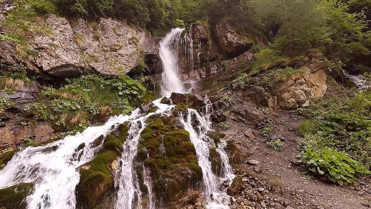
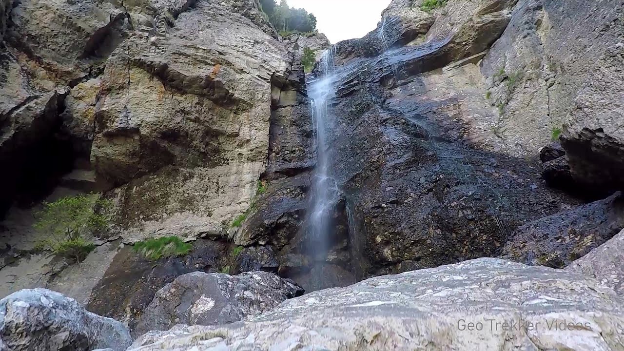
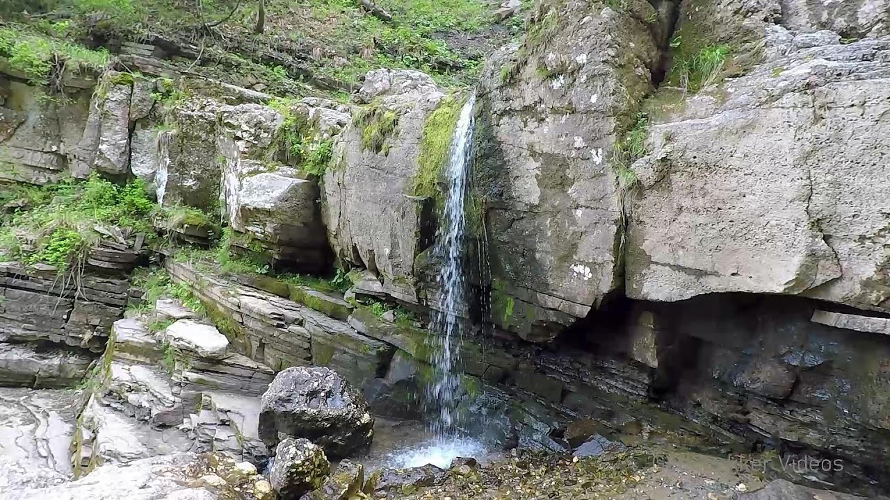
Valley of the Slim Figures (Valea Sugarilor) - Bucegi Mountains.
Copyright © 2006 - 2026 Trekkingklub.com. Please register for full and ad-free access.
Airport nearby: Ghimbav International Airport (GHV - Brașov (Ghimbav), Ro), 32 km away.
Photos of nearby places


The source region of the Jalomita River - Bucegi Mountains (14 photos) 2 km away. The source region of the Jalomita River (Obarsia Ialomitei) - Bucegi Mountains.

Turkish Mosque Rock - Bucegi Mountains (6 photos) 2.1 km away. Turkish Mosque Rock (Mecetul Turcesc) - Bucegi Mountains.

Ladies Valley - Bucegi Mountains (12 photos) 2.3 km away. Ladies Valley (Valea Doamnele) - Bucegi Mountains.

Valley of mountain pines - Bucegi (12 photos) 2.6 km away. Valley of mountain pines (Valea Jepilor) - Bucegi Mountains.

Omu Peak, chamois - Bucegi Mountains (18 photos) 2.8 km away. Omu Peak (Varful Omu), chamois - Bucegi Mountains.

Costila Peak, Caraiman Mountain - Bucegi (18 photos) 2.8 km away. Costila Peak, Caraiman Mountain - Bucegi Mountains.


Cave of Ialomita river - Bucegi Mountains (17 photos) 3.7 km away. Cave of Ialomita river (Pestera Ialomitei) - Bucegi Mountains.

Ciubotea-Scara - Bucegi Mountains (24 photos) 3.8 km away. Ciubotea clearing - Scara peak - Omu peak - Gaura sheepfold.
[ Top ↑ ]
Videos of nearby places
Foamy valley waterfall - Bucegi Mountains 4 km away. Access to the Foamy valley waterfall (Cascada Valea Spumoasa) is made from the town of Busteni. The starting point is the lower station of the cable car that ascends to the Babele cabin.
Upstream of the Izvorul Dorului creek - Vanturis waterfalls 8.8 km away. Upstream of the Izvorul Dorului (Source of longing) creek - Vanturis waterfalls, Bucegi Mountains.
Downstream of the Izvorul Dorului creek - Vanturis waterfalls 9.2 km away. Downstream of the Izvorul Dorului (Source of longing) creek - Vanturis waterfalls, Bucegi Mountains.

Big Via ferrata Rasnoavei Gorge 14.5 km away. The most dangerous Eastern European iron path, and also one of the most beautiful via ferrata routes in Romania, is in the Rasnoavei Gorges, Postavaru Mountains.The route is 450 m long, with a level difference of 220 m.

Small Via ferrata - Rasnoavei Gorge 14.5 km away. In the past few days, it has snowed, so I climbed the two climbing routes in the Rasnoavei Gorge under winter conditions. While the lower part of the challenging Big via ferrata was dry, the upper section had patches of snow and icicles.
Other places
Boli Cave Banita 167.3 km away. The Boli Cave is located 6 km north of Petrosani, on the road that connects Hateg with the Jiu Valley. Here, the railway line that connects the two parts of Hunedoara County passes through, featuring a total of 66 curves and 8 tunnels.
The Trovants Museum in Winter Costesti 113.5 km away.
Transalpina Ski Resort Vidra lake 137.1 km away.
Nobodys lake Miercurea Ciuc 106.2 km away. The passage of time (time lapse), dusk at Nobody's Lake. Miercurea Ciuc and the Sumuleu mountain can be seen in the background.
Dóczi stone-quarry Jigodin 105.3 km away.
Hot air balloon parade 2015 Campu Cetatii 143.1 km away. This year, the Hot Air Balloon Parade was organized in Campu Cetatii for the tenth time. Unfortunately, the weather only allowed for flying on Saturday morning and evening.
Falco Peregrinus via ferrata Falcons Rock, Corbu 178.7 km away. Falco Peregrinus (Peregrine falcon) via ferrata (B/C) - Falcon's Rock, Corbu.
Borov Kamak waterfall Zgorigrad, Vratsa 296.5 km away. The Vratsa eco-trail starts from the village of Zgorigrad, located 6 km from the city of Vratsa in Bulgaria, and ends at the Parshevitza hut. It is also known as the Zgorigradska or Borov Kamak eco-trail.
Prohodna cave Karlukovo 273.1 km away. The Prohodna cave nicknamed The Eyes of God is located in Bulgaria, in the Iskar Gorge, on one of the largest karst areas in Bulgaria, 2 km from the town of Karlukovo. It is essentially a 262-meter-long natural stone bridge, with a large (45 m high) and a small (35 m high) entrance.
Crystal Cave at Farcu Mine 281 km away. In the Padurea Craiului Mountains, near Rosia, in the Farcu bauxite mine, in 1987, the miners accidentally discovered a cave. It was filled with crystal-shaped limestone formations.
Banita Gorge and Banita rock bridge 167.9 km away. They say about this place that only very few people know about it, but that's not true. In fact, most nature lovers have heard of it, seen pictures taken here, even if not everyone has been able to come here.
Berim via ferrata Zubin Potok 479.1 km away. Difficulty level D, total length: 4 km, height difference: 520 m, year of construction: 2015. Climbing season: May 1 - October 30.
Devetashka cave Devetaki 247.5 km away. The Devetashka Cave is located in Bulgaria, near the village of Devetaki. After the entrance portal, which measures 30 m by 35 m, there is a vast open chamber that is 110 meters wide and 359 meters long.
Dalbina waterfall, Dark Blue Bruises of the Ponor 187.5 km away. Dalbina waterfall, Dark Blue Bruises of the Ponor (Vanatarile Ponorului).
TV-radio amplifying station Harghita Ciceu 109.1 km away. The hiking trail marked with a blue stripe starts at the Uz Bence shelter and runs from Harghita-Bai to Harghita Madaras. Our destination today is the Harghita Ciceu plateau.
[ Top ↑ ]
Copyright © 2003-2026 Trekkingklub and friends. Reproduction of any text, picture or video from this website, either in printed or electronic form, is prohibited without prior written permission.
The given distances are to be understood as straight line distances, and are approximate. Website made in Miercurea Ciuc  .
.