Costila Peak, Caraiman Mountain - Bucegi | Photos


Page no. 1, photos: 1-6, 18 photos in total. >>>

Costila Peak, Caraiman Mountain - Bucegi Mountains.
Copyright © 2005 - 2026 Trekkingklub.com. Please register for full and ad-free access.
Airport nearby: Ghimbav International Airport (GHV - Brașov (Ghimbav), Ro), 32 km away.
Photos of nearby places

Valley of mountain pines - Bucegi (12 photos) 1 km away. Valley of mountain pines (Valea Jepilor) - Bucegi Mountains.


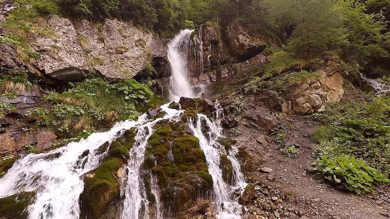
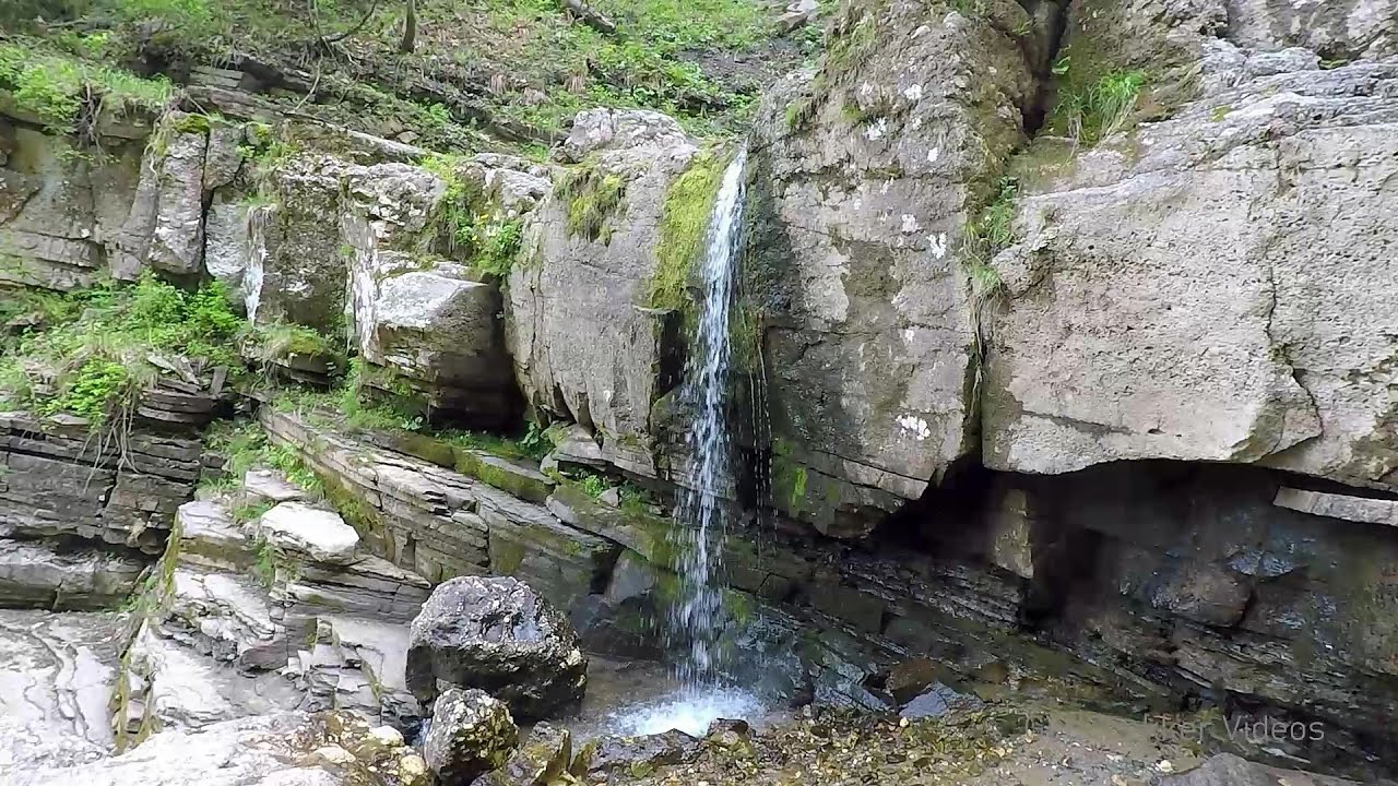
Urlatoarea waterfall - Bucegi Mountains (8 photos) 2.6 km away. Urlatoarea waterfall (Cascada Urlatoarea) - Bucegi Mountains.

Valley of the Slim Figures - Bucegi Mountains (5 photos) 2.8 km away. Valley of the Slim Figures (Valea Sugarilor) - Bucegi Mountains.


Ladies Valley - Bucegi Mountains (12 photos) 4.4 km away. Ladies Valley (Valea Doamnele) - Bucegi Mountains.

Turkish Mosque Rock - Bucegi Mountains (6 photos) 4.5 km away. Turkish Mosque Rock (Mecetul Turcesc) - Bucegi Mountains.

The source region of the Jalomita River - Bucegi Mountains (14 photos) 4.5 km away. The source region of the Jalomita River (Obarsia Ialomitei) - Bucegi Mountains.

Omu Peak, chamois - Bucegi Mountains (18 photos) 4.6 km away. Omu Peak (Varful Omu), chamois - Bucegi Mountains.

Great Bucsoi Mountain, Omu Peak - Bucegi (24 photos) 5.2 km away. Great Bucsoi Mountain (Bucsoiul Mare), Omu Peak (Varful Omu) - Bucegi Mountains.
[ Top ↑ ]
Videos of nearby places
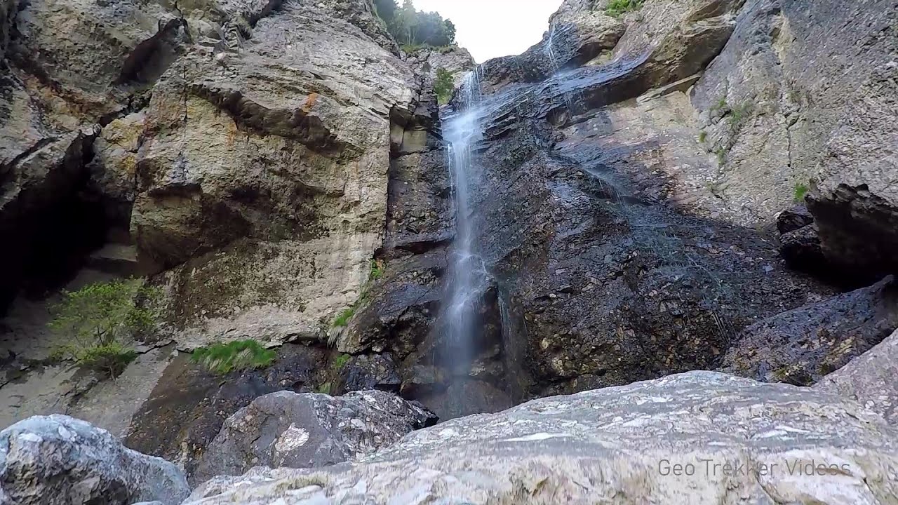
Foamy valley waterfall - Bucegi Mountains 1.3 km away. Access to the Foamy valley waterfall (Cascada Valea Spumoasa) is made from the town of Busteni. The starting point is the lower station of the cable car that ascends to the Babele cabin.
Upstream of the Izvorul Dorului creek - Vanturis waterfalls 8.3 km away. Upstream of the Izvorul Dorului (Source of longing) creek - Vanturis waterfalls, Bucegi Mountains.
Downstream of the Izvorul Dorului creek - Vanturis waterfalls 8.3 km away. Downstream of the Izvorul Dorului (Source of longing) creek - Vanturis waterfalls, Bucegi Mountains.

Big Via ferrata Rasnoavei Gorge 14.5 km away. The most dangerous Eastern European iron path, and also one of the most beautiful via ferrata routes in Romania, is in the Rasnoavei Gorges, Postavaru Mountains.The route is 450 m long, with a level difference of 220 m.

Small Via ferrata - Rasnoavei Gorge 14.5 km away. In the past few days, it has snowed, so I climbed the two climbing routes in the Rasnoavei Gorge under winter conditions. While the lower part of the challenging Big via ferrata was dry, the upper section had patches of snow and icicles.
Other places
Via Ferrata Pink Panther Baia de Fier 138.3 km away. In the area of Baia de Fier in Gorj County, several via ferrata routes have been set up on the rock above the Women's Cave (Muierii Cave) and on the other side of the road. At that time (2018), there were a total of seven.
Roman Baths Geoagiu-Bai, Metaliferi Mountains 190.4 km away.
Banita Gorge and Banita rock bridge 170.6 km away. They say about this place that only very few people know about it, but that's not true. In fact, most nature lovers have heard of it, seen pictures taken here, even if not everyone has been able to come here.
Sheepdogs Govora sheepfold Retezat mountains 196.2 km away. On the second day of my weekend Retezat hike, I visited a sheepfold on the Lancita Ridge. To my great disappointment, they didn't make cheese or curd here.
The palm of God and the Heavens door Fundatura Ponorului mountain village 182.1 km away. One of the most picturesque places in Romania, one of the most beautiful mountain villages, and a photographer's paradise. Fundatura Ponorului is located in the Ponor Stream Valley, part of the Gradistea Muncelului - Cioclovina National Park, in the Sureanu Mountains.
Big Cave Nochevo 394.1 km away. Kodzha in (Golyamata Peshtera, Big Cave) - Nochevo.
Natural stone bridge Aglen 264 km away. Natural stone arch on the Vit river, near the village of Aglen. Crocodile shaped rock, Elephant rock.
Bovska Skaklya waterfall Iskar gorge 316 km away. The Bovska Skaklya waterfall is located near the town of Svoge in Bulgaria. The waterfall formed on the Zaselska River has several reported heights online (120 m, 85 m).
Sugau Stone lookout point and iron path, Sugau Gorge Munticelu 159.3 km away. Sugau Stone lookout point and iron path (B/C), Sugau Gorge - Munticelu Nature Reserve.
Abandoned Sports Hall Varna 313.2 km away. An abandoned sports hall in Varna, with an unfinished dormitory and tennis courts across three levels.
Buzludzha monument Kazanluk 298.1 km away. Buzludzha is a historically significant mountain located in the Central Balkan Mountains of Bulgaria. At its summit, at an altitude of 1432 meters above sea level, there is an abandoned monument.
Waterfalls of Velnita stone-quarry Targu Ocna 125.1 km away. Starting from the Velnita quarry, an adventurous nature enthusiast, accustomed to wild and rugged terrains, will discover a true waterfall paradise. At the upper part of the quarry, two streams converge.
The Wooden Ladders The villages of Scarisoara and Inelet, Cerna valley 235.3 km away. Scarisoara and Inelet are small, isolated villages located in the mountainous region of Banat. They are situated on the right bank of the Cerna River, approximately 19 km away from the Baile Herculane resort.
Babsko Praskalo waterfall Tazha 303.6 km away. In the Central Balkans National Park, there are many rivers that cascade down spectacular waterfalls, which the locals call praskalo. One of the smallest waterfalls in the area is Babsko Praskalo, which stands at only 54 meters high.
Neviastata ecopath and iron path Smolyan 429.7 km away. The Neviastata eco-trail is located in Bulgaria, nestled in the heart of the Rhodope Mountains, between Smolyan and Pamporovo. Here, you will find a small, paid adventure park.
[ Top ↑ ]
Copyright © 2003-2026 Trekkingklub and friends. Reproduction of any text, picture or video from this website, either in printed or electronic form, is prohibited without prior written permission.
The given distances are to be understood as straight line distances, and are approximate. Website made in Miercurea Ciuc  .
.