Tourist attractions near Ucuris (Olcea, Bihor county, Romania)
Photos of nearby places

Kings Cave - Padurea Craiului Mountains (48 photos) 44.4 km away. Craiului (Kings) Cave - Padurea Craiului Mountains.

Sohodol pit cave - Padurea Craiului Mountains (10 photos) 45.5 km away. Sohodol pit cave (Avenul Sohodol) - Padurea Craiului Mountains.

Fern Cave - Padurea Craiului Mountains (9 photos) 47.1 km away. Ferigi (Fern) Cave - Padurea Craiului Mountains.


Valley of Hell - Padurea Craiului Mountains (23 photos) 51.7 km away. Valley of Hell (Valea Iadului) - Padurea Craiului Mountains.

Moanei Cave - Padurea Craiului Mountains (58 photos) 52.3 km away. The Moanei Cave (Pestera Moanei) is located on the upper course of the Misid River, on the right side of the Misid Gorge (Cheilor Misidului). The cave has two entrances, one fossil and sloped, while a subterranean stream flows through the active gallery.

The cave from the spring - Padurea Craiului Mountains (8 photos) 55.5 km away. Pestera de la Izvor (The cave from the spring) - Padurea Craiului Mountains.

Napistileu cave - Padurea Craiului (10 photos) 55.6 km away. Napistileu (Ungurul Mic) cave - Padurea Craiului Mountains.

Cave of Winds - Padurea Craiului Mountains (24 photos) 55.8 km away. The Cave of Winds (Pestera Vantului) is located in the Padurea Craiului Mountains, not far from Frantura meadow, near Suncuius, on the left geographical side of the Crisul Repede River. The Cave of Winds was discovered in 1957 by Béla Bagaméri and is currently (as of 2003) the longest cave system known in Romania as well as in the Carpathian Basin.


Oxen Waterfall - Padurea Craiului Mountains (12 photos) 58.5 km away. Oxen Waterfall (Cascada Boilor) - Padurea Craiului Mountains.


Balcony Clearing - Trascau Mountains (6 photos) 118.3 km away. Balcony Clearing (Erkély-tisztás, Balconul Sipotelor) - Trascau Mountains.

Dark Blue Bruises of the Ponor, Bedeleu (24 photos) 118.5 km away. Dark Blue Bruises of the Ponor (Vanatarile Ponorului), Bedeleu - Trascau Mountains.

Dark Blue Bruises of the Ponor - Trascau Mountains (16 photos) 118.7 km away. The Dark Blue Bruises of the Ponor (Vanatarile Ponorului) is a polje-type protected area. Polje is a Slovenian word meaning plain, and it refers to a surface karst form.

Aries valley - Trascau Mountains (10 photos) 118.7 km away. Aries (Golden) valley - Trascau Mountains.

Dragons Garden - Galgau Almasului (20 photos) 119.9 km away. The natural reservation site Dragon's Garden (Gradina Zmeilor, Sárkányok kertje) from Galgaul Almasului is located in Salaj County, in the Western Carpathians. This natural playground is made up of interesting and unusual sandstone formations, an ensemble of 10-12 m high towers with strange figures cut in sandstone by the wind and water erosion.

Goats Ledge - Trascau Mountains (10 photos) 121.1 km away. Goats Ledge (Brana Caprei, Kecskék párkánya) - Trascau Mountains .
[ Top ↑ ]
Videos of nearby places

Crystal Cave at Farcu Mine 40.8 km away. In the Padurea Craiului Mountains, near Rosia, in the Farcu bauxite mine, in 1987, the miners accidentally discovered a cave. It was filled with crystal-shaped limestone formations.

Meziad cave - Padurea Craiului Mountains 42.1 km away. The Meziad Cave is located near the village of Meziad, 22 km north of Beius, in the Padurea Craiului Mountains. It is one of our first tourist caves, its exploration is associated with the name of Gyula Czárán, cave researcher and writer.

Black Rocks iron path - Bihor Mountains 53.2 km away. Black Rocks is located in the Bihor Mountains, near the Vartop Saddle, to the west of it. It is interesting that the locals (if I understood correctly) do not know this name, but use the name Piatra Buna (meaning Good Stone) for this spectacular rock.

Vadu Crisului cave 55.5 km away. The Vadu Crisului Cave, with a total length of over 1000 meters, is located in the picturesque gorge of Crisul Repede creek. It consists of a gently meandering, long passage that features an active, stream level next to an upper, fossil level in its first section.

Hodoaba Valley iron path - Suncuius 55.7 km away. The Hodoaba Valley iron path is Romania's shortest and easiest (official) via ferrata route. It is located near Suncuius, in the Padurea Craiului Mountains, on the left bank of the Crisul Repede River.
Other places

Crivadia Gorge 162.5 km away. The Crivadia Gorge is located next to the village of Crivadia, which belongs to Banita. Access is difficult, and the hike is made through the streambed, with water up to the waist at its narrowest point.

TV-radio amplifying station Harghita Ciceu 281.6 km away. The hiking trail marked with a blue stripe starts at the Uz Bence shelter and runs from Harghita-Bai to Harghita Madaras. Our destination today is the Harghita Ciceu plateau.
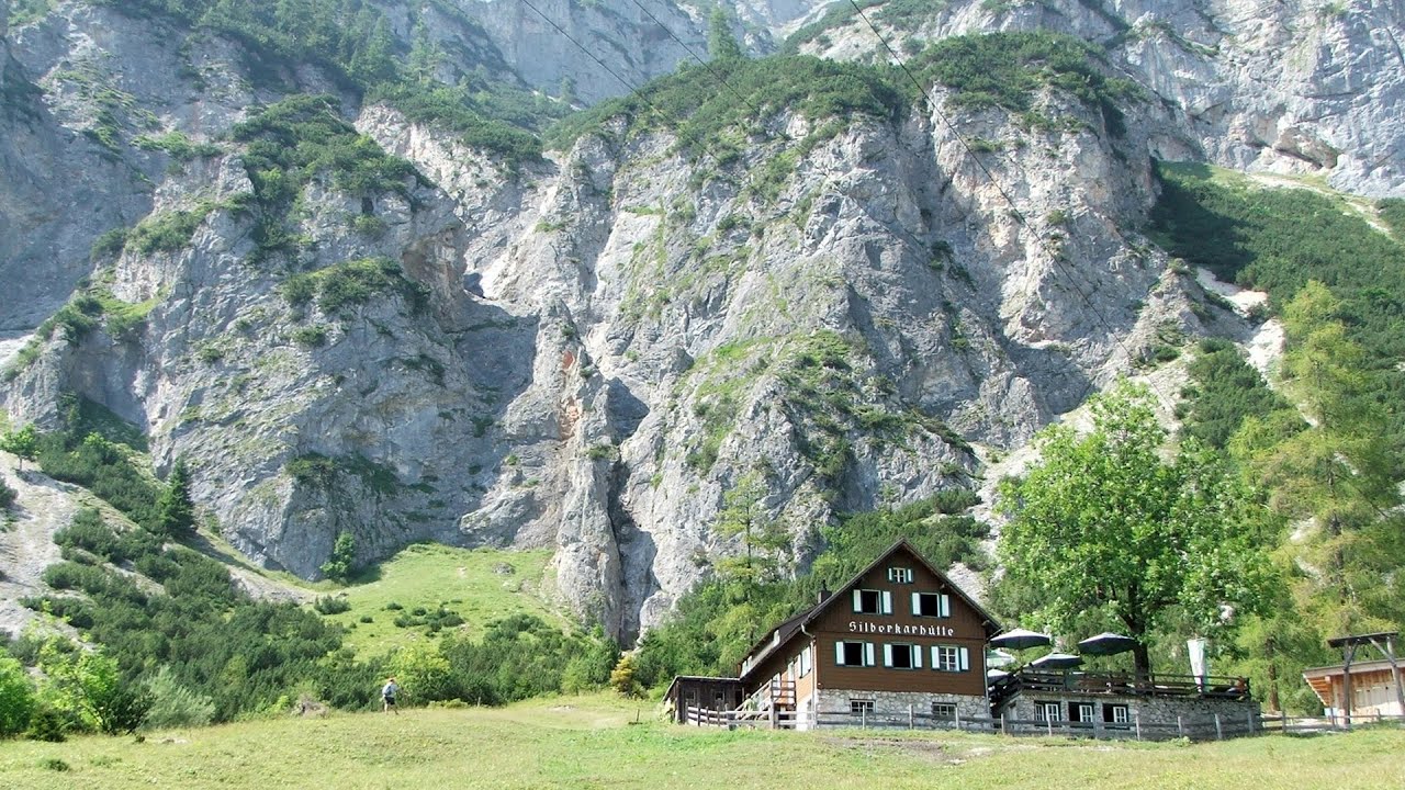
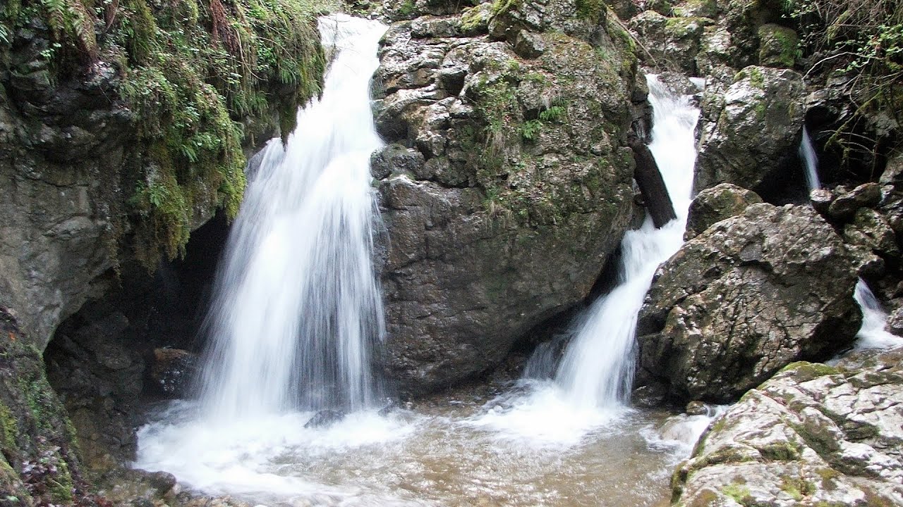
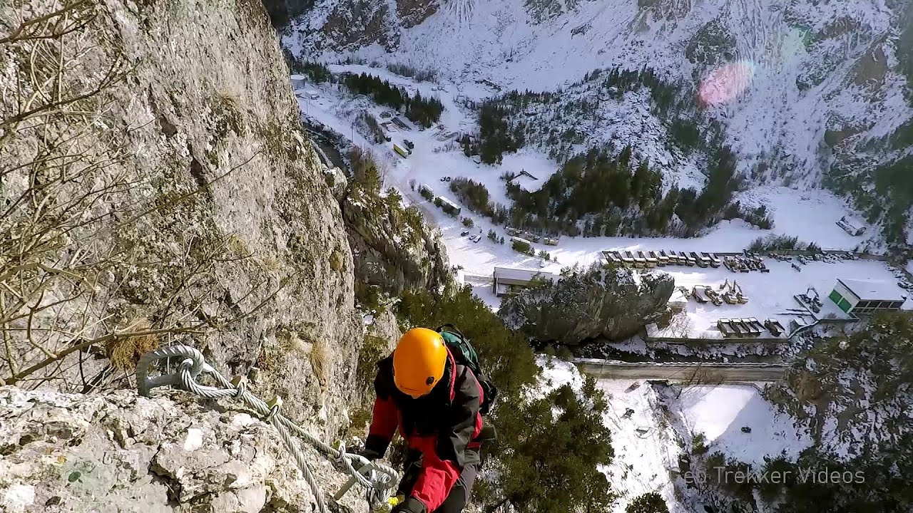
Siega via ferrata Silberkar Gorge, Ramsau am Dachstein The Siega via ferrata, categorized as a C/D level of difficulty, is perhaps the least interesting of the three via ferrata routes in the Silberkar Gorge (Silberkarklamm). This doesn't mean that it's not good, just that the other two are even better.
Waterfalls of Lapos creek Bicaz Gorge 294.5 km away. One of the lesser-known attractions of the Bicaz Gorges is the series of waterfalls along Lapos Creek. This creek flows between Cupas Stone and Bardos Stone before eventually merging with Bicaz Creek, forming spectacular waterfalls beneath the Altar Stone.

Dino Parc Rasnov 294.9 km away. On June 12, 2015, one of the largest dinosaur theme parks in the region opened in Rasnov, where we can see 45 life-sized dinosaurs. The facility is located directly next to the Rasnov Fortress, which is one of the best-preserved Transylvanian Saxon peasant fortresses.
Astragalus iron path in winter Glod Stone, Munticelu 297.5 km away. The official website of the Sugau Gorge published information about a new via ferrata climbing route named Astragalus. Sugau Gorges - Munticelu is a nature conservation area part of Natura 2000 located in Neamt County, which borders Harghita County.

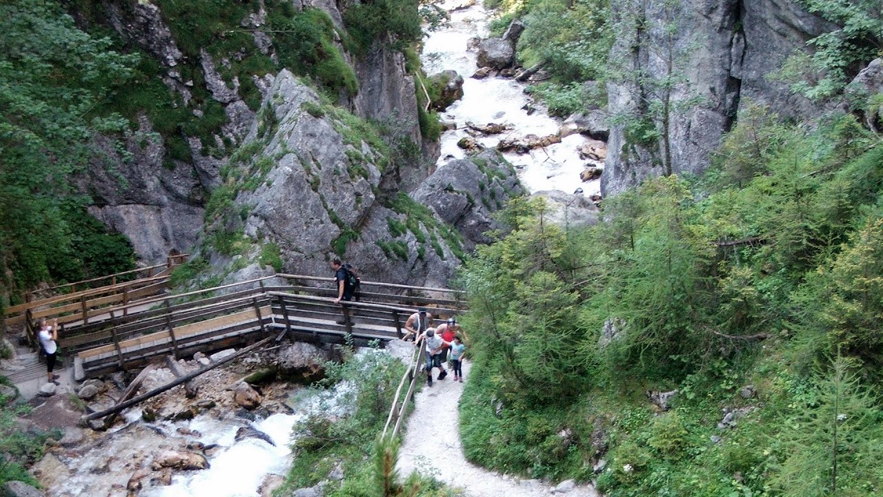
Silberkar Gorge Ramsau am Dachstein One of the most beautiful hiking spots in the area of Ramsau am Dachstein, is the Silberkarklamm (Silberkar Gorge). It is possible to drive to the entrance of the gorge, there is parking available on the side of the road, and you have to pay an entrance fee.

Shipka pass Shipka The Shipka Pass is one of the most spectacular crossings of the Balkan Mountains, and is part of the Bulgarka Nature Park. It separates the provinces of Gabrovo and Stara Zagora, and provides a connection between the cities of Gabrovo and Kazanlak.
[ Top ↑ ]
Copyright © 2003-2026 Trekkingklub and friends. Reproduction of any text, picture or video from this website, either in printed or electronic form, is prohibited without prior written permission. Website made with love  in Miercurea Ciuc.