Tourist attractions near Valea de Jos (Rieni, Bihor county, Romania)
Photos of nearby places


Valley of Hell - Padurea Craiului Mountains (23 photos) 28.2 km away. Valley of Hell (Valea Iadului) - Padurea Craiului Mountains.

Kings Cave - Padurea Craiului Mountains (48 photos) 28.8 km away. Craiului (Kings) Cave - Padurea Craiului Mountains.


Fern Cave - Padurea Craiului Mountains (9 photos) 30.4 km away. Ferigi (Fern) Cave - Padurea Craiului Mountains.

Sohodol pit cave - Padurea Craiului Mountains (10 photos) 33.1 km away. Sohodol pit cave (Avenul Sohodol) - Padurea Craiului Mountains.

Moanei Cave - Padurea Craiului Mountains (58 photos) 36.6 km away. The Moanei Cave (Pestera Moanei) is located on the upper course of the Misid River, on the right side of the Misid Gorge (Cheilor Misidului). The cave has two entrances, one fossil and sloped, while a subterranean stream flows through the active gallery.

Oxen Waterfall - Padurea Craiului Mountains (12 photos) 38.3 km away. Oxen Waterfall (Cascada Boilor) - Padurea Craiului Mountains.

The cave from the spring - Padurea Craiului Mountains (8 photos) 40.5 km away. Pestera de la Izvor (The cave from the spring) - Padurea Craiului Mountains.

Napistileu cave - Padurea Craiului (10 photos) 40.5 km away. Napistileu (Ungurul Mic) cave - Padurea Craiului Mountains.


Cave of Winds - Padurea Craiului Mountains (24 photos) 41 km away. The Cave of Winds (Pestera Vantului) is located in the Padurea Craiului Mountains, not far from Frantura meadow, near Suncuius, on the left geographical side of the Crisul Repede River. The Cave of Winds was discovered in 1957 by Béla Bagaméri and is currently (as of 2003) the longest cave system known in Romania as well as in the Carpathian Basin.

Balcony Clearing - Trascau Mountains (6 photos) 77.3 km away. Balcony Clearing (Erkély-tisztás, Balconul Sipotelor) - Trascau Mountains.

Dark Blue Bruises of the Ponor, Bedeleu (24 photos) 77.6 km away. Dark Blue Bruises of the Ponor (Vanatarile Ponorului), Bedeleu - Trascau Mountains.

Aries valley - Trascau Mountains (10 photos) 77.7 km away. Aries (Golden) valley - Trascau Mountains.

Dark Blue Bruises of the Ponor - Trascau Mountains (16 photos) 77.8 km away. The Dark Blue Bruises of the Ponor (Vanatarile Ponorului) is a polje-type protected area. Polje is a Slovenian word meaning plain, and it refers to a surface karst form.

Goats Ledge - Trascau Mountains (10 photos) 80.6 km away. Goats Ledge (Brana Caprei, Kecskék párkánya) - Trascau Mountains .

Stone of Cetea, Horse Pit - Trascau (16 photos) 83.9 km away. Stone of Cetea, Horse Pit (The pit cave from the Stone of Cetea) - Trascau Mountains.
[ Top ↑ ]
Videos of nearby places

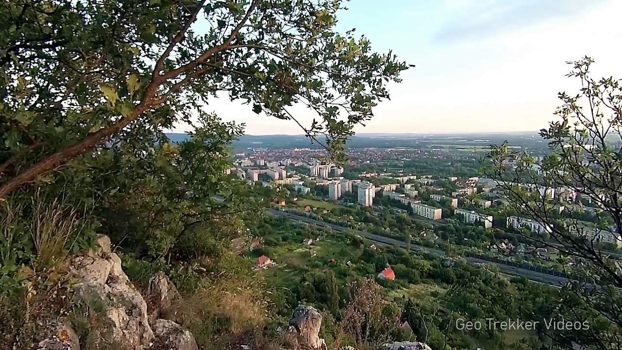
Black Rocks iron path - Bihor Mountains 12.7 km away. Black Rocks is located in the Bihor Mountains, near the Vartop Saddle, to the west of it. It is interesting that the locals (if I understood correctly) do not know this name, but use the name Piatra Buna (meaning Good Stone) for this spectacular rock.

Meziad cave - Padurea Craiului Mountains 21.2 km away. The Meziad Cave is located near the village of Meziad, 22 km north of Beius, in the Padurea Craiului Mountains. It is one of our first tourist caves, its exploration is associated with the name of Gyula Czárán, cave researcher and writer.

Crystal Cave at Farcu Mine 27.7 km away. In the Padurea Craiului Mountains, near Rosia, in the Farcu bauxite mine, in 1987, the miners accidentally discovered a cave. It was filled with crystal-shaped limestone formations.

Pisoaia waterfall - Vidra 38 km away. Pisoaia waterfall (Pisoaia Vidrii, Urine of the otter) - Nemesi, Vidra.

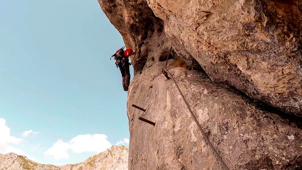
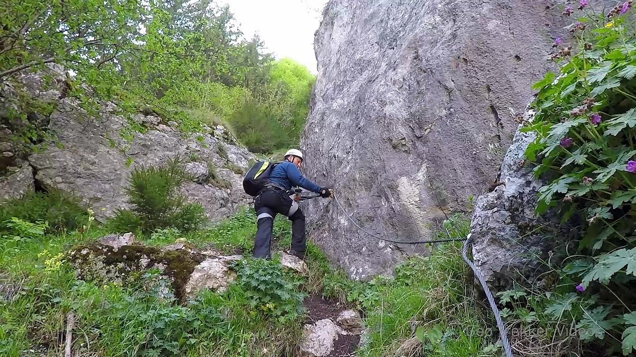
Hodoaba Valley iron path - Suncuius 40.3 km away. The Hodoaba Valley iron path is Romania's shortest and easiest (official) via ferrata route. It is located near Suncuius, in the Padurea Craiului Mountains, on the left bank of the Crisul Repede River.
Other places
Kaiserschild Klettersteig Eisenerzer Ramsau The 2,085-meter-high Kaiserschild peak is situated on the northern edge of the Eisenerz Alps in Styria, Austria. It forms a double summit with the slightly taller Hochkogel peak, which stands at 2,105 meters.

Vulva cave Rhodope Mountains The Vulva Cave (Peshtera Utroba) is situated near the village of Nenkovo and the city of Kardzhali, in the Rhodope Mountains of Bulgaria. It derives its name from the shape of its entrance, which resembles a vulva.
Sugau Stone lookout point and iron path, Sugau Gorge Munticelu 257.8 km away. Sugau Stone lookout point and iron path (B/C), Sugau Gorge - Munticelu Nature Reserve.
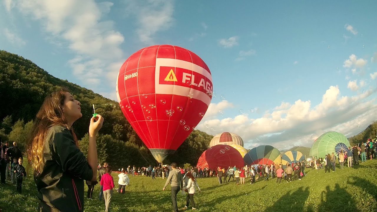
Hot air balloon parade 2015 Campu Cetatii 192.5 km away. This year, the Hot Air Balloon Parade was organized in Campu Cetatii for the tenth time. Unfortunately, the weather only allowed for flying on Saturday morning and evening.
Lookout platform Kis-Tubes Western Mecsek 332.5 km away. The lookout platform at Kis-Tubes, located at an altitude of 577 meters, was built in 1959, and offers a magnificent panorama of Pécs at the foot of the hills. The concrete lookout, situated on the western side of the Kis-Tubes peak along the ridge connecting Misina to Tubes, was designed by Tibor Kiss.

Shipka pass Shipka 480.6 km away. The Shipka Pass is one of the most spectacular crossings of the Balkan Mountains, and is part of the Bulgarka Nature Park. It separates the provinces of Gabrovo and Stara Zagora, and provides a connection between the cities of Gabrovo and Kazanlak.
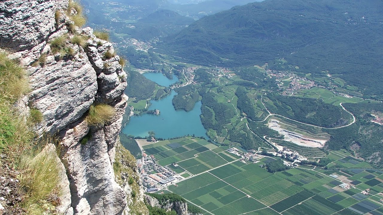
Via ferrata Ernesto Che Guevara al Monte Casale, Monti del Garda, Trentino Alto Adige The Che Guevara via ferrata is the longest iron climbing route I have ever climbed. There is a 1400 m level difference from the starting point to the peak of Monte Casale.
[ Top ↑ ]
Copyright © 2003-2026 Trekkingklub and friends. Reproduction of any text, picture or video from this website, either in printed or electronic form, is prohibited without prior written permission. Website made with love  in Miercurea Ciuc.