Tourist attractions near Cusma (Livezile, Bistrita-Nasaud county, Romania)
Photos of nearby places


Hollow Stone - Gurghiu Mountains (5 photos) 53.8 km away. Hollow Stone (Likas Stone) - Gurghiu Mountains.

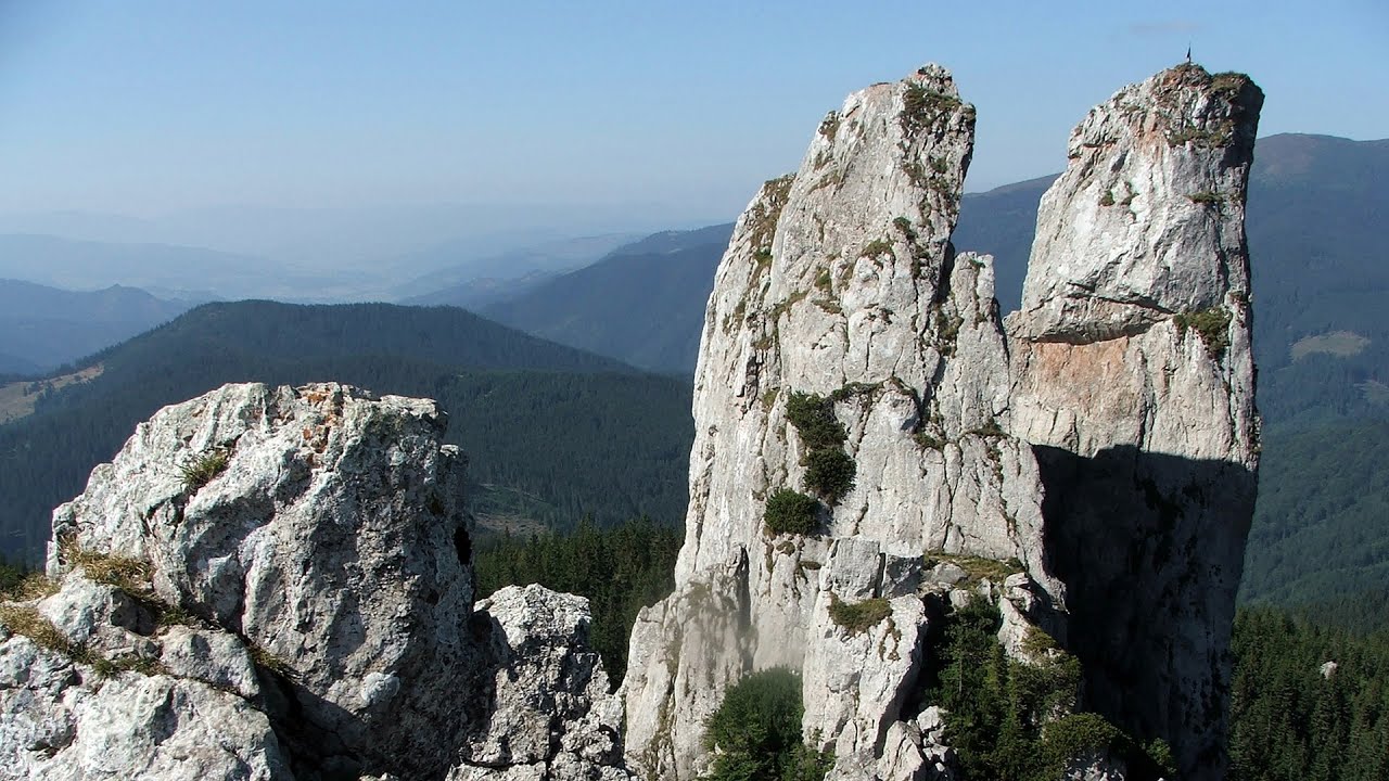
The Old Women of Gurghiu stone mushrooms, Batrana Peak (16 photos) 54.4 km away. The Old Women of Gurghiu (Babele Gurghiului) stone mushrooms, Batrana Peak (Varful Batrana). In the Gurghiu Mountains, 10 km from Toplita, near the peak Batrana, there are several groups of strange rocks.

Isuica Valley - Becheci Peak (12 photos) 60.6 km away. Isuica (Iszulyka) Valley - Becheci (Bekecs) Peak.

Table Rock - Gurghiu Mountains (10 photos) 63.4 km away. Table Rock (Asztal-kő, Stanca Mesei) - Gurghiu Mountains.

Borsec spa resort (9 photos) 67.5 km away. Borsec is one of the most beautifully situated resorts in the Eastern Carpathians. It consists of two parts: Lower Borsec and Upper Borsec, the latter being the actual resort area.

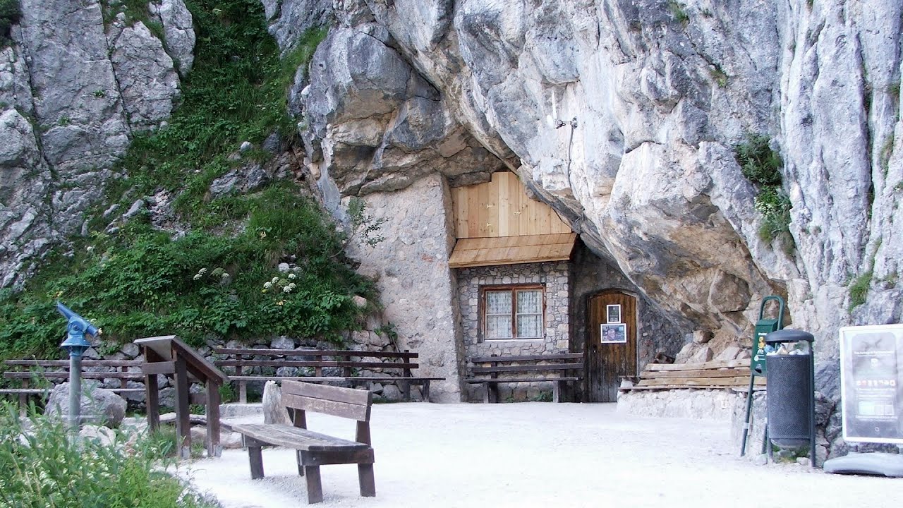
Bears cave, Ice Grotto - Borsec (12 photos) 67.8 km away. The Bears' cave is actually a deep rock fissure with a path leading into it. Local belief long considered it to be the habitat of bears, which is where the name comes from.

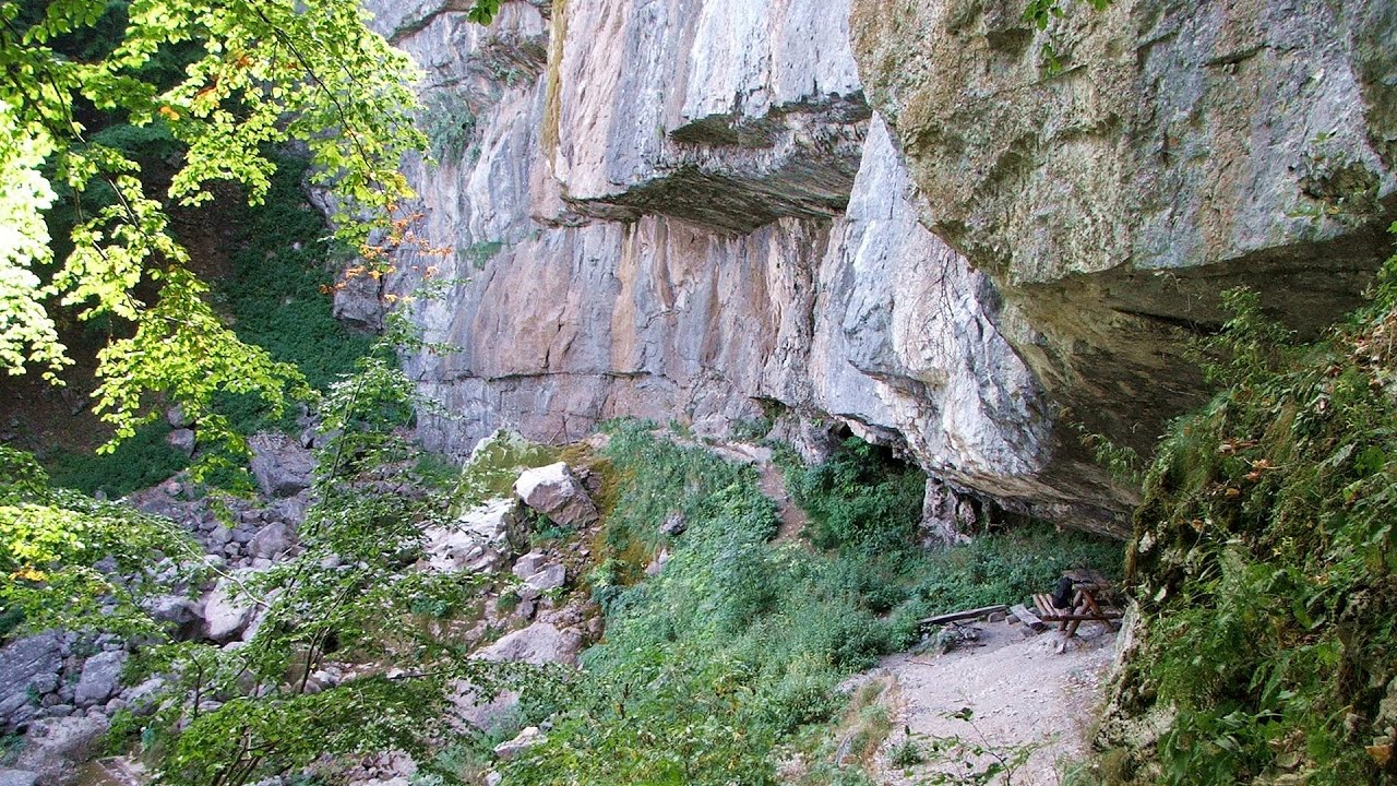
Stalactite Cave - Round Chair Hill, Borsec, Giurgeu Mountains (24 photos) 68 km away. The Stalactite Cave on the Round Chair Hill is the longest cave formed in travertine in the country. Its formation was mainly influenced by an open system of diaclases, which fragmented the travertine, with the contribution of infiltrated rainwater being essential in the transport and dissolution of limestone.

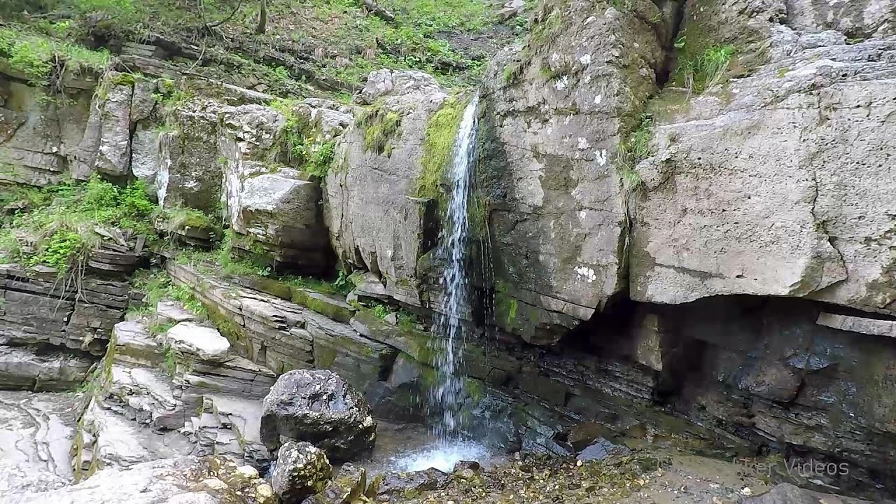
The Valleys of the Streams of the Cups and Rogozu (6 photos) 70 km away. The Valleys of the Streams of the Cups (Cupelor, Kupás) and Rogozu (Szacskai) - Borsec. September 7, 2003; September 14, 2003; November 10, 2007.

Shepherd Stone - Gurghiu Mountains (8 photos) 70.7 km away. Shepherd Stone (Pakulárkő, Piatra Pacurarului) - Gurghiu Mountains.

Small Pine Stone - Gurghiu Mountains (8 photos) 72.7 km away. Small Pine Stone (Kisfenyős Stone) - Gurghiu Mountains.

The Rock with a Hole - Corund (6 photos) 84.8 km away. The Likas Stone (The Rock with a Hole) is located near Corund, on a meadow next to the road and four graves. In the middle of the conglomerate rock block, there is a perfectly drilled, heart-shaped hole.

Sugo Cave - Giurgeu Mountains (60 photos) 89 km away. The Sugó Cave is located at the western foot of Sipos Stone (1566 m) at an altitude of 1064 m above sea level. It consists of a system of passages with four levels, totaling 1021 m in length and a level difference of -60 m.


White Glade, Horseshoe Rock (17 photos) 93.9 km away. White Glade (Poiana Alba), Horseshoe Rock (Piatra Potcoavei) - Hasmas Mountains.

Horseshoe Rock - Hasmas Mountains (9 photos) 93.9 km away. Horseshoe Rock (Piatra Potcoavei) - Hasmas Mountains.

Pit cave with three entrances - Hasmas Mountains (3 photos) 94.2 km away. Pit cave with three entrances (Avenul cu trei intrari) - Hasmas Mountains.

White Glade - Hasmas Mountains (6 photos) 94.4 km away. White Glade (Poiana Alba) - Hasmas Mountains.

Black Hasmas - Hasmas Mountains (27 photos) 95 km away. Hasmasul Negru (Black Hasmas) - Hasmas Mountains.
[ Top ↑ ]
Videos of nearby places
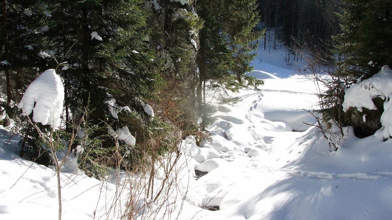
With snowshoes in the Tihu creek valley - Rastolita 31.1 km away. We met geotrekking treasure hunters from Gheorgheni, Miercurea Ciuc and Targu Mures in Rastolita. We entered the Calimani Mountains with an off-road vehicle, along the Rastolita and Tihu streams.
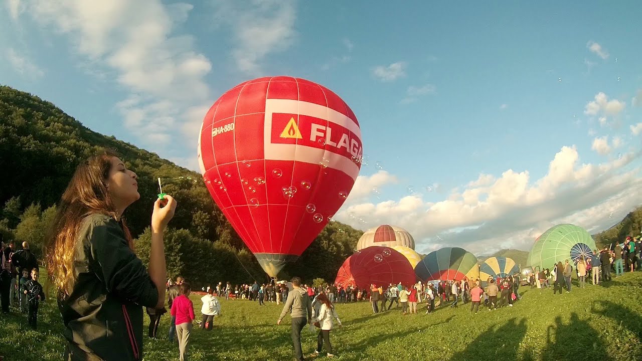
Hot air balloon parade 2015 - Campu Cetatii 56.2 km away. This year, the Hot Air Balloon Parade was organized in Campu Cetatii for the tenth time. Unfortunately, the weather only allowed for flying on Saturday morning and evening.
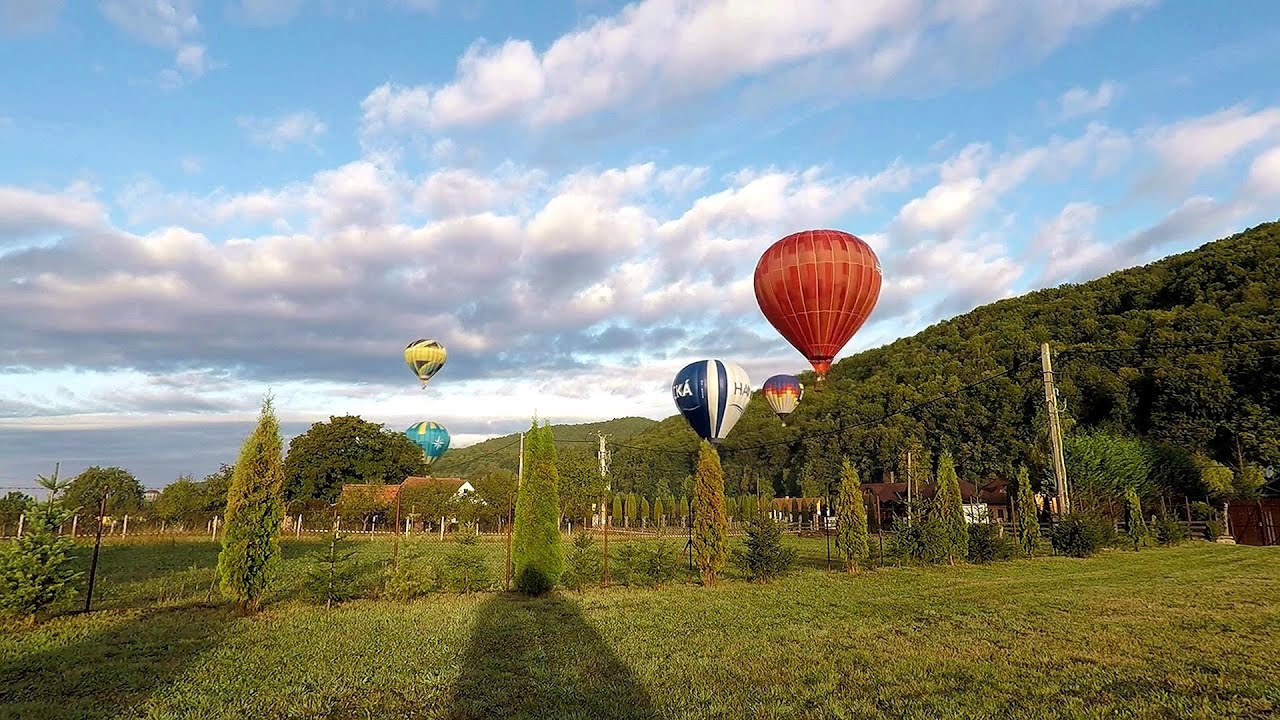
Hot Air Balloon Parade 2018 - Campu Cetatii 56.2 km away. This year, the hot air balloons flew low over Campu Cetatii. The weather did not really favor the parade.
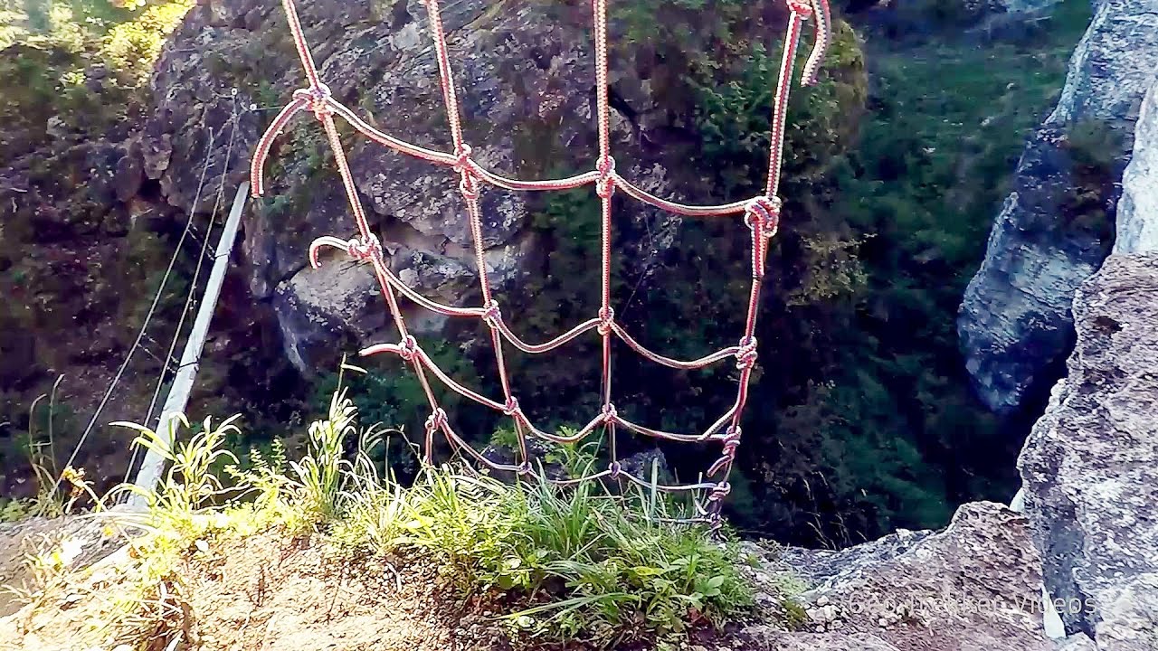
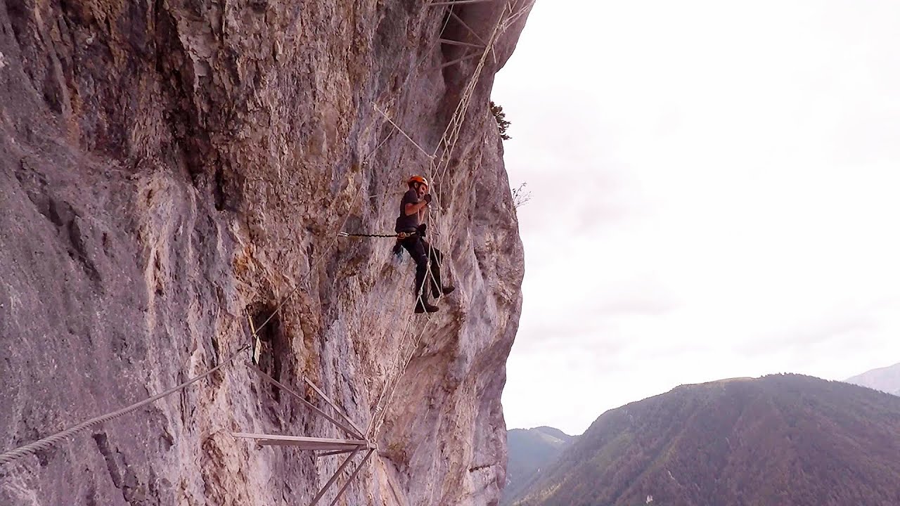
Via ferrata Bear Cave adventure and climbing zone - Borsec 67.8 km away. The Bear Cave in Borsec is a vast natural formation, scattered with rocks and deep crevices. Access to the cave's cavities is through a series of narrow formations resembling canyons, surrounded by giant fir trees and rocks with interesting shapes.
Ladys Stones - Rarau Mountains 73.6 km away. The Lady's Stones represent the heart, the mind, and the soul. The first two only help to understand the world when one possesses knowledge (they can be climbed with rock climbing gear), as emotions and thoughts (the two rock towers) obscure reality (the view).
Other places
Agnes Waterfall Western Mecsek The Agnes Waterfall is the largest waterfall in the Mecsek region, although the stream's water only cascades down from a height of one and a half to two meters, over a travertine ledge. Nearby attractions include the Meleg-mány Waterfall and the Mánfa Stone-Cave.

Sheepdogs Govora sheepfold Retezat mountains 233.6 km away. On the second day of my weekend Retezat hike, I visited a sheepfold on the Lancita Ridge. To my great disappointment, they didn't make cheese or curd here.
Giant Ice Cave Dachstein Salzkammergut, Obertraun am Hallstättersee The second cave accessible to the public at the Schönbergalm above Obertraun on Lake Hallstatt is the Giant Ice Cave (Rieseneishöhle). For me, it was more spectacular than the Mammoth Cave.
Abandoned Sports Hall Varna An abandoned sports hall in Varna, with an unfinished dormitory and tennis courts across three levels.
Borov Kamak waterfall Zgorigrad, Vratsa 452.2 km away. The Vratsa eco-trail starts from the village of Zgorigrad, located 6 km from the city of Vratsa in Bulgaria, and ends at the Parshevitza hut. It is also known as the Zgorigradska or Borov Kamak eco-trail.
Downstream of the Izvorul Dorului creek Vanturis waterfalls 207.9 km away. Downstream of the Izvorul Dorului (Source of longing) creek - Vanturis waterfalls, Bucegi Mountains.
Play Wall via ferrata park Mariazeller via ferrata, Felixs Ladder to the Heaven, Devils Bridge Located only ten kilometers from the town of Mariazell, you'll find the via ferrata park known as the Play Wall (Klettersteigpark Spielmäuer). Here, we find three via ferratas: Olivers Mariazeller Steig (B/C), Felix Himmelleiter (D), and Tristans Kirchbogensteig (C).
Lipovac via ferrata and monastery of Saint Stephen 455.6 km away. Difficulty level B, total length: 190 m, height difference: 90 m, year of construction: 2022. It is necessary to contact the PSK Brđanka club to obtain the key for the ladders at the entrance of the via ferrata.
[ Top ↑ ]
Copyright © 2003-2026 Trekkingklub and friends. Reproduction of any text, picture or video from this website, either in printed or electronic form, is prohibited without prior written permission. Website made with love  in Miercurea Ciuc.