Tourist attractions near Galgau Almasului (Balan, Salaj county, Romania)
Photos of nearby places

Dragons Garden - Galgau Almasului (20 photos) 1.7 km away. The natural reservation site Dragon's Garden (Gradina Zmeilor, Sárkányok kertje) from Galgaul Almasului is located in Salaj County, in the Western Carpathians. This natural playground is made up of interesting and unusual sandstone formations, an ensemble of 10-12 m high towers with strange figures cut in sandstone by the wind and water erosion.

Spherical concretions from Feleac (18 photos) 57.8 km away. The spherical concretions from Feleac are sedimentary rock materials that were cemented together to form a hard structure. The surrounding sediments slowly erode away, exposing the concretion.

Oxen Waterfall - Padurea Craiului Mountains (12 photos) 62.8 km away. Oxen Waterfall (Cascada Boilor) - Padurea Craiului Mountains.


Cave of Winds - Padurea Craiului Mountains (24 photos) 65.9 km away. The Cave of Winds (Pestera Vantului) is located in the Padurea Craiului Mountains, not far from Frantura meadow, near Suncuius, on the left geographical side of the Crisul Repede River. The Cave of Winds was discovered in 1957 by Béla Bagaméri and is currently (as of 2003) the longest cave system known in Romania as well as in the Carpathian Basin.

Napistileu cave - Padurea Craiului (10 photos) 66.1 km away. Napistileu (Ungurul Mic) cave - Padurea Craiului Mountains.

The cave from the spring - Padurea Craiului Mountains (8 photos) 66.2 km away. Pestera de la Izvor (The cave from the spring) - Padurea Craiului Mountains.

Moanei Cave - Padurea Craiului Mountains (58 photos) 69 km away. The Moanei Cave (Pestera Moanei) is located on the upper course of the Misid River, on the right side of the Misid Gorge (Cheilor Misidului). The cave has two entrances, one fossil and sloped, while a subterranean stream flows through the active gallery.

Valley of Hell - Padurea Craiului Mountains (23 photos) 70.5 km away. Valley of Hell (Valea Iadului) - Padurea Craiului Mountains.

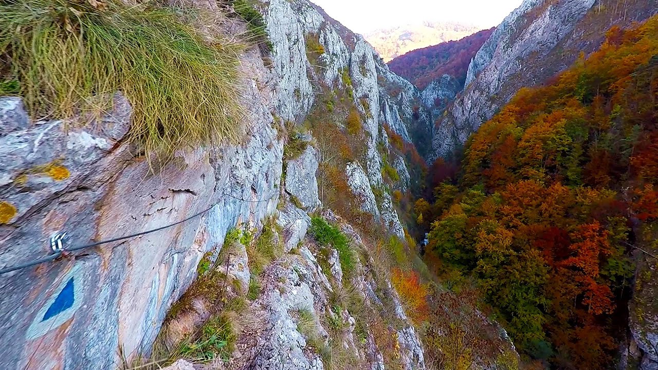
Tureni Gorge iron path visiting route (24 photos) 71.5 km away. Tureni Gorge iron path visiting route (via ferrata) - Trascau Mountains.


Fern Cave - Padurea Craiului Mountains (9 photos) 74.2 km away. Ferigi (Fern) Cave - Padurea Craiului Mountains.

Turda Gorge - Trascau Mountains (9 photos) 75 km away. Turda Gorge (Cheile Turzii) - Trascau Mountains.

Turda Gorge - Trascau Mountains (11 photos) 75 km away. Turda Gorge (Cheile Turzii) - Trascau Mountains.

Turda Gorge via ferrata (24 photos) 75.2 km away. Turda Gorge iron path (Via ferrata Cheile Turzii) - Trascau Mountains.

Sohodol pit cave - Padurea Craiului Mountains (10 photos) 75.8 km away. Sohodol pit cave (Avenul Sohodol) - Padurea Craiului Mountains.


Kings Cave - Padurea Craiului Mountains (48 photos) 76.9 km away. Craiului (Kings) Cave - Padurea Craiului Mountains.


[ Top ↑ ]
Videos of nearby places


Acapulcos spur via ferrata 65.8 km away. Acapulco's spur (Pintenul lui Acapulco) via ferrata (B/C) - Montana Land, Suncuius.

Hodoaba Valley iron path - Suncuius 66 km away. The Hodoaba Valley iron path is Romania's shortest and easiest (official) via ferrata route. It is located near Suncuius, in the Padurea Craiului Mountains, on the left bank of the Crisul Repede River.

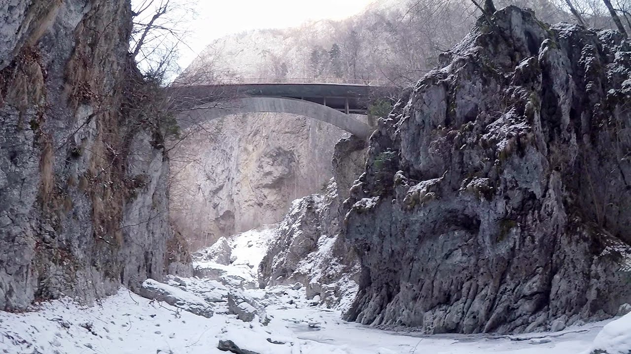
Fairy Cliff via ferrata route - Vadu Crisului 66.5 km away. Fairy Cliff (Peretele Zanelor) via ferrata route - Vadu Crisului. In Vadu Crisului, in the Padurea Craiului Mountains, on the right bank of the Crisul Repede, you can find the newest, in chronological order (2015) the fifth Transylvanian, new type of via ferrata route.
Other places

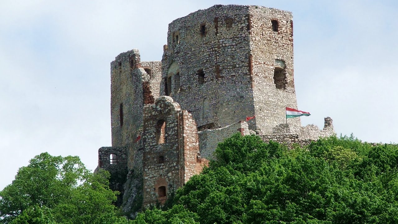
Dino Parc Rasnov 242.9 km away. On June 12, 2015, one of the largest dinosaur theme parks in the region opened in Rasnov, where we can see 45 life-sized dinosaurs. The facility is located directly next to the Rasnov Fortress, which is one of the best-preserved Transylvanian Saxon peasant fortresses.

Ski resort Poiana Brasov Postavarul Mountains 248.7 km away. Shining sun and an Austria-feeling on the impeccable slopes of the ski paradise Poiana Brasov above Brasov. Sunbathing, coffee and refreshing drinks on the terrace of Julius Römer chalet.


Goats Ledge iron path Ramet Gorge 100.6 km away. Via ferrata Goats Ledge (Brana Caprei) iron path - Ramet Gorge, Trascau Mountains.

Vulva cave Rhodope Mountains The Vulva Cave (Peshtera Utroba) is situated near the village of Nenkovo and the city of Kardzhali, in the Rhodope Mountains of Bulgaria. It derives its name from the shape of its entrance, which resembles a vulva.
Abandoned Sports Hall Varna An abandoned sports hall in Varna, with an unfinished dormitory and tennis courts across three levels.
Oltet Gorge Capatana Mountains 224.3 km away. Oltet Gorge (Cheile Oltetului) - Capatana Mountains. That day, we had planned to ski at the Ranca resort, situated alongside the Transalpina high altitude mountain road in the Parang Mountains.
Castle panorama route, Zoltán Tálos memorial route, Besiegers route Csesznek 411.3 km away. Castle panorama route (D), Zoltán Tálos memorial route (E), Besieger's route (C), Kőmosó-ravine, Csesznek, Veszprém county, Hungary. The via ferratas in Csesznek are suitable for both getting acquainted with climbing, and assessing our capabilities.
[ Top ↑ ]
Copyright © 2003-2026 Trekkingklub and friends. Reproduction of any text, picture or video from this website, either in printed or electronic form, is prohibited without prior written permission. Website made with love  in Miercurea Ciuc.