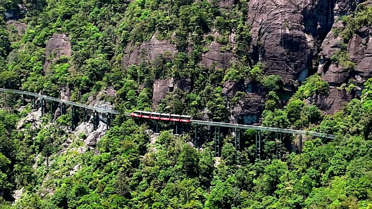
Guzhao Water Highway | Video
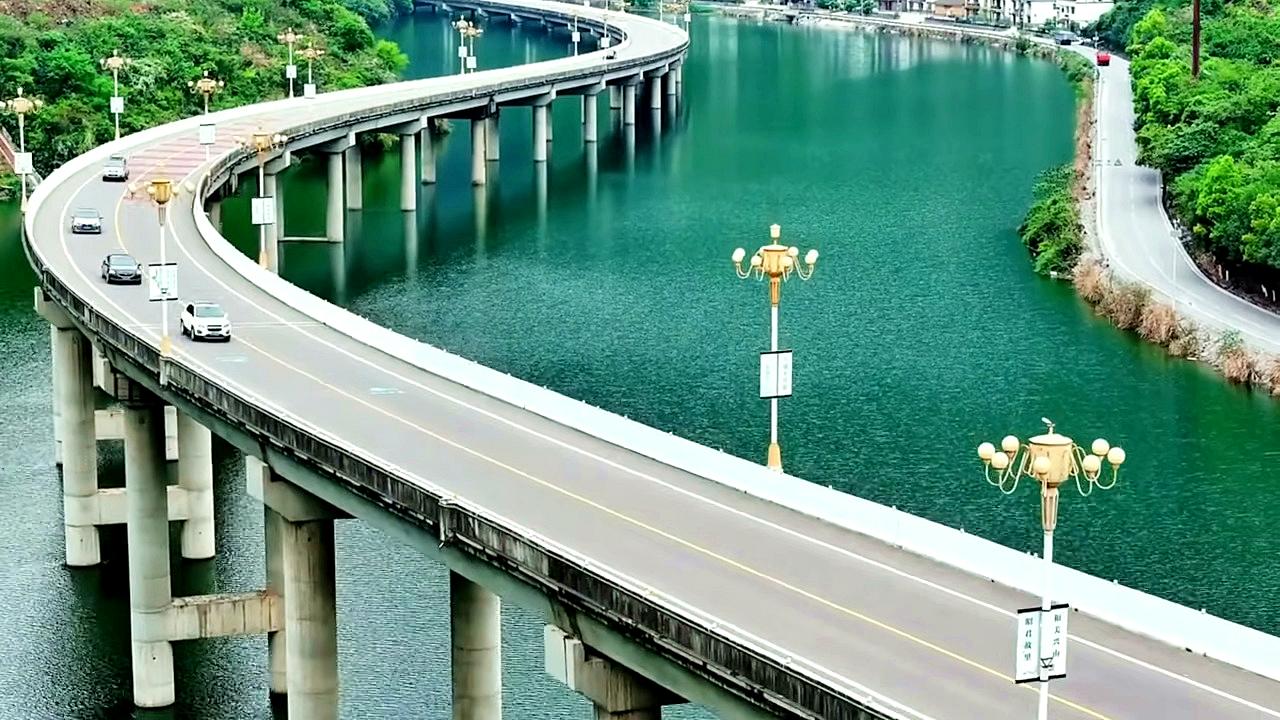
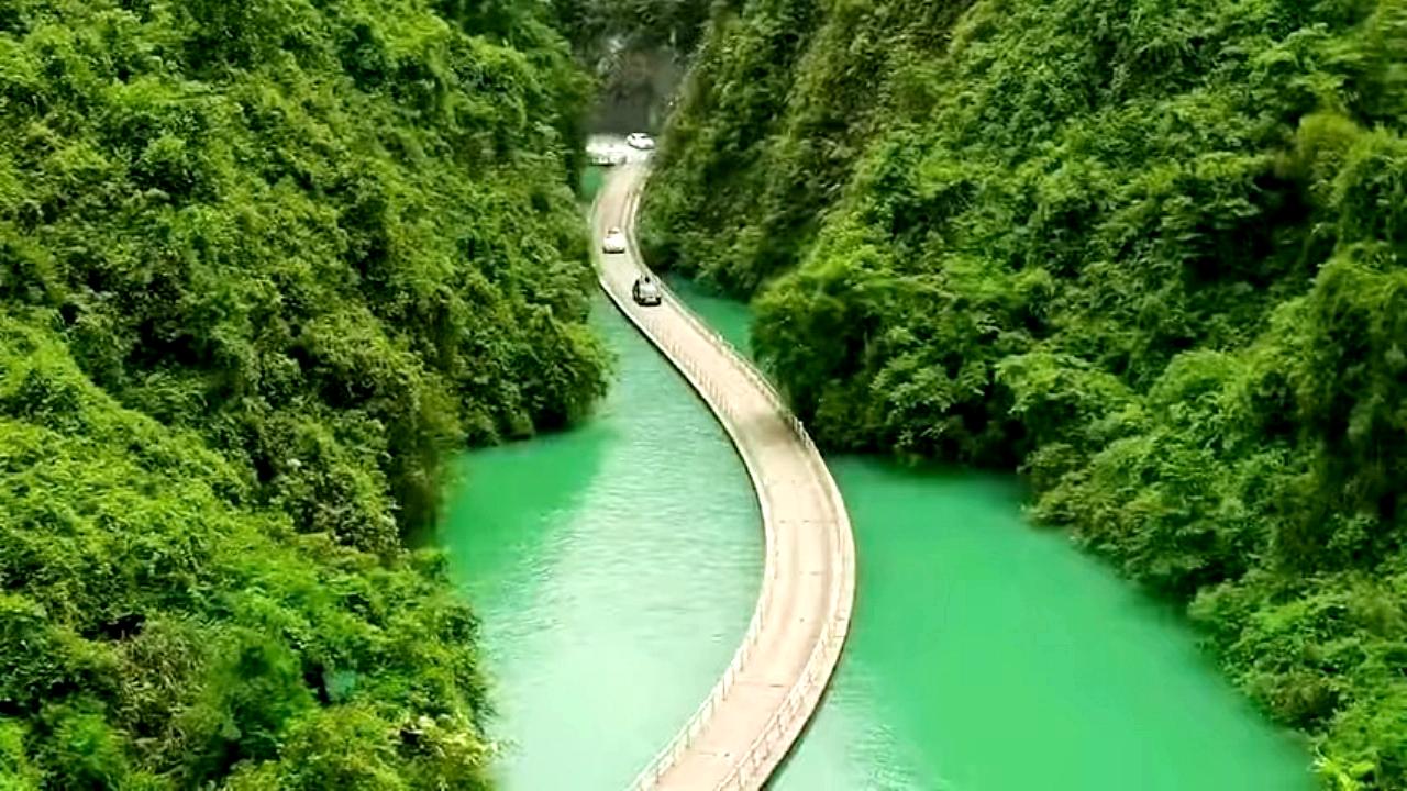
Guzhao Water Highway - Hubei province. The 11 km long water highway connects Xingshan County and Zhaojun Bridge.
Login (register) for the full descriptions, and access to the photos and videos.
Airport nearby Shennongjia Hongping Airport (HPG - Shennongjia (Hongping), Cn), 54 km away from Guzhao Water Highway.
Photos of nearby places

Pricopanului ridge - Macin Mountains (61 photos) Pricopanului ridge is the secondary, but imposing ridge of Macin Mountains, characterized by huge granite formations, lofty rocks and wide sceneries all around. The landscape, as well as the relief is of mountain type, and even if the height of the ridge is apparently small, the ascending effort is slighty sustained.

Fortress Kariya and the Lighthouse on Cape Shabla (0 photos) Shabla's lighthouse marks the easternmost point of Bulgaria. With its 32-meter height, it is the oldest and tallest lighthouse on the Black Sea.

Bird Observatory at Shabla Tuzla Lake (11 photos) Three coastal lakes - Shabla, Ezerets, and Shabla Tuzla - support a great variety of plants and animals. The lakes are especially important in winter, and they are protected to provide a refuge for their unique wildlife.

Ezerets beach - Shabla, Dobrich (10 photos) The beach near the village of Ezerets is semi-wild, relatively quiet and clean, without sunbeds or umbrellas. The sand is fine-grained, and the water is clear.

Stone Sea and Little Sea beach - Shabla (10 photos) Monument of fallen Soviet aviators (May 17, 1944), Stone Sea and Little Sea beach - Shabla.

The coast of the Black Sea north of Tyulonovo (36 photos) The Portal, the Salt Pools, the Wild Frog's Point, the Seal Cave, the Passage and the Whale.

Fishermens harbor - Tyulenovo (14 photos) Tyulenovo church, Monument to Lieutenant Valentin Terziev, Fishermen's harbor. Tyulenovo translates to Village of Seals in Bulgarian, although seals have not been observed in the area since the 1980s.

Tyulenovo Cliffs and the Rock Arch (23 photos) The coast of Tyulenovo consists of a complex of sheer reefs, steep sea cliffs, and natural and artificial sea caves. There are picturesque beaches and rocky coasts, along with adjacent marine areas, both north and south of Tyulenovo.

The coast of the Black Sea south of Tyulenovo (10 photos) The coast of the Black Sea south of Tyulenovo.

The cave with the metal ladder - Tyulenovo (27 photos) The cave with the metal ladder (Peshterata s metalnata stalba) - Tyulenovo.

The Gate of the 40 Virgins (12 photos) The Gate of the 40 Virgins, The monument to Admiral Ushakov on Cape Kaliakra.


Round rocks from Viisoara - Berzunti (12 photos) Round rocks are quite a common curiosity, apart from those in Costesti, Valcea county, there are numerous other locations with similar rock formations. The round rocks from Viisoara are located northwest of the village, at a distance of approximately 700 meters from DC152 road.

Rock with a cauldron - Gosmanu Ridge (10 photos) Rock with a cauldron (Piatra cu ceaun) - Gosmanu Ridge, Tarcau Mountains.

Rock with fir trees - Gosmanu-Tarcau Mountains (21 photos) Rock with fir trees (Stanca cu brazi, Haystack Rock, Stogul de Piatra) - Gosmanu-Tarcau Mountains.

Altar, Handprint Rock - Gosmanu Ridge (17 photos) Altar, Handprint Rock (Stanca La deget) - Gosmanu Ridge, Tarcau Mountains.

The waterfalls of Velnita stone-quarry - Left side (18 photos) Fan waterfall, Side waterfall, Double-decked waterfall, Waterfall with stairs, Hammock waterfall, Terrrace waterfall, The waterfall behind the arch, Suspended rock cube, Brown waterfall, Ceiling waterfall.

The waterfalls of Velnita stone-quarry - Right side (16 photos) The waterfall from the quarry, Green waterfall, Water-jet waterfall, Run down waterfall.

Beer waterfall - Gosmanu Ridge (12 photos) Beer waterfall (Cascada Berea) - Gosmanu Ridge, Tarcau Mountains.


[ Top ↑ ]
Videos of nearby places
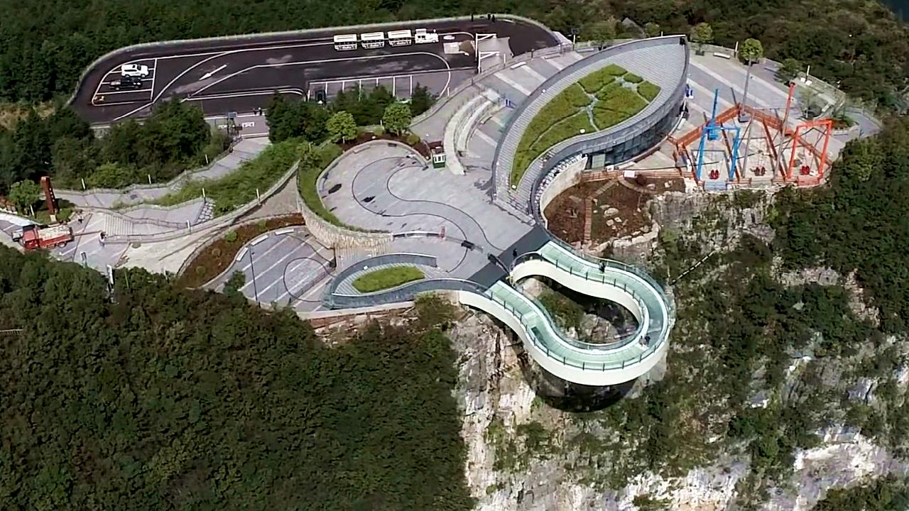
Cloud cantilever bridge - Dragon Sinkhole 178.3 km away. Cloud cantilever bridge (Cloudwalk Sky Bridge) - Dragon Sinkhole (Longgang Tiankeng) scenic area, Yunyang county, Chongqing. The bridge, which has a cantilever structure, glass deck and railings, has a circumference of 60 m.
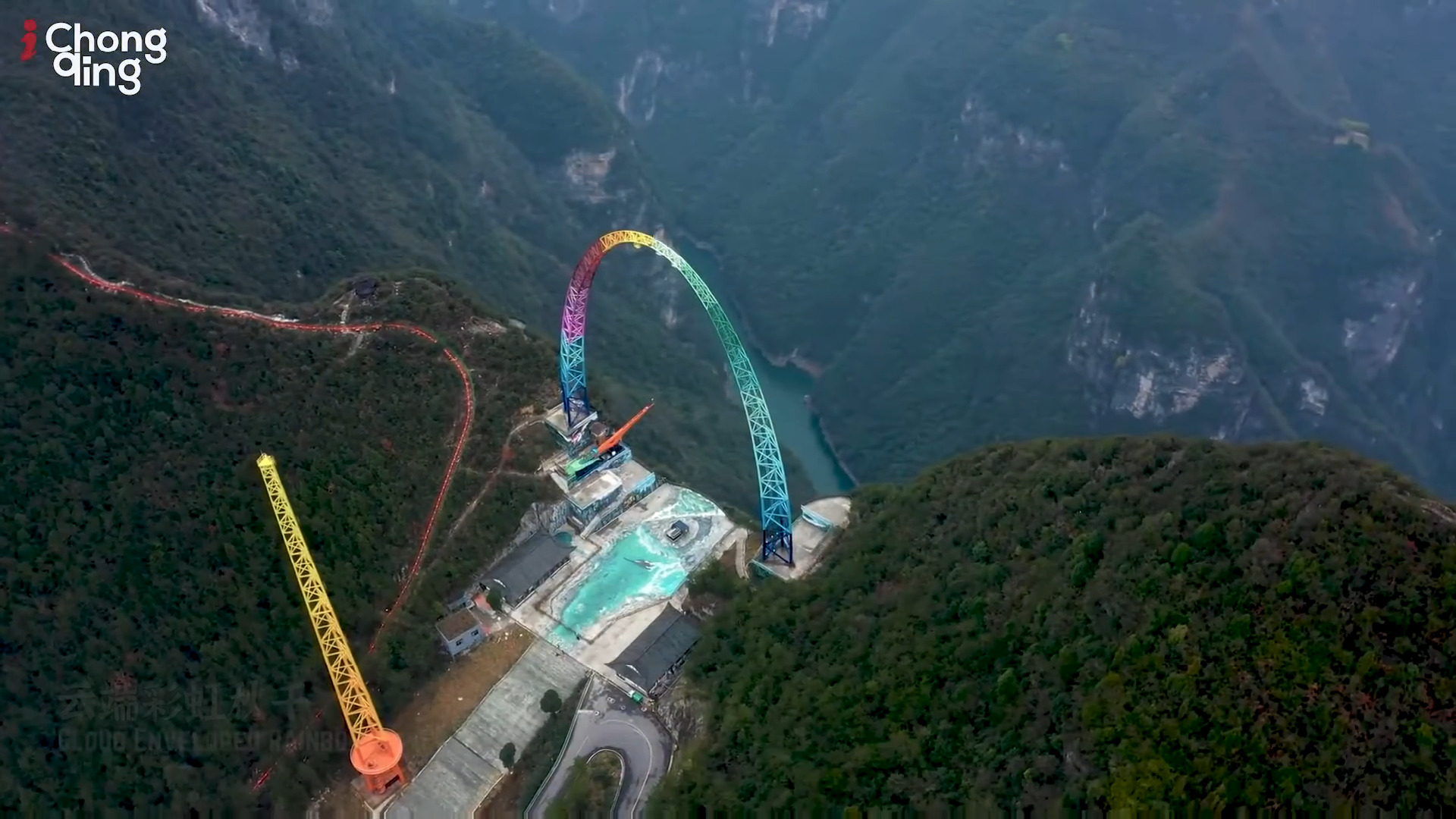
Cloud Rainbow Swing 179.2 km away. Cloud Rainbow Swing - Dragon Sinkhole (Longgang Tiankeng) scenic area, Yunyang county, Chongqing. The tallest swing frame in the world measures 75.
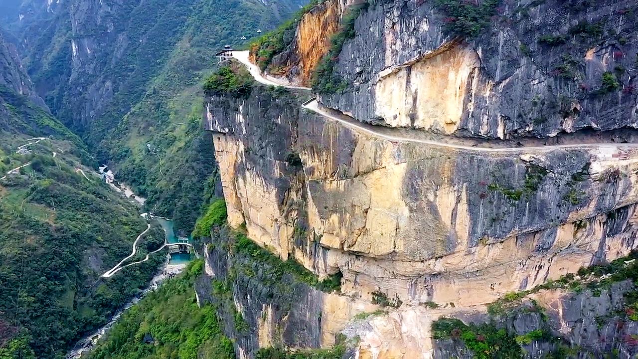
Lion passageway floating bridge, the Bridge of Dreams 186.1 km away. Lion passageway (Shiziguan) floating road bridge (Bridge of Dreams) and scenic area. Qing river, Enshi Tujia and Miao autonomous prefecture, Hubei province.
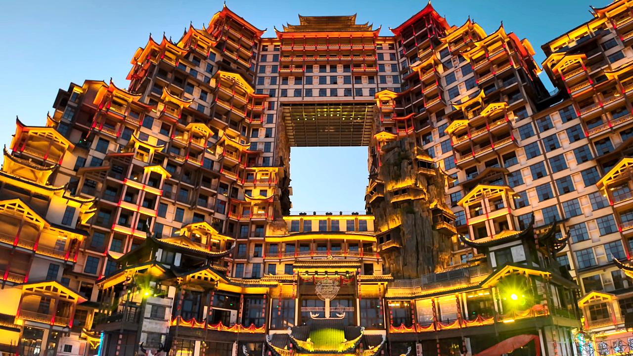
72 Strange Buildings - Zhangjiajie 240.2 km away. 72 Strange Buildings (72 Qilou), the world's highest stilted building. Yongding district, Zhangjiajie, Hunan province.
Other places
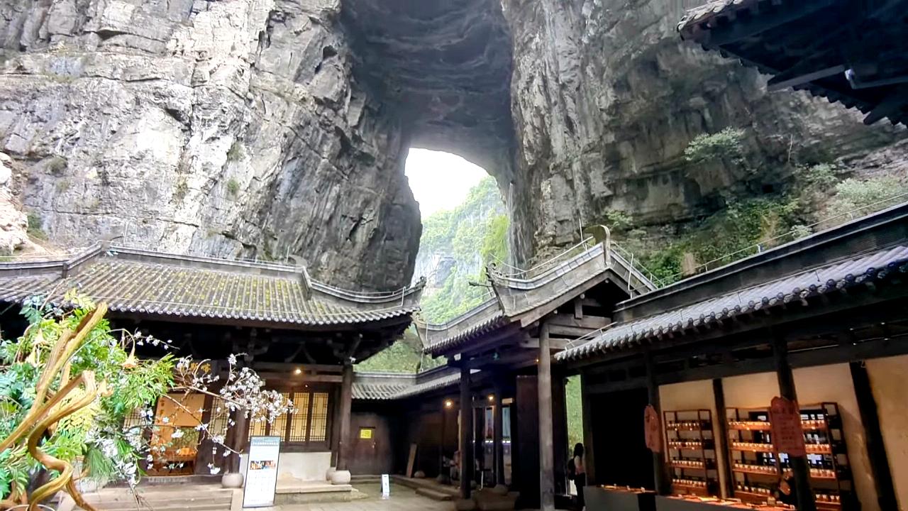
Three Natural Bridges 350.6 km away. West entrance - Three Natural Bridges scenic area. Wulong district, Chongqing municipality.
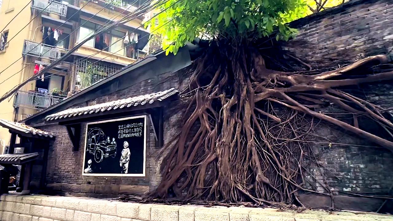
Daijiaxiang Cliff Trail 444 km away. Daijiaxiang Cliff Trail - Yuzhong District, Chongqing. Huangjue tree (Huangge tree, Ficus virens), the city tree of Chongqing.
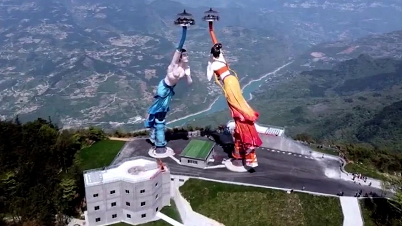
Flying Kiss Wangxian Cliff 370 km away. Wangxian, Baima town, Wulong district, Chongqing. Inside White Horse (Baima) mountain scenic area.
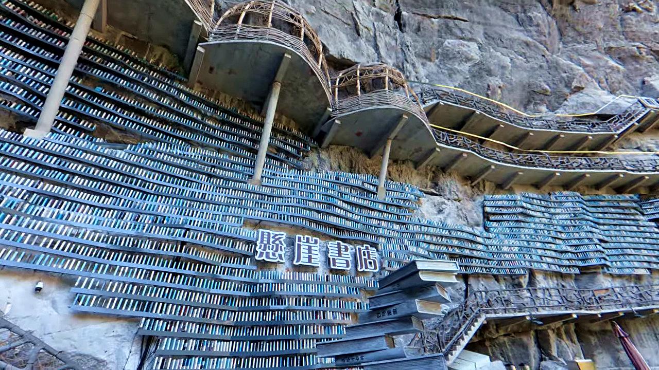
Cotton Sinkhole hanging library Cotton Sinkhole (Mianhua tian keng) hanging library - Luocheng Mulao Autonomous County, Hechi city, Guangxi Zhuang Autonomous Region. Inside of this large grotto, the Cotton Sinkhole, there is a unique library hanging on the side of the rock wall, with rock-hanging wooden walkways and balconies.
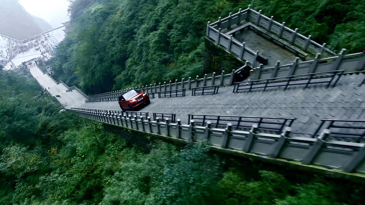
Dragon Challenge 2018 Heavens Gate, Tianmen Mountain 250.3 km away. The Range Rover Sport Plug-in Hybrid Dragon Challenge 2018. Heaven's Gate, Tianmen Mountain - 99 turns, 999 steps, 22 minutes and 41 seconds.
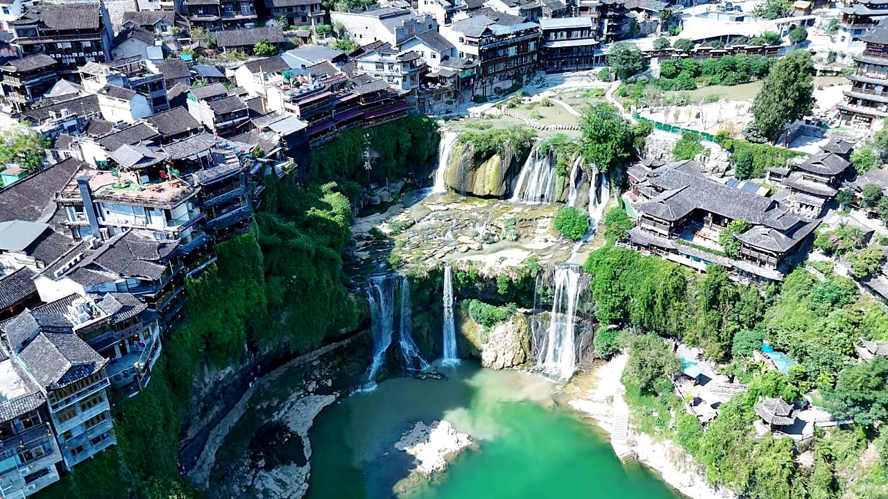
Furong Waterfall Furong ancient town 293.8 km away. Furong waterfall, Tujia ancestors' cave relics, Tusi palace, Wuli slate street, Tuwang bridge, Xizhou copper pillar. From Zhangjiajie West Railway Station, take the high-speed train to Furong Town Railway Station, 25 minutes.
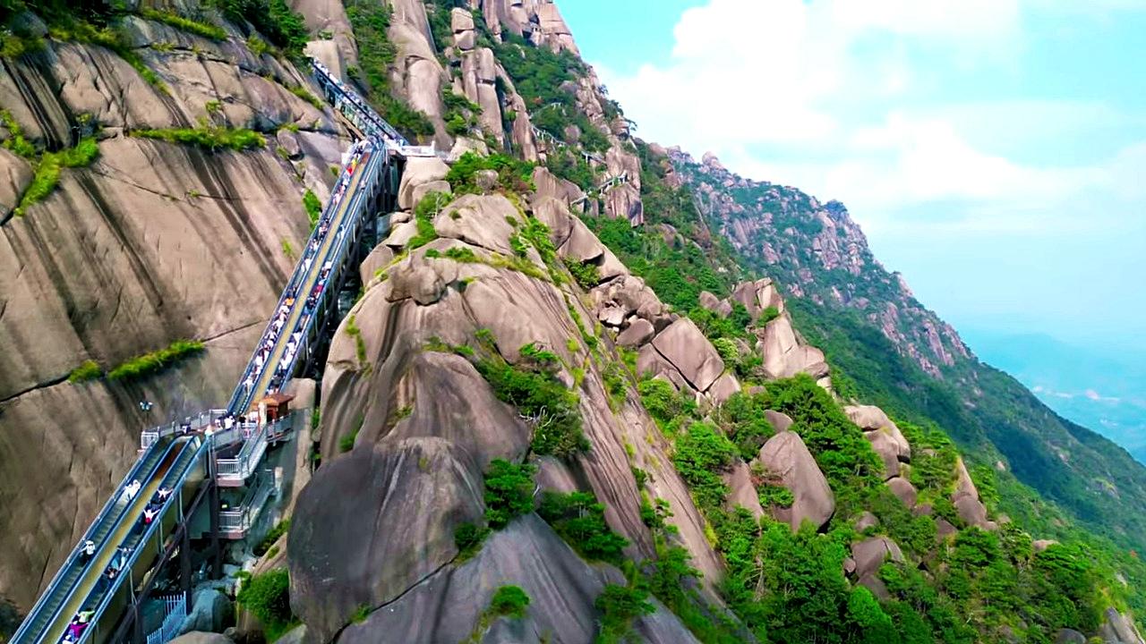
Ling Mountain Scenic Area Cloud Ladder escalator Guangxin district, Shangrao city, Jiangxi province. The Cloud Ladder is the world's longest cliffside escalator - length: 753 m; height: 267 m; duration: 30 minutes.
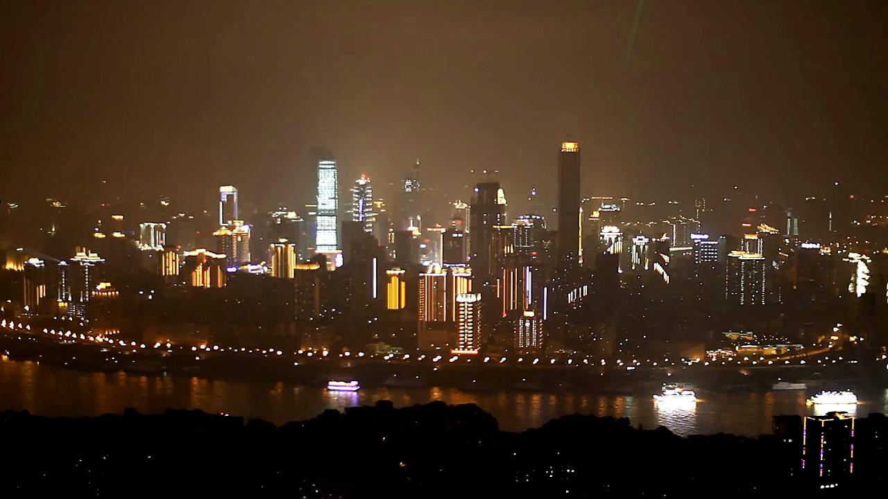
Single Tree lookout tower South Mountain 442.5 km away. Single Tree (Yikeshu) is a popular lookout tower located in the Nan'an district of Chongqing. One of the best places to see a panorama of central Chongqing.
Other destinations
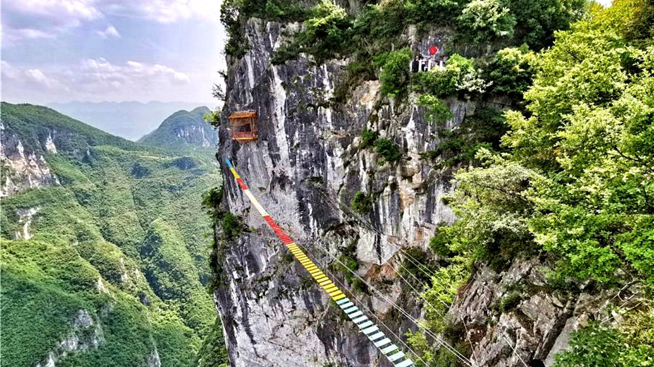
Cloud Colorful Bridge via ferrata 178.2 km away. Cloud Colorful Bridge via ferrata - Dragon Sinkhole (Longgang Tiankeng) scenic area, Yunyang county, Chongqing. Via ferrata, cable bridge, Zodiac Bridge, Changkong Plank Road, Burmese Bridge, cliff hut.
[ Top ↑ ]
Copyright © 2003-2026 Trekkingklub and friends. Reproduction of any text, picture or video from the Guzhao Water Highway website, either in printed or electronic form, is prohibited without prior written permission.
The given distances are to be understood as straight line distances, and are approximate. Website made in Miercurea Ciuc  .
.