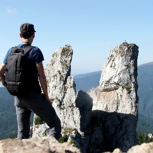
Fortress Kariya and the Lighthouse on Cape Shabla | Photos
Page no. 1, photos: 1-6, 13 photos in total. >>>
Shabla's lighthouse marks the easternmost point of Bulgaria. With its 32-meter height, it is the oldest and tallest lighthouse on the Black Sea. It was officially opened on July 15th (27th), 1856. The lighthouse protects ships from impact with an underwater reef that extends approximately one nautical mile and prevents them from sinking into the shallows between Cape Shabla and the village of Tyulenovo. In the early 5th century, there was a Fire Watch station. The south bay of the lighthouse was called Karon Limen. During ancient times, the port of Kariya was the most important transit port in the area.
Read more
Copyright © 2025 - 2026 Trekkingklub.com. Please register for full and ad-free access.
Airport nearby: Balchik Airfield ( - Balchik, Bg), 37 km away.
Photos of nearby places

Stone Sea and Little Sea beach - Shabla (10 photos) 2.2 km away. Monument of fallen Soviet aviators (May 17, 1944), Stone Sea and Little Sea beach - Shabla.

Bird Observatory at Shabla Tuzla Lake (11 photos) 2.6 km away. Three coastal lakes - Shabla, Ezerets, and Shabla Tuzla - support a great variety of plants and animals. The lakes are especially important in winter, and they are protected to provide a refuge for their unique wildlife.

The coast of the Black Sea north of Tyulonovo (36 photos) 4.4 km away. The Portal, the Salt Pools, the Wild Frog's Point, the Seal Cave, the Passage and the Whale.

Fishermens harbor - Tyulenovo (14 photos) 5.4 km away. Tyulenovo church, Monument to Lieutenant Valentin Terziev, Fishermen's harbor. Tyulenovo translates to Village of Seals in Bulgarian, although seals have not been observed in the area since the 1980s.

Tyulenovo Cliffs and the Rock Arch (23 photos) 5.6 km away. The coast of Tyulenovo consists of a complex of sheer reefs, steep sea cliffs, and natural and artificial sea caves. There are picturesque beaches and rocky coasts, along with adjacent marine areas, both north and south of Tyulenovo.

The coast of the Black Sea south of Tyulenovo (10 photos) 6.2 km away. The coast of the Black Sea south of Tyulenovo.

Ezerets beach - Shabla, Dobrich (10 photos) 6.4 km away. The beach near the village of Ezerets is semi-wild, relatively quiet and clean, without sunbeds or umbrellas. The sand is fine-grained, and the water is clear.

The cave with the metal ladder - Tyulenovo (27 photos) 7.1 km away. The cave with the metal ladder (Peshterata s metalnata stalba) - Tyulenovo.

The Gate of the 40 Virgins (12 photos) 22.1 km away. The Gate of the 40 Virgins, The monument to Admiral Ushakov on Cape Kaliakra.
[ Top ↑ ]
Videos of nearby places
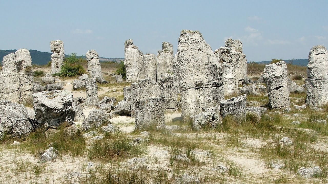
Stone Forest - Slanchevo 80.7 km away. The Stone Forest (Stones stuck in the ground, Pobiti Kamani) of Bulgaria is located 18 km west of Varna, at the foothills of the Eastern Balkan Mountains. Its Bulgarian name, Pobiti Kamani, translates to planted stones, and it is referred to in English as the Stone Desert or Stone Forest.
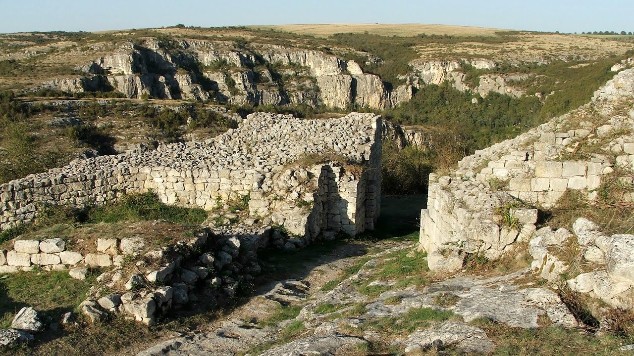
Cherven, a medieval fortified town - Bulgaria 208.3 km away. Located about 30 km south of the city of Ruse in Bulgaria, the Cherven medieval fortress can be found in the Rusenski Lom Nature Park. Originally a Byzantine fortification from the 6th century, it reached the height of its development in the 14th century.
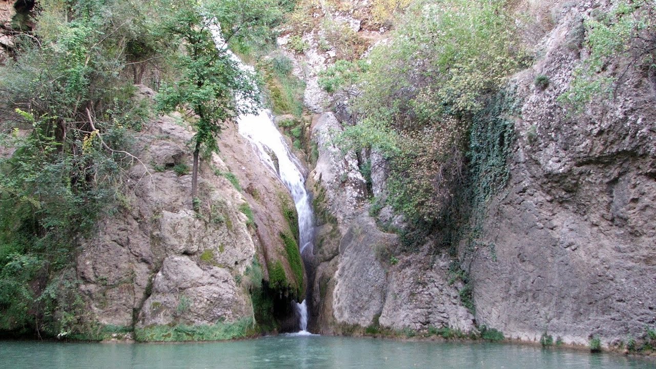
Kaya Bunar - Hotnitsa 253.9 km away. The Kaya Bunar Waterfall (Hotnishki Vodopadi, Hotnitsa Waterfall) is located 20 km from the city of Veliko Tarnovo in Bulgaria. The waterfall is 30 meters high, and there are several smaller cascades above it.
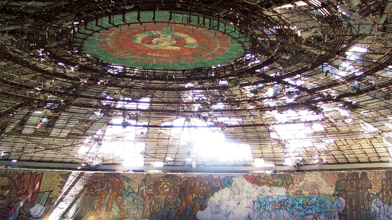
Buzludzha monument - Kazanluk 275.6 km away. Buzludzha is a historically significant mountain located in the Central Balkan Mountains of Bulgaria. At its summit, at an altitude of 1432 meters above sea level, there is an abandoned monument.
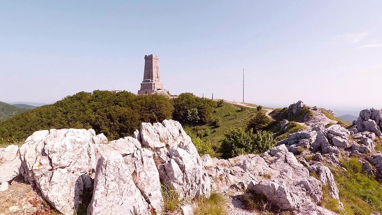
Shipka pass - Shipka 280.7 km away. The Shipka Pass is one of the most spectacular crossings of the Balkan Mountains, and is part of the Bulgarka Nature Park. It separates the provinces of Gabrovo and Stara Zagora, and provides a connection between the cities of Gabrovo and Kazanlak.
Other places
Downstream of the Izvorul Dorului creek Vanturis waterfalls 318.2 km away. Downstream of the Izvorul Dorului (Source of longing) creek - Vanturis waterfalls, Bucegi Mountains.
Dino Parc Rasnov 337 km away. On June 12, 2015, one of the largest dinosaur theme parks in the region opened in Rasnov, where we can see 45 life-sized dinosaurs. The facility is located directly next to the Rasnov Fortress, which is one of the best-preserved Transylvanian Saxon peasant fortresses.
Kossuth Rock Harghita Bath 392.2 km away. Kossuth Rock - Harghita Bath (Harghita-Bai), Harghita Mountains.
Bovska Skaklya waterfall Iskar gorge 430.6 km away. The Bovska Skaklya waterfall is located near the town of Svoge in Bulgaria. The waterfall formed on the Zaselska River has several reported heights online (120 m, 85 m).
Preachers Rock Bodoc Mountains 348.7 km away. In the Bodoc Mountains, west-southwest from the Henter peak, we find a rock formation shaped like a mushroom by erosion, called Preacher's Rock. This 2-meter high rock probably got its name from the pagan Hungarian priests, who preached here in the past.
Loreley and Pink Panther iron path Baia de Fier 427 km away. The Loreley via ferrata (graded B/C, with an elevation difference of approximately 100 m and a length of about 100 m) is located on the rock wall on the opposite side of the road. A branch from its upper section leads to the Pink Panther (Pantera Roz, graded A/B/C, approximately 200 meters long, with an elevation difference of about 50 meters).
Sumuleu-Ciuc in winter 382.7 km away. Sumuleu-Ciuc (Csíksomlyó) in winter.
Small Via ferrata Rasnoavei Gorge 331.1 km away. In the past few days, it has snowed, so I climbed the two climbing routes in the Rasnoavei Gorge under winter conditions. While the lower part of the challenging Big via ferrata was dry, the upper section had patches of snow and icicles.
Sterp- and White creek valleys Ciucas Mountains 299 km away.
Lonely Stone Hasmas Mountains 412.1 km away. On June 1, 2003, with a small group of friends, I left Balan, walking along the valley of the Sep (Beautiful) stream towards the Lonely Stone (Piatra Singuratica). Those who were with me at the time fell behind, and then other people joined for the hike.
Roman Baths Cetea, Trascau Mountains 499 km away. Roman Baths (Baile Romane) - Cetea, Trascau Mountains. Among the valleys of the Trascau Mountains, the Cetea Gorge best deserves the name of a crevice valley.
Varghis gorges in winter 383.2 km away. I went out to admire the ice stalagmites (standing icicles) in the Varghis Gorge. Anyone arriving here at the end of winter can observe meter-high ice stalagmites in the entrance area of Meresti Cave (now known as Orban Balazs Cave).
Walking to the top of Sumuleul Mare Sumuleu Ciuc 382.4 km away. This was my first attempt at shooting a video.
Falco Peregrinus via ferrata Falcons Rock, Corbu 448.7 km away. Falco Peregrinus (Peregrine falcon) via ferrata (B/C) - Falcon's Rock, Corbu.
Via Ferrata Pink Panther Baia de Fier 426.9 km away. In the area of Baia de Fier in Gorj County, several via ferrata routes have been set up on the rock above the Women's Cave (Muierii Cave) and on the other side of the road. At that time (2018), there were a total of seven.
Other destinations
Abandoned Sports Hall Varna 63.5 km away. An abandoned sports hall in Varna, with an unfinished dormitory and tennis courts across three levels.
Fox Ears Beach Sinemorets 174.6 km away. Fox Ears Beach (Plazh Lisichi ushi) - Sinemorets.
Stone Beach Sinemorets 175.3 km away. Stone Beach (Kamenniat plazh) - Sinemorets.
[ Top ↑ ]
Copyright © 2003-2026 Trekkingklub and friends. Reproduction of any text, picture or video from this website, either in printed or electronic form, is prohibited without prior written permission.
The given distances are to be understood as straight line distances, and are approximate. Website made in Miercurea Ciuc  .
.
 .
.


