Otasan Shrine - Hokkaido | Video
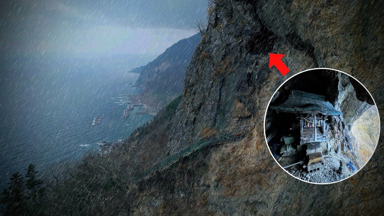
The Otasan Shrine is a cave shrine on Mount Ota in western Hokkaido, at an elevation of 485 meters. It is linked to the guardian deity Otakamoi of the Ezo region. Access is extremely difficult.
Read more
Login (register) for the full descriptions, and access to the photos and videos.
Airport nearby Okushiri Airport (OIR - Okushiri Island, Jp), 37 km away from Otasan Shrine - Hokkaido.
Photos of nearby places


Rock with a cauldron - Gosmanu Ridge (10 photos) Rock with a cauldron (Piatra cu ceaun) - Gosmanu Ridge, Tarcau Mountains.

Rock with fir trees - Gosmanu-Tarcau Mountains (21 photos) Rock with fir trees (Stanca cu brazi, Haystack Rock, Stogul de Piatra) - Gosmanu-Tarcau Mountains.

Altar, Handprint Rock - Gosmanu Ridge (17 photos) Altar, Handprint Rock (Stanca La deget) - Gosmanu Ridge, Tarcau Mountains.

Pricopanului ridge - Macin Mountains (61 photos) Pricopanului ridge is the secondary, but imposing ridge of Macin Mountains, characterized by huge granite formations, lofty rocks and wide sceneries all around. The landscape, as well as the relief is of mountain type, and even if the height of the ridge is apparently small, the ascending effort is slighty sustained.

Beer waterfall - Gosmanu Ridge (12 photos) Beer waterfall (Cascada Berea) - Gosmanu Ridge, Tarcau Mountains.

Round rocks from Viisoara - Berzunti (12 photos) Round rocks are quite a common curiosity, apart from those in Costesti, Valcea county, there are numerous other locations with similar rock formations. The round rocks from Viisoara are located northwest of the village, at a distance of approximately 700 meters from DC152 road.

The Valleys of the Streams of the Cups and Rogozu (6 photos) The Valleys of the Streams of the Cups (Cupelor, Kupás) and Rogozu (Szacskai) - Borsec. September 7, 2003; September 14, 2003; November 10, 2007.

Stalactite Cave - Round Chair Hill, Borsec, Giurgeu Mountains (24 photos) The Stalactite Cave on the Round Chair Hill is the longest cave formed in travertine in the country. Its formation was mainly influenced by an open system of diaclases, which fragmented the travertine, with the contribution of infiltrated rainwater being essential in the transport and dissolution of limestone.

Borsec spa resort (9 photos) Borsec is one of the most beautifully situated resorts in the Eastern Carpathians. It consists of two parts: Lower Borsec and Upper Borsec, the latter being the actual resort area.

Bears cave, Ice Grotto - Borsec (12 photos) The Bears' cave is actually a deep rock fissure with a path leading into it. Local belief long considered it to be the habitat of bears, which is where the name comes from.

The waterfalls of Velnita stone-quarry - Right side (16 photos) The waterfall from the quarry, Green waterfall, Water-jet waterfall, Run down waterfall.

The waterfalls of Velnita stone-quarry - Left side (18 photos) Fan waterfall, Side waterfall, Double-decked waterfall, Waterfall with stairs, Hammock waterfall, Terrrace waterfall, The waterfall behind the arch, Suspended rock cube, Brown waterfall, Ceiling waterfall.

Pit cave with three entrances - Hasmas Mountains (3 photos) Pit cave with three entrances (Avenul cu trei intrari) - Hasmas Mountains.


Dry Valley canyon - Hasmas Mountains (9 photos) Dry Valley (Paraului Sec) canyon - Hasmas Mountains.

Valley of the Lazarus-creek - Hasmas Mountains (15 photos) Valley of the Lazarus-creek (Valea paraului Lazar), Log Slide - Hasmas Mountains.


White Glade, Horseshoe Rock (17 photos) White Glade (Poiana Alba), Horseshoe Rock (Piatra Potcoavei) - Hasmas Mountains.


[ Top ↑ ]
Videos of nearby places
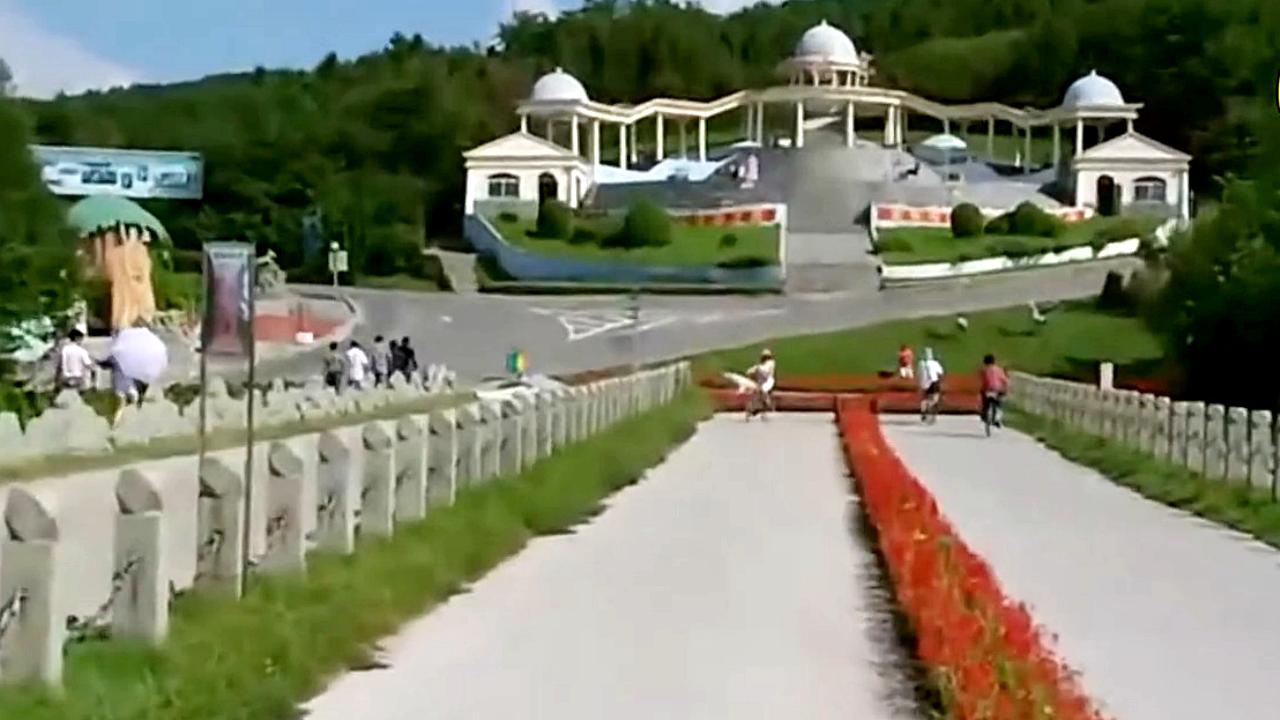
Strange Slope - Shenyang The Strange Slope is 80 meters long and 15 meters wide, seemingly defying the law of gravity. You can roll up it without any effort, but you need to pedal your bike or accelerate your car to go down.
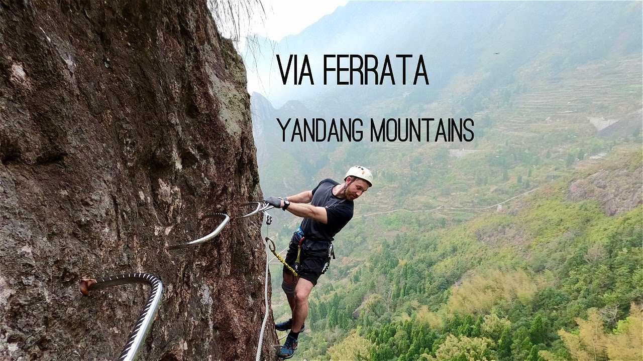
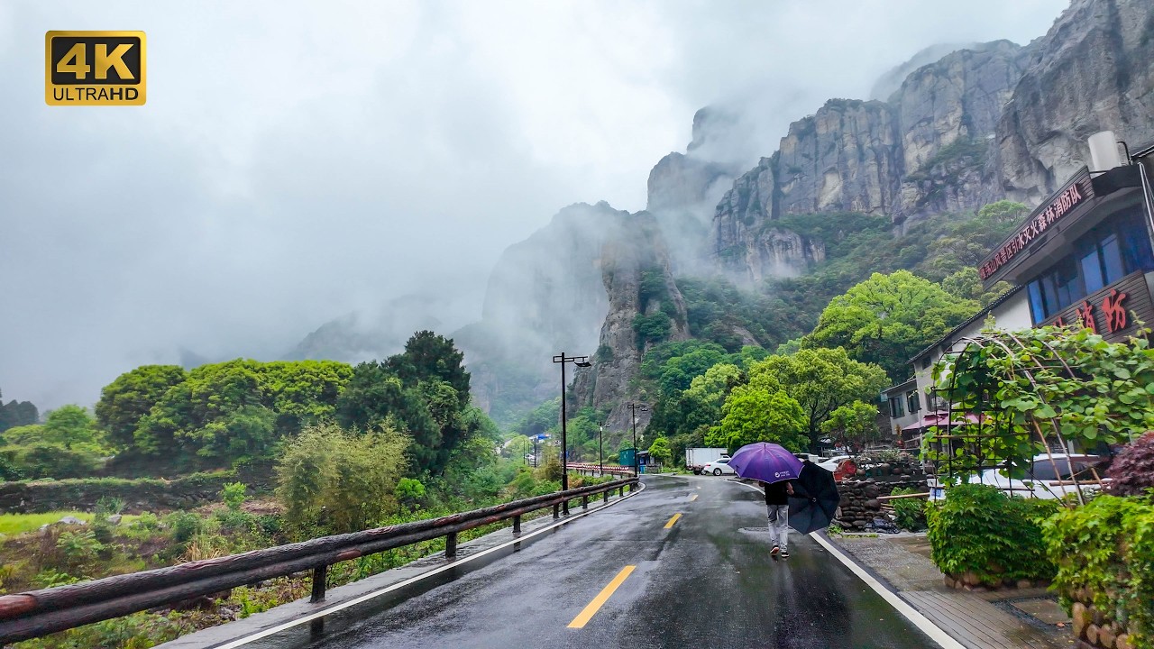
Yandangshan via ferrata - Yandang Mountains Yandangshan via ferrata - Yandang (Wild Goose Pond) Mountains, Wenzhou, Zhejiang.
Dalongqiu waterfall - Yandang Mountains Dalongqiu (Big Dragon Pond) waterfall - Yandang (Wild Goose Pond) Mountains.
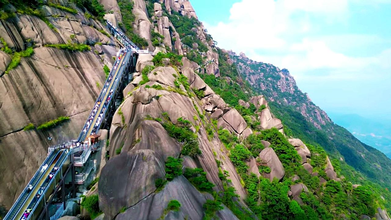
Ling Mountain Scenic Area - Cloud Ladder escalator Guangxin district, Shangrao city, Jiangxi province. The Cloud Ladder is the world's longest cliffside escalator - length: 753 m; height: 267 m; duration: 30 minutes.
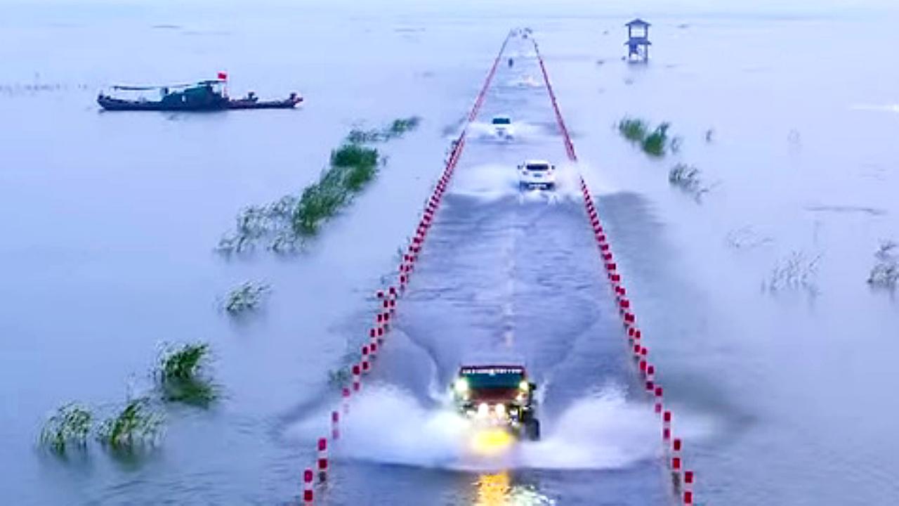
Yongwu flooded road - Poyang lake The road under the water, Yongwu flooded road. Poyang lake, Wuchengzhen, Yongxiu county, Jiujiang, Jiangxi province.
[ Top ↑ ]
Copyright © 2003-2026 Trekkingklub and friends. Reproduction of any text, picture or video from the Otasan Shrine - Hokkaido website, either in printed or electronic form, is prohibited without prior written permission.
The given distances are to be understood as straight line distances, and are approximate. Website made in Miercurea Ciuc  .
.