Niedzica Castle | Video
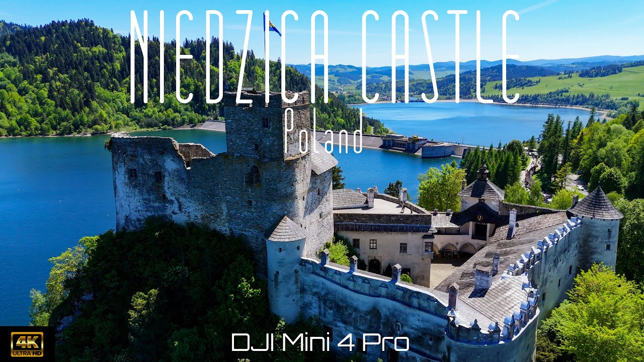
Niedzica Castle (Dunajec Castle, Zamek w Niedzicy).
Login (register) for the full descriptions, and access to the photos and videos.
Airport nearby Kraków John Paul II International Airport (KRK - Balice, Pl), 82 km away from Niedzica Castle.
Photos of nearby places

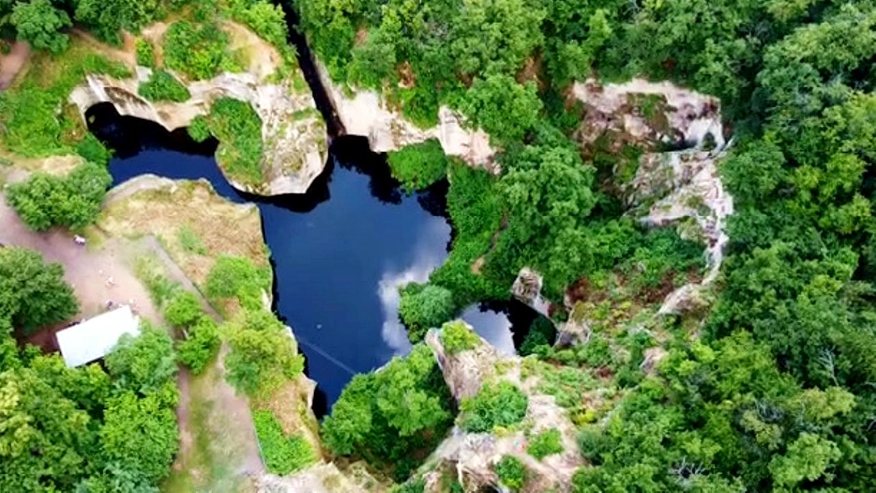
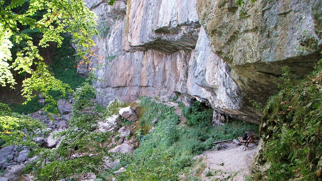
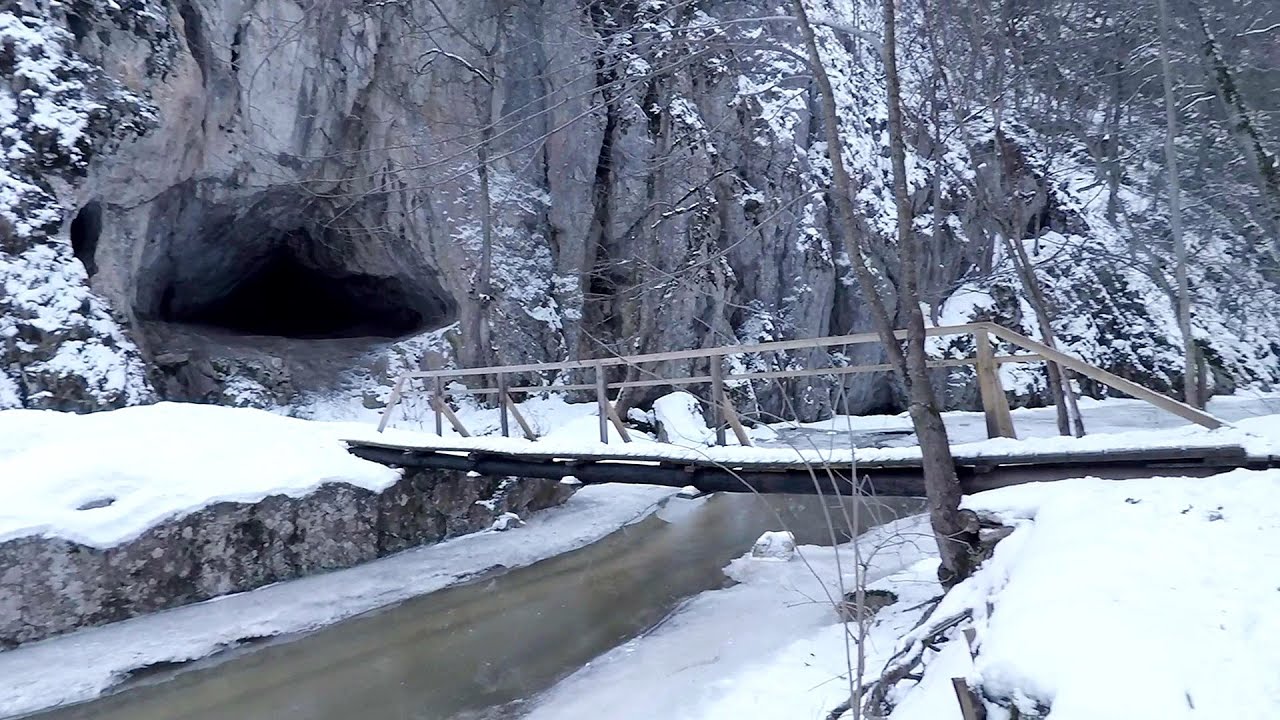
Cave of Winds - Padurea Craiului Mountains (24 photos) 321.6 km away. The Cave of Winds (Pestera Vantului) is located in the Padurea Craiului Mountains, not far from Frantura meadow, near Suncuius, on the left geographical side of the Crisul Repede River. The Cave of Winds was discovered in 1957 by Béla Bagaméri and is currently (as of 2003) the longest cave system known in Romania as well as in the Carpathian Basin.


The cave from the spring - Padurea Craiului Mountains (8 photos) 322.1 km away. Pestera de la Izvor (The cave from the spring) - Padurea Craiului Mountains.

Napistileu cave - Padurea Craiului (10 photos) 322.1 km away. Napistileu (Ungurul Mic) cave - Padurea Craiului Mountains.

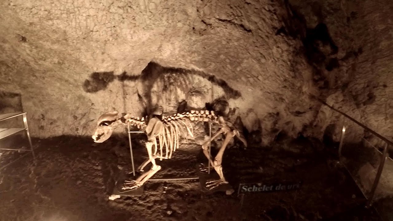
Moanei Cave - Padurea Craiului Mountains (58 photos) 324.8 km away. The Moanei Cave (Pestera Moanei) is located on the upper course of the Misid River, on the right side of the Misid Gorge (Cheilor Misidului). The cave has two entrances, one fossil and sloped, while a subterranean stream flows through the active gallery.

Sohodol pit cave - Padurea Craiului Mountains (10 photos) 325 km away. Sohodol pit cave (Avenul Sohodol) - Padurea Craiului Mountains.

Oxen Waterfall - Padurea Craiului Mountains (12 photos) 327.8 km away. Oxen Waterfall (Cascada Boilor) - Padurea Craiului Mountains.

Fern Cave - Padurea Craiului Mountains (9 photos) 328.8 km away. Ferigi (Fern) Cave - Padurea Craiului Mountains.

Kings Cave - Padurea Craiului Mountains (48 photos) 329.2 km away. Craiului (Kings) Cave - Padurea Craiului Mountains.

Dragons Garden - Galgau Almasului (20 photos) 331.4 km away. The natural reservation site Dragon's Garden (Gradina Zmeilor, Sárkányok kertje) from Galgaul Almasului is located in Salaj County, in the Western Carpathians. This natural playground is made up of interesting and unusual sandstone formations, an ensemble of 10-12 m high towers with strange figures cut in sandstone by the wind and water erosion.

Valley of Hell - Padurea Craiului Mountains (23 photos) 334.8 km away. Valley of Hell (Valea Iadului) - Padurea Craiului Mountains.


Spherical concretions from Feleac (18 photos) 387 km away. The spherical concretions from Feleac are sedimentary rock materials that were cemented together to form a hard structure. The surrounding sediments slowly erode away, exposing the concretion.

Tureni Gorge iron path visiting route (24 photos) 401.5 km away. Tureni Gorge iron path visiting route (via ferrata) - Trascau Mountains.


Turda Gorge - Trascau Mountains (9 photos) 403.8 km away. Turda Gorge (Cheile Turzii) - Trascau Mountains.

Turda Gorge - Trascau Mountains (11 photos) 403.8 km away. Turda Gorge (Cheile Turzii) - Trascau Mountains.
[ Top ↑ ]
Videos of nearby places
Mine lake - Megyer mountain, Sárospatak 149.7 km away. The via ferrata routes of the Megyer mountain mine lake. The geologists' path E 25 m, Szabó József-memorial path C 200 m, Amphitheater D 40 m, Devil's Cauldron E 70 m, Sweet aquatic life D 150 m, Velociraptor C 35 m.

Castle panorama route, Zoltán Tálos memorial route, Besiegers route - Csesznek 292.4 km away. Castle panorama route (D), Zoltán Tálos memorial route (E), Besieger's route (C), Kőmosó-ravine, Csesznek, Veszprém county, Hungary. The via ferratas in Csesznek are suitable for both getting acquainted with climbing, and assessing our capabilities.

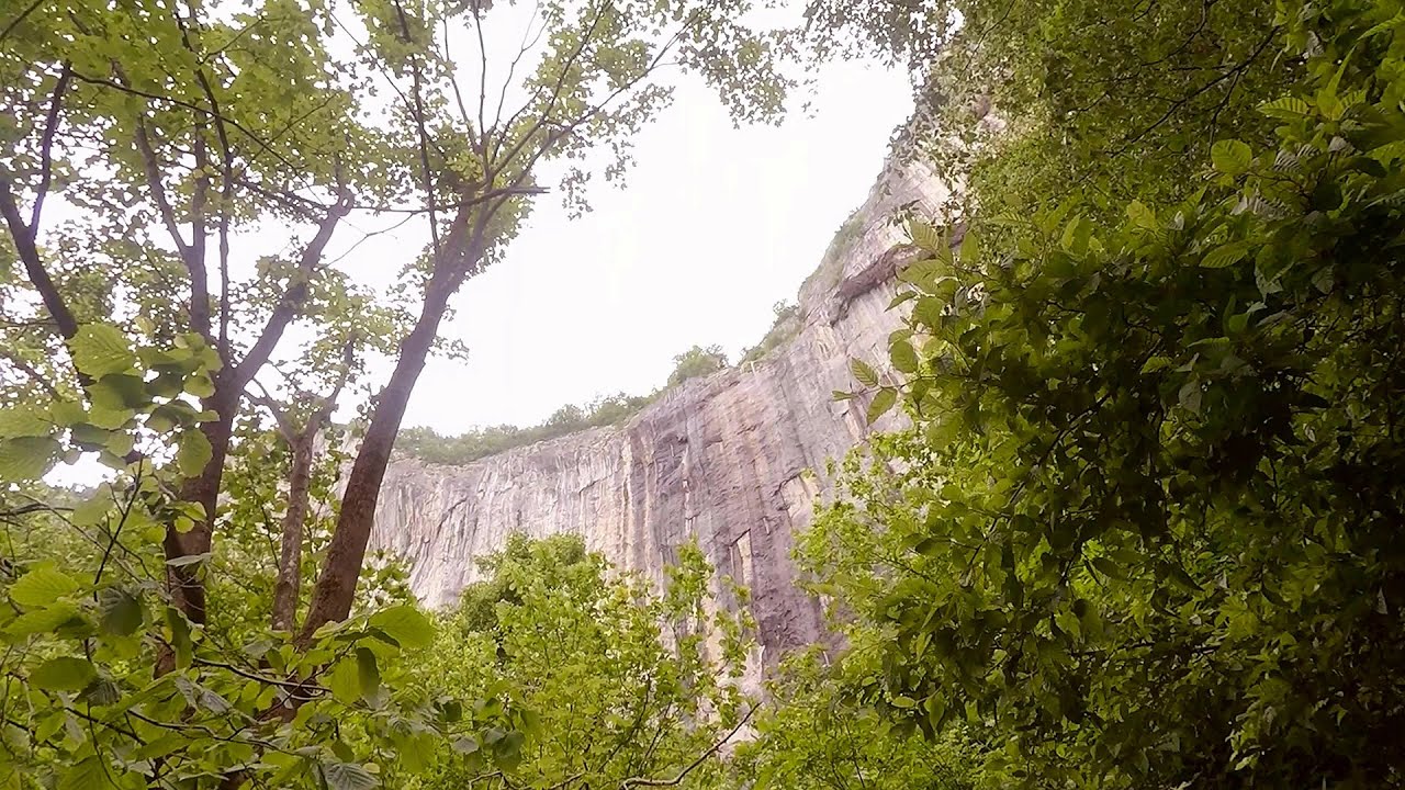
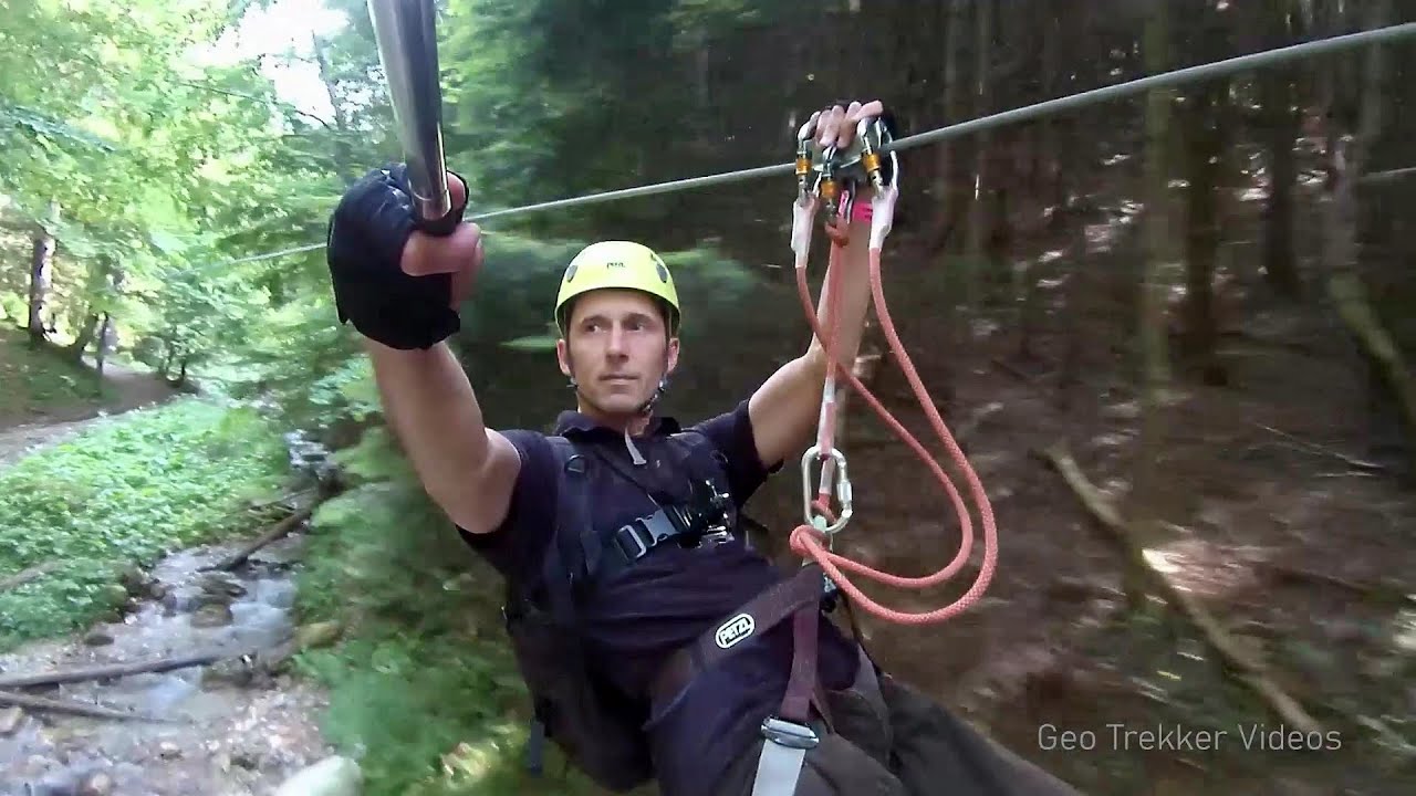
Via Ferrata Fairy Castle - Vadu Crisului 317.3 km away. Via Ferrata Fairy Castle (Castelul Zanelor, Casa Zmeului, The House of the Dragon) - Vadu Crisului. South of Vadu Crisului, in the Padurea Craiului Mountains, lies the Vadu Crisului Gorge, a section of the Crisul Repede river that narrows between rocky walls.
Other places
Borov Kamak waterfall Zgorigrad, Vratsa The Vratsa eco-trail starts from the village of Zgorigrad, located 6 km from the city of Vratsa in Bulgaria, and ends at the Parshevitza hut. It is also known as the Zgorigradska or Borov Kamak eco-trail.

Fairy Cliff via ferrata route Vadu Crisului 317.5 km away. Fairy Cliff (Peretele Zanelor) via ferrata route - Vadu Crisului. In Vadu Crisului, in the Padurea Craiului Mountains, on the right bank of the Crisul Repede, you can find the newest, in chronological order (2015) the fifth Transylvanian, new type of via ferrata route.
Muierii Cave Baia de Fier We visited the Baia de Fier area, and climbed on the rock that also conceals the Women's Cave (Pestera Muierilor). Between two via ferrata routes, we also participated in one of the guided cave tours, which depart every hour.
Falco Tinnunculus via ferrata, the ascent Falcons Rock, Corbu 479.6 km away. Falco Tinnunculus (Common kestrel) via ferrata (E), the ascent - Falcon's Rock, Corbu. Over Corbu village in Harghita County, on the rocks of Falcon's Rock (Piatra Soimilor), which belong to the Bistrita Mountains, five via ferrata routes have been established.
Skaklya waterfall Vratsa The largest seasonal waterfall in Bulgaria plunges down from a height of 141 meters. It is located in the Vratsa Mountain National Park, just one and a half kilometers away from the city of Vratsa.
Varghis gorges in winter I went out to admire the ice stalagmites (standing icicles) in the Varghis Gorge. Anyone arriving here at the end of winter can observe meter-high ice stalagmites in the entrance area of Meresti Cave (now known as Orban Balazs Cave).

The Heart of Jesus look-out Lupeni 498.6 km away. Through the mud on Gordon Mountain, above Farkaslaka (Lupeni commune, Harghita county, Transilvania), on a cloudy afternoon, at the end of February. The destination is the Heart of Jesus lookout, nicknamed as Pléhkrisztus (The Tin Christ).
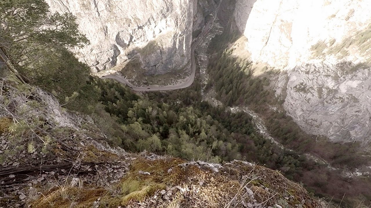
Poienii Rock, north-eastern lookout point Bicaz Gorge From the viewpoint at the top of the northeastern wall of Poienii Rock in the Bicaz Gorges, we can look down 300 meters to the mouth of the Bicajel stream. The Bridge of the Hungarians is hidden among pine trees.
Other destinations
Tesárska Gorge 168 km away. Tesárska gorge (Tesárska roklina) - Hontianske Tesáre.
[ Top ↑ ]
Copyright © 2003-2026 Trekkingklub and friends. Reproduction of any text, picture or video from the Niedzica Castle website, either in printed or electronic form, is prohibited without prior written permission.
The given distances are to be understood as straight line distances, and are approximate. Website made in Miercurea Ciuc  .
.