Silberkar Gorge - Ramsau am Dachstein | Video


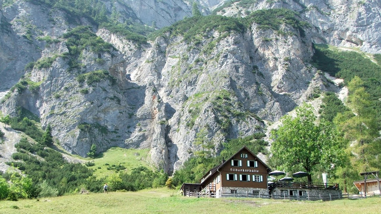
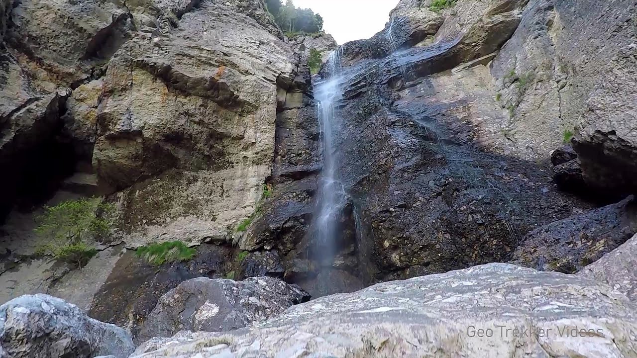
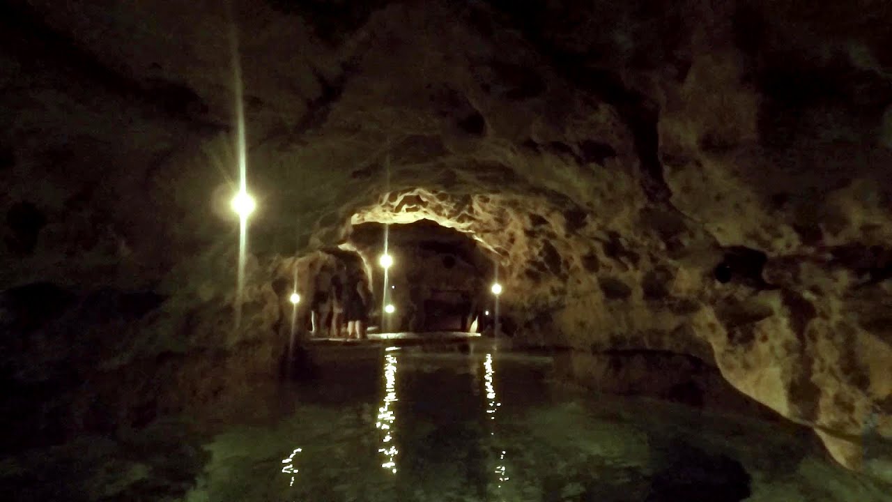
One of the most beautiful hiking spots in the area of Ramsau am Dachstein, is the Silberkarklamm (Silberkar Gorge). It is possible to drive to the entrance of the gorge, there is parking available on the side of the road, and you have to pay an entrance fee. Read more
Filmed with SJCAM SJ5000 Plus. Music: Silence by Kai Engel. Copyright © 2015 - 2026 Geo Trekker Videos. Please register for full and ad-free access.
Airport nearby Salzburg Airport (SZG - Salzburg, At), 67 km away from Silberkar Gorge - Ramsau am Dachstein.
Photos of nearby places

Kanin cableway and ski resort - Shooting window, Monte Forato, Bovec, Sella Nevea (48 photos) 121 km away. The Kanin Mountains are located in the Western Julian Alps, on the border of Slovenia and Italy. The highest peak in this range, known as (High) Kanin or Monte Canin Alto, in Slovenian and Italian respectively, reaches a height of 2,587 m above sea level.

The Devils Bridge - Wegscheid, Austria (18 photos) 122.7 km away. The Devil's Bridge, Teufelsbrücke in German, is located just ten kilometers from the city of Mariazell, near the Klettersteigpark Spielmäuer via ferrata park. From the top of the via ferrata park, it is worth taking a detour to the Devil's Bridge, which is located near the starting point of the descent path.

Mariazell climbing route, Felixs Celestial Ladder, Devils Bridge - Climbing Park Spielmäuer (60 photos) 123.5 km away. Climbing Park Spielmäuer - Mariazell climbing route, Felix's Celestial Ladder, Devil's Bridge (Kletterpark Spielmäuer - Mariazeller Steig, Felix Himmelsleiter, Teufelsbrücke) - Wegscheid, Austria.

Boka Waterfall - Slovenia (11 photos) 125.4 km away. Boka (Slap Boka) is a waterfall in western Slovenia, near the Soca River. It has two stages, with the first being 106 m high and 18 m wide, and the second being 33 m high.

Slap Savica waterfall - Slovenia (12 photos) 127.3 km away. Slap Savica, found in the northwestern part of Slovenia, is a magnificent, 78 m high waterfall. It derives its water from a karst spring called Savica located just above the falls.

Lake Bohinj - Upper Carniola, Slovenia (10 photos) 129.5 km away. Lake Bohinj, also known as Bohinjsko jezero in Slovene and Wocheiner See in German, is the biggest permanent lake in Slovenia, covering a vast area of 318 hectares. Situated in the Bohinj Valley of the Julian Alps, in the northwestern region of Upper Carniola (Gorenjska, Alta Carniola, Oberkrain), it forms a part of the Triglav National Park.

Vogel Ski Resort - Slovenia (33 photos) 130.7 km away. Vogel Ski Resort is situated in Slovenia, above Bohinj and adjacent to Lake Bohinj, on the outskirts of Triglav National Park. The resort derives its name from the nearby Mount Vogel, and was established in 1964.

Slap Kozjak waterfall - Slovenia (24 photos) 131.1 km away. Slap Kozjak waterfall, perhaps the most beautiful waterfall in Slovenia, is situated near Kobarid. Located within the Kozjak stream gorge, and overlooking the stunning emerald green Soca River, this magnificent waterfall cascades 15 meters high, and is enclosed within a mesmerizing stone chamber.

Napoleon Bridge - Kobarid, Slovenia (22 photos) 132.5 km away. The Napoleon bridge (Napoleonov most) is located near Kobarid, on the banks of the Soca (Isonzo) river. The bridge has existed since ancient times, and has undergone multiple demolitions and reconstructions.

Predjama Castle - Slovenia (54 photos) 182.9 km away. Predjama Castle built onto a cave, is situated on a cliff, in the village of Predjama, Slovenia. The castle has a rich history dating back to the 13th century.

Postojna Cave - Slovenia (12 photos) 187.6 km away. The Postojna Cave (Postojnska jama) is a renowned tourist attraction located in Slovenia. It is a network of underground galleries and halls, stretching over 24 kilometers, known for its geological formations, including stalagmites and stalactites.

Skocjan Caves - Slovenia (22 photos) 198 km away. The Skocjan Caves (Skocjanske jame) are a system of underground caves located in the Karst region of Slovenia. These caves are famous for their breathtaking natural beauty, and extensive underground river system.

Venice - Italy (60 photos) 246.4 km away. Venice (Venezia) is a city located in northeastern Italy, it is the capital of the region of Veneto. It is known for its unique setup of being built on a lagoon, on a group of islands separated by canals and connected by bridges.

Old town Krk - Krk Island, Croatia (11 photos) 276 km away. Krk is a Croatian island located in the Adriatic Sea. It is the largest island in the country, and has a rich history dating back to ancient times.

Slunjcica - Rastoke, Slunj - Croatia (12 photos) 295 km away. The Slunjcica river is situated in central Croatia, flowing through the Kordun region. The city of Slunj is named after this river.

Rab Island - Croatia (24 photos) 308.9 km away. Rab is a small island located in the Adriatic Sea, belonging to Croatia. It is known for its beautiful beaches, mild climate, and historic town of the same name.

Port of Jablanac - Croatia (18 photos) 317 km away. Situated in Lika-Senj county, Croatia, Jablanac is a village located beneath the Velebit mountain, overlooking the neighboring island of Rab in the Adriatic Sea. In close proximity to Jablanac are the Velebit mountain and the Northern Velebit National Park.

Plitvice Lakes - Croatia (60 photos) 317.5 km away. The Plitvice Lakes National Park is the oldest and largest national park in Croatia. It is located in a mountainous region between Mala Kapela and Licka Pljesivica.

Manita pec cave - Croatia (21 photos) 372.9 km away. There are 115 caves so far known in the Paklenica National Park, Manita pec is the most famous one, and is open to the public for guided visits. The cave has beautiful chambers, and various cave formations such as stalagmites, stalactites, columns, and flowstones.

Paklenica National Park - Croatia (55 photos) 374.5 km away. In 1949, the area of Velika and Mala Paklenica was designated as a national park due to its natural features, forests, and geomorphologic structures. The main purpose was to protect the largest and best-preserved forest complex in Dalmatia, which was at risk from excessive exploitation.

Rome - Italy (24 photos) Rome is the capital city of Italy. With a history spanning over 2,800 years, it is one of the oldest continuously occupied cities in the world.

Sohodol pit cave - Padurea Craiului Mountains (10 photos) Sohodol pit cave (Avenul Sohodol) - Padurea Craiului Mountains.
[ Top ↑ ]
Videos of nearby places

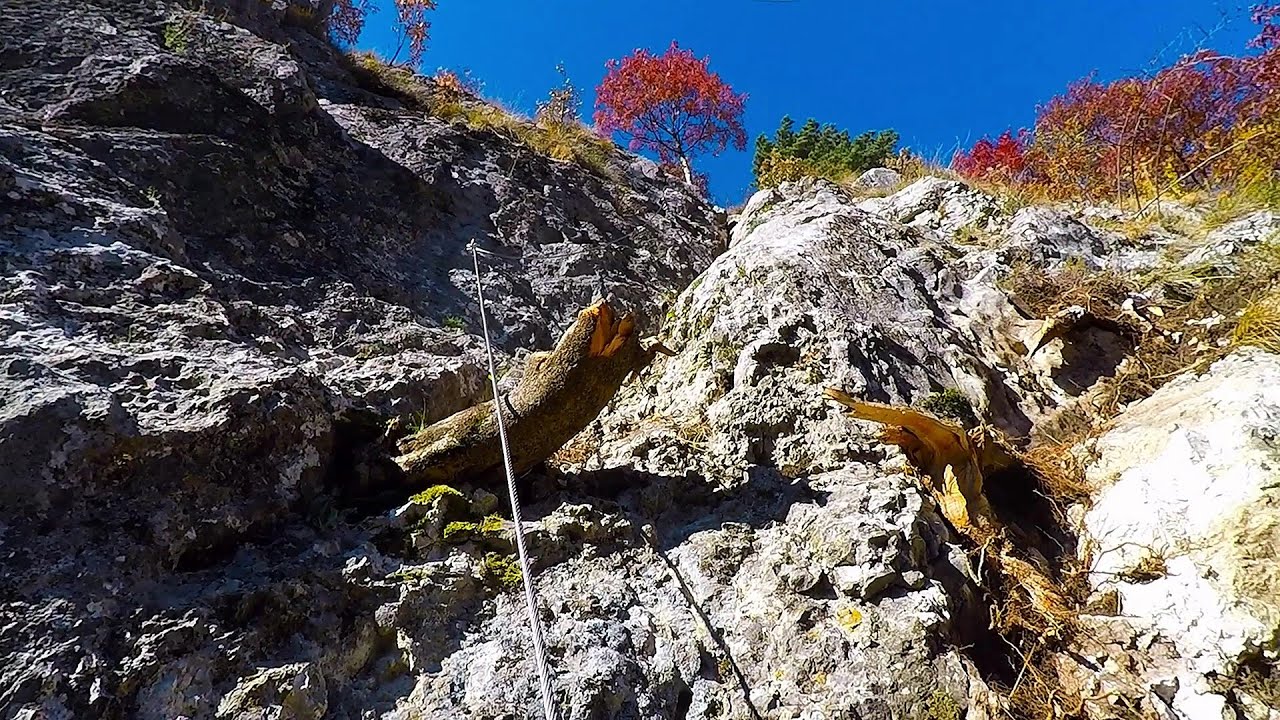
Hias via ferrata - Silberkarklamm, Ramsau am Dachstein 0.2 km away. The Hias via ferrata in the Silberkar Gorge (Silberkarklamm) is the first of the three via ferrata routes, and perhaps the easiest to complete. Two cable bridges and a few trickier sections make it interesting, but it is truly impressive due to the view of the narrow gorge.
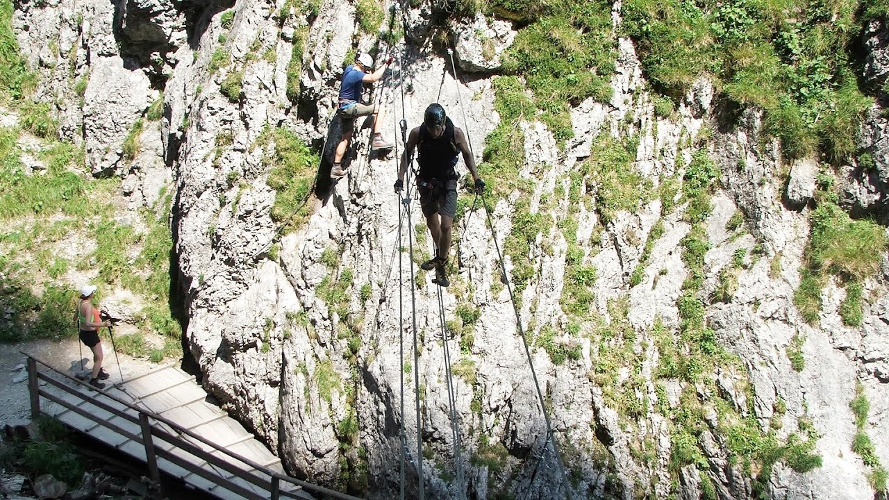
Rosina via ferrata - Silberkar Gorge, Ramsau am Dachstein 0.3 km away. The Rosina via ferrata is the most difficult via ferrata in the Silberkar Gorge (Silberkarklamm), has a D difficulty rating, and it is a vertical masterpiece. After a short suspension bridge above the stream, it leads up the rock wall next to the gorge waterfall, all the way vertically.
Siega via ferrata - Silberkar Gorge, Ramsau am Dachstein 1.1 km away. The Siega via ferrata, categorized as a C/D level of difficulty, is perhaps the least interesting of the three via ferrata routes in the Silberkar Gorge (Silberkarklamm). This doesn't mean that it's not good, just that the other two are even better.
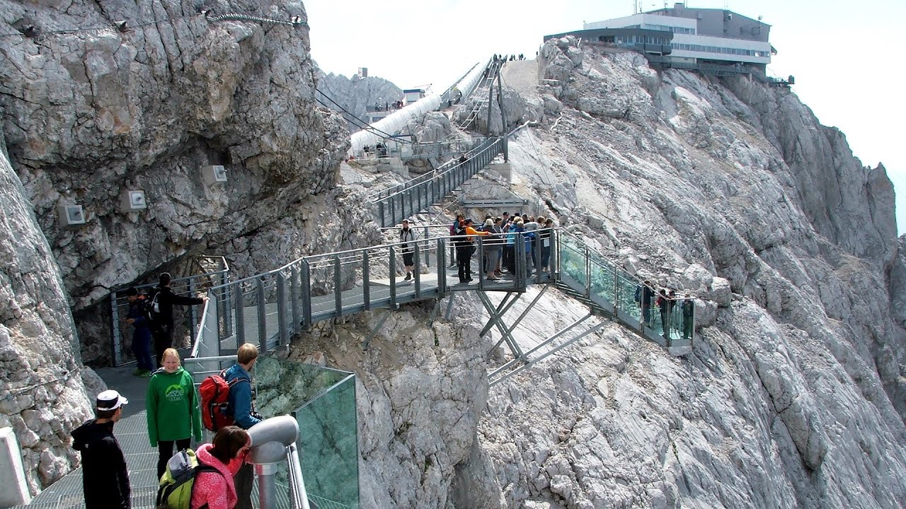
Sky Walk, Suspension Bridge, Stairway to Nothingness - Styria, Dachstein 7.8 km away. The Dachstein cable car (Gletscherbahn Panorama Gondel, Panorama Cable Car) took me up to a height of 2700 meters, to the highest mountain in Styria (Steiermark), the Dachstein. Next to the upper station of the cable car there are several tourist attractions.
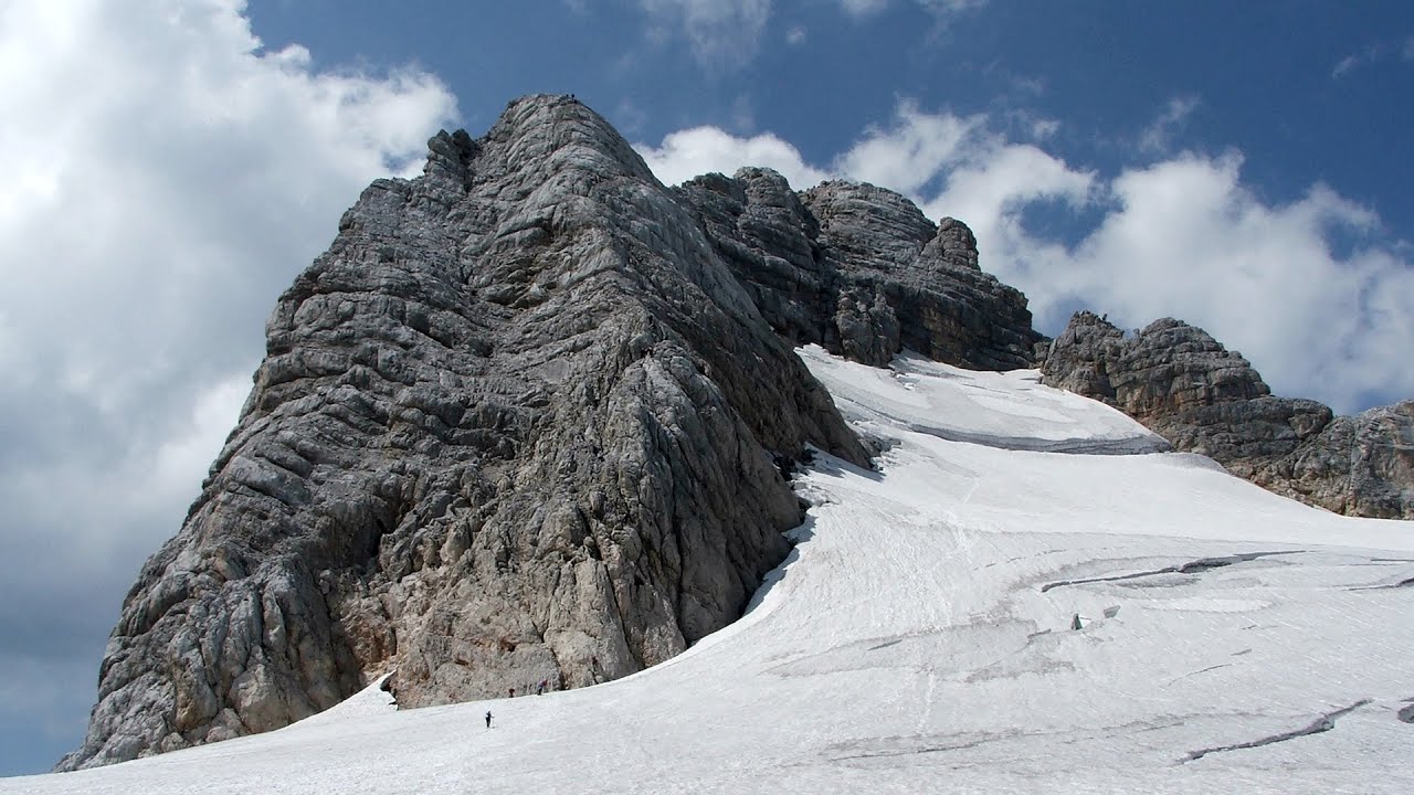
Schulter Anstieg klettersteig - Hoher Dachstein 9.1 km away. Two routes lead to the top of the Hoher Dachstein. The Randkluft is shorter, but can only be reached through a glacier with cracks.
Other places

The Heart of Jesus look-out Lupeni Through the mud on Gordon Mountain, above Farkaslaka (Lupeni commune, Harghita county, Transilvania), on a cloudy afternoon, at the end of February. The destination is the Heart of Jesus lookout, nicknamed as Pléhkrisztus (The Tin Christ).

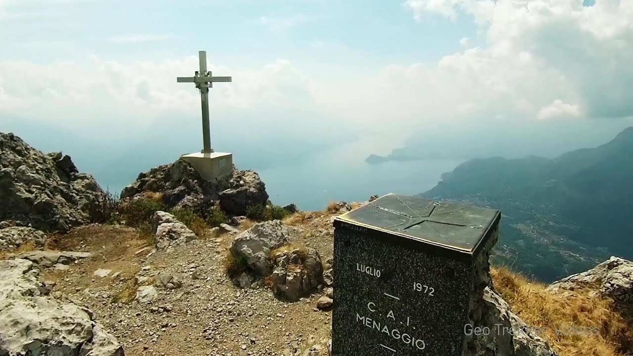
Via Ferrata Centenario C.A.O Monte Grona, Prealpi Lombarde, Lombardia 375.6 km away. In the magnificent rocky world of Monte Grona, the Centenario via ferrata leads upwards, which I had the opportunity to climb accompanied by lizards. Although it was cloudy and gloomy, I had a great view of Lake Lugano and Lake Como along the way.
Upstream of the Izvorul Dorului creek Vanturis waterfalls Upstream of the Izvorul Dorului (Source of longing) creek - Vanturis waterfalls, Bucegi Mountains.
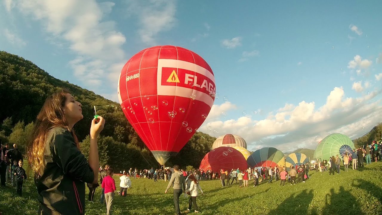
Hot air balloon parade 2015 Campu Cetatii This year, the Hot Air Balloon Parade was organized in Campu Cetatii for the tenth time. Unfortunately, the weather only allowed for flying on Saturday morning and evening.

TV-radio amplifying station Harghita Ciceu The hiking trail marked with a blue stripe starts at the Uz Bence shelter and runs from Harghita-Bai to Harghita Madaras. Our destination today is the Harghita Ciceu plateau.

Small Via ferrata Rasnoavei Gorge In the past few days, it has snowed, so I climbed the two climbing routes in the Rasnoavei Gorge under winter conditions. While the lower part of the challenging Big via ferrata was dry, the upper section had patches of snow and icicles.
Tapolca lake cave Balaton-felvidéki National Park 288.4 km away. The Tapolca lake cave is situated in the Balaton-felvidéki National Park. A modern visitor center has been constructed at its entrance, featuring ten rooms that highlight the unique characteristics of karst regions.
[ Top ↑ ]
Copyright © 2003-2026 Trekkingklub and friends. Reproduction of any text, picture or video from the Silberkar Gorge - Ramsau am Dachstein website, either in printed or electronic form, is prohibited without prior written permission.
The given distances are to be understood as straight line distances, and are approximate. Website made in Miercurea Ciuc  .
.