Blasted Rock hanging path - photos


Page no. 1, photos: 1-10, 16 photos in total. >>>

Copyright © 2013 - 2025 Trekkingklub.com.
Already published 8925 photos and 175 videos. Please register for full access.
Photos of nearby places


[ Top ↑ ]
Videos of nearby places
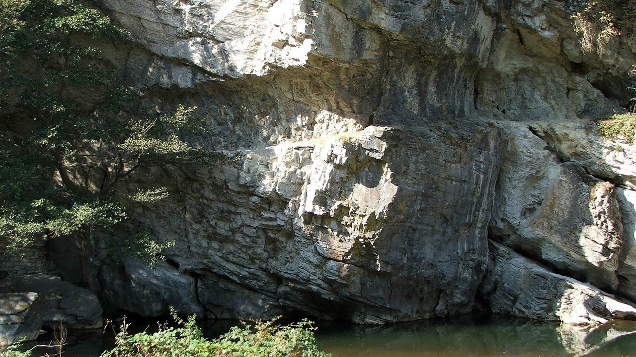
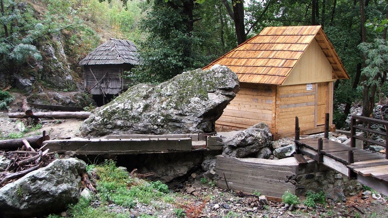
Blasted Rock (Piatra Puscata) hanging path - Cerna Valley 0 km away
The Blasted Rock hanging path is located on the geographical right bank of the Cerna River, near the confluence of the Iuta stream, approximately 20 km from Baile Herculane. In this area, the presence of limestone formations has caused the valley to become narrower.
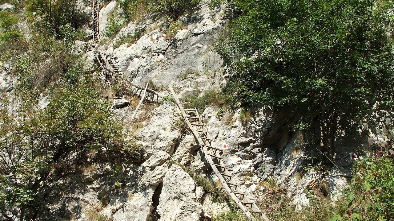
The Wooden Ladders - The villages of Scarisoara and Inelet, Cerna valley 0.84 km away
Scarisoara and Inelet are small, isolated villages located in the mountainous region of Banat. They are situated on the right bank of the Cerna River, approximately 19 km away from the Baile Herculane resort.
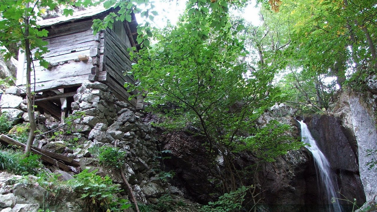
Mill of the Devils (Moara Dracilor) - Tasna Gorge (Cheile Tasnei) 7.01 km away
The Tasna Gorges are located in the Mehedinti Mountains, approximately 15 km from the resort of Baile Herculane. The gorges are part of the Domogled - Cerna Valley (Valea Cernei) National Park.
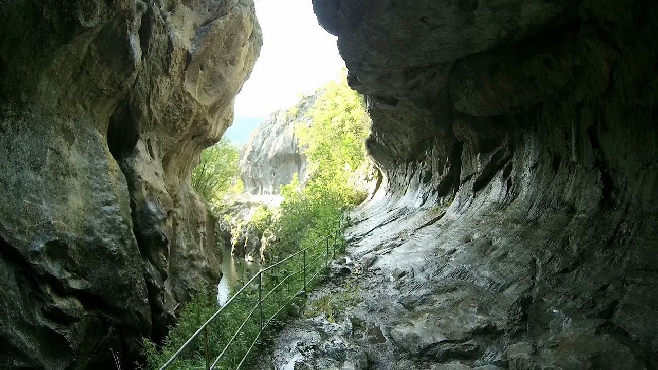
Corcoaia Gorge - Gorj county 16.52 km away
The Corcoaia Gorge is one of the most beautiful tourist attractions in the Cerna Valley. It can be reached by car, 43 km away from Baile Herculane, of which about 17 km is on a dusty gravel road.
Rudariei watermills - Eftimie Murgu 39.66 km away
I have visited the twenty-two wooden water mills with horizontal wheels, located in the valley of the Rudaria stream, mostly in the rain and under an umbrella. Some of them are still in use today.
Other places
Seven Ladder Canyon and Waterfall Piatra Mare Mountain 249.07 km away
The Seven Ladder Gorge is the largest and most spectacular gorge in the Piatra Mare massif. The narrow canyon has a length of 160 meters, and over a drop of 58 meters includes 7 bigger and several smaller waterfalls.
The Seven Ladder Gorge is the largest and most spectacular gorge in the Piatra Mare massif. The narrow canyon has a length of 160 meters, and over a drop of 58 meters includes 7 bigger and several smaller waterfalls.
Bicajel Gorge, Bicajel Waterfall, Stone of the Gorge 322.22 km away
Bicajel Gorge (Cheile Bicajelului), Bicajel Waterfall (Cascada Bicajel), Stone of the Gorge (Surduc Stone, Piatra Surducului) - Hasmas Mountains.
Bicajel Gorge (Cheile Bicajelului), Bicajel Waterfall (Cascada Bicajel), Stone of the Gorge (Surduc Stone, Piatra Surducului) - Hasmas Mountains.
Stan Valley Canyon 165.83 km away
The Stan Valley is located near Lake Vidraru, southwest of it, in the Fruntii Mountains. Those who have visited the Seven Ladders Waterfall will appreciate this canyon, outfitted with infrastructure for tourist accessibility.
The Stan Valley is located near Lake Vidraru, southwest of it, in the Fruntii Mountains. Those who have visited the Seven Ladders Waterfall will appreciate this canyon, outfitted with infrastructure for tourist accessibility.
Krushuna waterfalls Krushuna 279.51 km away
The Krushuna Waterfalls are a series of karst cascades formed in travertine. They are located near the village of Krushuna, not far from the town of Lovech, and are Bulgaria's largest waterfall of this type.
The Krushuna Waterfalls are a series of karst cascades formed in travertine. They are located near the village of Krushuna, not far from the town of Lovech, and are Bulgaria's largest waterfall of this type.
Kaya Bunar (Hotnishki Vodopadi, Hotnitsa Waterfall) Hotnitsa 315.11 km away
The Kaya Bunar Waterfall (Hotnishki Vodopadi) is located 20 km from the city of Veliko Tarnovo in Bulgaria. The waterfall is 30 meters high, and there are several smaller cascades above it.
The Kaya Bunar Waterfall (Hotnishki Vodopadi) is located 20 km from the city of Veliko Tarnovo in Bulgaria. The waterfall is 30 meters high, and there are several smaller cascades above it.
[ Top ↑ ]
[ Top ↑ ]
Copyright © 2003-2025 Trekkingklub and friends. Reproduction of any text, picture or video from this website, either in printed or electronic form, is prohibited without prior written permission.
The given distances are to be understood as straight line distances, and are approximate. Website made in Miercurea Ciuc  .
.