Ramnuta Mare waterfalls - Mehedinti Mountains | Photos
Hiking photos and videos Login Register
Select language: - Magyar - Romana - Deutsch - Français - Italiano - Español -
Select language: - Magyar - Romana - Deutsch - Français - Italiano - Español -


Page no. 1, photos: 1-10, 16 photos in total. >>>

Copyright © 2013 - 2025 Trekkingklub.com.
Already published 8983 photos and 180 videos. Please register for full and ad-free access.
Photos of nearby places


[ Top ↑ ]
Videos of nearby places
Blasted Rock (Piatra Puscata) hanging path - Cerna Valley 7.9 km away
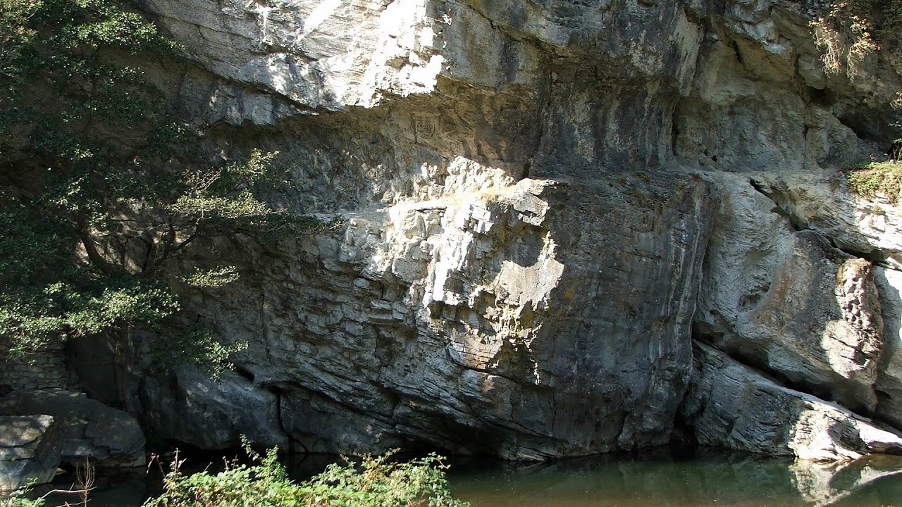
The Blasted Rock hanging path is located on the geographical right bank of the Cerna River, near the confluence of the Iuta stream, approximately 20 km from Baile Herculane. In this area, the presence of limestone formations has caused the valley to become narrower.
Corcoaia Gorge - Gorj county 8.62 km away
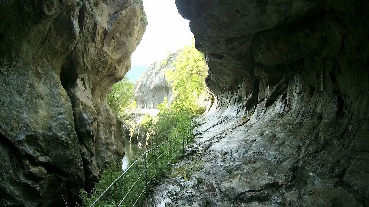
The Corcoaia Gorge is one of the most beautiful tourist attractions in the Cerna Valley. It can be reached by car, 43 km away from Baile Herculane, of which about 17 km is on a dusty gravel road.
The Wooden Ladders - The villages of Scarisoara and Inelet, Cerna valley 8.73 km away
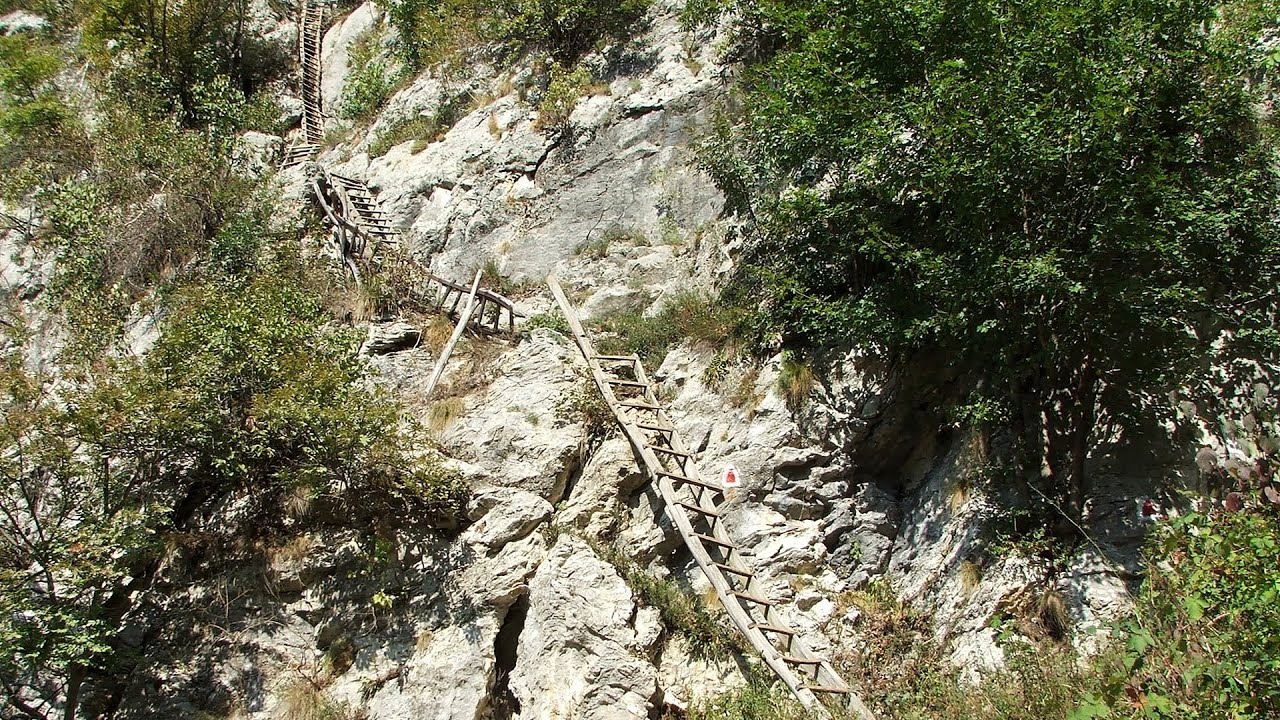
Scarisoara and Inelet are small, isolated villages located in the mountainous region of Banat. They are situated on the right bank of the Cerna River, approximately 19 km away from the Baile Herculane resort.
Mill of the Devils (Moara Dracilor) - Tasna Gorge (Cheile Tasnei) 14.85 km away
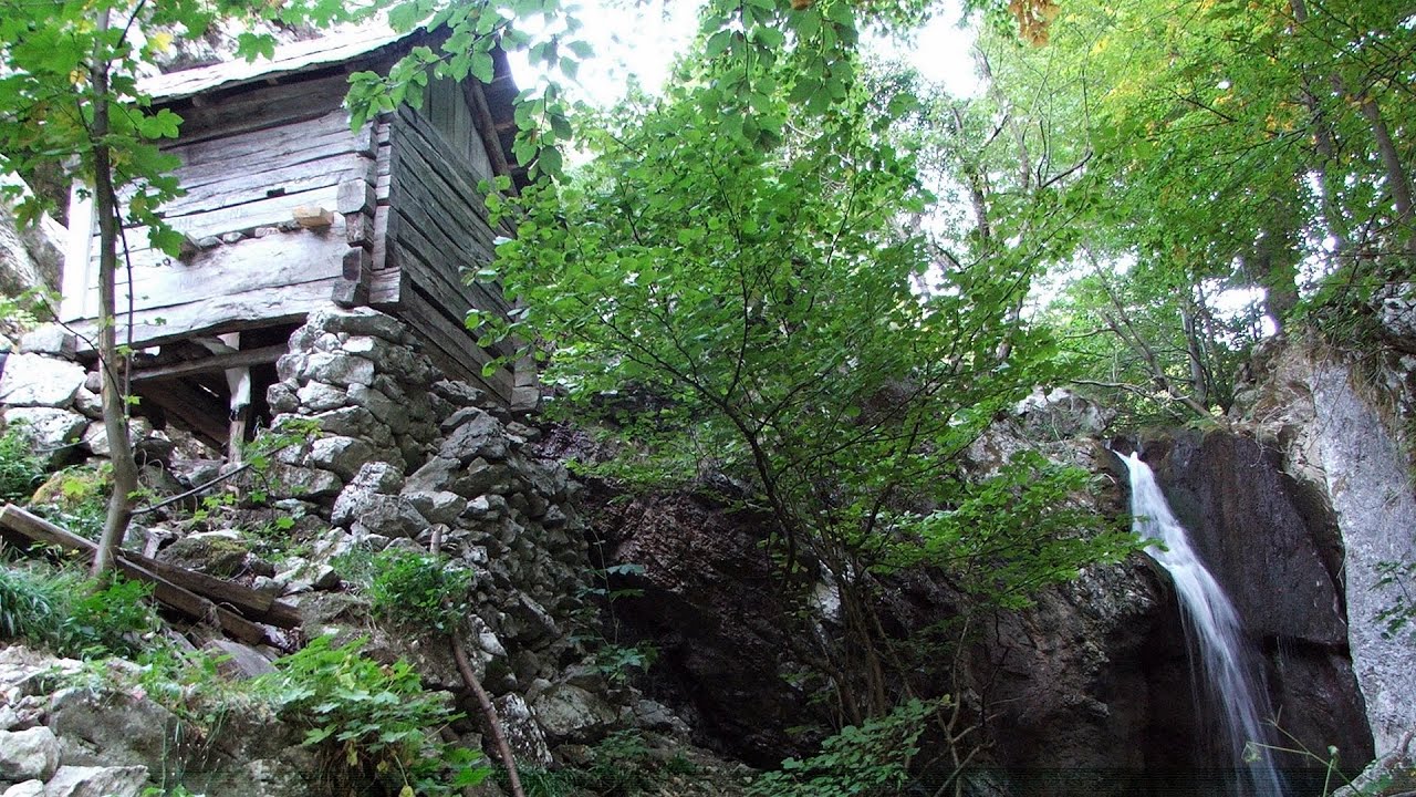
The Tasna Gorges are located in the Mehedinti Mountains, approximately 15 km from the resort of Baile Herculane. The gorges are part of the Domogled - Cerna Valley (Valea Cernei) National Park.
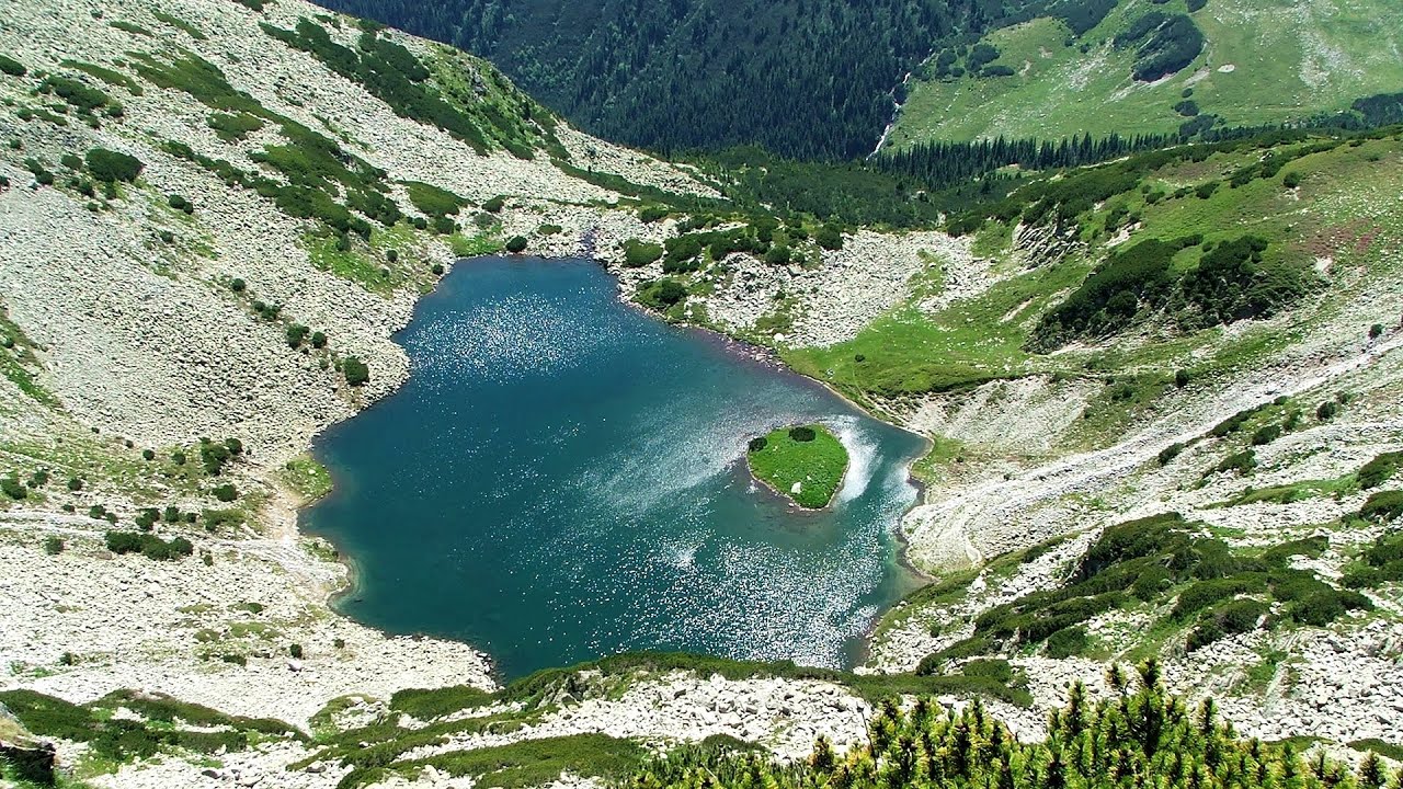
Billy-goat lake, Closed Gates - Retezat Mountains 41 km away
The most unique ridge trail of the Retezat Mountains is the Closed Gates.Below, at an altitude of 2070 m above sea level, is the Billy-goat lake.
Other places
Ski Gyimes ski slope Lunca de Sus 304.4 km away
The Ski Gyimes ski slope is located in Lunca de Sus, right next to the main road. It is 800 m long, the level difference is 160 m.
The Ski Gyimes ski slope is located in Lunca de Sus, right next to the main road. It is 800 m long, the level difference is 160 m.
Transalpina Ski Resort Vidra lake 93.01 km away
Suchurum waterfall Karlovo 321.3 km away
The 15-meter-high Suchurum Waterfall is located at the foot of the Stara Planina mountain range, 1 km north of the town of Karlovo in Bulgaria. It is situated below the Karlovo hydroelectric power plant, on the waters of the Stara Reka stream.
The 15-meter-high Suchurum Waterfall is located at the foot of the Stara Planina mountain range, 1 km north of the town of Karlovo in Bulgaria. It is situated below the Karlovo hydroelectric power plant, on the waters of the Stara Reka stream.
Roman Baths Geoagiu-Bai, Metaliferi Mountains 104.6 km away
[ Top ↑ ]
[ Top ↑ ]
Copyright © 2003-2025 Trekkingklub and friends. Reproduction of any text, picture or video from this website, either in printed or electronic form, is prohibited without prior written permission.
The given distances are to be understood as straight line distances, and are approximate. Website made in Miercurea Ciuc  .
.