Kaya Bunar (Hotnishki Vodopadi, Hotnitsa Waterfall) - Hotnitsa | Video

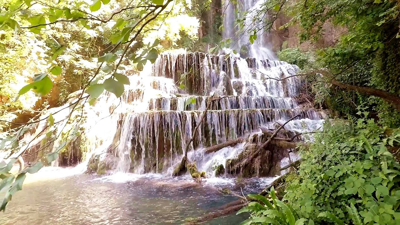
The Kaya Bunar Waterfall (Hotnishki Vodopadi) is located 20 km from the city of Veliko Tarnovo in Bulgaria. The waterfall is 30 meters high, and there are several smaller cascades above it. Below, a picturesque little pond has formed. You can drive quite close to the waterfall. In the clearing in front, there are wooden tables and benches waiting for those who wish to relax.
Read more
Filmed with GoPro HERO5 Black. Music: The Fresh Monday by Dexter Britain. Copyright © 2017 - 2025 Geo Trekker Videos.
Already published 8983 photos and 180 videos. Please register for full and ad-free access.
Photos of nearby places


Wonderful Rocks (Chudnite skali) - Asparuhovo (24 photos) 145.79 km away
The Wonderful Rocks, a very beautiful and impressive rock formation, are located on the right bank of the Luda Kamchiya River, on the shores of the Tsonevo Reservoir and near the village of Asparuhovo. They have the shapes of pointed, tall cones and pyramids.


Replica of the Eiffel Tower and Arc de Triomphe - Sveti Vlas (5 photos) 187.61 km away
Small-sized replica of the Eiffel Tower and Arc de Triomphe, in front of the decorative pool at the Romance Paris luxury hotel complex, in Sveti Vlas (Saint Blaise) resort.
[ Top ↑ ]
Videos of nearby places
Krushuna waterfalls - Krushuna 40.48 km away
The Krushuna Waterfalls are a series of karst cascades formed in travertine. They are located near the village of Krushuna, not far from the town of Lovech, and are Bulgaria's largest waterfall of this type.

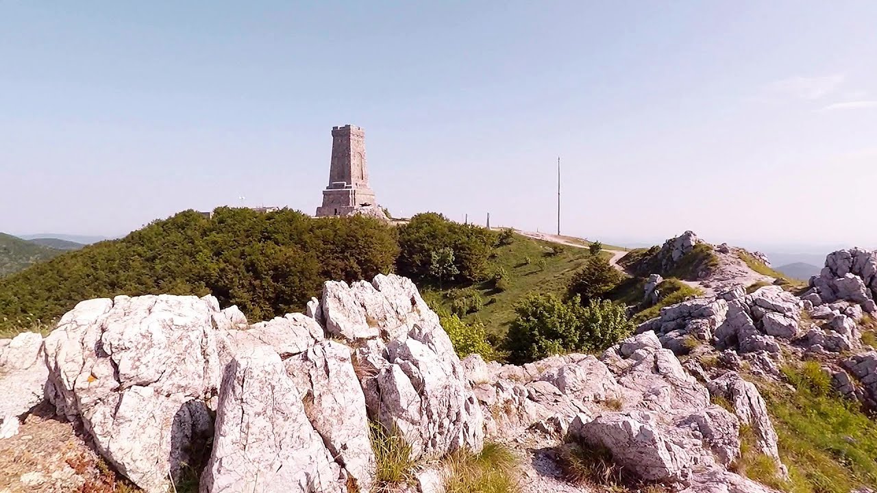
Buzludzha monument - Kazanluk 46.61 km away
Buzludzha is a historically significant mountain located in the Central Balkan Mountains of Bulgaria. At its summit, at an altitude of 1432 meters above sea level, there is an abandoned monument.
Shipka pass - Shipka 46.9 km away
The Shipka Pass is one of the most spectacular crossings of the Balkan Mountains, and is part of the Bulgarka Nature Park. It separates the provinces of Gabrovo and Stara Zagora, and provides a connection between the cities of Gabrovo and Kazanlak.
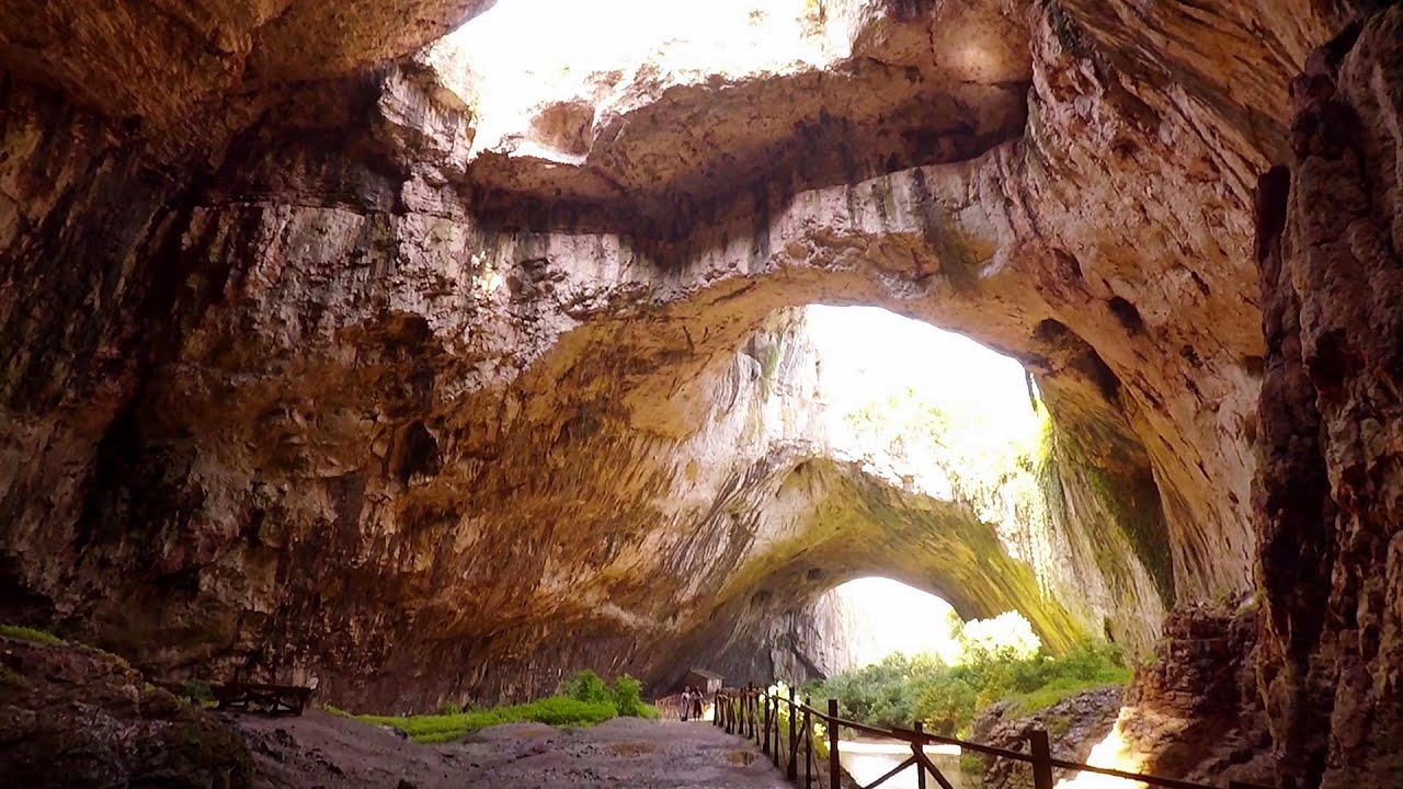
Devetashka cave - Devetaki 51.93 km away
The Devetashka Cave is located in Bulgaria, near the village of Devetaki. After the entrance portal, which measures 30 m by 35 m, there is a vast open chamber that is 110 meters wide and 359 meters long.
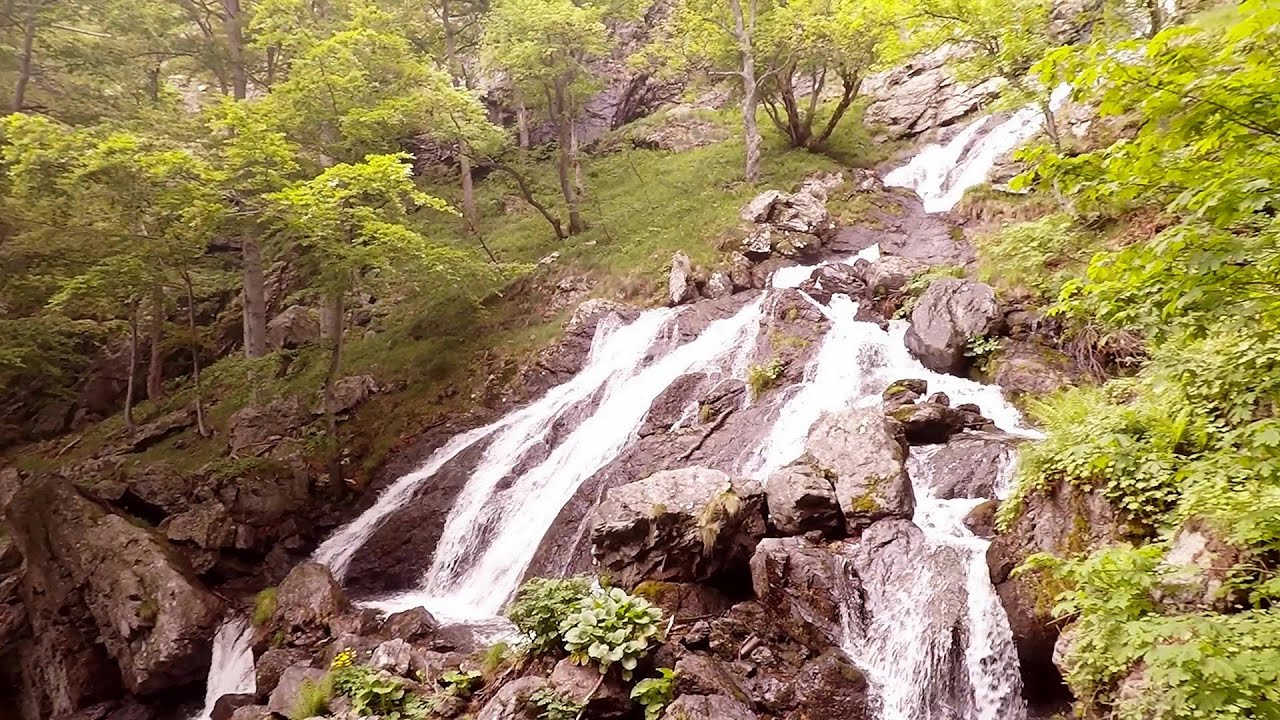
Babsko Praskalo waterfall - Tazha 62 km away
In the Central Balkans National Park, there are many rivers that cascade down spectacular waterfalls, which the locals call praskalo. One of the smallest waterfalls in the area is Babsko Praskalo, which stands at only 54 meters high.
Other places
Dyavolski Most (Devil's Bridge) Ardino 172.72 km away
The Devil's Bridge (Dyavolski Most, in Turkish Sheytan Kyupriya) is located in the gorge of the Arda River, just north of the town of Ardino in Bulgaria. It was constructed in the early 16th century, between 1515 and 1518, by an architect named Dimitar, on the remains of an earlier Roman bridge.
The Devil's Bridge (Dyavolski Most, in Turkish Sheytan Kyupriya) is located in the gorge of the Arda River, just north of the town of Ardino in Bulgaria. It was constructed in the early 16th century, between 1515 and 1518, by an architect named Dimitar, on the remains of an earlier Roman bridge.
Seven Ladder Canyon and Waterfall Piatra Mare Mountain 269.41 km away
The Seven Ladder Gorge is the largest and most spectacular gorge in the Piatra Mare massif. The narrow canyon has a length of 160 meters, and over a drop of 58 meters includes 7 bigger and several smaller waterfalls.
The Seven Ladder Gorge is the largest and most spectacular gorge in the Piatra Mare massif. The narrow canyon has a length of 160 meters, and over a drop of 58 meters includes 7 bigger and several smaller waterfalls.
Prohodna cave (The Eyes of God) Karlukovo 116.87 km away
The cave nicknamed The Eyes of God is located in Bulgaria, in the Iskar Gorge, on one of the largest karst areas in Bulgaria, 2 km from the town of Karlukovo. It is essentially a 262-meter-long natural stone bridge, with a large (45 m high) and a small (35 m high) entrance.
The cave nicknamed The Eyes of God is located in Bulgaria, in the Iskar Gorge, on one of the largest karst areas in Bulgaria, 2 km from the town of Karlukovo. It is essentially a 262-meter-long natural stone bridge, with a large (45 m high) and a small (35 m high) entrance.
Balea waterfall and the Transfagarasan mountain_road 285.83 km away
Balea waterfall and the Transfagarasan mountain road - blue triangle marked trail, Balea valley, Fagaras Mountains, Southern Carpathians.
Balea waterfall and the Transfagarasan mountain road - blue triangle marked trail, Balea valley, Fagaras Mountains, Southern Carpathians.
Iskar gorge (Lyutibrod) Temnata dupka cave (Lakatnik) 172.97 km away
The Iskar is the longest purely Bulgarian river, the oldest river in the Balkans, and a right tributary of the Danube. The river is 368 km long, with approximately 150 km consisting of a gorge.
The Iskar is the longest purely Bulgarian river, the oldest river in the Balkans, and a right tributary of the Danube. The river is 368 km long, with approximately 150 km consisting of a gorge.
Planned destinations
Natural stone bridge Aglen 97.28 km away
Natural stone arch on the Vit river, near the village of Aglen. Crocodile shaped rock, Elephant rock.
Natural stone arch on the Vit river, near the village of Aglen. Crocodile shaped rock, Elephant rock.
[ Top ↑ ]
[ Top ↑ ]
Select language: - Magyar - Romana - Deutsch - Français - Italiano - Español - Copyright © 2003-2025 Trekkingklub and friends. Reproduction of any text, picture or video from this website, either in printed or electronic form, is prohibited without prior written permission. The given distances are to be understood as straight line distances, and are approximate. Website made in Miercurea Ciuc