Shipka pass - Shipka | Video

The Shipka Pass is one of the most spectacular crossings of the Balkan Mountains, and is part of the Bulgarka Nature Park. It separates the provinces of Gabrovo and Stara Zagora, and provides a connection between the cities of Gabrovo and Kazanlak. The pass is located 13 km north of the town of Shipka.
Read more
Filmed with GoPro HERO5 Black. Music: I Know What You Are by Alasdair Cooper. Copyright © 2017 - 2025 Geo Trekker Videos.
Already published 8983 photos and 180 videos. Please register for full and ad-free access.
Photos of nearby places


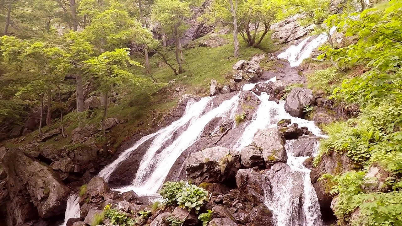
Canyon of Waterfalls eco-trail - Smolyan (8 photos) 141.26 km away
The Soskovcheto Reserve was established in 1968 and covers an area of 177 hectares. It is situated in the Perelishko-Prespanski region of the Rhodope Mountains.

Wonderful Rocks (Chudnite skali) - Asparuhovo (24 photos) 162.48 km away
The Wonderful Rocks, a very beautiful and impressive rock formation, are located on the right bank of the Luda Kamchiya River, on the shores of the Tsonevo Reservoir and near the village of Asparuhovo. They have the shapes of pointed, tall cones and pyramids.

Castle of Ravadinovo (In love with the wind) (79 photos) 196.55 km away
The Castle of Ravadinovo, situated near Sozopol in Bulgaria, is a enchanting structure that delights visitors with its fairytale-like appearance and distinctive charm. Also known as In Love with the Wind, this castle is the visionary project of architect Georgi Kostadinov Tumpalov, who dedicated himself to its design and construction from 1996 onward, transforming his dream into reality through perseverance and community support.
[ Top ↑ ]
Videos of nearby places

Buzludzha monument - Kazanluk 6.09 km away
Buzludzha is a historically significant mountain located in the Central Balkan Mountains of Bulgaria. At its summit, at an altitude of 1432 meters above sea level, there is an abandoned monument.
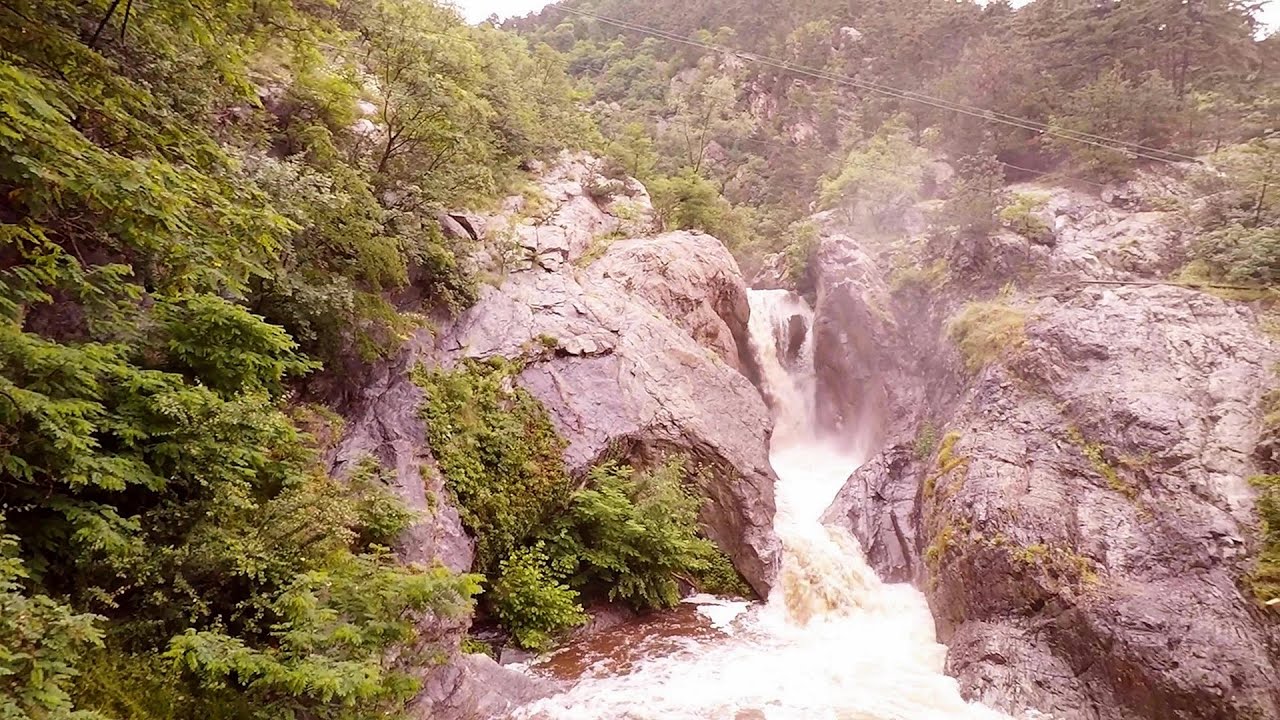
Babsko Praskalo waterfall - Tazha 22.78 km away
In the Central Balkans National Park, there are many rivers that cascade down spectacular waterfalls, which the locals call praskalo. One of the smallest waterfalls in the area is Babsko Praskalo, which stands at only 54 meters high.
Byala Reka eco-trail - Kalofer 31.05 km away
The Byala Reka eco-trail is situated at the foot of the Stara Planina mountain range, 8 km from the town of Kalofer. A 1,830-meter-long hiking trail has been established along the White Creek within the Central Balkan National Park.
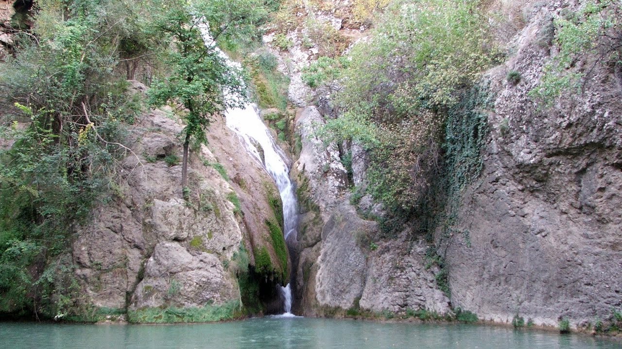
Suchurum waterfall - Karlovo 43.18 km away
The 15-meter-high Suchurum Waterfall is located at the foot of the Stara Planina mountain range, 1 km north of the town of Karlovo in Bulgaria. It is situated below the Karlovo hydroelectric power plant, on the waters of the Stara Reka stream.
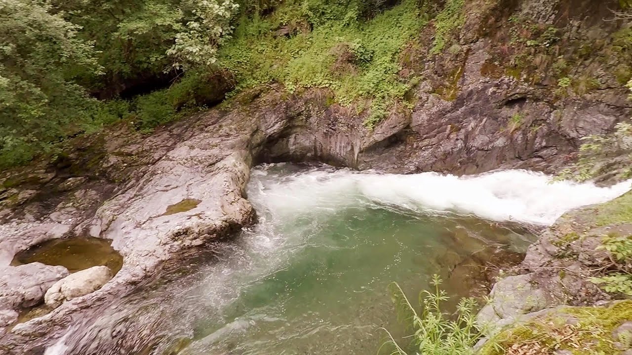
Kaya Bunar (Hotnishki Vodopadi, Hotnitsa Waterfall) - Hotnitsa 46.9 km away
The Kaya Bunar Waterfall (Hotnishki Vodopadi) is located 20 km from the city of Veliko Tarnovo in Bulgaria. The waterfall is 30 meters high, and there are several smaller cascades above it.
Other places
Belogradchik fortress Bulgaria 235.45 km away
Belogradchik is located in the northwestern part of Bulgaria, in the Vidin Province, at the foot of the Balkan Mountains, near the Serbian border. Its name means little white town.
Belogradchik is located in the northwestern part of Bulgaria, in the Vidin Province, at the foot of the Balkan Mountains, near the Serbian border. Its name means little white town.
Doabra Stones Brezoi, Lotru Mountains 302.33 km away
The DN7A road branches off west from the Olt Valley, from the main road between Sibiu and Ramnicu Valcea, leading towards Voineasa and Lake Vidra. The first settlement is a small town, Brezoi, which is located at the confluence of the Lotru and Olt rivers.
The DN7A road branches off west from the Olt Valley, from the main road between Sibiu and Ramnicu Valcea, leading towards Voineasa and Lake Vidra. The first settlement is a small town, Brezoi, which is located at the confluence of the Lotru and Olt rivers.
Muierii Cave (Pestera Muierilor) Baia de Fier 299.3 km away
We visited the Baia de Fier area, and climbed on the rock that also conceals the Women's Cave (Pestera Muierilor). Between two via ferrata routes, we also participated in one of the guided cave tours, which depart every hour.
We visited the Baia de Fier area, and climbed on the rock that also conceals the Women's Cave (Pestera Muierilor). Between two via ferrata routes, we also participated in one of the guided cave tours, which depart every hour.
Women's Spiral (Spirala Muierilor) via ferrata, climbing fun Baia de Fier 299.25 km away
The Women's Spiral (Spirala Muierilor) via ferrata is set up on the rock that conceals the Women's Cave (Pestera Muierii). It is one of the seven routes near Baia de Fier as of now (2018).
The Women's Spiral (Spirala Muierilor) via ferrata is set up on the rock that conceals the Women's Cave (Pestera Muierii). It is one of the seven routes near Baia de Fier as of now (2018).
Planned destinations
Abandoned copper mine Tsar Asen, Pazardzhik 91.48 km away
The turquoise waters of this mine lake are extremely beautiful but dangerously poisonous. Do not descend to the shore or touch the water!
The turquoise waters of this mine lake are extremely beautiful but dangerously poisonous. Do not descend to the shore or touch the water!
Natural stone bridge Aglen 95.75 km away
Natural stone arch on the Vit river, near the village of Aglen. Crocodile shaped rock, Elephant rock.
Natural stone arch on the Vit river, near the village of Aglen. Crocodile shaped rock, Elephant rock.
Kodzha in (Golyamata Peshtera, Big Cave) Nochevo 97.21 km away
[ Top ↑ ]
[ Top ↑ ]
Select language: - Magyar - Romana - Deutsch - Français - Italiano - Español - Copyright © 2003-2025 Trekkingklub and friends. Reproduction of any text, picture or video from this website, either in printed or electronic form, is prohibited without prior written permission. The given distances are to be understood as straight line distances, and are approximate. Website made in Miercurea Ciuc