Wonderful Rocks (Chudnite skali) - Asparuhovo - photos


Page no. 1, photos: 1-10, 24 photos in total. >>>

The Wonderful Rocks, a very beautiful and impressive rock formation, are located on the right bank of the Luda Kamchiya River, on the shores of the Tsonevo Reservoir and near the village of Asparuhovo. They have the shapes of pointed, tall cones and pyramids. When viewed from afar, they resemble a semi-destroyed ancient castle.
Read more
Copyright © 2025 Trekkingklub.com.
Already published 8971 photos and 179 videos. Please register for full and ad-free access.
Photos of nearby places


Replica of the Eiffel Tower and Arc de Triomphe - Sveti Vlas (5 photos) 46.4 km away
Small-sized replica of the Eiffel Tower and Arc de Triomphe, in front of the decorative pool at the Romance Paris luxury hotel complex, in Sveti Vlas (Saint Blaise) resort.

UNESCO World Heritage Site: Nesebar, the pearl of the Black Sea (20 photos) 49.55 km away
Nesebar is an ancient Bulgarian city on the Black Sea Coast, today a UNESCO World Heritage Site. It is renowned for its over three thousand years of history, diverse cultural heritage, and well-preserved medieval monuments.

Seagulls beach and the Marina Port Sozopol harbour (2 photos) 69.04 km away
Marina Port Sozopol offers everything an experienced sailor could wish for. The port has 243 berths for boats up to 25 meters long, equipped with electricity and drinking water.

Castle of Ravadinovo (In love with the wind) (79 photos) 71.44 km away
The Castle of Ravadinovo, situated near Sozopol in Bulgaria, is a enchanting structure that delights visitors with its fairytale-like appearance and distinctive charm. Also known as In Love with the Wind, this castle is the visionary project of architect Georgi Kostadinov Tumpalov, who dedicated himself to its design and construction from 1996 onward, transforming his dream into reality through perseverance and community support.

Art Complex Anel Sozopol - Budjaka Peninsula (6 photos) 72.25 km away
Art Complex Anel is located on Bulgaria's Black Sea coast near Sozopol, on the Budjaka Peninsula. It is the world's only hotel-art-museum complex, featuring a natural lagoon and stunning architecture.

Cape Agalina - Sozopol (24 photos) 74.36 km away
Agalina Cape is located on Bulgaria's southern Black Sea coast, south of Sozopol, Smokinya Beach, and Kavacite Beach. Its name, Agalina, comes from the Greek word agalia, which means embrace.

Drivers (Alepu) beach between Duni and Arkutino (6 photos) 76.22 km away
Drivers or Chauffeurs Beach, also known as Alepu Beach or Dunes, is one of the most renowned and scenic wild beaches along the South Black Sea coast. Located between Duni Resort to the north and Cape Humata to the south, the beach stretches nearly 3 kilometers in length and reaches a width of up to 70 meters.
[ Top ↑ ]
Videos of nearby places
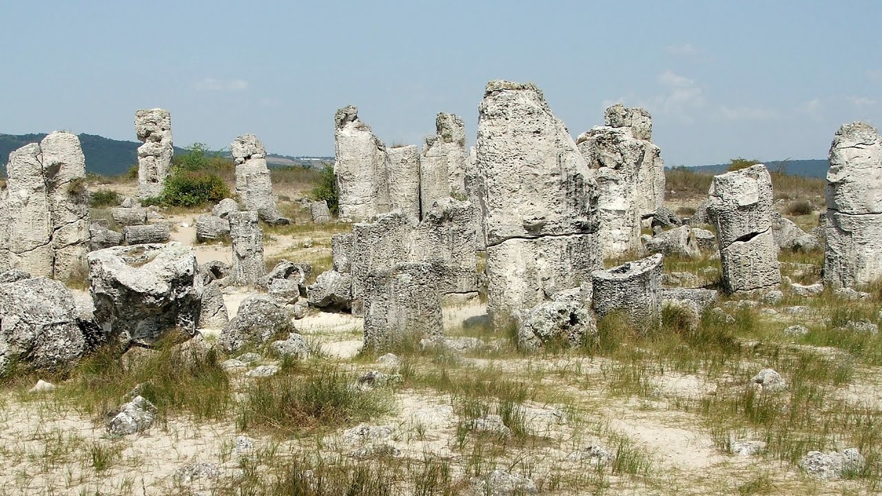
Pobiti Kamani (Stone Forest) - Slanchevo 44.37 km away
The Stone Forest of Bulgaria is located 18 km west of Varna, at the foothills of the Eastern Balkan Mountains. Its Bulgarian name, Pobiti Kamani, translates to planted stones, and it is referred to in English as the Stone Desert or Stone Forest.
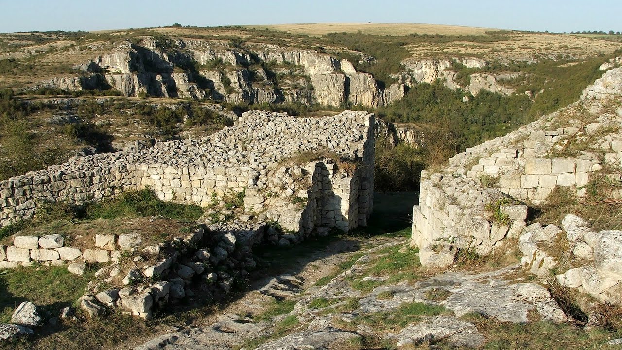
Cherven, a medieval fortified town - Bulgaria 126.01 km away
Located about 30 km south of the city of Ruse in Bulgaria, the Cherven medieval fortress can be found in the Rusenski Lom Nature Park. Originally a Byzantine fortification from the 6th century, it reached the height of its development in the 14th century.
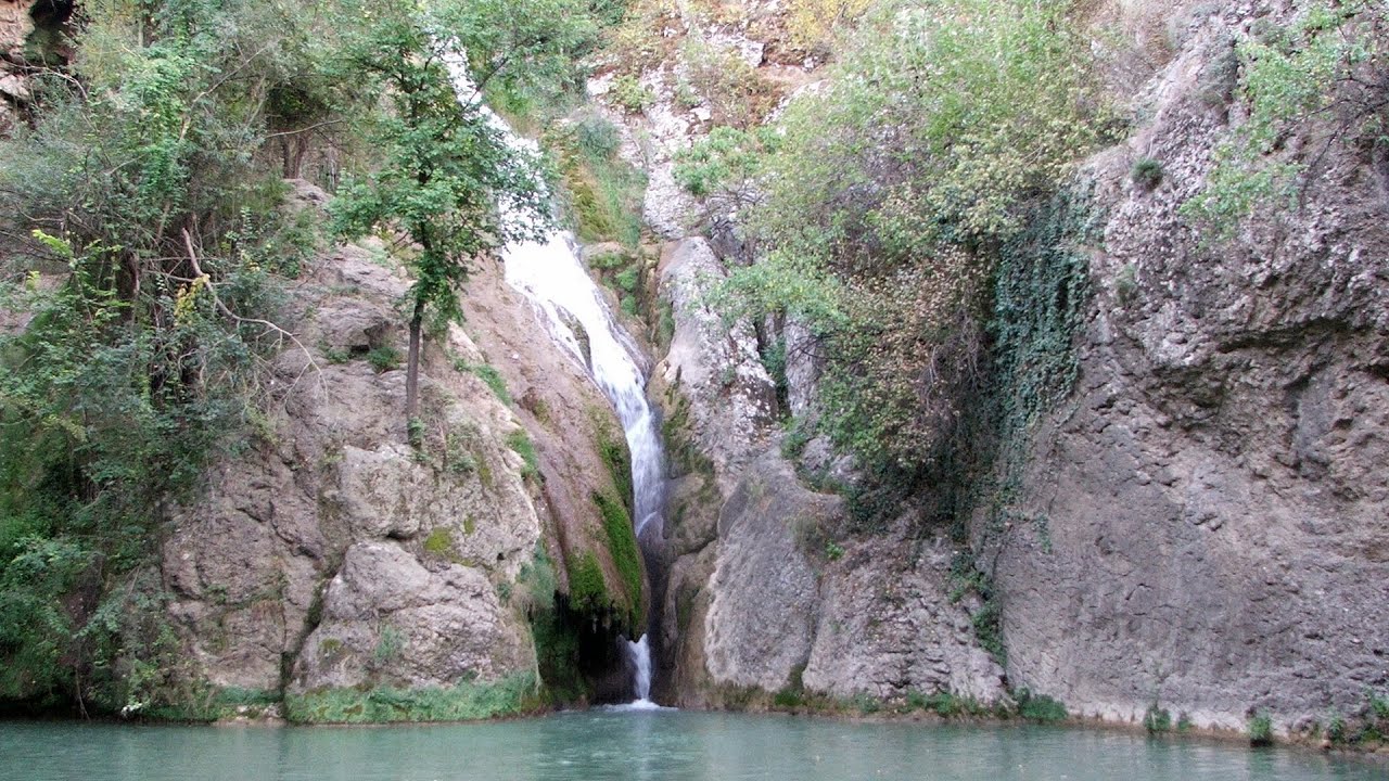
Kaya Bunar (Hotnishki Vodopadi, Hotnitsa Waterfall) - Hotnitsa 145.79 km away
The Kaya Bunar Waterfall (Hotnishki Vodopadi) is located 20 km from the city of Veliko Tarnovo in Bulgaria. The waterfall is 30 meters high, and there are several smaller cascades above it.

Buzludzha monument - Kazanluk 156.86 km away
Buzludzha is a historically significant mountain located in the Central Balkan Mountains of Bulgaria. At its summit, at an altitude of 1432 meters above sea level, there is an abandoned monument.
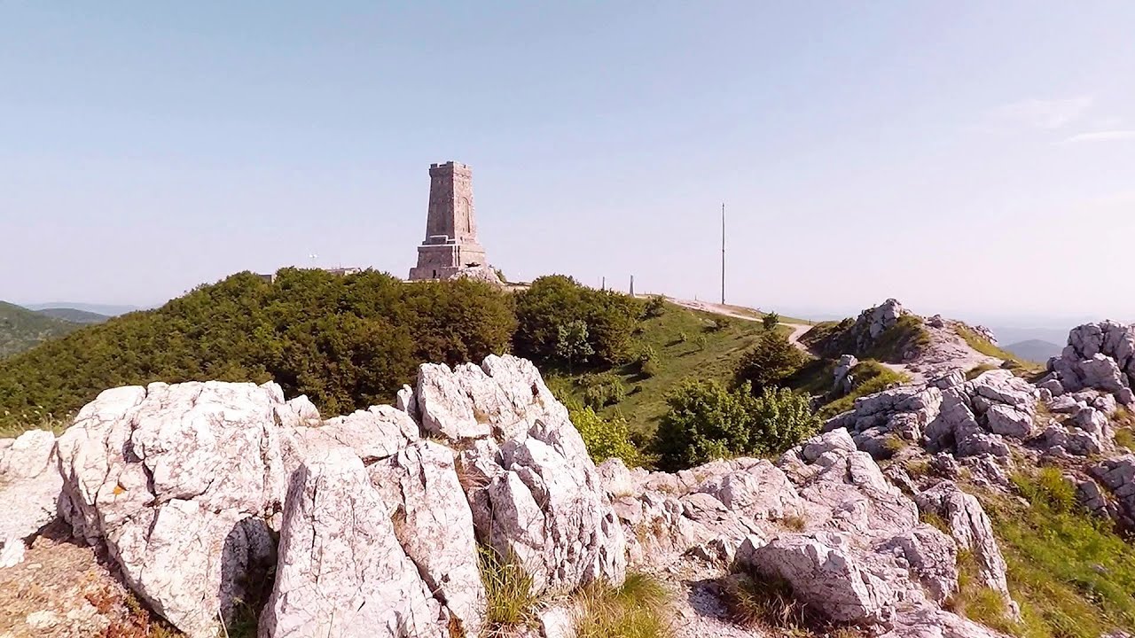
Shipka pass - Shipka 162.48 km away
The Shipka Pass is one of the most spectacular crossings of the Balkan Mountains, and is part of the Bulgarka Nature Park. It separates the provinces of Gabrovo and Stara Zagora, and provides a connection between the cities of Gabrovo and Kazanlak.
Other places
Vulva cave Rhodope Mountains 218.94 km away
The Vulva Cave (Peshtera Utroba) is situated near the village of Nenkovo and the city of Kardzhali, in the Rhodope Mountains of Bulgaria. It derives its name from the shape of its entrance, which resembles a vulva.
The Vulva Cave (Peshtera Utroba) is situated near the village of Nenkovo and the city of Kardzhali, in the Rhodope Mountains of Bulgaria. It derives its name from the shape of its entrance, which resembles a vulva.
God's bridge (Bozhite mostove, Bozhi Most) Vratsa 305.89 km away
Anyone who has been to Bulgaria may be familiar with the Prohodna Cave, affectionately known as the Eyes of God; the Devetashka Cave, illuminated by seven windows in its ceiling; and perhaps they have also seen the Wonderful Bridges in the Rhodope Mountains. But there is another spectacular natural stone bridge in this country, known as the Bridge of God.
Anyone who has been to Bulgaria may be familiar with the Prohodna Cave, affectionately known as the Eyes of God; the Devetashka Cave, illuminated by seven windows in its ceiling; and perhaps they have also seen the Wonderful Bridges in the Rhodope Mountains. But there is another spectacular natural stone bridge in this country, known as the Bridge of God.
Borov Kamak waterfall Zgorigrad, Vratsa 308.37 km away
The Vratsa eco-trail starts from the village of Zgorigrad, located 6 km from the city of Vratsa in Bulgaria, and ends at the Parshevitza hut. It is also known as the Zgorigradska or Borov Kamak eco-trail.
The Vratsa eco-trail starts from the village of Zgorigrad, located 6 km from the city of Vratsa in Bulgaria, and ends at the Parshevitza hut. It is also known as the Zgorigradska or Borov Kamak eco-trail.
Ski resort Poiana Brasov Postavarul Mountains 320.93 km away
Shining sun and an Austria-feeling on the impeccable slopes of the ski paradise Poiana Brasov above Brasov. Sunbathing, coffee and refreshing drinks on the terrace of Julius Römer chalet.
Shining sun and an Austria-feeling on the impeccable slopes of the ski paradise Poiana Brasov above Brasov. Sunbathing, coffee and refreshing drinks on the terrace of Julius Römer chalet.
Stan Valley Canyon 341.2 km away
The Stan Valley is located near Lake Vidraru, southwest of it, in the Fruntii Mountains. Those who have visited the Seven Ladders Waterfall will appreciate this canyon, outfitted with infrastructure for tourist accessibility.
The Stan Valley is located near Lake Vidraru, southwest of it, in the Fruntii Mountains. Those who have visited the Seven Ladders Waterfall will appreciate this canyon, outfitted with infrastructure for tourist accessibility.
Planned destinations
Abandoned Sports Hall Varna 60.86 km away
An abandoned sports hall in Varna, with an unfinished dormitory and tennis courts across three levels.
An abandoned sports hall in Varna, with an unfinished dormitory and tennis courts across three levels.
[ Top ↑ ]
[ Top ↑ ]
Copyright © 2003-2025 Trekkingklub and friends. Reproduction of any text, picture or video from this website, either in printed or electronic form, is prohibited without prior written permission.
The given distances are to be understood as straight line distances, and are approximate. Website made in Miercurea Ciuc  .
.