Abandoned Sports Hall - Varna
Hiking photos and videos Login Register
Select language: - Magyar - Romana - Deutsch - Français - Italiano - Español -
Select language: - Magyar - Romana - Deutsch - Français - Italiano - Español -

An abandoned sports hall in Varna, with an unfinished dormitory and tennis courts across three levels.
Planned destination. Copyright © Trekkingklub
Photos of nearby places


The Gate of the 40 Virgins (12 photos) 44.23 km away
The Gate of the 40 Virgins, The monument to Admiral Ushakov on Cape Kaliakra.

The cave with the metal ladder (Peshterata s metalnata stalba) - Tyulenovo (27 photos) 57.88 km away


Replica of the Eiffel Tower and Arc de Triomphe - Sveti Vlas (5 photos) 59.02 km away
Small-sized replica of the Eiffel Tower and Arc de Triomphe, in front of the decorative pool at the Romance Paris luxury hotel complex, in Sveti Vlas (Saint Blaise) resort.

Tyulenovo Cliffs and the Rock Arch (23 photos) 59.12 km away
The coast of Tyulenovo consists of a complex of sheer reefs, steep sea cliffs, and natural and artificial sea caves. There are picturesque beaches and rocky coasts, along with adjacent marine areas, both north and south of Tyulenovo.
[ Top ↑ ]
Videos of nearby places
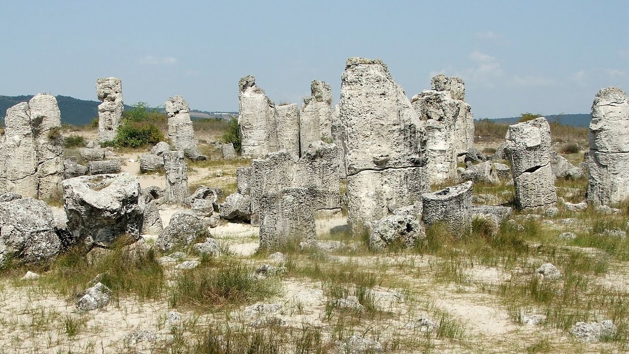
Stone Forest (Stones stuck in the ground, Pobiti Kamani) - Slanchevo 20.58 km away
The Stone Forest of Bulgaria is located 18 km west of Varna, at the foothills of the Eastern Balkan Mountains. Its Bulgarian name, Pobiti Kamani, translates to planted stones, and it is referred to in English as the Stone Desert or Stone Forest.
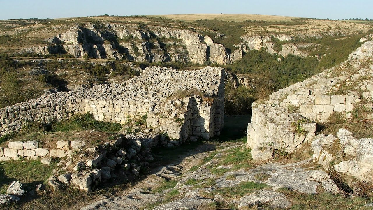
Cherven, a medieval fortified town - Bulgaria 162.8 km away
Located about 30 km south of the city of Ruse in Bulgaria, the Cherven medieval fortress can be found in the Rusenski Lom Nature Park. Originally a Byzantine fortification from the 6th century, it reached the height of its development in the 14th century.
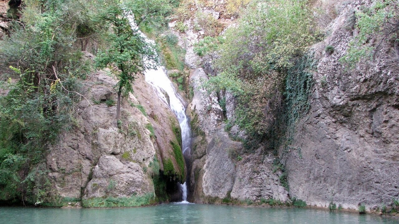
Kaya Bunar (Hotnishki Vodopadi, Hotnitsa Waterfall) - Hotnitsa 198.38 km away
The Kaya Bunar Waterfall (Hotnishki Vodopadi) is located 20 km from the city of Veliko Tarnovo in Bulgaria. The waterfall is 30 meters high, and there are several smaller cascades above it.

Buzludzha monument - Kazanluk 215.43 km away
Buzludzha is a historically significant mountain located in the Central Balkan Mountains of Bulgaria. At its summit, at an altitude of 1432 meters above sea level, there is an abandoned monument.
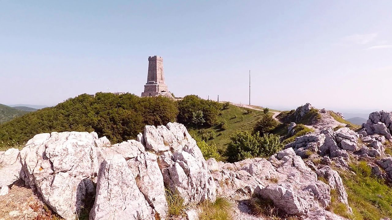
Shipka pass - Shipka 220.81 km away
The Shipka Pass is one of the most spectacular crossings of the Balkan Mountains, and is part of the Bulgarka Nature Park. It separates the provinces of Gabrovo and Stara Zagora, and provides a connection between the cities of Gabrovo and Kazanlak.
Other places
Neviastata ecopath and iron path Smolyan 323.25 km away
The Neviastata eco-trail is located in Bulgaria, nestled in the heart of the Rhodope Mountains, between Smolyan and Pamporovo. Here, you will find a small, paid adventure park.
The Neviastata eco-trail is located in Bulgaria, nestled in the heart of the Rhodope Mountains, between Smolyan and Pamporovo. Here, you will find a small, paid adventure park.
Deubel's path Piatra Craiului Mountains (King's Rock) 337.55 km away
Foamy valley waterfall (Cascada Valea Spumoasa) Bucegi Mountains 311.95 km away
Access to the Foamy valley waterfall (Cascada Valea Spumoasa) is made from the town of Busteni. The starting point is the lower station of the cable car that ascends to the Babele cabin.
Access to the Foamy valley waterfall (Cascada Valea Spumoasa) is made from the town of Busteni. The starting point is the lower station of the cable car that ascends to the Babele cabin.
Cherven, a medieval fortified town Bulgaria 162.8 km away
Located about 30 km south of the city of Ruse in Bulgaria, the Cherven medieval fortress can be found in the Rusenski Lom Nature Park. Originally a Byzantine fortification from the 6th century, it reached the height of its development in the 14th century.
Located about 30 km south of the city of Ruse in Bulgaria, the Cherven medieval fortress can be found in the Rusenski Lom Nature Park. Originally a Byzantine fortification from the 6th century, it reached the height of its development in the 14th century.
Upstream of the Izvorul Dorului (Source of longing) creek Vanturis waterfalls, Bucegi Mountains 307.95 km away
[ Top ↑ ]
[ Top ↑ ]
Copyright © 2003-2025 Trekkingklub and friends. Reproduction of any text, picture or video from this website, either in printed or electronic form, is prohibited without prior written permission.
The given distances are to be understood as straight line distances, and are approximate. Website made in Miercurea Ciuc  .
.