Tyulenovo Cliffs and the Rock Arch | Photos
Hiking photos and videos Login Register
Select language: - Magyar - Romana - Deutsch - Français - Italiano - Español -
Select language: - Magyar - Romana - Deutsch - Français - Italiano - Español -


Page no. 1, photos: 1-10, 23 photos in total. >>>

The coast of Tyulenovo consists of a complex of sheer reefs, steep sea cliffs, and natural and artificial sea caves. There are picturesque beaches and rocky coasts, along with adjacent marine areas, both north and south of Tyulenovo.
Read more
Copyright © 2025 Trekkingklub.com.
Already published 8983 photos and 180 videos. Please register for full and ad-free access.
Photos of nearby places

Fishermen's harbor - Tyulenovo (14 photos) 0.27 km away
Tyulenovo church, Monument to Lieutenant Valentin Terziev, Fishermen's harbor. Tyulenovo translates to Village of Seals in Bulgarian, although seals have not been observed in the area since the 1980s.


The coast of the Black Sea north of Tyulonovo (36 photos) 1.27 km away
The Portal, the Salt Pools, the Wild Frog's Point, the Seal Cave, the Passage and the Whale.


Stone Sea and Little Sea beach - Shabla (10 photos) 3.44 km away
Monument of fallen Soviet aviators (May 17, 1944), Stone Sea and Little Sea beach - Shabla.

Fortress Kariya and the Lighthouse on Cape Shabla (13 photos) 5.63 km away
Shabla's lighthouse marks the easternmost point of Bulgaria. With its 32-meter height, it is the oldest and tallest lighthouse on the Black Sea.

Bird Observatory at Shabla Tuzla Lake (11 photos) 7.41 km away
Three coastal lakes - Shabla, Ezerets, and Shabla Tuzla - support a great variety of plants and animals. The lakes are especially important in winter, and they are protected to provide a refuge for their unique wildlife.

[ Top ↑ ]
Videos of nearby places
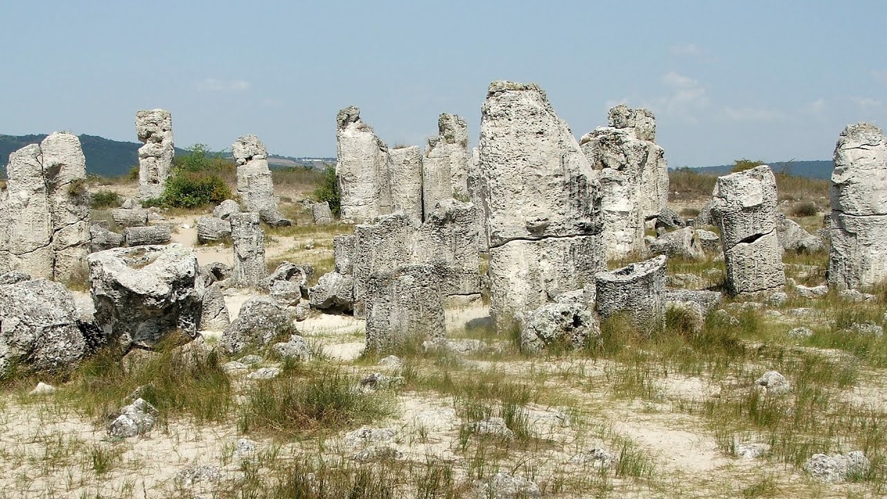
Stone Forest (Stones stuck in the ground, Pobiti Kamani) - Slanchevo 76.89 km away
The Stone Forest of Bulgaria is located 18 km west of Varna, at the foothills of the Eastern Balkan Mountains. Its Bulgarian name, Pobiti Kamani, translates to planted stones, and it is referred to in English as the Stone Desert or Stone Forest.
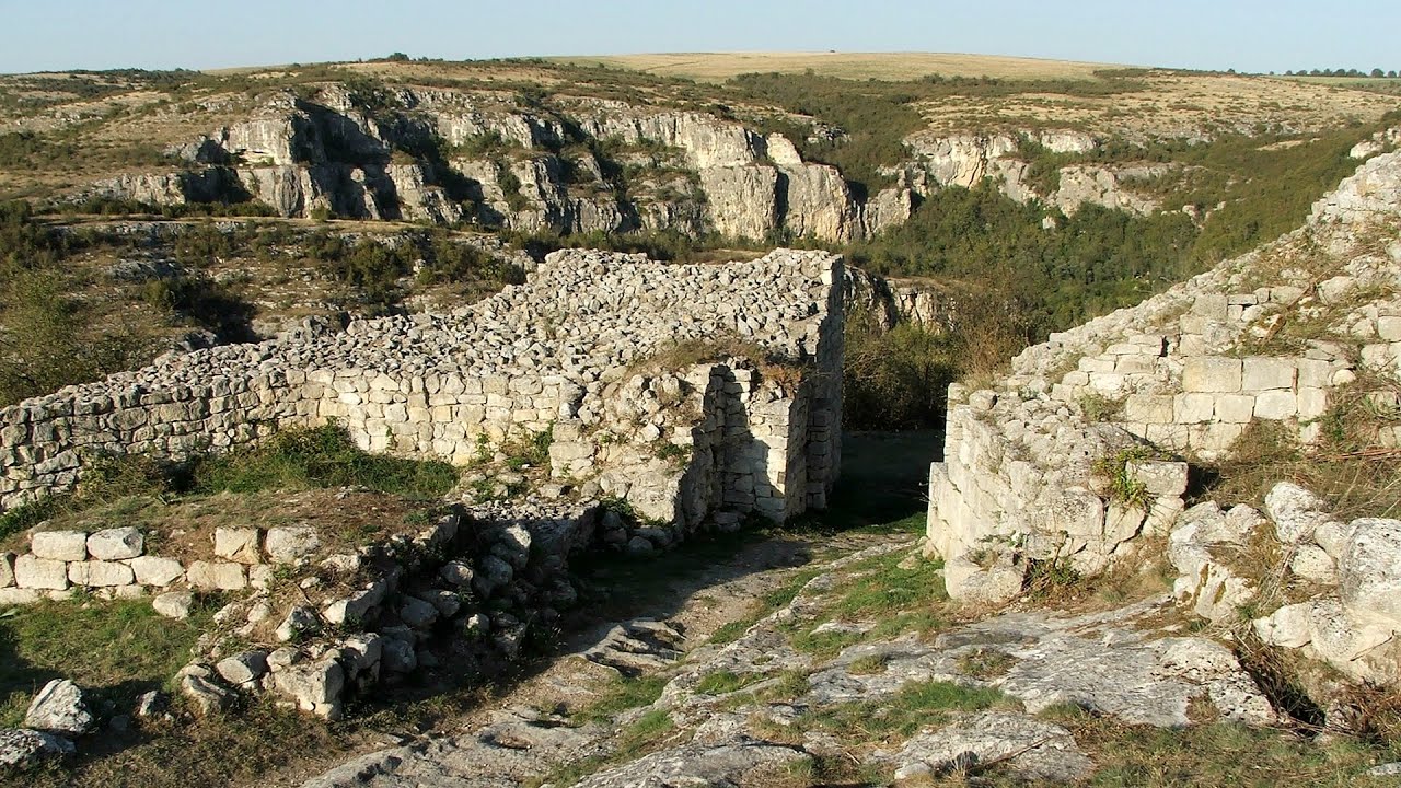
Cherven, a medieval fortified town - Bulgaria 206.97 km away
Located about 30 km south of the city of Ruse in Bulgaria, the Cherven medieval fortress can be found in the Rusenski Lom Nature Park. Originally a Byzantine fortification from the 6th century, it reached the height of its development in the 14th century.
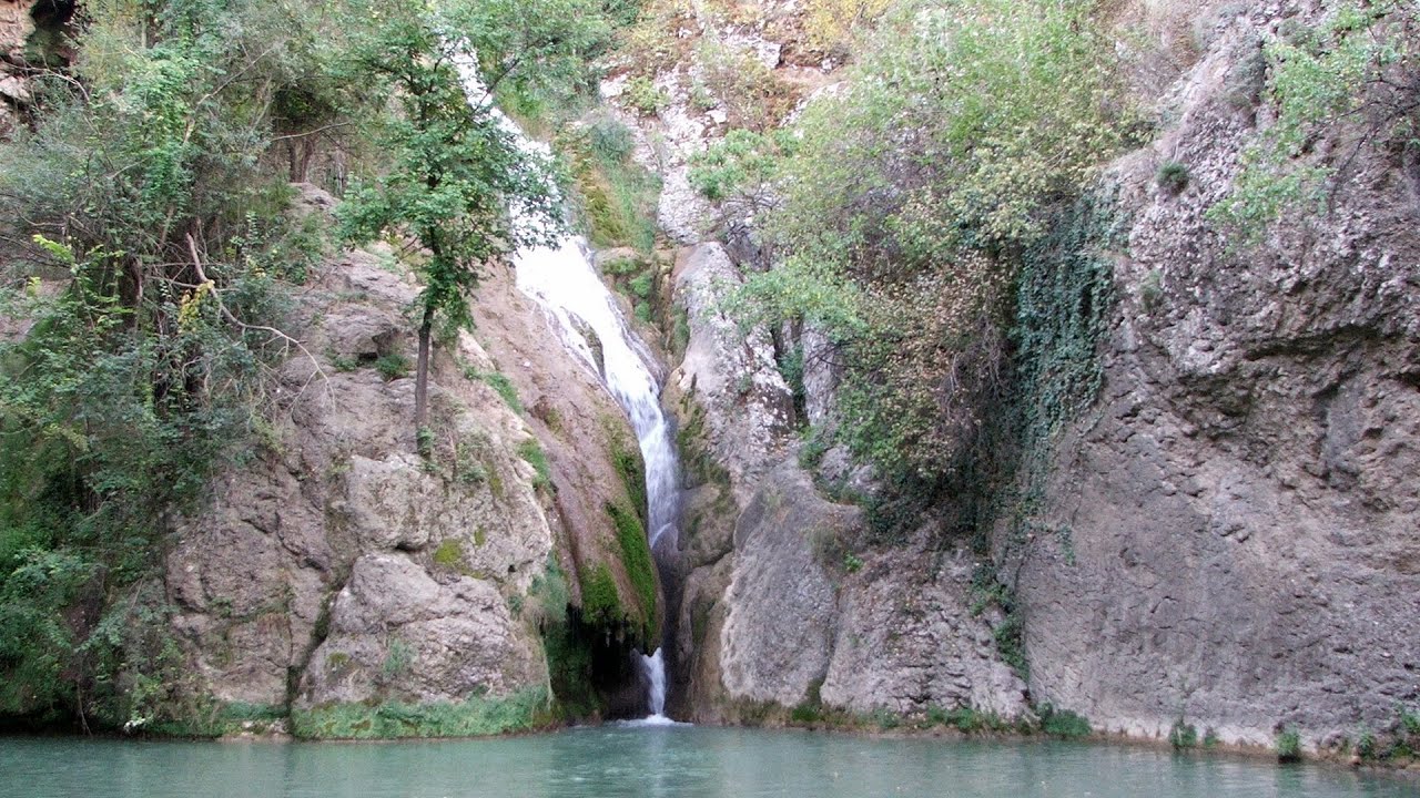
Kaya Bunar (Hotnishki Vodopadi, Hotnitsa Waterfall) - Hotnitsa 251.35 km away
The Kaya Bunar Waterfall (Hotnishki Vodopadi) is located 20 km from the city of Veliko Tarnovo in Bulgaria. The waterfall is 30 meters high, and there are several smaller cascades above it.

Buzludzha monument - Kazanluk 272.29 km away
Buzludzha is a historically significant mountain located in the Central Balkan Mountains of Bulgaria. At its summit, at an altitude of 1432 meters above sea level, there is an abandoned monument.
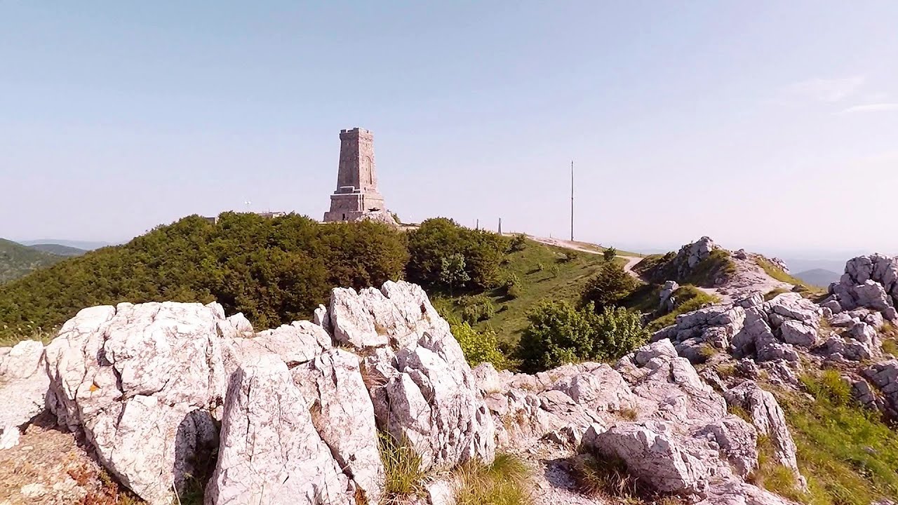
Shipka pass - Shipka 277.47 km away
The Shipka Pass is one of the most spectacular crossings of the Balkan Mountains, and is part of the Bulgarka Nature Park. It separates the provinces of Gabrovo and Stara Zagora, and provides a connection between the cities of Gabrovo and Kazanlak.
Other places
Buzludzha monument Kazanluk 272.29 km away
Buzludzha is a historically significant mountain located in the Central Balkan Mountains of Bulgaria. At its summit, at an altitude of 1432 meters above sea level, there is an abandoned monument.
Buzludzha is a historically significant mountain located in the Central Balkan Mountains of Bulgaria. At its summit, at an altitude of 1432 meters above sea level, there is an abandoned monument.
Zip-line near Seven Ladder Canyon Piatra Mare Mountain 329.25 km away
Kamenni Gabi (Stone Mushrooms) Beli Plast 320.12 km away
The Stone Mushrooms (Kamenni Gabi) nature reserve in Bulgaria is situated east of the village of Beli Plast, along the road that connects Kardzhali to Haskovo. Spanning an area of 3 hectares, the reserve is home to several mushroom-shaped rock formations.
The Stone Mushrooms (Kamenni Gabi) nature reserve in Bulgaria is situated east of the village of Beli Plast, along the road that connects Kardzhali to Haskovo. Spanning an area of 3 hectares, the reserve is home to several mushroom-shaped rock formations.
Byala Reka eco-trail Kalofer 308.52 km away
The Byala Reka eco-trail is situated at the foot of the Stara Planina mountain range, 8 km from the town of Kalofer. A 1,830-meter-long hiking trail has been established along the White Creek within the Central Balkan National Park.
The Byala Reka eco-trail is situated at the foot of the Stara Planina mountain range, 8 km from the town of Kalofer. A 1,830-meter-long hiking trail has been established along the White Creek within the Central Balkan National Park.
Sterp- and White creek valleys Ciucas Mountains 301.77 km away
Planned destinations
Abandoned Sports Hall Varna 59.12 km away
An abandoned sports hall in Varna, with an unfinished dormitory and tennis courts across three levels.
An abandoned sports hall in Varna, with an unfinished dormitory and tennis courts across three levels.
[ Top ↑ ]
[ Top ↑ ]
Copyright © 2003-2025 Trekkingklub and friends. Reproduction of any text, picture or video from this website, either in printed or electronic form, is prohibited without prior written permission.
The given distances are to be understood as straight line distances, and are approximate. Website made in Miercurea Ciuc  .
.