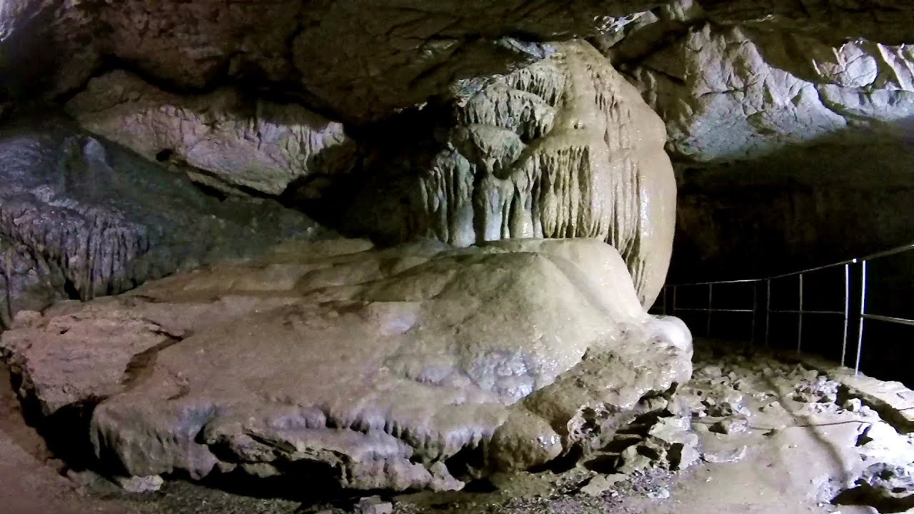
Napistileu (Ungurul Mic) cave - Padurea Craiului Mountains | Photos


Page no. 1, photos: 1-10, 10 photos in total.

Copyright © 2007 - 2025 Trekkingklub.com.
Already published 8983 photos and 180 videos. Please register for full and ad-free access.
Photos of nearby places


Cave of Winds (Pestera Vantului) - Padurea Craiului Mountains (24 photos) 0.6 km away
The Cave of Winds is located in the Padurea Craiului Mountains, not far from Frantura meadow, near Suncuius, on the left geographical side of the Crisul Repede River. The Cave of Winds was discovered in 1957 by Béla Bagaméri and is currently (as of 2003) the longest cave system known in Romania as well as in the Carpathian Basin.


Moanei Cave (Pestera Moanei) - Padurea Craiului Mountains (58 photos) 4.02 km away
The Moanei Cave is located on the upper course of the Misid River, on the right side of the Misid Gorge (Cheilor Misidului). The cave has two entrances, one fossil and sloped, while a subterranean stream flows through the active gallery.

[ Top ↑ ]
Videos of nearby places

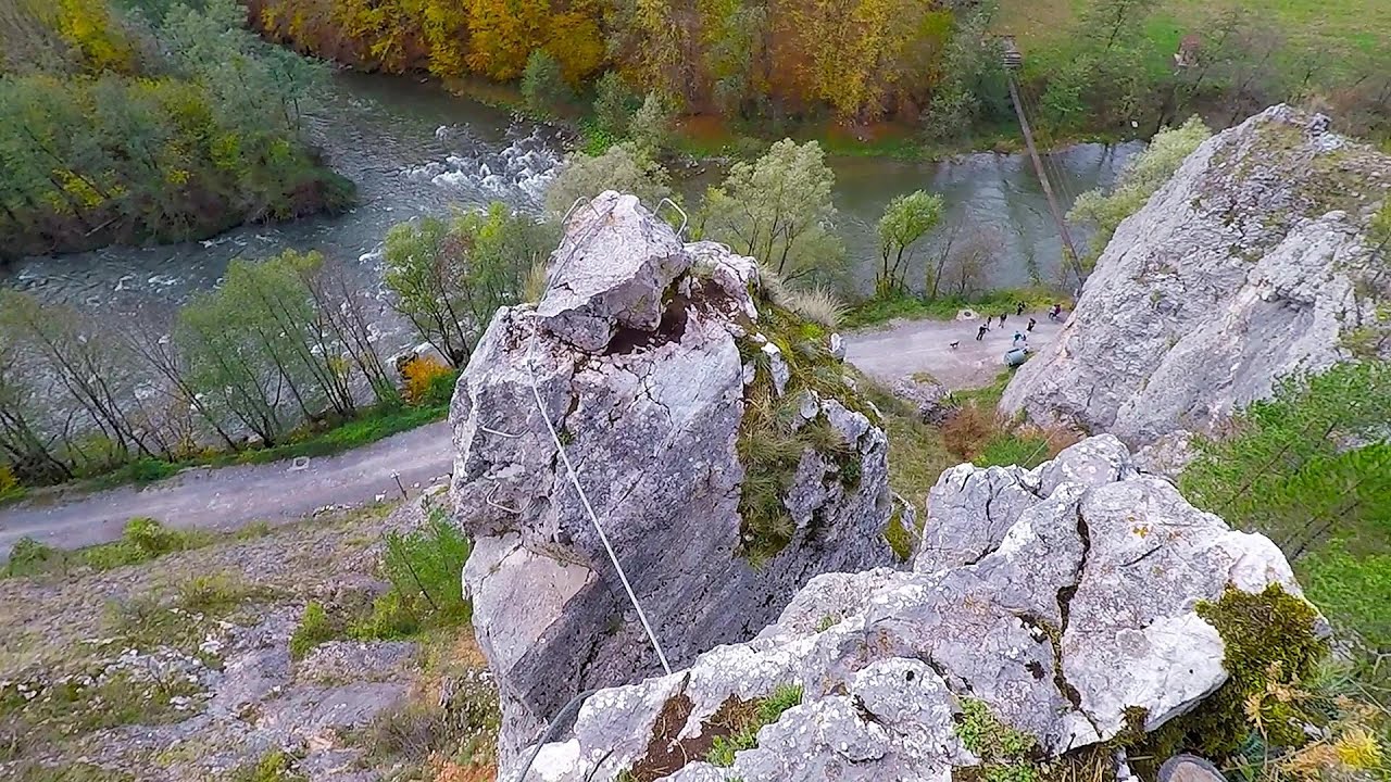
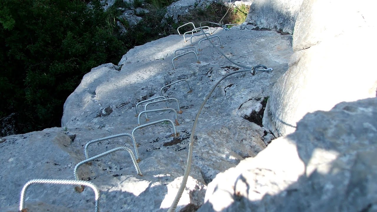
Hodoaba Valley iron path - Suncuius 0.28 km away
The Hodoaba Valley iron path is Romania's shortest and easiest (official) via ferrata route. It is located near Suncuius, in the Padurea Craiului Mountains, on the left bank of the Crisul Repede River.
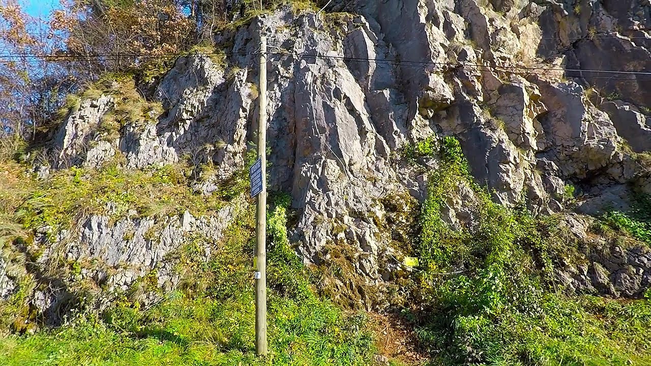
Acapulco's spur via ferrata 0.55 km away
Acapulco's spur (Pintenul lui Acapulco) via ferrata (B/C) - Montana Land, Suncuius.
Vadu Crisului cave 4.05 km away
The Vadu Crisului Cave, with a total length of over 1000 meters, is located in the picturesque gorge of Crisul Repede creek. It consists of a gently meandering, long passage that features an active, stream level next to an upper, fossil level in its first section.
Fairy Cliff (Peretele Zanelor) via ferrata route - Vadu Crisului 4.67 km away
In Vadu Crisului, in the Padurea Craiului Mountains, on the right bank of the Crisul Repede, you can find the newest, in chronological order (2015) the fifth Transylvanian, new type of via ferrata route. I will not count here the traditional iron paths, the high-mountain hiking trails, partly secured with iron cables, or the rock canyons with iron ladders and footbridges.
Other places
Wind's iron path (Via ferrata Vanturilor, D) Baia de Fier 214.96 km away
The Wind's iron path (Via ferrata Vanturilor) is the via ferrata route number 11 in the Baia de Fier - Polovragi area. The sign at the base of the route was installed on February 9, 2020.
The Wind's iron path (Via ferrata Vanturilor) is the via ferrata route number 11 in the Baia de Fier - Polovragi area. The sign at the base of the route was installed on February 9, 2020.
Seven Ladder Canyon and Waterfall Piatra Mare Mountain 282.6 km away
The Seven Ladder Gorge is the largest and most spectacular gorge in the Piatra Mare massif. The narrow canyon has a length of 160 meters, and over a drop of 58 meters includes 7 bigger and several smaller waterfalls.
The Seven Ladder Gorge is the largest and most spectacular gorge in the Piatra Mare massif. The narrow canyon has a length of 160 meters, and over a drop of 58 meters includes 7 bigger and several smaller waterfalls.
Lonely Stone (Piatra Singuratica) Hasmas Mountains 251.17 km away
On June 1, 2003, with a small group of friends, I left Balan, walking along the valley of the Sep (Beautiful) stream towards the Lonely Stone (Piatra Singuratica). Those who were with me at the time fell behind, and then other people joined for the hike.
On June 1, 2003, with a small group of friends, I left Balan, walking along the valley of the Sep (Beautiful) stream towards the Lonely Stone (Piatra Singuratica). Those who were with me at the time fell behind, and then other people joined for the hike.
Muierii Cave (Pestera Muierilor) Baia de Fier 214.92 km away
We visited the Baia de Fier area, and climbed on the rock that also conceals the Women's Cave (Pestera Muierilor). Between two via ferrata routes, we also participated in one of the guided cave tours, which depart every hour.
We visited the Baia de Fier area, and climbed on the rock that also conceals the Women's Cave (Pestera Muierilor). Between two via ferrata routes, we also participated in one of the guided cave tours, which depart every hour.
Falco Tinnunculus (Common kestrel) via ferrata (E), the ascent Falcon's Rock, Corbu 239.44 km away
Over Corbu village in Harghita County, on the rocks of Falcon's Rock (Piatra Soimilor), which belong to the Bistrita Mountains, five via ferrata routes have been established. In November 2019, the first three routes of the Falcon's Rock via ferrata were complemented with two additional ones, featuring a roughly 15-meter hanging bridge and a 15-meter-high iron ladder.
Over Corbu village in Harghita County, on the rocks of Falcon's Rock (Piatra Soimilor), which belong to the Bistrita Mountains, five via ferrata routes have been established. In November 2019, the first three routes of the Falcon's Rock via ferrata were complemented with two additional ones, featuring a roughly 15-meter hanging bridge and a 15-meter-high iron ladder.
[ Top ↑ ]
[ Top ↑ ]
Copyright © 2003-2025 Trekkingklub and friends. Reproduction of any text, picture or video from this website, either in printed or electronic form, is prohibited without prior written permission.
The given distances are to be understood as straight line distances, and are approximate. Website made in Miercurea Ciuc  .
.