King's Road - Ranca holiday resort | Photos


Page no. 1, photos: 1-10, 16 photos in total. >>>

Copyright © 2011 - 2025 Trekkingklub.com.
Already published 8983 photos and 180 videos. Please register for full and ad-free access.
Photos of nearby places

Parangul Mare peak (16 photos) 9.17 km away
Chamois saddle (Saua Caprelor), Carja mountain shelter (Refugiul Carja) - Carja peak (Varful Carja) - Stoienita peak (Varful Stoienita) - Gemanarea - Parangul Mare peak.

Women's Cave (Pestera Muierii) - Parang Mountains (11 photos) 20.71 km away
The Cave of Women (Pestera Muierii, Pestera Muierilor) is located at the southern foot of the Parang Mountains, in the area of Baia de Fier in Gorj County. There are several climbing routes established on the rocks above the cave and on the other side of the road.


Bolii Cave - Banita (20 photos) 27.83 km away
The main cave passage is approximately 460 m long, with an entrance portal that is 10 m high and 20 m wide at its base. In the 1960s, bridges were built over the underground stream flowing through the cave.

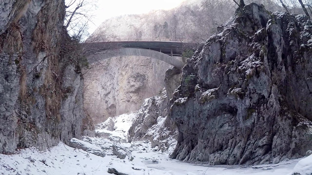
Banita Gorge - Banita (16 photos) 28.26 km away
The approximately 250 m long gorge, similar to the Corcoaia Gorge, is truly spectacular. According to assumptions, it was formed by the collapse of a cave passage ceiling, and then the erosion formed spectacular karst formations in the limestone.

Natural bridge next to the Banita Stone Quarry (12 photos) 31.74 km away
Although the Banita Stone Bridge is not far from the road that passes through the village, it is located beyond the railway line, so its approach is a bit cumbersome. We can go around the railway line on Carierei Street, and then we have to walk a few meters from the stone quarry.


[ Top ↑ ]
Videos of nearby places
Oltet Gorge (Cheile Oltetului) - Capatana Mountains 20.28 km away
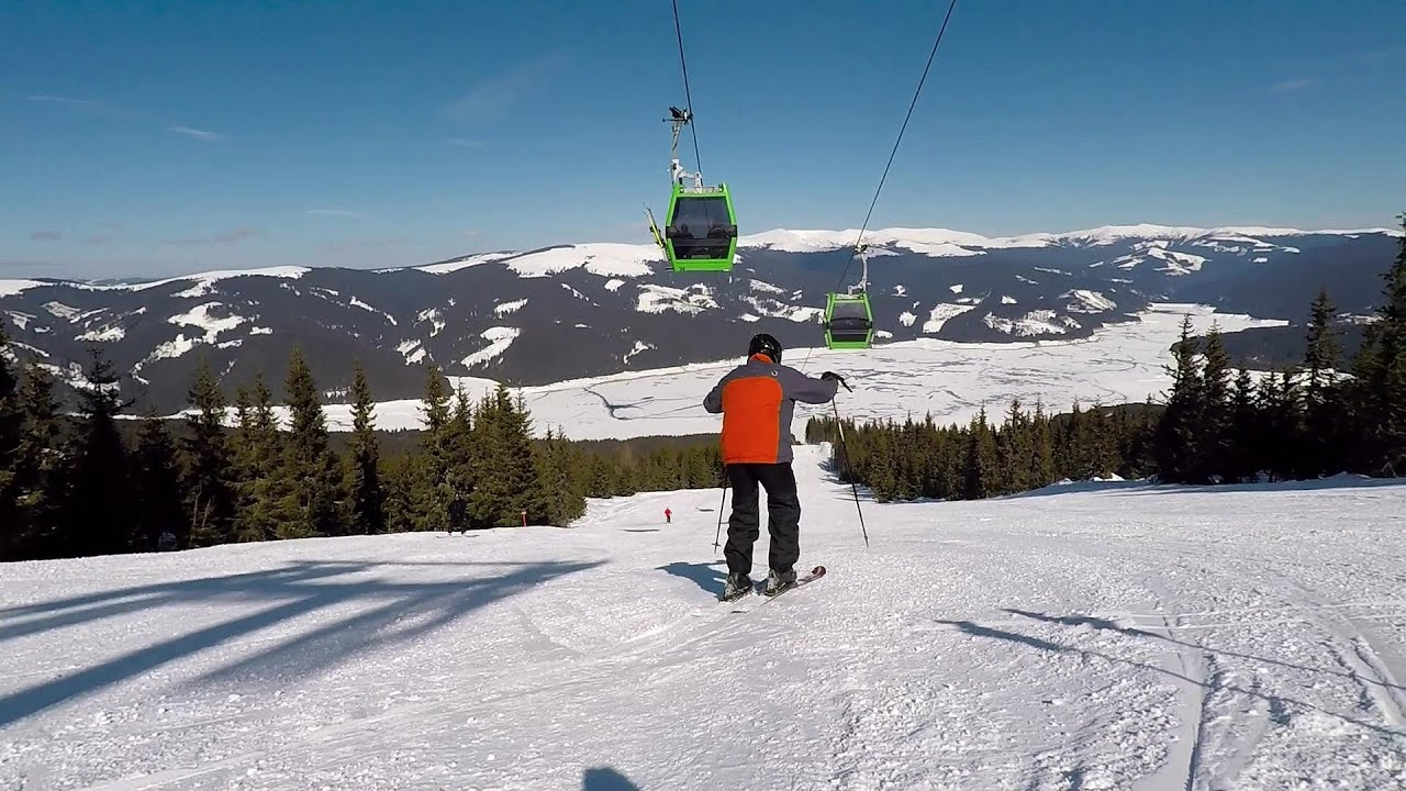
That day, we had planned to ski at the Ranca resort, situated alongside the Transalpina high altitude mountain road in the Parang Mountains. Unfortunately, the very small snowfall made skiing unfeasible, so we had to find an alternative activity on our way home.
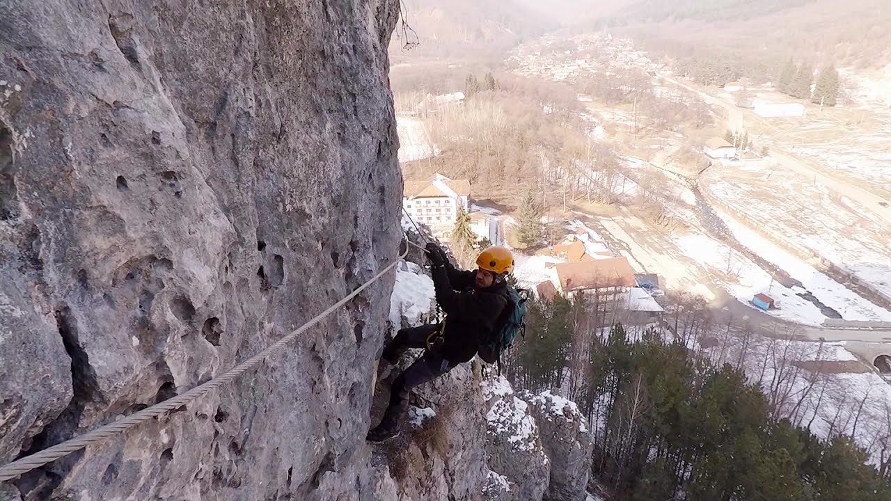
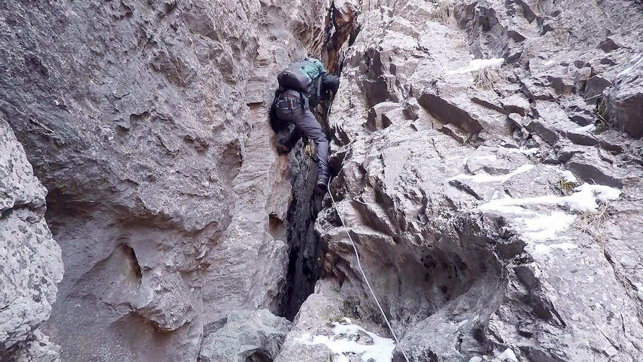
Womens Spiral, Cave Ridge, and The Great Crack iron paths - Baia de Fier 20.68 km away
Perhaps the most interesting via ferrata among the routes in the Baia de Fier area is the Womens Spiral. After completing it, I can say that it is the second most thrilling via ferrata in Romania, following the Big Via Ferrata at Rasnov.
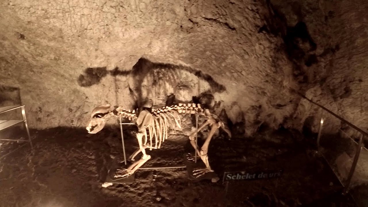
Muierii Cave (Pestera Muierilor) - Baia de Fier 20.71 km away
We visited the Baia de Fier area, and climbed on the rock that also conceals the Women's Cave (Pestera Muierilor). Between two via ferrata routes, we also participated in one of the guided cave tours, which depart every hour.
Other places
Wild Ferenc memorial path Suhardul Mic 229.64 km away
In recent days, this news has been everywhere: the via ferrata route built on the southwest wall of Suhardul Mic (Little Suhard) has finally been completed and inaugurated. The new route has been named after Ferenc Wild, in memory of the former mountain rescuer, sports writer, and one of the founders of the mountain rescue association in Gheorgheni.
In recent days, this news has been everywhere: the via ferrata route built on the southwest wall of Suhardul Mic (Little Suhard) has finally been completed and inaugurated. The new route has been named after Ferenc Wild, in memory of the former mountain rescuer, sports writer, and one of the founders of the mountain rescue association in Gheorgheni.
The Wooden Ladders The villages of Scarisoara and Inelet, Cerna valley 94.76 km away
Scarisoara and Inelet are small, isolated villages located in the mountainous region of Banat. They are situated on the right bank of the Cerna River, approximately 19 km away from the Baile Herculane resort.
Scarisoara and Inelet are small, isolated villages located in the mountainous region of Banat. They are situated on the right bank of the Cerna River, approximately 19 km away from the Baile Herculane resort.
Walking to the top of Sumuleul Mare Sumuleu Ciuc 203.11 km away
This was my first attempt at shooting a video.
This was my first attempt at shooting a video.
Hot Air Balloon Parade 2018 Campu Cetatii 178.64 km away
This year, the hot air balloons flew low over Campu Cetatii. The weather did not really favor the parade.
This year, the hot air balloons flew low over Campu Cetatii. The weather did not really favor the parade.
Fairy Cliff (Peretele Zanelor) via ferrata route Vadu Crisului 198.9 km away
In Vadu Crisului, in the Padurea Craiului Mountains, on the right bank of the Crisul Repede, you can find the newest, in chronological order (2015) the fifth Transylvanian, new type of via ferrata route. I will not count here the traditional iron paths, the high-mountain hiking trails, partly secured with iron cables, or the rock canyons with iron ladders and footbridges.
In Vadu Crisului, in the Padurea Craiului Mountains, on the right bank of the Crisul Repede, you can find the newest, in chronological order (2015) the fifth Transylvanian, new type of via ferrata route. I will not count here the traditional iron paths, the high-mountain hiking trails, partly secured with iron cables, or the rock canyons with iron ladders and footbridges.
[ Top ↑ ]
[ Top ↑ ]
Select language: - Magyar - Romana - Deutsch - Français - Italiano - Español - Copyright © 2003-2025 Trekkingklub and friends. Reproduction of any text, picture or video from this website, either in printed or electronic form, is prohibited without prior written permission. The given distances are to be understood as straight line distances, and are approximate. Website made in Miercurea Ciuc