Campusel forester's lodge - Retezat Mountains | Photos


Page no. 1, photos: 1-5, 5 photos in total.

Copyright © 2007 - 2025 Trekkingklub.com.
Already published 8983 photos and 180 videos. Please register for full and ad-free access.
Photos of nearby places


[ Top ↑ ]
Videos of nearby places
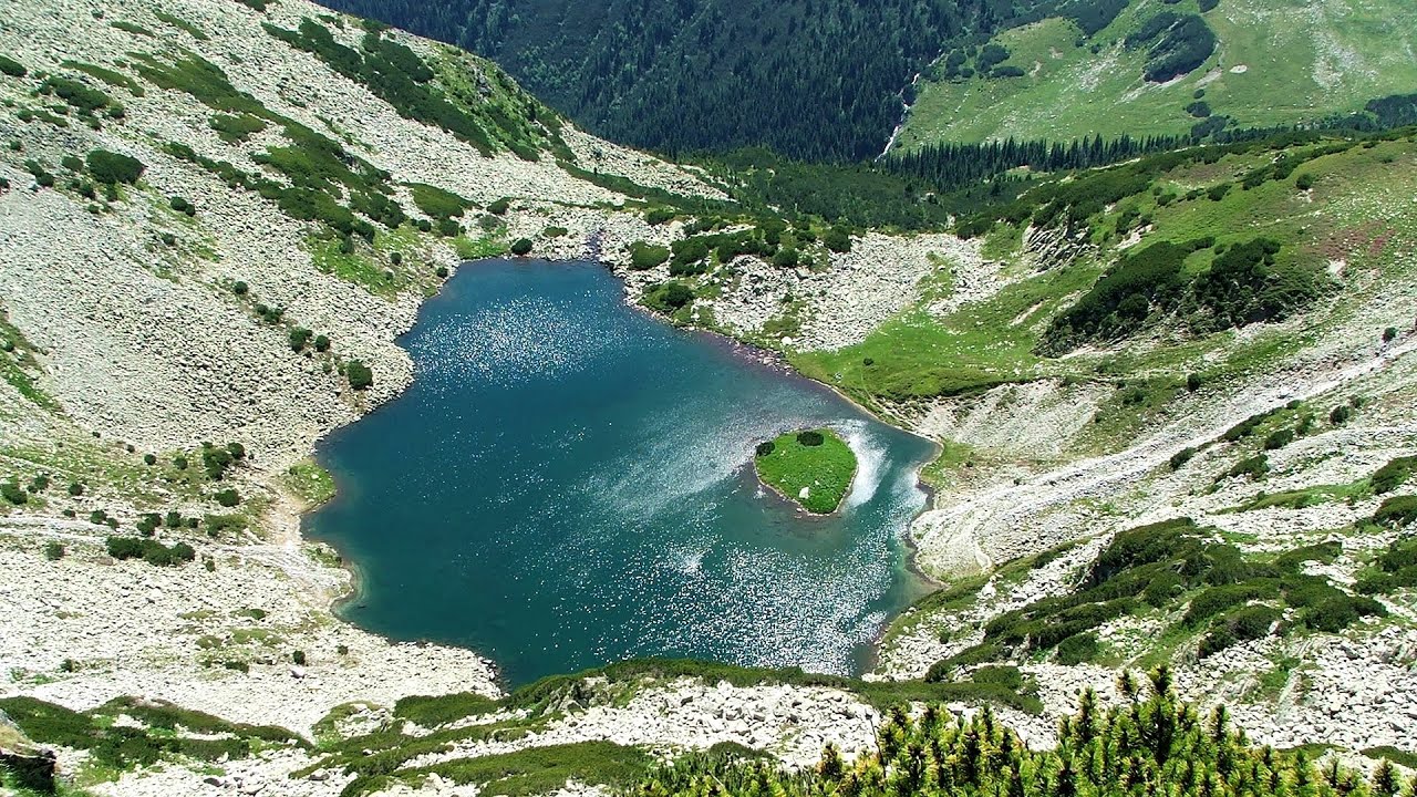
Billy-goat lake, Closed Gates - Retezat Mountains 13.24 km away
The most unique ridge trail of the Retezat Mountains is the Closed Gates.Below, at an altitude of 2070 m above sea level, is the Billy-goat lake.
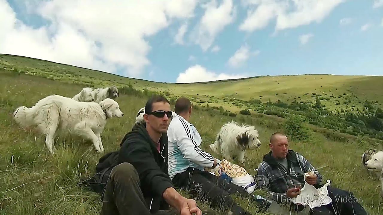
Sheepdogs - Govora sheepfold - Retezat mountains 17.5 km away
On the second day of my weekend Retezat hike, I visited a sheepfold on the Lancita Ridge. To my great disappointment, they didn't make cheese or curd here.
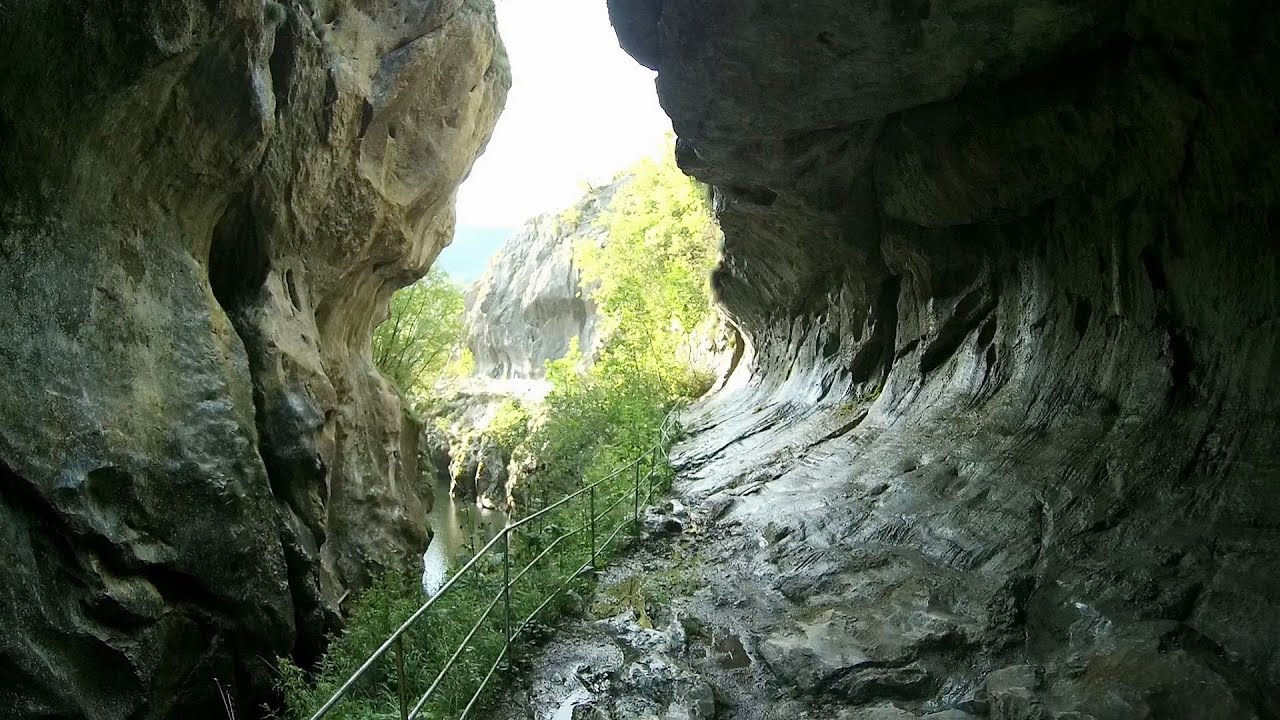
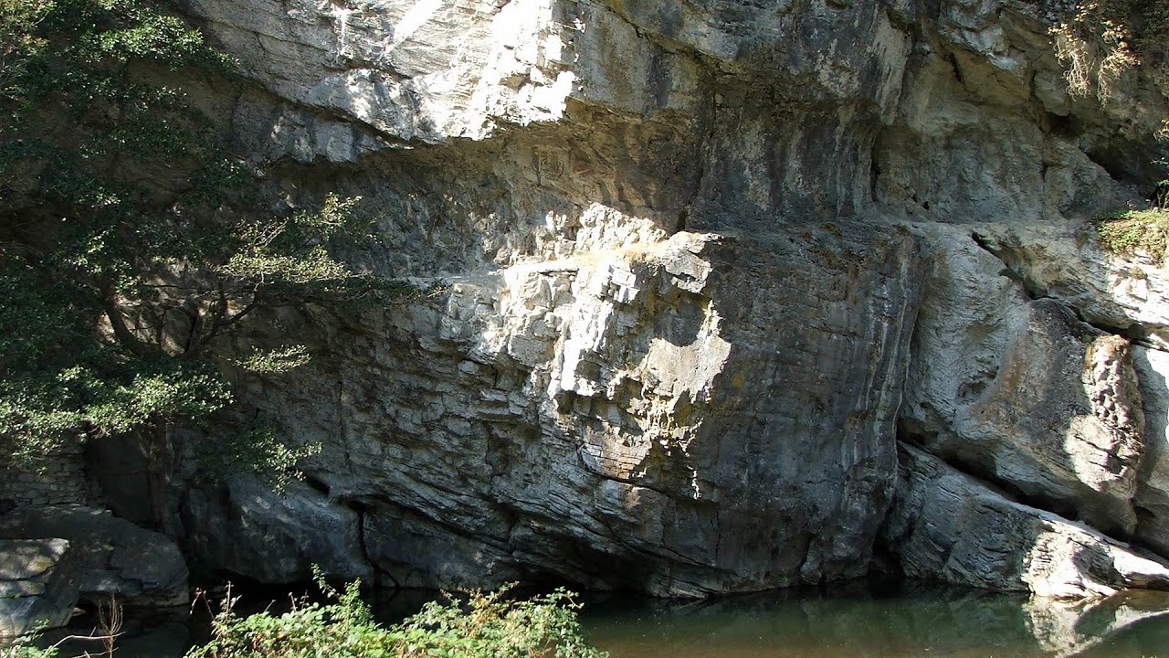
Corcoaia Gorge - Gorj county 20.01 km away
The Corcoaia Gorge is one of the most beautiful tourist attractions in the Cerna Valley. It can be reached by car, 43 km away from Baile Herculane, of which about 17 km is on a dusty gravel road.
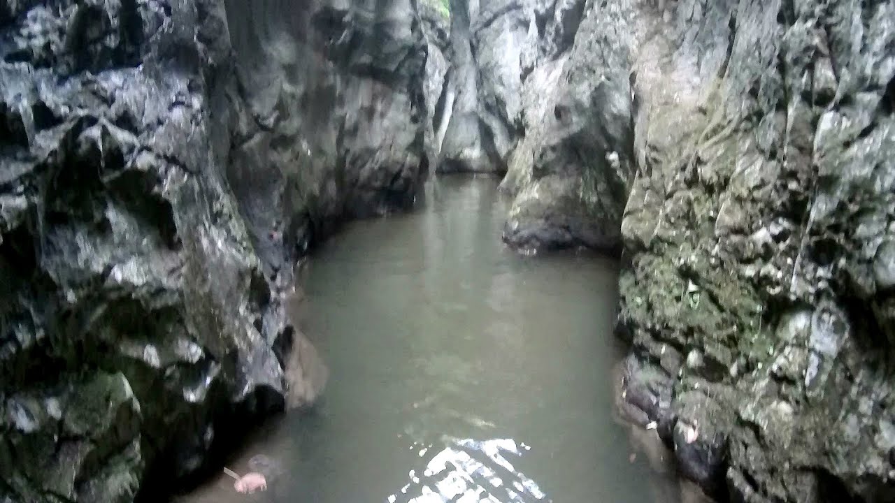
Crivadia Gorge 34.45 km away
The Crivadia Gorge is located next to the village of Crivadia, which belongs to Banita. Access is difficult, and the hike is made through the streambed, with water up to the waist at its narrowest point.
Blasted Rock (Piatra Puscata) hanging path - Cerna Valley 36.52 km away
The Blasted Rock hanging path is located on the geographical right bank of the Cerna River, near the confluence of the Iuta stream, approximately 20 km from Baile Herculane. In this area, the presence of limestone formations has caused the valley to become narrower.
Other places
Upstream of the Izvorul Dorului (Source of longing) creek Vanturis waterfalls, Bucegi Mountains 204.16 km away
Shipka pass Shipka 341.37 km away
The Shipka Pass is one of the most spectacular crossings of the Balkan Mountains, and is part of the Bulgarka Nature Park. It separates the provinces of Gabrovo and Stara Zagora, and provides a connection between the cities of Gabrovo and Kazanlak.
The Shipka Pass is one of the most spectacular crossings of the Balkan Mountains, and is part of the Bulgarka Nature Park. It separates the provinces of Gabrovo and Stara Zagora, and provides a connection between the cities of Gabrovo and Kazanlak.
Skaklya waterfall Vratsa 237.55 km away
The largest seasonal waterfall in Bulgaria plunges down from a height of 141 meters. It is located in the Vratsa Mountain National Park, just one and a half kilometers away from the city of Vratsa.
The largest seasonal waterfall in Bulgaria plunges down from a height of 141 meters. It is located in the Vratsa Mountain National Park, just one and a half kilometers away from the city of Vratsa.
Nobody's lake Miercurea Ciuc 254.71 km away
The passage of time (time lapse), dusk at Nobody's Lake. Miercurea Ciuc and the Sumuleu mountain can be seen in the background.
The passage of time (time lapse), dusk at Nobody's Lake. Miercurea Ciuc and the Sumuleu mountain can be seen in the background.
Waterfalls of Lapos creek Bicaz Gorge 285.02 km away
One of the lesser-known attractions of the Bicaz Gorges is the series of waterfalls along Lapos Creek. This creek flows between Cupas Stone and Bardos Stone before eventually merging with Bicaz Creek, forming spectacular waterfalls beneath the Altar Stone.
One of the lesser-known attractions of the Bicaz Gorges is the series of waterfalls along Lapos Creek. This creek flows between Cupas Stone and Bardos Stone before eventually merging with Bicaz Creek, forming spectacular waterfalls beneath the Altar Stone.
[ Top ↑ ]
[ Top ↑ ]
Select language: - Magyar - Romana - Copyright © 2003-2025 Trekkingklub and friends. Reproduction of any text, picture or video from this website, either in printed or electronic form, is prohibited without prior written permission. The given distances are to be understood as straight line distances, and are approximate. Website made in Miercurea Ciuc