Tourist attractions near Carandeni (Lazareni, Bihor county, Romania)
Photos of nearby places

Sohodol pit cave - Padurea Craiului Mountains (10 photos) 27.8 km away. Sohodol pit cave (Avenul Sohodol) - Padurea Craiului Mountains.

Kings Cave - Padurea Craiului Mountains (48 photos) 29.1 km away. Craiului (Kings) Cave - Padurea Craiului Mountains.

Fern Cave - Padurea Craiului Mountains (9 photos) 31.1 km away. Ferigi (Fern) Cave - Padurea Craiului Mountains.

Moanei Cave - Padurea Craiului Mountains (58 photos) 33.9 km away. The Moanei Cave (Pestera Moanei) is located on the upper course of the Misid River, on the right side of the Misid Gorge (Cheilor Misidului). The cave has two entrances, one fossil and sloped, while a subterranean stream flows through the active gallery.

The cave from the spring - Padurea Craiului Mountains (8 photos) 35.8 km away. Pestera de la Izvor (The cave from the spring) - Padurea Craiului Mountains.

Napistileu cave - Padurea Craiului (10 photos) 35.9 km away. Napistileu (Ungurul Mic) cave - Padurea Craiului Mountains.

Cave of Winds - Padurea Craiului Mountains (24 photos) 35.9 km away. The Cave of Winds (Pestera Vantului) is located in the Padurea Craiului Mountains, not far from Frantura meadow, near Suncuius, on the left geographical side of the Crisul Repede River. The Cave of Winds was discovered in 1957 by Béla Bagaméri and is currently (as of 2003) the longest cave system known in Romania as well as in the Carpathian Basin.


Valley of Hell - Padurea Craiului Mountains (23 photos) 38 km away. Valley of Hell (Valea Iadului) - Padurea Craiului Mountains.

Oxen Waterfall - Padurea Craiului Mountains (12 photos) 40.8 km away. Oxen Waterfall (Cascada Boilor) - Padurea Craiului Mountains.


Dragons Garden - Galgau Almasului (20 photos) 99.9 km away. The natural reservation site Dragon's Garden (Gradina Zmeilor, Sárkányok kertje) from Galgaul Almasului is located in Salaj County, in the Western Carpathians. This natural playground is made up of interesting and unusual sandstone formations, an ensemble of 10-12 m high towers with strange figures cut in sandstone by the wind and water erosion.

Spherical concretions from Feleac (18 photos) 114.9 km away. The spherical concretions from Feleac are sedimentary rock materials that were cemented together to form a hard structure. The surrounding sediments slowly erode away, exposing the concretion.

Balcony Clearing - Trascau Mountains (6 photos) 116.8 km away. Balcony Clearing (Erkély-tisztás, Balconul Sipotelor) - Trascau Mountains.

Aries valley - Trascau Mountains (10 photos) 116.9 km away. Aries (Golden) valley - Trascau Mountains.

Dark Blue Bruises of the Ponor, Bedeleu (24 photos) 117.2 km away. Dark Blue Bruises of the Ponor (Vanatarile Ponorului), Bedeleu - Trascau Mountains.

Dark Blue Bruises of the Ponor - Trascau Mountains (16 photos) 118 km away. The Dark Blue Bruises of the Ponor (Vanatarile Ponorului) is a polje-type protected area. Polje is a Slovenian word meaning plain, and it refers to a surface karst form.
[ Top ↑ ]
Videos of nearby places

Crystal Cave at Farcu Mine 26 km away. In the Padurea Craiului Mountains, near Rosia, in the Farcu bauxite mine, in 1987, the miners accidentally discovered a cave. It was filled with crystal-shaped limestone formations.

Meziad cave - Padurea Craiului Mountains 31.6 km away. The Meziad Cave is located near the village of Meziad, 22 km north of Beius, in the Padurea Craiului Mountains. It is one of our first tourist caves, its exploration is associated with the name of Gyula Czárán, cave researcher and writer.

Vadu Crisului cave 34.3 km away. The Vadu Crisului Cave, with a total length of over 1000 meters, is located in the picturesque gorge of Crisul Repede creek. It consists of a gently meandering, long passage that features an active, stream level next to an upper, fossil level in its first section.

Via Ferrata Fairy Castle - Vadu Crisului 34.9 km away. Via Ferrata Fairy Castle (Castelul Zanelor, Casa Zmeului, The House of the Dragon) - Vadu Crisului. South of Vadu Crisului, in the Padurea Craiului Mountains, lies the Vadu Crisului Gorge, a section of the Crisul Repede river that narrows between rocky walls.

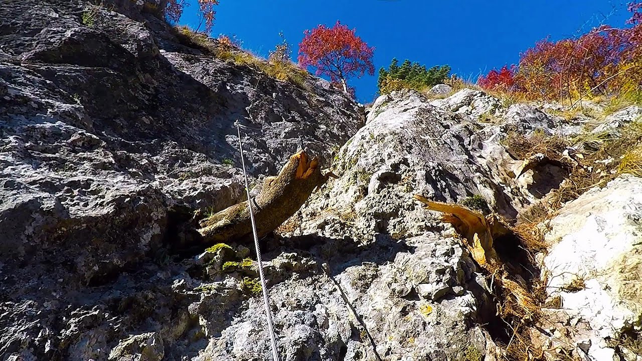
Fairy Cliff via ferrata route - Vadu Crisului 34.9 km away. Fairy Cliff (Peretele Zanelor) via ferrata route - Vadu Crisului. In Vadu Crisului, in the Padurea Craiului Mountains, on the right bank of the Crisul Repede, you can find the newest, in chronological order (2015) the fifth Transylvanian, new type of via ferrata route.
Other places
The two niches with the visor Nochevo Dvete nishi s kozirkata (The two niches with the visor) - Nochevo.
Abandoned copper mine Tsar Asen, Pazardzhik The turquoise waters of this mine lake are extremely beautiful but dangerously poisonous. Do not descend to the shore or touch the water!
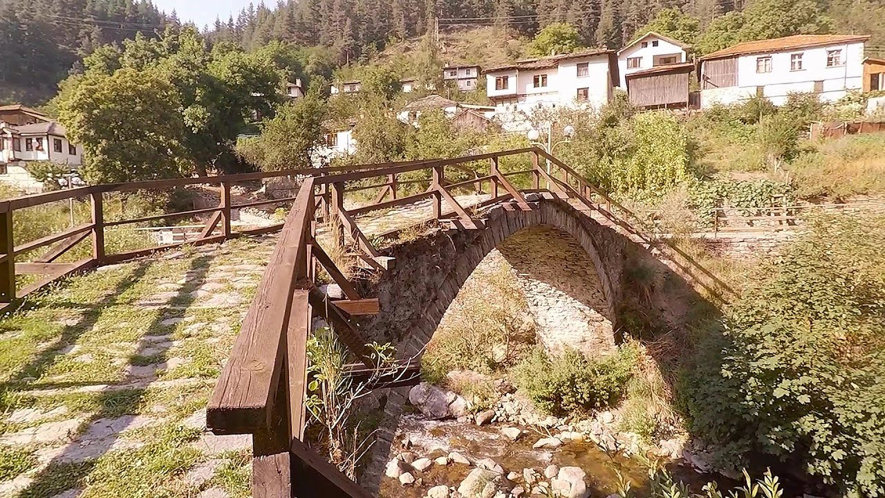
Shiroka Laka village Smolyan Shiroka Laka is one of the most beautiful villages in Bulgaria. It is located in the Rhodope Mountains, in the Smolyan province, in the southern part of the country.
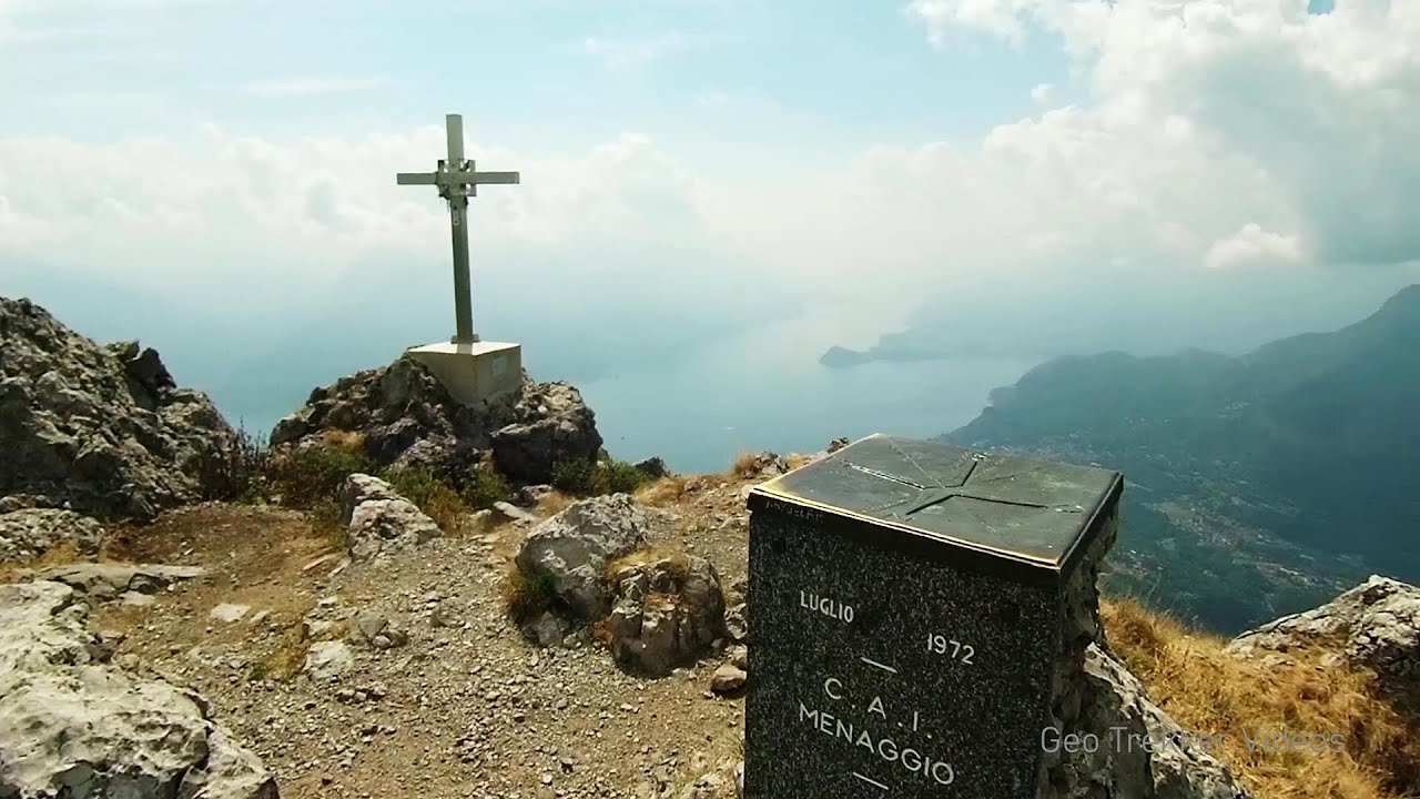
Via Ferrata Centenario C.A.O Monte Grona, Prealpi Lombarde, Lombardia In the magnificent rocky world of Monte Grona, the Centenario via ferrata leads upwards, which I had the opportunity to climb accompanied by lizards. Although it was cloudy and gloomy, I had a great view of Lake Lugano and Lake Como along the way.

Stan Valley Canyon 256.2 km away. The Stan Valley is located near Lake Vidraru, southwest of it, in the Fruntii Mountains. Those who have visited the Seven Ladders Waterfall will appreciate this canyon, outfitted with infrastructure for tourist accessibility.
Eagles Eye Yagodina Orlovo Oko (Eagle's Eye) is a lookout viewpoint located in the Rhodope Mountains, near the peak of Saint Ilia and close to the village of Yagodina, Bulgaria. The steel structure, built at an altitude of 1,563 meters, rises 670 meters above the spectacular Buynovsko Gorge, along with the winding river and road that traverse it.
Agnes Waterfall Western Mecsek 306.6 km away. The Agnes Waterfall is the largest waterfall in the Mecsek region, although the stream's water only cascades down from a height of one and a half to two meters, over a travertine ledge. Nearby attractions include the Meleg-mány Waterfall and the Mánfa Stone-Cave.
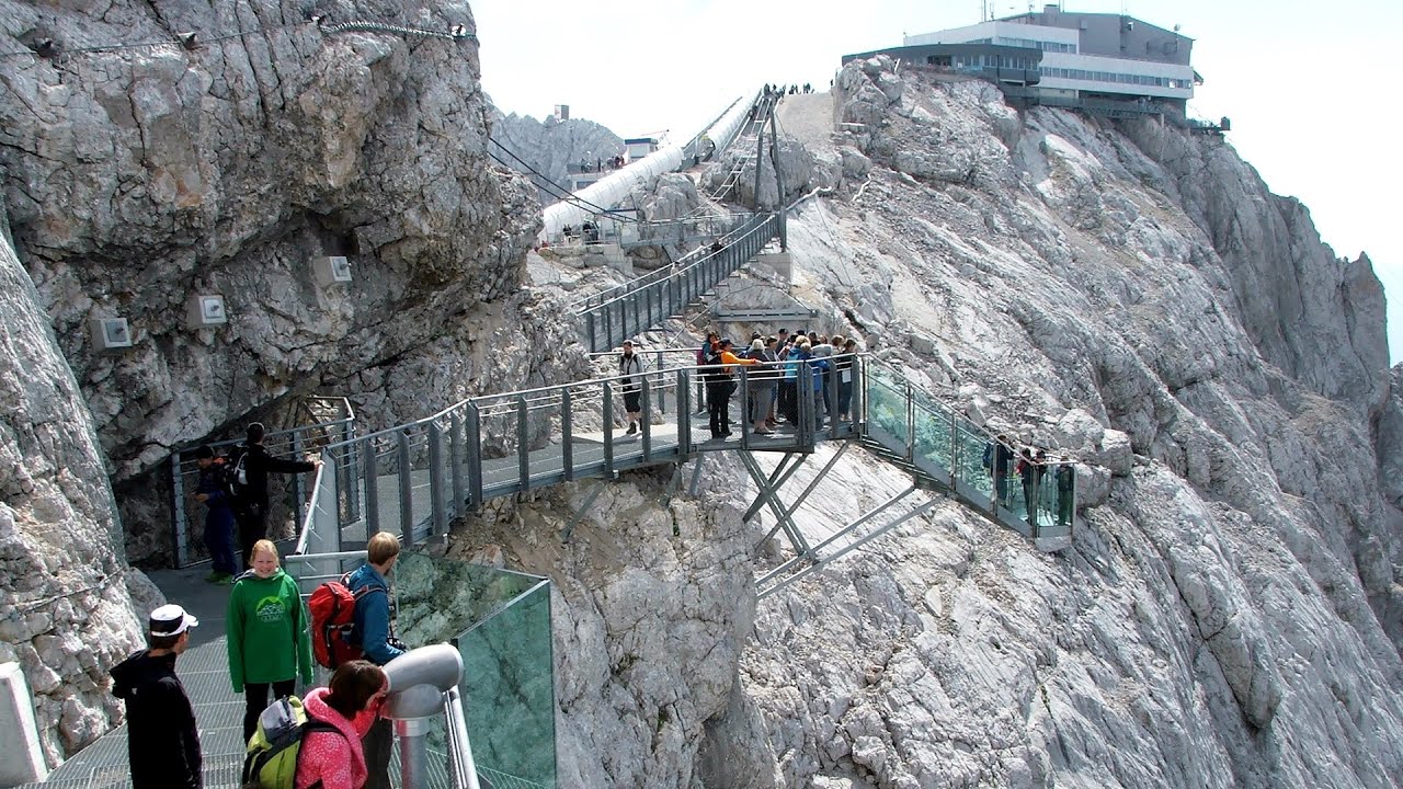
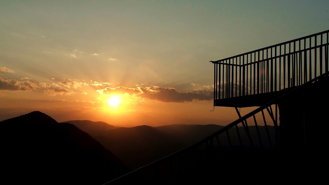
Sky Walk, Suspension Bridge, Stairway to Nothingness Styria, Dachstein The Dachstein cable car (Gletscherbahn Panorama Gondel, Panorama Cable Car) took me up to a height of 2700 meters, to the highest mountain in Styria (Steiermark), the Dachstein. Next to the upper station of the cable car there are several tourist attractions.
[ Top ↑ ]
Copyright © 2003-2026 Trekkingklub and friends. Reproduction of any text, picture or video from this website, either in printed or electronic form, is prohibited without prior written permission. Website made with love  in Miercurea Ciuc.