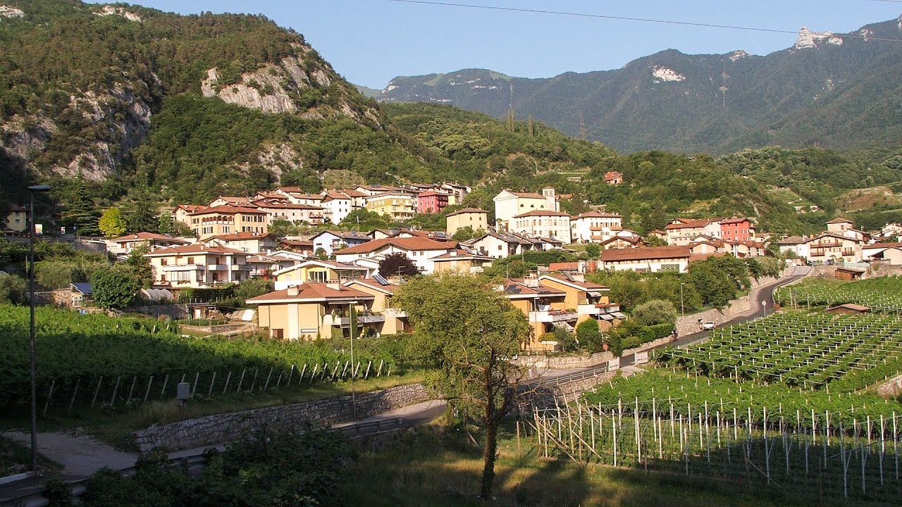
Tourist attractions near Cihei (Sanmartin, Bihor county, Romania)
Photos of nearby places

Sohodol pit cave - Padurea Craiului Mountains (10 photos) 40.5 km away. Sohodol pit cave (Avenul Sohodol) - Padurea Craiului Mountains.

Kings Cave - Padurea Craiului Mountains (48 photos) 43.2 km away. Craiului (Kings) Cave - Padurea Craiului Mountains.

Fern Cave - Padurea Craiului Mountains (9 photos) 44.6 km away. Ferigi (Fern) Cave - Padurea Craiului Mountains.

Moanei Cave - Padurea Craiului Mountains (58 photos) 45 km away. The Moanei Cave (Pestera Moanei) is located on the upper course of the Misid River, on the right side of the Misid Gorge (Cheilor Misidului). The cave has two entrances, one fossil and sloped, while a subterranean stream flows through the active gallery.

Cave of Winds - Padurea Craiului Mountains (24 photos) 45.3 km away. The Cave of Winds (Pestera Vantului) is located in the Padurea Craiului Mountains, not far from Frantura meadow, near Suncuius, on the left geographical side of the Crisul Repede River. The Cave of Winds was discovered in 1957 by Béla Bagaméri and is currently (as of 2003) the longest cave system known in Romania as well as in the Carpathian Basin.

The cave from the spring - Padurea Craiului Mountains (8 photos) 45.4 km away. Pestera de la Izvor (The cave from the spring) - Padurea Craiului Mountains.

Napistileu cave - Padurea Craiului (10 photos) 45.5 km away. Napistileu (Ungurul Mic) cave - Padurea Craiului Mountains.


Oxen Waterfall - Padurea Craiului Mountains (12 photos) 51.6 km away. Oxen Waterfall (Cascada Boilor) - Padurea Craiului Mountains.

Valley of Hell - Padurea Craiului Mountains (23 photos) 51.9 km away. Valley of Hell (Valea Iadului) - Padurea Craiului Mountains.


Dragons Garden - Galgau Almasului (20 photos) 104.8 km away. The natural reservation site Dragon's Garden (Gradina Zmeilor, Sárkányok kertje) from Galgaul Almasului is located in Salaj County, in the Western Carpathians. This natural playground is made up of interesting and unusual sandstone formations, an ensemble of 10-12 m high towers with strange figures cut in sandstone by the wind and water erosion.

Spherical concretions from Feleac (18 photos) 127.8 km away. The spherical concretions from Feleac are sedimentary rock materials that were cemented together to form a hard structure. The surrounding sediments slowly erode away, exposing the concretion.

Balcony Clearing - Trascau Mountains (6 photos) 133 km away. Balcony Clearing (Erkély-tisztás, Balconul Sipotelor) - Trascau Mountains.

Aries valley - Trascau Mountains (10 photos) 133.1 km away. Aries (Golden) valley - Trascau Mountains.

Dark Blue Bruises of the Ponor, Bedeleu (24 photos) 133.5 km away. Dark Blue Bruises of the Ponor (Vanatarile Ponorului), Bedeleu - Trascau Mountains.

Dark Blue Bruises of the Ponor - Trascau Mountains (16 photos) 134.5 km away. The Dark Blue Bruises of the Ponor (Vanatarile Ponorului) is a polje-type protected area. Polje is a Slovenian word meaning plain, and it refers to a surface karst form.
[ Top ↑ ]
Videos of nearby places

Crystal Cave at Farcu Mine 41.1 km away. In the Padurea Craiului Mountains, near Rosia, in the Farcu bauxite mine, in 1987, the miners accidentally discovered a cave. It was filled with crystal-shaped limestone formations.

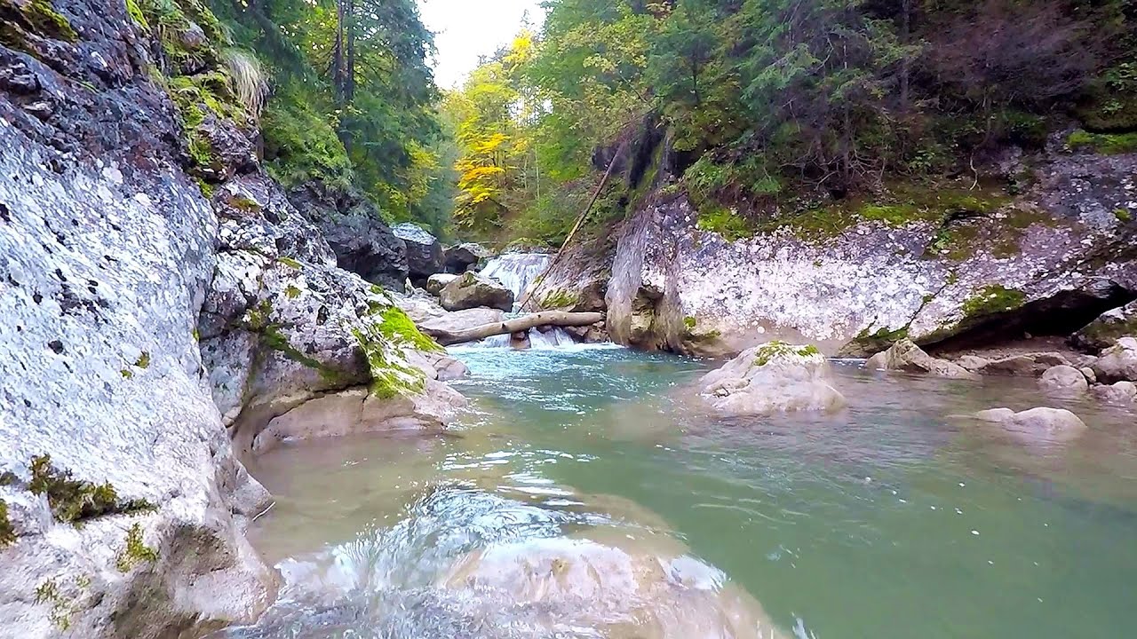
Vadu Crisului cave 42.5 km away. The Vadu Crisului Cave, with a total length of over 1000 meters, is located in the picturesque gorge of Crisul Repede creek. It consists of a gently meandering, long passage that features an active, stream level next to an upper, fossil level in its first section.

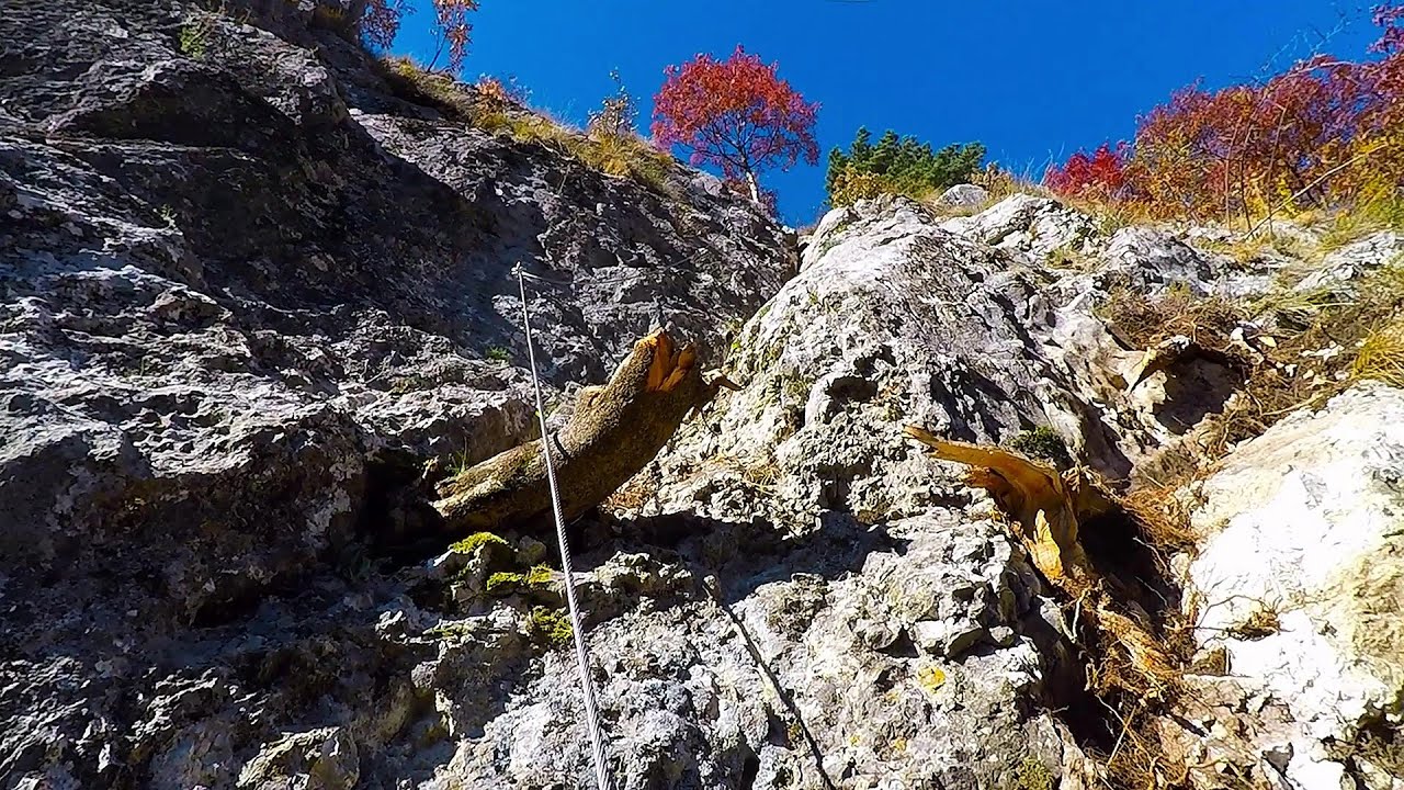
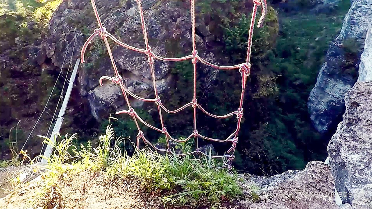
Via Ferrata Fairy Castle - Vadu Crisului 42.6 km away. Via Ferrata Fairy Castle (Castelul Zanelor, Casa Zmeului, The House of the Dragon) - Vadu Crisului. South of Vadu Crisului, in the Padurea Craiului Mountains, lies the Vadu Crisului Gorge, a section of the Crisul Repede river that narrows between rocky walls.

Fairy Cliff via ferrata route - Vadu Crisului 42.7 km away. Fairy Cliff (Peretele Zanelor) via ferrata route - Vadu Crisului. In Vadu Crisului, in the Padurea Craiului Mountains, on the right bank of the Crisul Repede, you can find the newest, in chronological order (2015) the fifth Transylvanian, new type of via ferrata route.

Other places

Banita Gorge and Banita rock bridge 201.4 km away. They say about this place that only very few people know about it, but that's not true. In fact, most nature lovers have heard of it, seen pictures taken here, even if not everyone has been able to come here.
Via ferrata Rio Sallagoni Drena, Italia The surrounding iron climbing routes are located on rock walls exposed to a scorching sun. But the Rio Sallagoni via ferrata goes upwards in a pleasantly cool gorge, above the creek and waterfalls, and eventually reaches the Drena Castle.
Bicajel Gorge Hasmas Mountains 295.2 km away. Bicajel Gorge (Cheile Bicajelului) - Hasmas Mountains.
The two niches with the visor Nochevo Dvete nishi s kozirkata (The two niches with the visor) - Nochevo.

Blasted Rock hanging path Cerna Valley 224.8 km away. The Blasted Rock (Piatra Puscata) hanging path is located on the geographical right bank of the Cerna River, near the confluence of the Iuta stream, approximately 20 km from Baile Herculane. In this area, the presence of limestone formations has caused the valley to become narrower.
Great Canyon cave Peja Gryka e Madhe (Great Canyon) cave - Peja.
Via ferrata Bear Cave adventure and climbing zone Borsec 274.2 km away. The Bear Cave in Borsec is a vast natural formation, scattered with rocks and deep crevices. Access to the cave's cavities is through a series of narrow formations resembling canyons, surrounded by giant fir trees and rocks with interesting shapes.
Via ferrata Dachstein Gams Krippenstein, Obertraun am Hallstättersee The Dachstein Gams is a new via ferrata route on Krippenstein. It has three parts: Himmeleck (A/B), Gams (C), and Nordwand (E).
[ Top ↑ ]
Copyright © 2003-2026 Trekkingklub and friends. Reproduction of any text, picture or video from this website, either in printed or electronic form, is prohibited without prior written permission. Website made with love  in Miercurea Ciuc.