Tourist attractions near Pacalesti (Draganesti, Bihor county, Romania)
Photos of nearby places


[ Top ↑ ]
Videos of nearby places

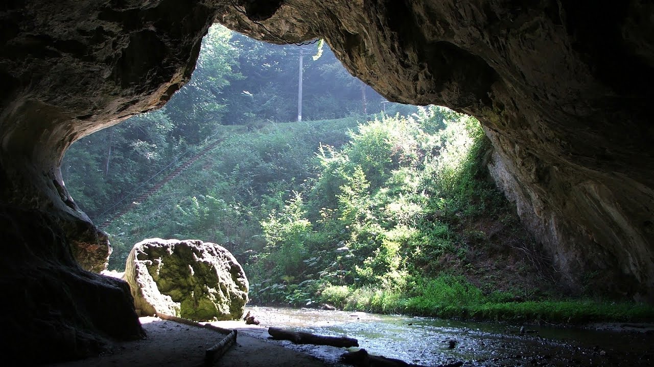
Meziad cave - Padurea Craiului Mountains 16.4 km away. The Meziad Cave is located near the village of Meziad, 22 km north of Beius, in the Padurea Craiului Mountains. It is one of our first tourist caves, its exploration is associated with the name of Gyula Czárán, cave researcher and writer.

Black Rocks iron path - Bihor Mountains 20.7 km away. Black Rocks is located in the Bihor Mountains, near the Vartop Saddle, to the west of it. It is interesting that the locals (if I understood correctly) do not know this name, but use the name Piatra Buna (meaning Good Stone) for this spectacular rock.

Crystal Cave at Farcu Mine 21.6 km away. In the Padurea Craiului Mountains, near Rosia, in the Farcu bauxite mine, in 1987, the miners accidentally discovered a cave. It was filled with crystal-shaped limestone formations.

Hodoaba Valley iron path - Suncuius 36 km away. The Hodoaba Valley iron path is Romania's shortest and easiest (official) via ferrata route. It is located near Suncuius, in the Padurea Craiului Mountains, on the left bank of the Crisul Repede River.

Acapulcos spur via ferrata 36.6 km away. Acapulco's spur (Pintenul lui Acapulco) via ferrata (B/C) - Montana Land, Suncuius.
Other places

Jumping waterfall Harghita Mountains 244.9 km away. Jumping waterfall (Cascada Saritoarea, Szökő) - Harghita Mountains.
Boli Cave Banita 147.8 km away. The Boli Cave is located 6 km north of Petrosani, on the road that connects Hateg with the Jiu Valley. Here, the railway line that connects the two parts of Hunedoara County passes through, featuring a total of 66 curves and 8 tunnels.

Virus and Antivirus iron paths Baia de Fier 190.4 km away. With Virus (B/C) and Antivirus (C), the number of via ferrata routes at Baia de Fier has increased to thirteen. In fact, it is a Y-shaped route that starts near the entrance of the Laura via ferrata, and the exits are located just a few meters from the Laura exit.

Vulva cave Rhodope Mountains The Vulva Cave (Peshtera Utroba) is situated near the village of Nenkovo and the city of Kardzhali, in the Rhodope Mountains of Bulgaria. It derives its name from the shape of its entrance, which resembles a vulva.

Preachers Rock Bodoc Mountains 276 km away. In the Bodoc Mountains, west-southwest from the Henter peak, we find a rock formation shaped like a mushroom by erosion, called Preacher's Rock. This 2-meter high rock probably got its name from the pagan Hungarian priests, who preached here in the past.

Seven Ladder Canyon and Waterfall Piatra Mare Mountain 275.7 km away. The Seven Ladder Gorge is the largest and most spectacular gorge in the Piatra Mare massif. The narrow canyon has a length of 160 meters, and over a drop of 58 meters includes 7 bigger and several smaller waterfalls.
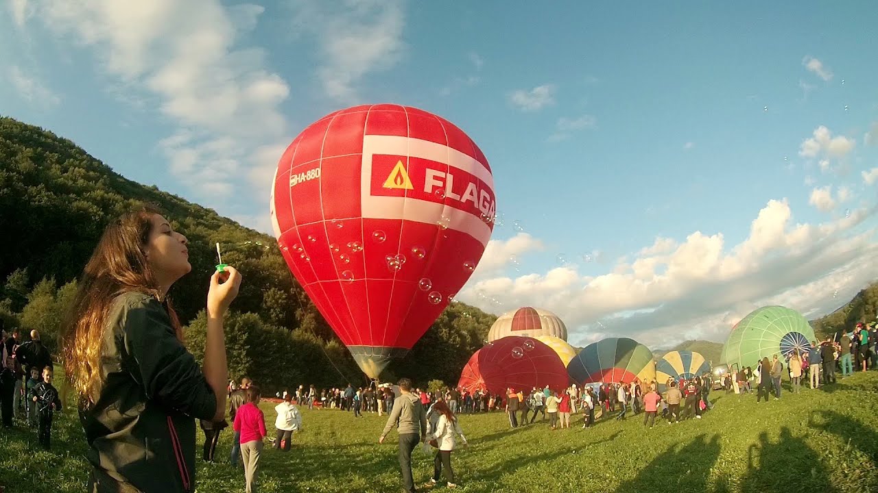
Hot air balloon parade 2015 Campu Cetatii 198.1 km away. This year, the Hot Air Balloon Parade was organized in Campu Cetatii for the tenth time. Unfortunately, the weather only allowed for flying on Saturday morning and evening.

Crivadia Gorge 143.2 km away. The Crivadia Gorge is located next to the village of Crivadia, which belongs to Banita. Access is difficult, and the hike is made through the streambed, with water up to the waist at its narrowest point.
[ Top ↑ ]
Copyright © 2003-2026 Trekkingklub and friends. Reproduction of any text, picture or video from this website, either in printed or electronic form, is prohibited without prior written permission. Website made with love  in Miercurea Ciuc.