Tourist attractions near Sacele (Sacele, Brasov county, Romania)
Photos of nearby places


Seven Ladder Waterfall - Piatra Mare Mountains (12 photos) 7.1 km away. The Seven Ladders are located in the middle-western part of the Piatra Mare Mountains, at an average altitude of 980 m, not far away from Valea Timisului (Dambu Morii), on the Seven Ladders River, the left-side affluent of Sipoaia creek. These are the greatest and the most spectacular gorges of the whole Piatra Mare Mountains.


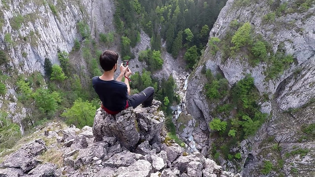
Piatra Mare peak and surroundings (24 photos) 8.2 km away. Piatra Mare hut - Piatra Mare peak - Stone Mushrooms - Stone Barn.


[ Top ↑ ]
Videos of nearby places
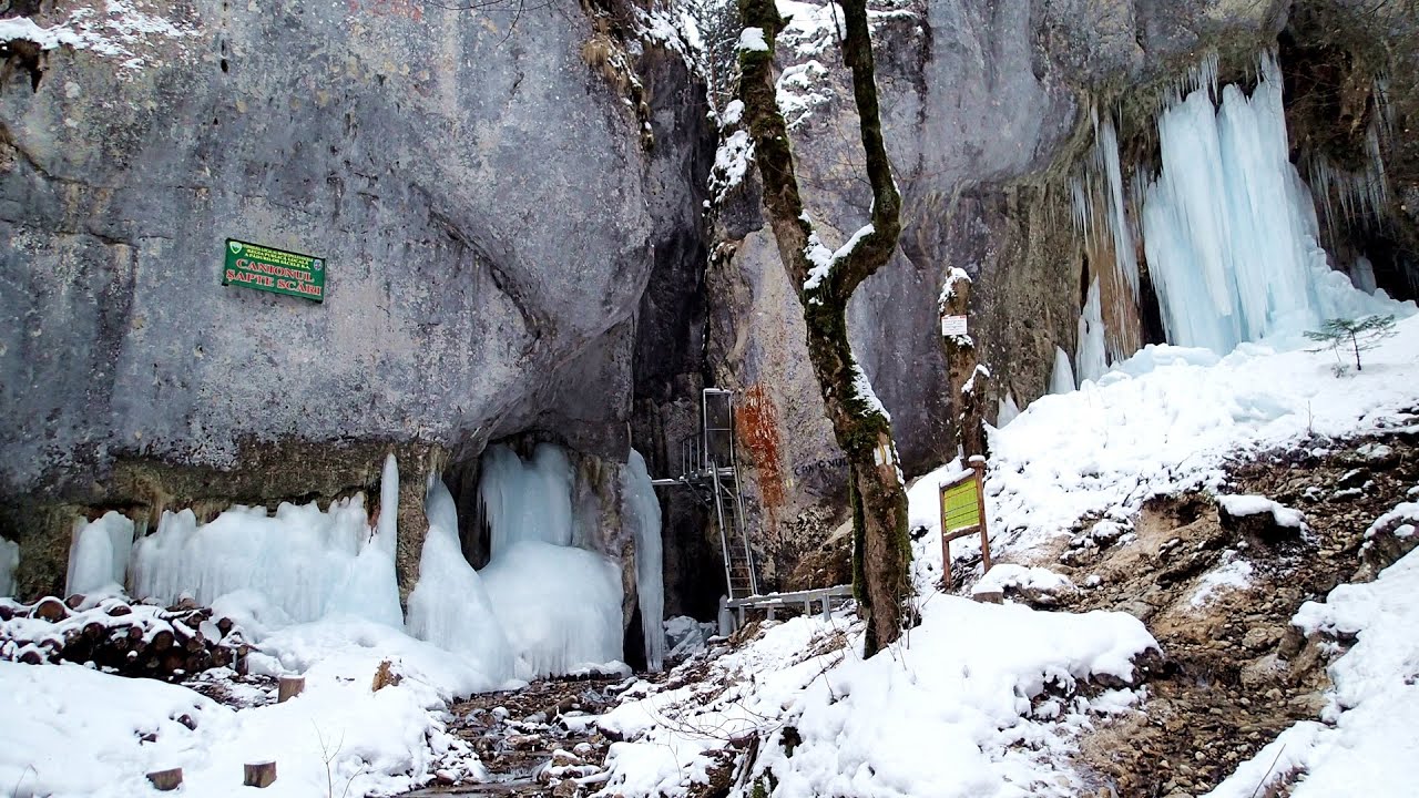
Seven Ladder Canyon in Winter - Piatra Mare Mountain 7 km away. Seven Ladder Canyon and Waterfall in Winter - Piatra Mare Mountain

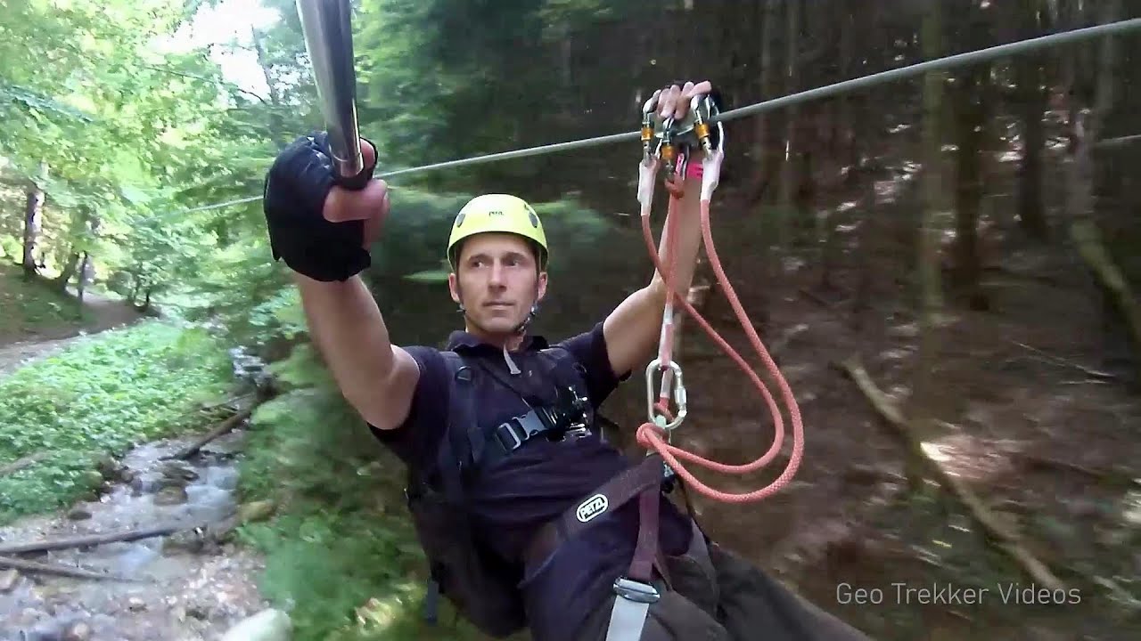
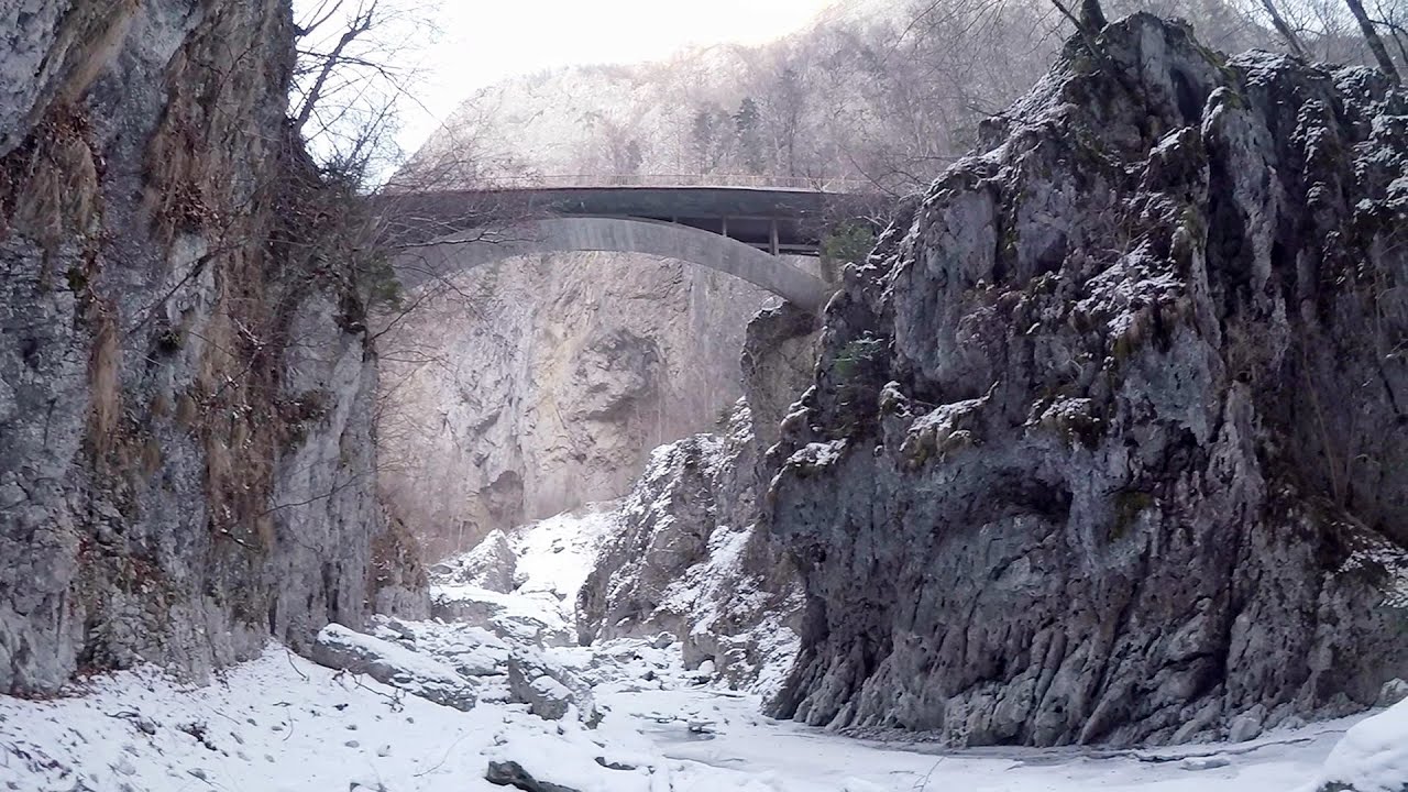
Seven Ladder Canyon and Waterfall - Piatra Mare Mountain 7.1 km away. The Seven Ladder Gorge is the largest and most spectacular gorge in the Piatra Mare massif. The narrow canyon has a length of 160 meters, and over a drop of 58 meters includes 7 bigger and several smaller waterfalls.

Ski resort - Poiana Brasov - Postavarul Mountains 12.3 km away. Shining sun and an Austria-feeling on the impeccable slopes of the ski paradise Poiana Brasov above Brasov. Sunbathing, coffee and refreshing drinks on the terrace of Julius Römer chalet.

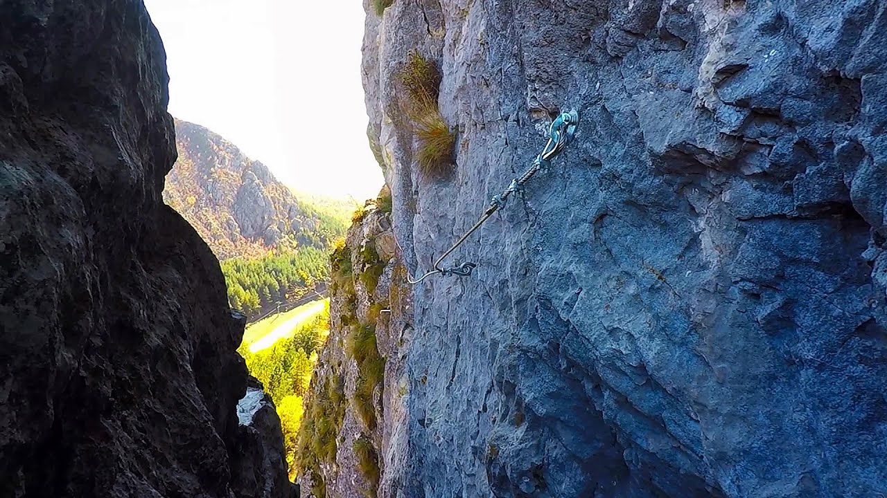
Big Via ferrata Rasnoavei Gorge 16.2 km away. The most dangerous Eastern European iron path, and also one of the most beautiful via ferrata routes in Romania, is in the Rasnoavei Gorges, Postavaru Mountains.The route is 450 m long, with a level difference of 220 m.
Other places
The Gorge of the Creek of the Gorge Buila-Vanturarita National Park 128.7 km away. The Gorges of the Creek of the Gorge (Cheii Gorge, Cheile Cheii) is located in the Buila-Vanturarita National Park within the Capatana Mountains. It is one of the most beautiful and picturesque gorges in Romania.
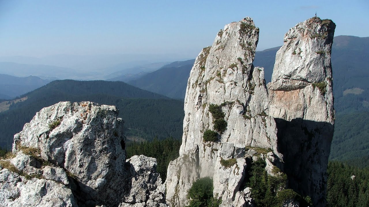
Ladys Stones Rarau Mountains 203.7 km away. The Lady's Stones represent the heart, the mind, and the soul. The first two only help to understand the world when one possesses knowledge (they can be climbed with rock climbing gear), as emotions and thoughts (the two rock towers) obscure reality (the view).
Arched stone bridge Rugova Canyon Arched stone bridge - Rugova Canyon (Gryka e Rugoves).
Middle Belt via ferrata route Baia de Fier 159 km away. Middle Belt (Spirala Medie) via ferrata route - Baia de Fier. In May 2018, two new via ferrata routes were inaugurated in Baia de Fier.
Oltet Gorge Capatana Mountains 156.7 km away. Oltet Gorge (Cheile Oltetului) - Capatana Mountains. That day, we had planned to ski at the Ranca resort, situated alongside the Transalpina high altitude mountain road in the Parang Mountains.

Cherven, a medieval fortified town Bulgaria 223.2 km away. Located about 30 km south of the city of Ruse in Bulgaria, the Cherven medieval fortress can be found in the Rusenski Lom Nature Park. Originally a Byzantine fortification from the 6th century, it reached the height of its development in the 14th century.
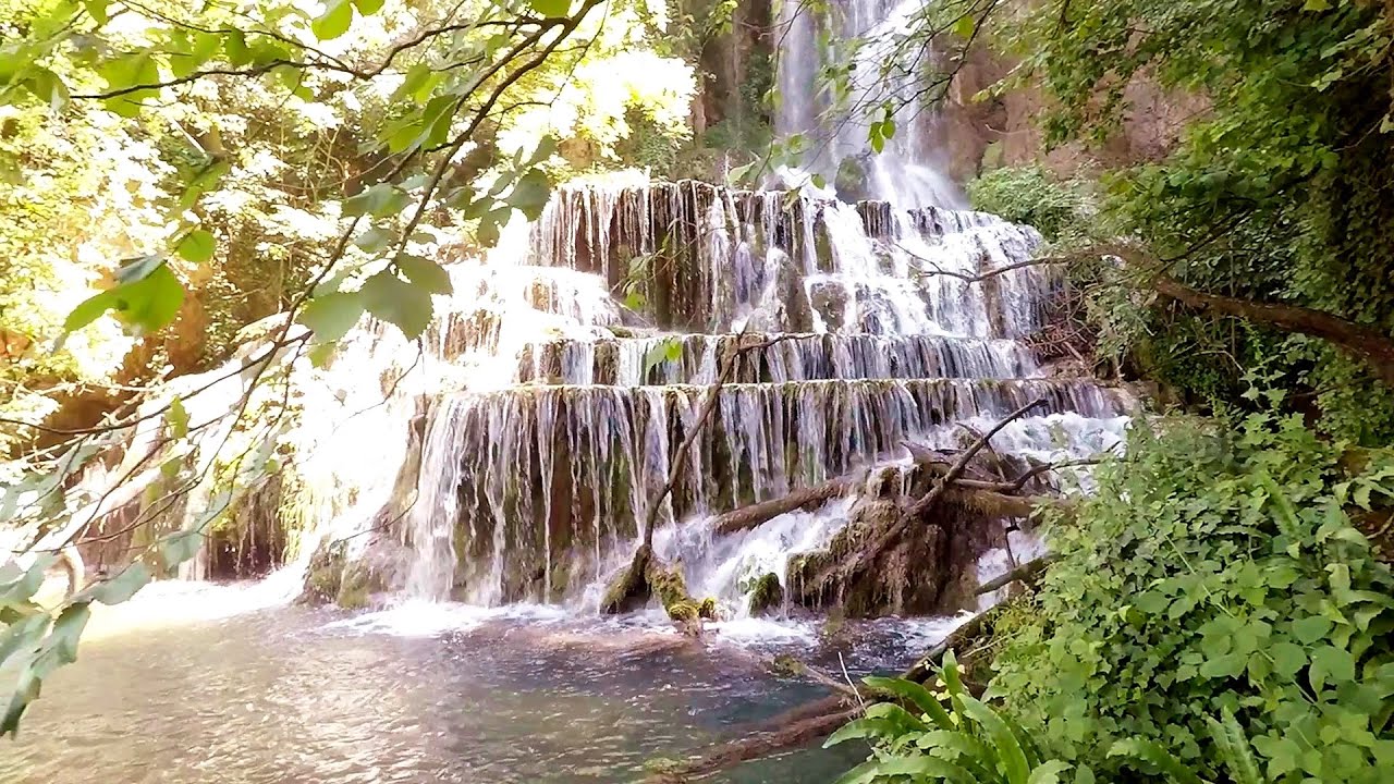
Krushuna waterfalls Krushuna 269.2 km away. The Krushuna Waterfalls are a series of karst cascades formed in travertine. They are located near the village of Krushuna, not far from the town of Lovech, and are Bulgaria's largest waterfall of this type.
[ Top ↑ ]
Copyright © 2003-2026 Trekkingklub and friends. Reproduction of any text, picture or video from this website, either in printed or electronic form, is prohibited without prior written permission. Website made with love  in Miercurea Ciuc.