Tourist attractions near Margau (Margau, Cluj county, Romania)
Photos of nearby places


[ Top ↑ ]
Videos of nearby places

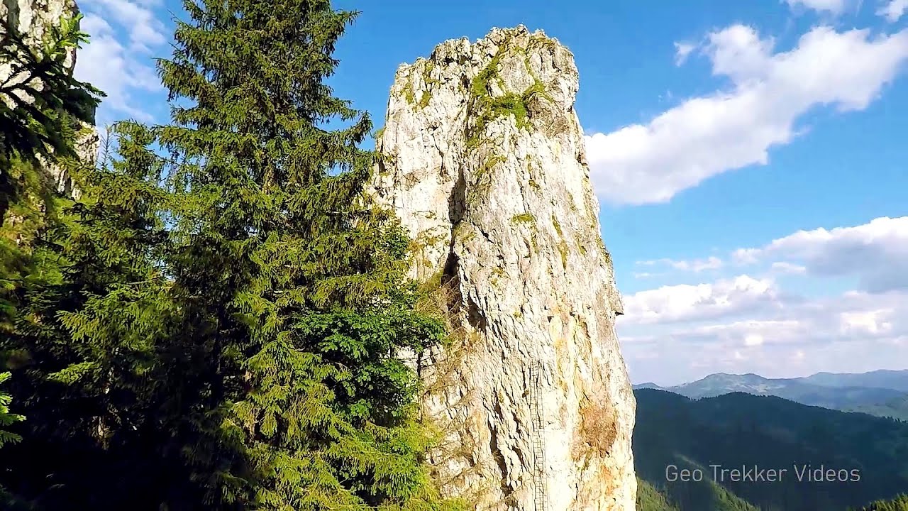
Black Rocks iron path - Bihor Mountains 36.2 km away. Black Rocks is located in the Bihor Mountains, near the Vartop Saddle, to the west of it. It is interesting that the locals (if I understood correctly) do not know this name, but use the name Piatra Buna (meaning Good Stone) for this spectacular rock.

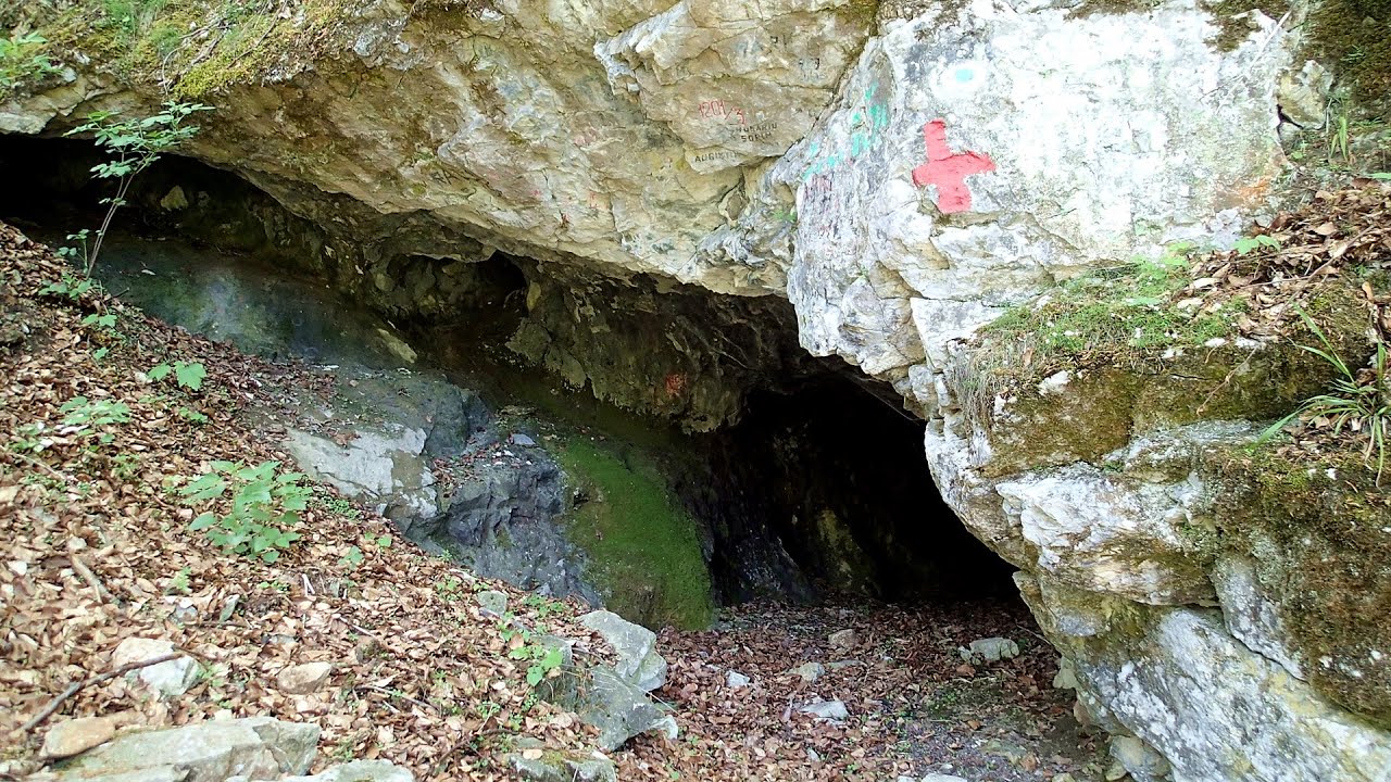
Meziad cave - Padurea Craiului Mountains 36.6 km away. The Meziad Cave is located near the village of Meziad, 22 km north of Beius, in the Padurea Craiului Mountains. It is one of our first tourist caves, its exploration is associated with the name of Gyula Czárán, cave researcher and writer.

Hodoaba Valley iron path - Suncuius 37.1 km away. The Hodoaba Valley iron path is Romania's shortest and easiest (official) via ferrata route. It is located near Suncuius, in the Padurea Craiului Mountains, on the left bank of the Crisul Repede River.

Acapulcos spur via ferrata 37.6 km away. Acapulco's spur (Pintenul lui Acapulco) via ferrata (B/C) - Montana Land, Suncuius.

Other places
The Cave of Thieves Apata 210.5 km away. The Cave of Thieves (Pestera Hotilor, Tolvajos), located in the Olt Gorge at Racos, is situated at the source of the Tepeu creek. From the karst spring that emerges from the cave, one of the branches of the creek originates.

SkiGyimes ski slope Lunca de Sus 230.2 km away. It is well-known that in Rimetea, due to the Piatra Secuiului (Szekler's Rock) mountain, the Sun rises twice. However, perhaps few know that in Lunca de Sus, the Sun sets three times.
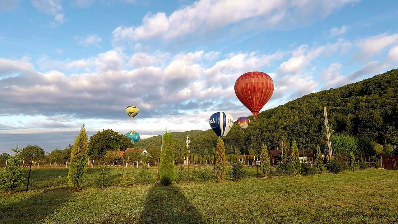
Hot Air Balloon Parade 2018 Campu Cetatii 156.1 km away. This year, the hot air balloons flew low over Campu Cetatii. The weather did not really favor the parade.
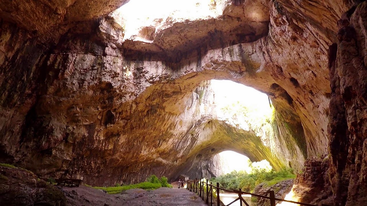
Devetashka cave Devetaki 419.6 km away. The Devetashka Cave is located in Bulgaria, near the village of Devetaki. After the entrance portal, which measures 30 m by 35 m, there is a vast open chamber that is 110 meters wide and 359 meters long.

Shipka pass Shipka 482.7 km away. The Shipka Pass is one of the most spectacular crossings of the Balkan Mountains, and is part of the Bulgarka Nature Park. It separates the provinces of Gabrovo and Stara Zagora, and provides a connection between the cities of Gabrovo and Kazanlak.
Óbányai Valley Eastern Mecsek 355.4 km away. The Óbányai Valley is located in the Eastern Mecsek Landscape Protection Area, stretching between Óbánya and Kisújbánya. Its attractions include the Slanting waterfall or Fairy Stairs, and the Dripping Rock.
Siega via ferrata Silberkar Gorge, Ramsau am Dachstein The Siega via ferrata, categorized as a C/D level of difficulty, is perhaps the least interesting of the three via ferrata routes in the Silberkar Gorge (Silberkarklamm). This doesn't mean that it's not good, just that the other two are even better.
Falco Tinnunculus via ferrata, the ascent Falcons Rock, Corbu 210.3 km away. Falco Tinnunculus (Common kestrel) via ferrata (E), the ascent - Falcon's Rock, Corbu. Over Corbu village in Harghita County, on the rocks of Falcon's Rock (Piatra Soimilor), which belong to the Bistrita Mountains, five via ferrata routes have been established.

Sheepdogs Govora sheepfold Retezat mountains 150.6 km away. On the second day of my weekend Retezat hike, I visited a sheepfold on the Lancita Ridge. To my great disappointment, they didn't make cheese or curd here.
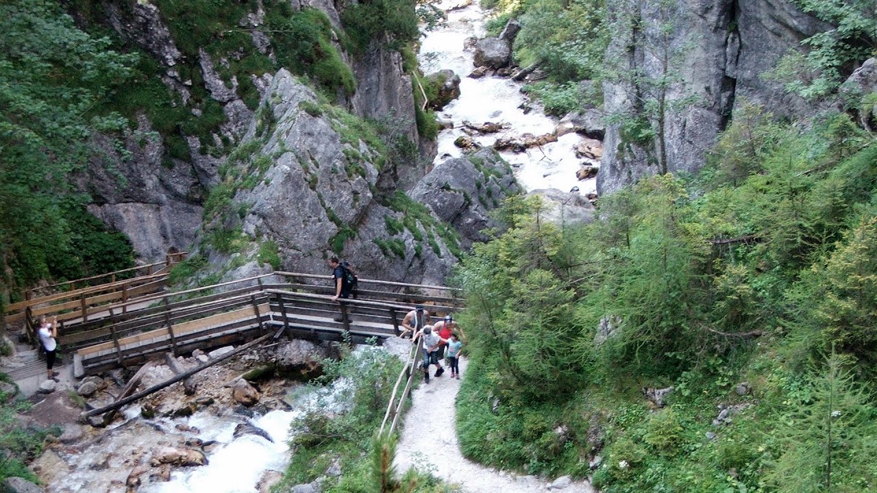
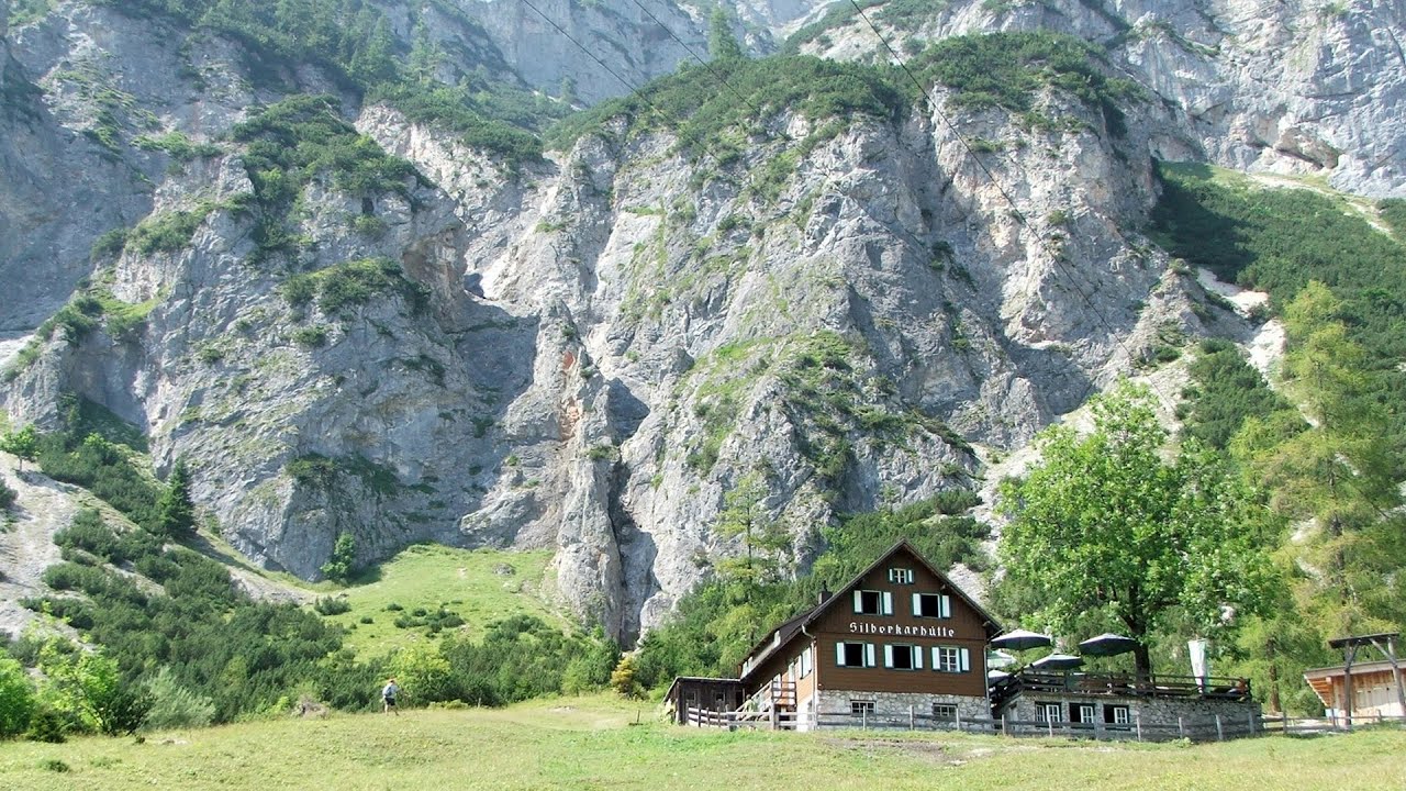
Silberkar Gorge Ramsau am Dachstein One of the most beautiful hiking spots in the area of Ramsau am Dachstein, is the Silberkarklamm (Silberkar Gorge). It is possible to drive to the entrance of the gorge, there is parking available on the side of the road, and you have to pay an entrance fee.
Fox Ears Beach Sinemorets Fox Ears Beach (Plazh Lisichi ushi) - Sinemorets.
Amazing Bridges Zabardo The Amazing Bridges (Chudni Mostove, Wonderful Bridges) are natural stone bridges. They are located in the Rhodope Mountains, in the Smolyan Province of Bulgaria, within the valley of the Erkyupriya River, at an altitude of 1,450 meters above sea level.
Gornjak via ferrata and Kudelinovs fortress Zdrelo 297.2 km away. Difficulty level C/D, total length: 400 m, height difference: 330 m, year of construction: 2019, total length of the route to Kudelinov's fortress: 1100 m. Access to the via ferrata is free.

Stone Forest Slanchevo The Stone Forest (Stones stuck in the ground, Pobiti Kamani) of Bulgaria is located 18 km west of Varna, at the foothills of the Eastern Balkan Mountains. Its Bulgarian name, Pobiti Kamani, translates to planted stones, and it is referred to in English as the Stone Desert or Stone Forest.
[ Top ↑ ]
Copyright © 2003-2026 Trekkingklub and friends. Reproduction of any text, picture or video from this website, either in printed or electronic form, is prohibited without prior written permission. Website made with love  in Miercurea Ciuc.