Tourist attractions near Fitod (Leliceni, Harghita county, Romania)
Photos of nearby places

Ruins of the Harom fortress - Jigodin Bath (10 photos) 6.5 km away. The Harom Fortress was built around the beginning of the 12th century and was part of the system of fortifications that protected Transylvania from the east. It is located south of Miercurea Ciuc, east of Harom Peak, which has an altitude of 1079 m, near the southwestern limits of Jigodin Bath (Baile Jigodin).

The sources of the river Trotus - Fagetel (10 photos) 15.2 km away. Fagetel, Piposz property, The sources of the river Trotus (Tatros).

Harghita Bath - Harghita Mountains (15 photos) 16.4 km away. Harghita Bath (Harghita-Bai) - Harghita Mountains.


Condra cross - Three rocks peak (24 photos) 25.5 km away. Condra cross - Trei Pietre (Three rocks) peak.


Brother Mountain - Hasmas Mountains (15 photos) 35.2 km away. Brother Mountain (Fratele, Ecem, Ecsém) - Hasmas Mountains.


Brother Mountain - Hasmas Mountains (11 photos) 36 km away. Brother Mountain (Ecsém-tető, Muntele Fratele, Muntele Ecem) - Hasmas Mountains.

Watchstone and the Lonely Stone in March (18 photos) 36.4 km away. Watchstone (Stanca La Panda) and the Lonely Stone (Piatra Singuratica) in March.

Lonely Stone - Hasmas Mountains (9 photos) 36.4 km away. Lonely Stone (Piatra Singuratica) - Hasmas Mountains.


Sugo Cave - Giurgeu Mountains (60 photos) 38.4 km away. The Sugó Cave is located at the western foot of Sipos Stone (1566 m) at an altitude of 1064 m above sea level. It consists of a system of passages with four levels, totaling 1021 m in length and a level difference of -60 m.


Valley of the Lazarus-creek - Hasmas Mountains (15 photos) 38.7 km away. Valley of the Lazarus-creek (Valea paraului Lazar), Log Slide - Hasmas Mountains.

Lazar peak - Hasmas Mountains (18 photos) 39.8 km away. The pit under the Lazar peak 2004-09-02, 2014-11-27.

White Glade - Hasmas Mountains (6 photos) 41.2 km away. White Glade (Poiana Alba) - Hasmas Mountains.

Dry Valley canyon - Hasmas Mountains (9 photos) 41.8 km away. Dry Valley (Paraului Sec) canyon - Hasmas Mountains.

White Glade, Horseshoe Rock (17 photos) 41.9 km away. White Glade (Poiana Alba), Horseshoe Rock (Piatra Potcoavei) - Hasmas Mountains.

Horseshoe Rock - Hasmas Mountains (9 photos) 41.9 km away. Horseshoe Rock (Piatra Potcoavei) - Hasmas Mountains.
[ Top ↑ ]
Videos of nearby places

Walking to the top of Sumuleul Mare - Sumuleu Ciuc 1.4 km away. This was my first attempt at shooting a video.


Nobodys lake - Miercurea Ciuc 6.6 km away. The passage of time (time lapse), dusk at Nobody's Lake. Miercurea Ciuc and the Sumuleu mountain can be seen in the background.

Kossuth Rock - Harghita Bath 14.7 km away. Kossuth Rock - Harghita Bath (Harghita-Bai), Harghita Mountains.
Other places

Pisoaia waterfall Vidra 227.9 km away. Pisoaia waterfall (Pisoaia Vidrii, Urine of the otter) - Nemesi, Vidra.

Mill of the Devils Tasna Gorge 301.8 km away. Mill of the Devils (Moara Dracilor) - Tasna Gorge (Cheile Tasnei). The Tasna Gorges are located in the Mehedinti Mountains, approximately 15 km from the resort of Baile Herculane.
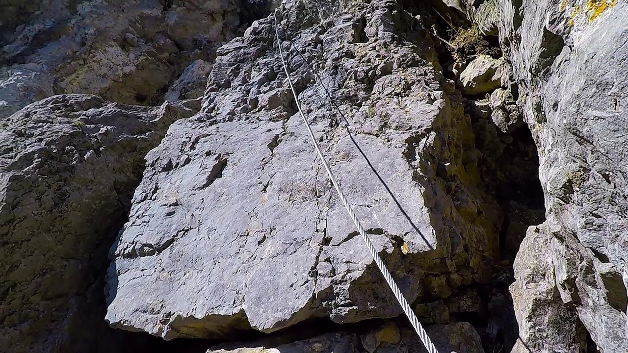
The Bears Jump iron path Baia de Fier 207.7 km away. The Bear's Jump (Saritoarea Ursului) is a fantasy-named via ferrata that opened in May 2018 near Baia de Fier, alongside the Middle Belt (Spirala Medie). Both routes begin from the G zone of the rock face that conceals the Women's Cave (Pestera Muierilor).

Rudariei watermills Eftimie Murgu 335.1 km away. I have visited the twenty-two wooden water mills with horizontal wheels, located in the valley of the Rudaria stream, mostly in the rain and under an umbrella. Some of them are still in use today.
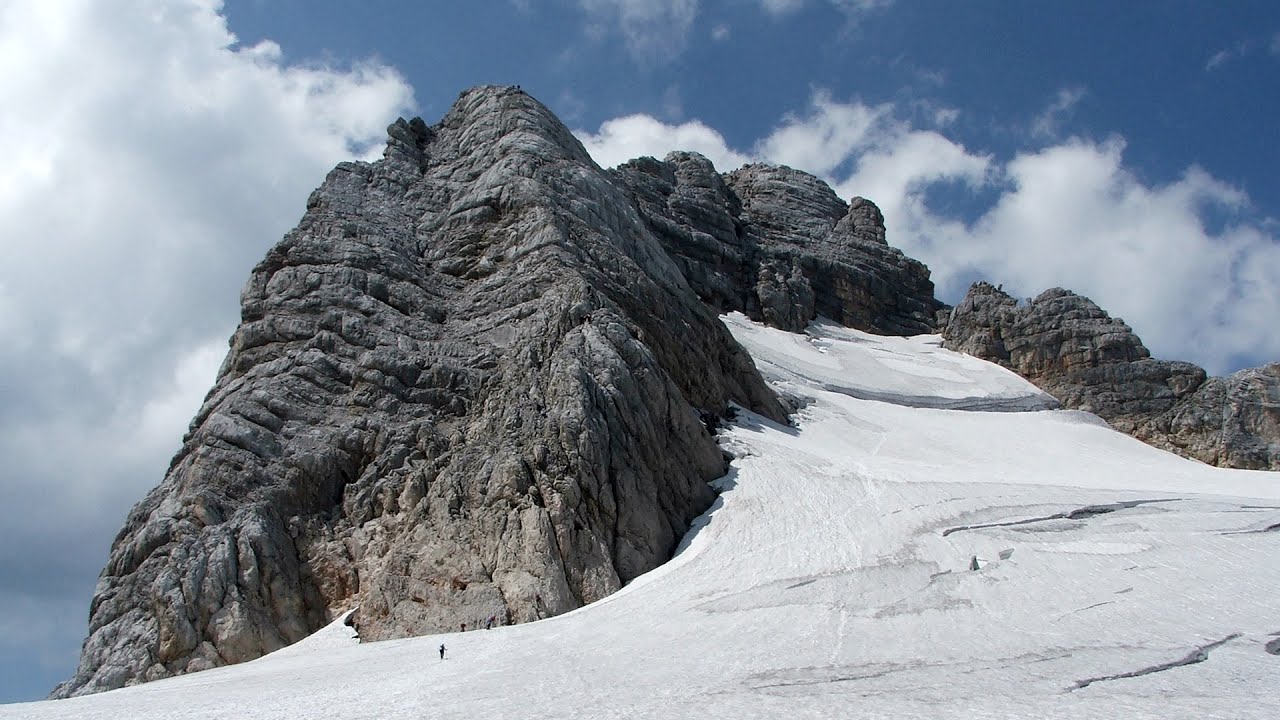
Schulter Anstieg klettersteig Hoher Dachstein Two routes lead to the top of the Hoher Dachstein. The Randkluft is shorter, but can only be reached through a glacier with cracks.
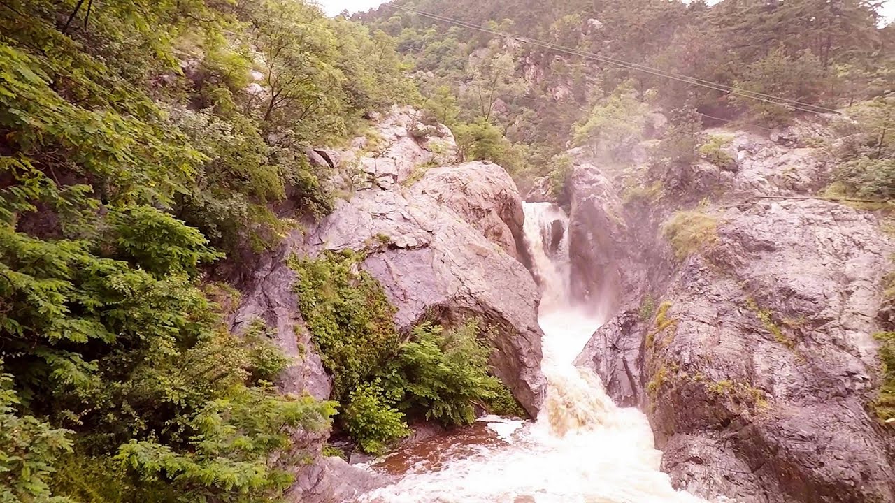
Suchurum waterfall Karlovo 420 km away. The 15-meter-high Suchurum Waterfall is located at the foot of the Stara Planina mountain range, 1 km north of the town of Karlovo in Bulgaria. It is situated below the Karlovo hydroelectric power plant, on the waters of the Stara Reka stream.
Balázs Hill Lookout Western Mecsek The Balázs hill lookout, located at an altitude of 320 meters, offers a beautiful view of Lake Pécs and the wooded mountain ranges of Western Mecsek. The original lookout, built in 1975, was destroyed by fire, and it was rebuilt in 2001 using a metal structure, which was renovated in 2014.
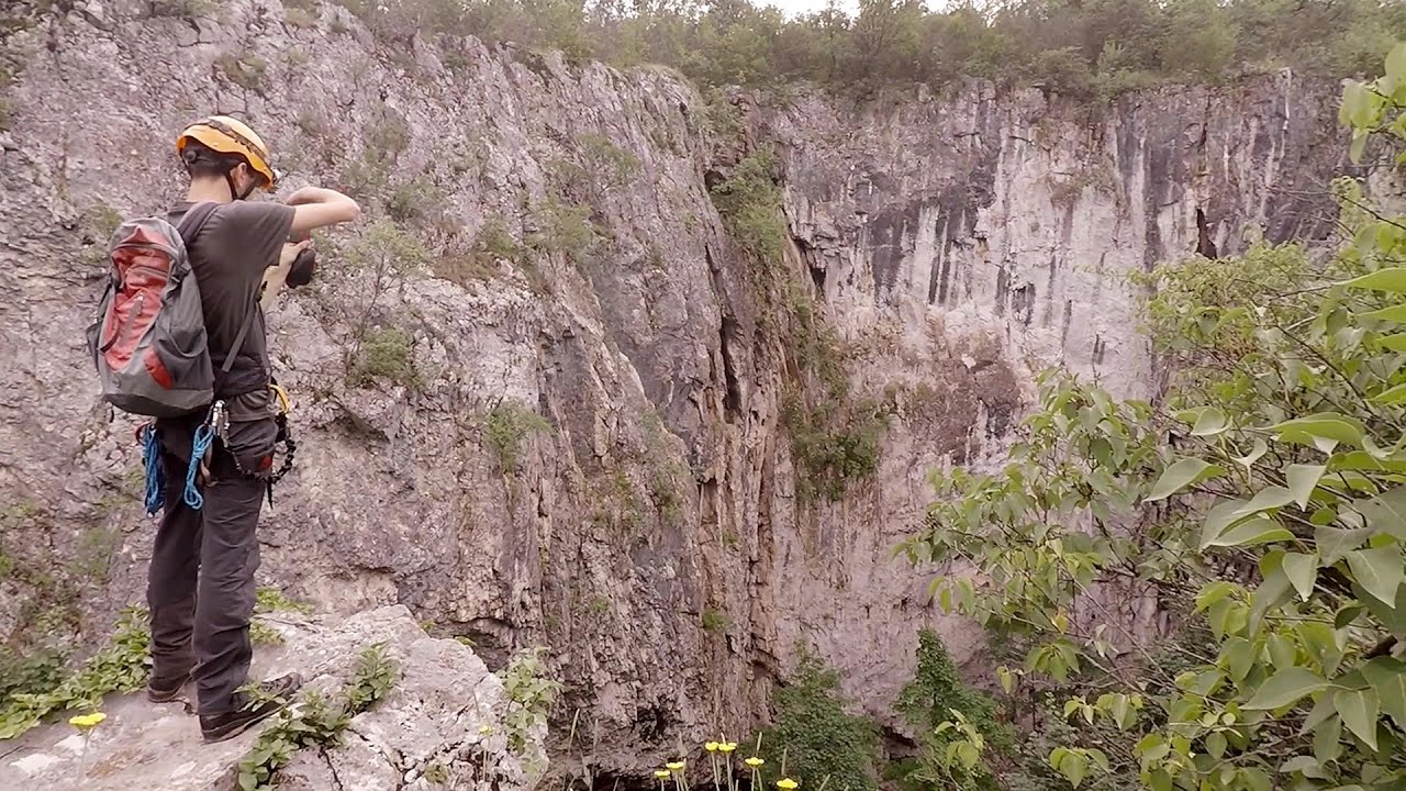
Lednica iron path Brestnitsa 390.9 km away. The Lednica via ferrata is located next to the Saeva Dupka Cave, near the village of Brestnitsa in Bulgaria. The trail leading to the via ferrata, which opened in 2007, starts from the cave parking lot next to a covered resting area.
[ Top ↑ ]
Copyright © 2003-2026 Trekkingklub and friends. Reproduction of any text, picture or video from this website, either in printed or electronic form, is prohibited without prior written permission. Website made with love  in Miercurea Ciuc.