Chirui Bath | Photos


Page no. 1, photos: 1-6, 6 photos in total.

Chirui Bath (Baile Chirui).
Copyright © 2004 - 2026 Trekkingklub.com. Please register for full and ad-free access.
Airport nearby: Ghimbav International Airport (GHV - Brașov (Ghimbav), Ro), 67 km away.
Photos of nearby places


Harghita Bath - Harghita Mountains (15 photos) 9.8 km away. Harghita Bath (Harghita-Bai) - Harghita Mountains.


[ Top ↑ ]
Videos of nearby places
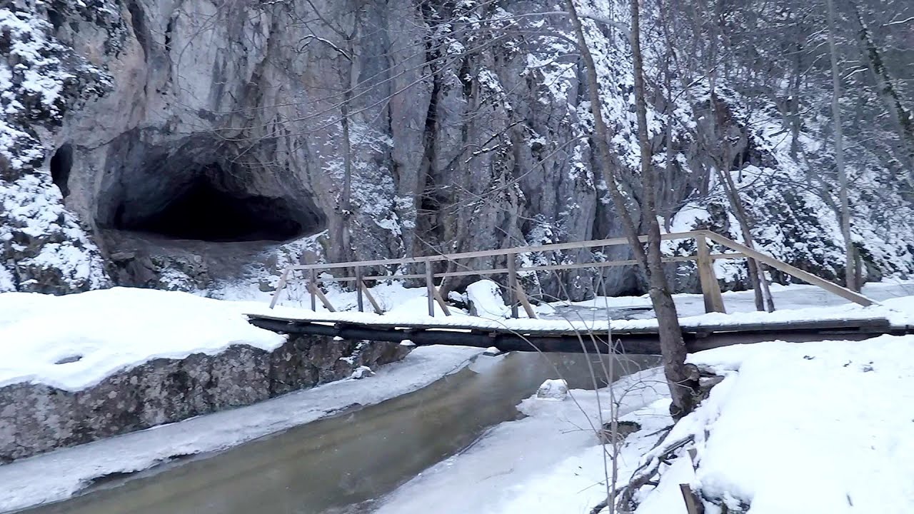
Varghis gorges in winter 10 km away. I went out to admire the ice stalagmites (standing icicles) in the Varghis Gorge. Anyone arriving here at the end of winter can observe meter-high ice stalagmites in the entrance area of Meresti Cave (now known as Orban Balazs Cave).

Kossuth Rock - Harghita Bath 10.7 km away. Kossuth Rock - Harghita Bath (Harghita-Bai), Harghita Mountains.

TV-radio amplifying station - Harghita Ciceu 10.7 km away. The hiking trail marked with a blue stripe starts at the Uz Bence shelter and runs from Harghita-Bai to Harghita Madaras. Our destination today is the Harghita Ciceu plateau.

Nobodys lake - Miercurea Ciuc 14.5 km away. The passage of time (time lapse), dusk at Nobody's Lake. Miercurea Ciuc and the Sumuleu mountain can be seen in the background.

Other places
Roman Baths Cetea, Trascau Mountains 156.4 km away. Roman Baths (Baile Romane) - Cetea, Trascau Mountains. Among the valleys of the Trascau Mountains, the Cetea Gorge best deserves the name of a crevice valley.
Huda lui Papara cave Salciua de Jos 163.3 km away. Huda lui Papara cave (Paparas Hole) - Salciua de Jos, Trascau Mountains.
Loreley and Pink Panther iron path Baia de Fier 188.1 km away. The Loreley via ferrata (graded B/C, with an elevation difference of approximately 100 m and a length of about 100 m) is located on the rock wall on the opposite side of the road. A branch from its upper section leads to the Pink Panther (Pantera Roz, graded A/B/C, approximately 200 meters long, with an elevation difference of about 50 meters).
Belintash Ridge of Dobrostan, Rhodope Mountains 497.9 km away. Belintash is a mysterious monolithic complex located approximately 50 km from Plovdiv, passing through the scenic Rhodope Mountains. It is situated southeast of the village of Vrata and west of the village of Sini Vruh.
Big Cave Nochevo 492.9 km away. Kodzha in (Golyamata Peshtera, Big Cave) - Nochevo.
Devils Mill Gorge Campulung Moldovenesc 130.3 km away. The Devil's Mill Gorge is relatively short, measuring only 60 to 70 meters in length. It was formed in yellowish-gray-white dolomite by the work of a stream that crosses the gorge, as a result of erosion and the dissolution characteristic of limestone.
Transylvania A3 Highway Viaduct- Suplacu de Barcau 255.7 km away.
Poenari citadel Arges valley 128.8 km away. The Poenari citadel is located on the southern slope of the Fagaras Mountains, on the western side of the Transfagaras road, in the Arges Valley, about 4 km from the Vidraru Lake dam. Along a steep incline, a concrete staircase leads up to the castle, which is built atop a mountain.
Pisoaia waterfall Vidra 208.1 km away. Pisoaia waterfall (Pisoaia Vidrii, Urine of the otter) - Nemesi, Vidra.
Womens Spiral via ferrata, climbing fun Baia de Fier 188.3 km away. The Women's Spiral (Spirala Muierilor) via ferrata is set up on the rock that conceals the Women's Cave (Pestera Muierii). It is one of the seven routes near Baia de Fier as of now (2018).
Mine lake Megyer mountain, Sárospatak 378.9 km away. The via ferrata routes of the Megyer mountain mine lake. The geologists' path E 25 m, Szabó József-memorial path C 200 m, Amphitheater D 40 m, Devil's Cauldron E 70 m, Sweet aquatic life D 150 m, Velociraptor C 35 m.
Fairy Cliff via ferrata route Vadu Crisului 246 km away. Fairy Cliff (Peretele Zanelor) via ferrata route - Vadu Crisului. In Vadu Crisului, in the Padurea Craiului Mountains, on the right bank of the Crisul Repede, you can find the newest, in chronological order (2015) the fifth Transylvanian, new type of via ferrata route.
Little Spiral via ferrata Baia de Fier 188.3 km away.
Via Ferrata Pink Panther Baia de Fier 188.1 km away. In the area of Baia de Fier in Gorj County, several via ferrata routes have been set up on the rock above the Women's Cave (Muierii Cave) and on the other side of the road. At that time (2018), there were a total of seven.
Stone Forest Slanchevo 380.6 km away. The Stone Forest (Stones stuck in the ground, Pobiti Kamani) of Bulgaria is located 18 km west of Varna, at the foothills of the Eastern Balkan Mountains. Its Bulgarian name, Pobiti Kamani, translates to planted stones, and it is referred to in English as the Stone Desert or Stone Forest.
[ Top ↑ ]
Copyright © 2003-2026 Trekkingklub and friends. Reproduction of any text, picture or video from this website, either in printed or electronic form, is prohibited without prior written permission.
The given distances are to be understood as straight line distances, and are approximate. Website made in Miercurea Ciuc  .
.