Tourist attractions near Lunca de Sus (Lunca de Sus, Harghita county, Romania)
Photos of nearby places

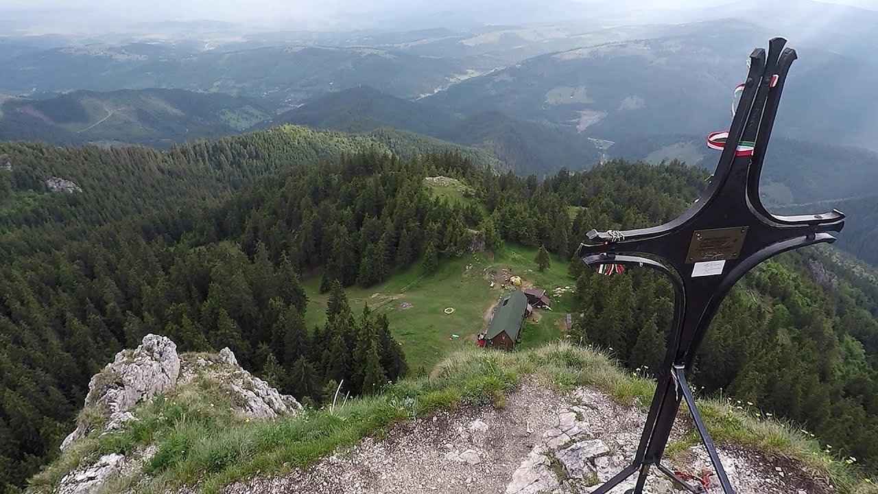
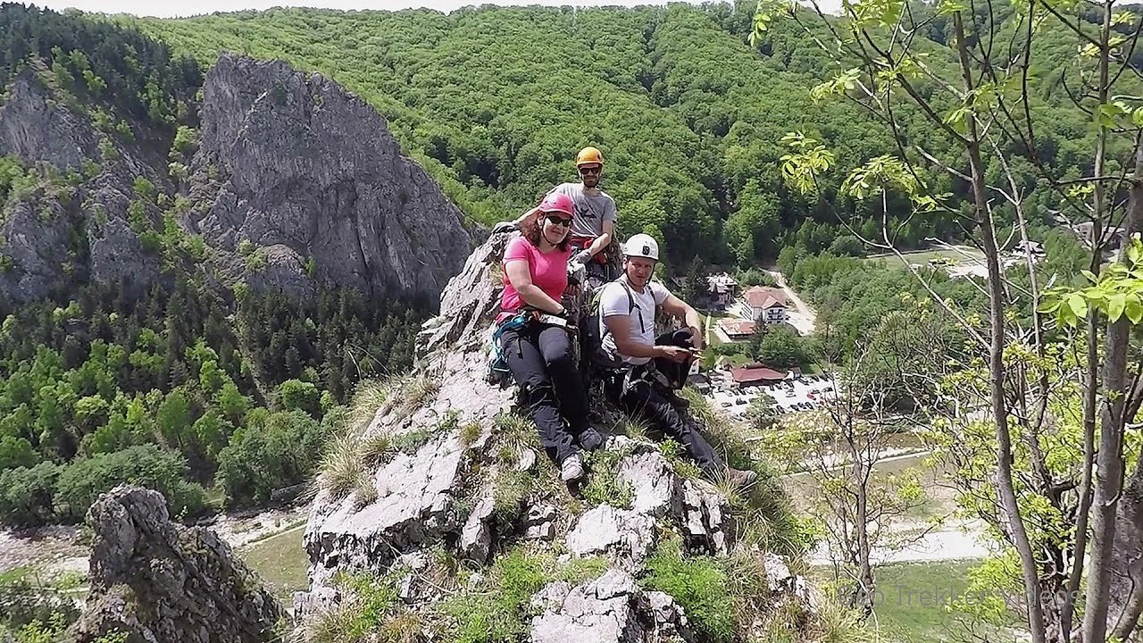
Condra cross - Three rocks peak (24 photos) 6.3 km away. Condra cross - Trei Pietre (Three rocks) peak.

The sources of the river Trotus - Fagetel (10 photos) 10.1 km away. Fagetel, Piposz property, The sources of the river Trotus (Tatros).

Brother Mountain - Hasmas Mountains (15 photos) 18.4 km away. Brother Mountain (Fratele, Ecem, Ecsém) - Hasmas Mountains.

Brother Mountain - Hasmas Mountains (11 photos) 19.3 km away. Brother Mountain (Ecsém-tető, Muntele Fratele, Muntele Ecem) - Hasmas Mountains.


Watchstone and the Lonely Stone in March (18 photos) 20 km away. Watchstone (Stanca La Panda) and the Lonely Stone (Piatra Singuratica) in March.

Lonely Stone - Hasmas Mountains (9 photos) 20 km away. Lonely Stone (Piatra Singuratica) - Hasmas Mountains.

Valley of the Lazarus-creek - Hasmas Mountains (15 photos) 21.4 km away. Valley of the Lazarus-creek (Valea paraului Lazar), Log Slide - Hasmas Mountains.

Lazar peak - Hasmas Mountains (18 photos) 23.1 km away. The pit under the Lazar peak 2004-09-02, 2014-11-27.

Dry Valley canyon - Hasmas Mountains (9 photos) 25 km away. Dry Valley (Paraului Sec) canyon - Hasmas Mountains.

White Glade - Hasmas Mountains (6 photos) 25.1 km away. White Glade (Poiana Alba) - Hasmas Mountains.

Black Hasmas - Hasmas Mountains (27 photos) 25.8 km away. Hasmasul Negru (Black Hasmas) - Hasmas Mountains.

White Glade, Horseshoe Rock (17 photos) 25.8 km away. White Glade (Poiana Alba), Horseshoe Rock (Piatra Potcoavei) - Hasmas Mountains.

Horseshoe Rock - Hasmas Mountains (9 photos) 25.8 km away. Horseshoe Rock (Piatra Potcoavei) - Hasmas Mountains.

Pit cave with three entrances - Hasmas Mountains (3 photos) 27 km away. Pit cave with three entrances (Avenul cu trei intrari) - Hasmas Mountains.

Ruins of the Harom fortress - Jigodin Bath (10 photos) 27.2 km away. The Harom Fortress was built around the beginning of the 12th century and was part of the system of fortifications that protected Transylvania from the east. It is located south of Miercurea Ciuc, east of Harom Peak, which has an altitude of 1079 m, near the southwestern limits of Jigodin Bath (Baile Jigodin).

Sugo Cave - Giurgeu Mountains (60 photos) 27.5 km away. The Sugó Cave is located at the western foot of Sipos Stone (1566 m) at an altitude of 1064 m above sea level. It consists of a system of passages with four levels, totaling 1021 m in length and a level difference of -60 m.


Harghita Bath - Harghita Mountains (15 photos) 29.6 km away. Harghita Bath (Harghita-Bai) - Harghita Mountains.

Beer waterfall - Gosmanu Ridge (12 photos) 33.2 km away. Beer waterfall (Cascada Berea) - Gosmanu Ridge, Tarcau Mountains.

Altar, Handprint Rock - Gosmanu Ridge (17 photos) 37.9 km away. Altar, Handprint Rock (Stanca La deget) - Gosmanu Ridge, Tarcau Mountains.
[ Top ↑ ]
Videos of nearby places
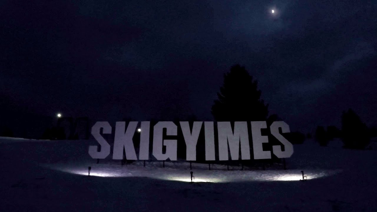
Ski Gyimes ski slope - Lunca de Sus 1.1 km away. The Ski Gyimes ski slope is located in Lunca de Sus, right next to the main road. It is 800 m long, the level difference is 160 m.

SkiGyimes ski slope - Lunca de Sus 1.1 km away. It is well-known that in Rimetea, due to the Piatra Secuiului (Szekler's Rock) mountain, the Sun rises twice. However, perhaps few know that in Lunca de Sus, the Sun sets three times.
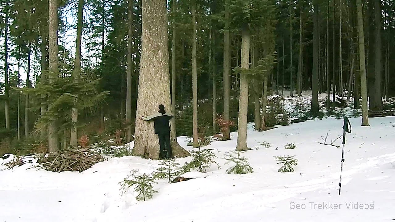
Giant fir trees - Ghimes 15 km away. One of the lesser-known attractions of Ghimes is the two giant-sized common fir trees. They are 42 meters tall, and have diameters of 110 cm and 130 cm at chest height.

Lonely Stone - Hasmas Mountains 20 km away. On June 1, 2003, with a small group of friends, I left Balan, walking along the valley of the Sep (Beautiful) stream towards the Lonely Stone (Piatra Singuratica). Those who were with me at the time fell behind, and then other people joined for the hike.
Other places
Goats Ledge iron path Ramet Gorge 193.4 km away. Via ferrata Goats Ledge (Brana Caprei) iron path - Ramet Gorge, Trascau Mountains.

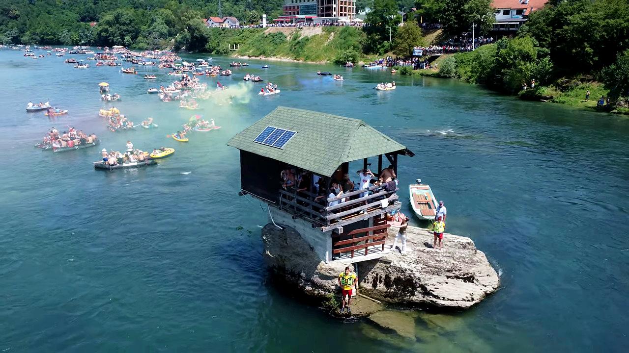
Drina river house Bajina Bašta The house visible on the Drina River (Kućica na Drini) is a unique wooden structure built on a rock in the middle of the river, near Bajina Bašta, Serbia. The house is located on the border between Serbia and Bosnia-Herzegovina, close to the border line between the two countries.

Fairy Cliff via ferrata route Vadu Crisului 267 km away. Fairy Cliff (Peretele Zanelor) via ferrata route - Vadu Crisului. In Vadu Crisului, in the Padurea Craiului Mountains, on the right bank of the Crisul Repede, you can find the newest, in chronological order (2015) the fifth Transylvanian, new type of via ferrata route.
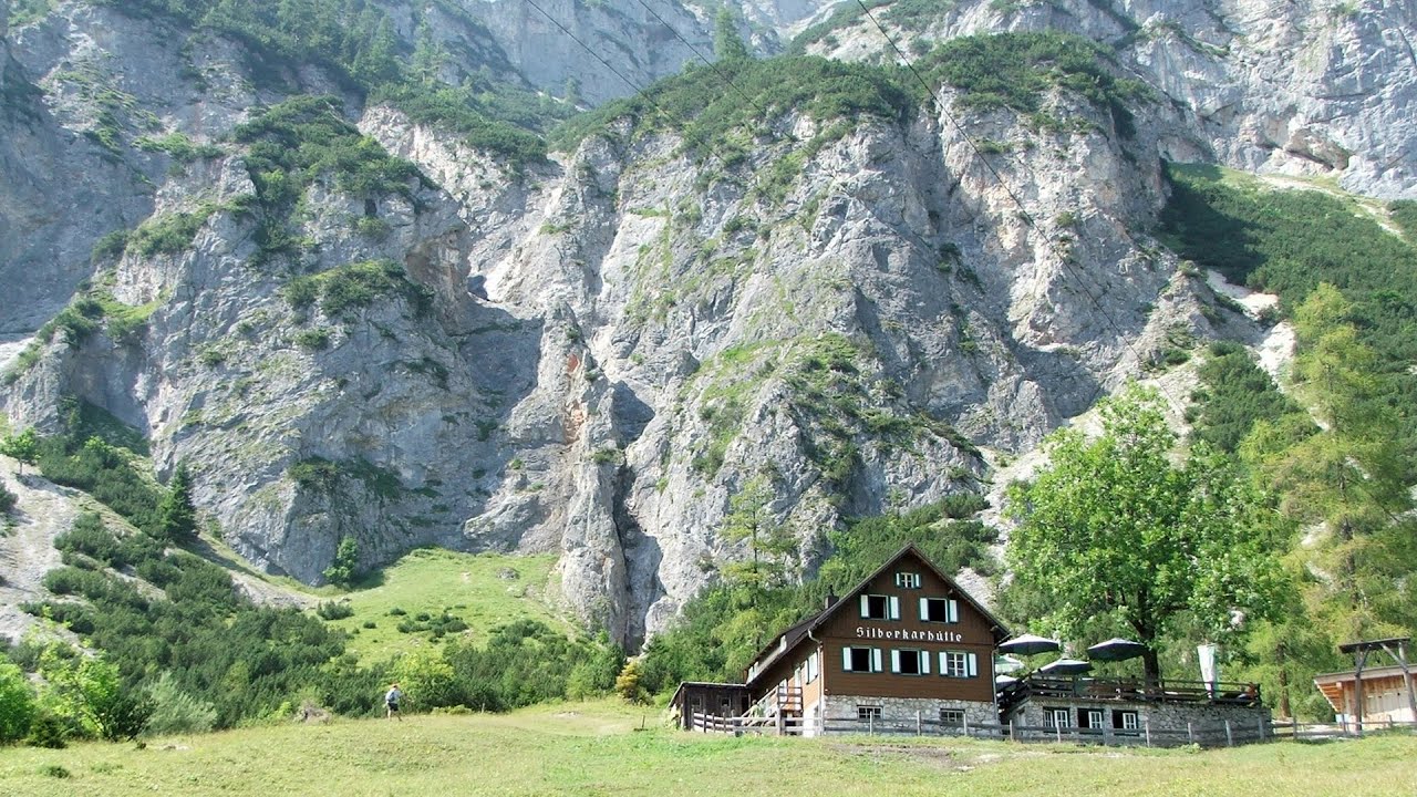
Siega via ferrata Silberkar Gorge, Ramsau am Dachstein The Siega via ferrata, categorized as a C/D level of difficulty, is perhaps the least interesting of the three via ferrata routes in the Silberkar Gorge (Silberkarklamm). This doesn't mean that it's not good, just that the other two are even better.

Acapulcos spur via ferrata 264 km away. Acapulco's spur (Pintenul lui Acapulco) via ferrata (B/C) - Montana Land, Suncuius.
Borov Kamak waterfall Zgorigrad, Vratsa 422.5 km away. The Vratsa eco-trail starts from the village of Zgorigrad, located 6 km from the city of Vratsa in Bulgaria, and ends at the Parshevitza hut. It is also known as the Zgorigradska or Borov Kamak eco-trail.
Iskar gorge Lyutibrod Temnata dupka cave Lakatnik 433.1 km away. The Iskar is the longest purely Bulgarian river, the oldest river in the Balkans, and a right tributary of the Danube. The river is 368 km long, with approximately 150 km consisting of a gorge.
Via Ferrata Pink Panther Baia de Fier 226.2 km away. In the area of Baia de Fier in Gorj County, several via ferrata routes have been set up on the rock above the Women's Cave (Muierii Cave) and on the other side of the road. At that time (2018), there were a total of seven.
[ Top ↑ ]
Copyright © 2003-2026 Trekkingklub and friends. Reproduction of any text, picture or video from this website, either in printed or electronic form, is prohibited without prior written permission. Website made with love  in Miercurea Ciuc.