Tourist attractions near Rachitaua (Batrana, Hunedoara county, Romania)
Photos of nearby places

Natural bridge next to the Banita Stone Quarry (12 photos) 67.5 km away. Although the Banita Stone Bridge is not far from the road that passes through the village, it is located beyond the railway line, so its approach is a bit cumbersome. We can go around the railway line on Carierei Street, and then we have to walk a few meters from the stone quarry.

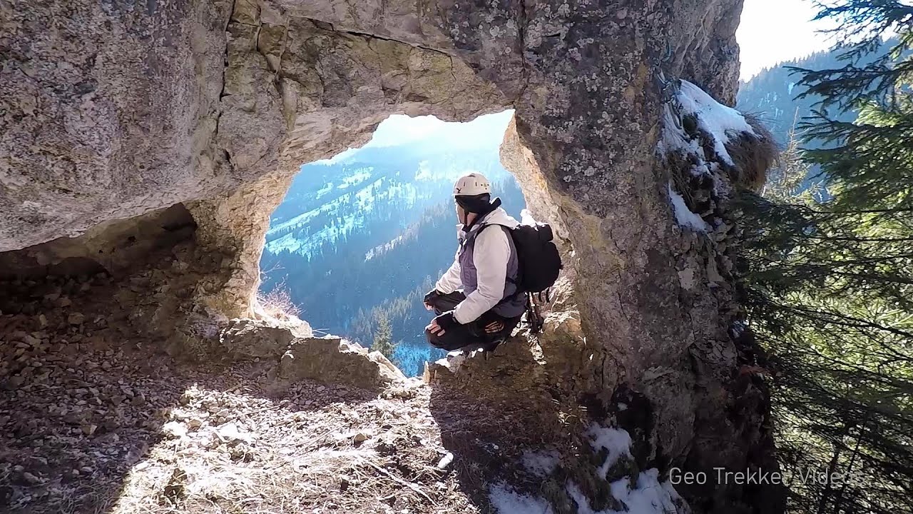
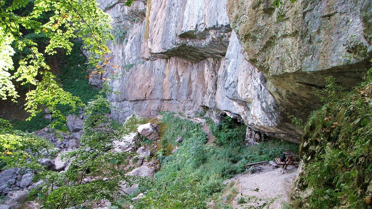
Banita Gorge - Banita (16 photos) 70.3 km away. The approximately 250 m long gorge, similar to the Corcoaia Gorge, is truly spectacular. According to assumptions, it was formed by the collapse of a cave passage ceiling, and then the erosion formed spectacular karst formations in the limestone.

Boli Cave - Banita (20 photos) 70.5 km away. The main cave passage is approximately 460 m long, with an entrance portal that is 10 m high and 20 m wide at its base. In the 1960s, bridges were built over the underground stream flowing through the cave.


Goat Stone - Craiva, Trascau Mountains (18 photos) 82.7 km away. Goat Stone (Piatra Craivii, Piatra Craivei, Apulon) - Craiva, Trascau Mountains.

Stone of Cetea, Horse Pit - Trascau (16 photos) 86.2 km away. Stone of Cetea, Horse Pit (The pit cave from the Stone of Cetea) - Trascau Mountains.

Goats Ledge - Trascau Mountains (10 photos) 86.7 km away. Goats Ledge (Brana Caprei, Kecskék párkánya) - Trascau Mountains .


Dark Blue Bruises of the Ponor - Trascau Mountains (16 photos) 91.8 km away. The Dark Blue Bruises of the Ponor (Vanatarile Ponorului) is a polje-type protected area. Polje is a Slovenian word meaning plain, and it refers to a surface karst form.

Parangul Mare peak (16 photos) 91.9 km away. Chamois saddle (Saua Caprelor), Carja mountain shelter (Refugiul Carja) - Carja peak (Varful Carja) - Stoienita peak (Varful Stoienita) - Gemanarea - Parangul Mare peak.

Dark Blue Bruises of the Ponor, Bedeleu (24 photos) 94.2 km away. Dark Blue Bruises of the Ponor (Vanatarile Ponorului), Bedeleu - Trascau Mountains.


Balcony Clearing - Trascau Mountains (6 photos) 94.9 km away. Balcony Clearing (Erkély-tisztás, Balconul Sipotelor) - Trascau Mountains.

Aries valley - Trascau Mountains (10 photos) 95.9 km away. Aries (Golden) valley - Trascau Mountains.

Szekler Stone North - Trascau Mountains (8 photos) 104.8 km away. Szekler Stone North (Piatra Secuilor Nord) - Trascau Mountains.

Szekler Stone - Trascau Mountains (42 photos) 104.8 km away. Szekler Stone (Székely-kő, Piatra Secuilor) - Trascau Mountains.


Valley of Hell - Padurea Craiului Mountains (23 photos) 111.2 km away. Valley of Hell (Valea Iadului) - Padurea Craiului Mountains.

Kings Cave - Padurea Craiului Mountains (48 photos) 113 km away. Craiului (Kings) Cave - Padurea Craiului Mountains.
[ Top ↑ ]
Videos of nearby places


The palm of God and the Heavens door - Fundatura Ponorului mountain village 54.9 km away. One of the most picturesque places in Romania, one of the most beautiful mountain villages, and a photographer's paradise. Fundatura Ponorului is located in the Ponor Stream Valley, part of the Gradistea Muncelului - Cioclovina National Park, in the Sureanu Mountains.

Billy-goat lake, Closed Gates - Retezat Mountains 56.1 km away. The most unique ridge trail of the Retezat Mountains is the Closed Gates.Below, at an altitude of 2070 m above sea level, is the Billy-goat lake.

Sheepdogs - Govora sheepfold - Retezat mountains 56.4 km away. On the second day of my weekend Retezat hike, I visited a sheepfold on the Lancita Ridge. To my great disappointment, they didn't make cheese or curd here.
Other places
Fox Ears Beach Sinemorets Fox Ears Beach (Plazh Lisichi ushi) - Sinemorets.
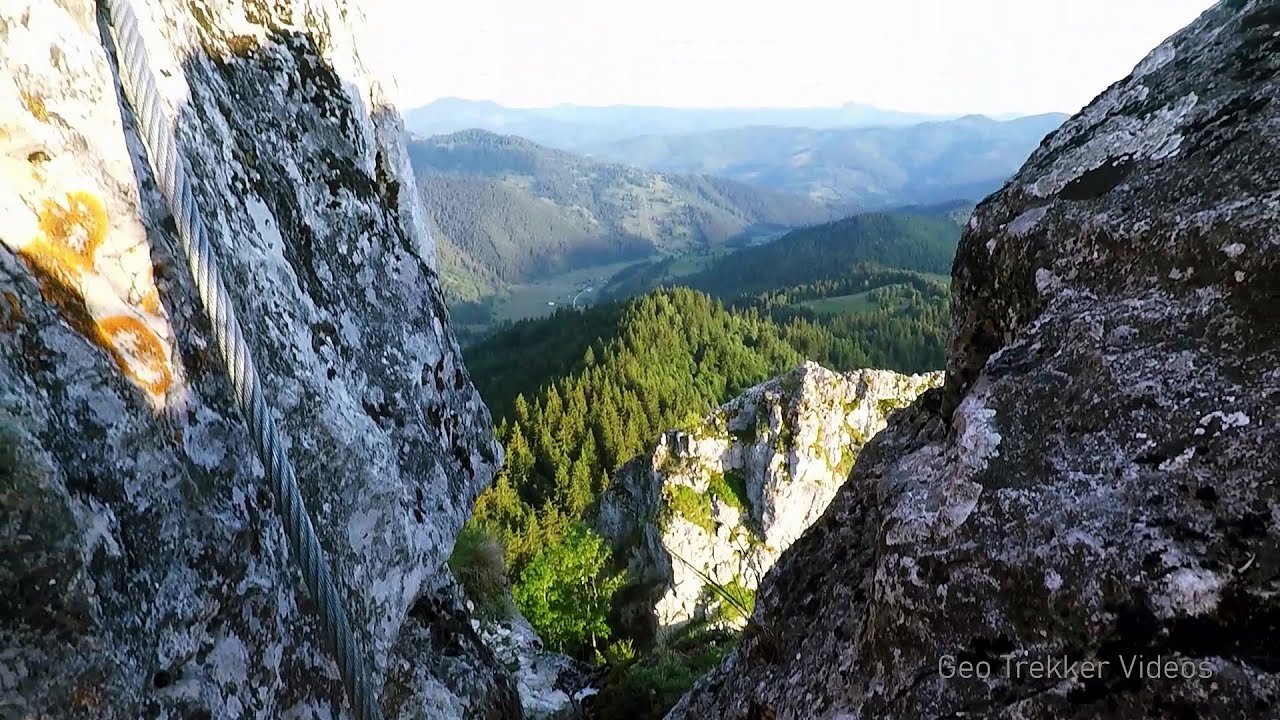
Via ferrata Rio Sallagoni Drena, Italia The surrounding iron climbing routes are located on rock walls exposed to a scorching sun. But the Rio Sallagoni via ferrata goes upwards in a pleasantly cool gorge, above the creek and waterfalls, and eventually reaches the Drena Castle.
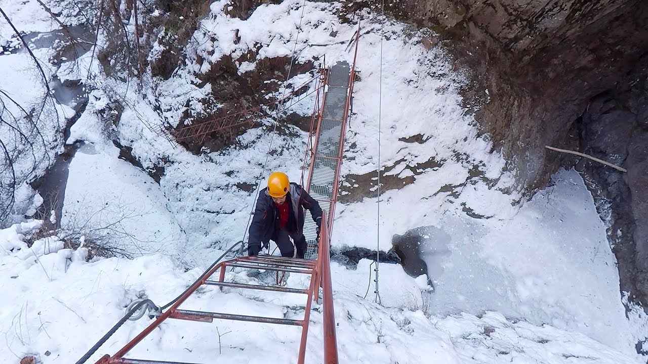
Stan Valley Canyon in winter 165.5 km away. The Stan Valley is a picturesque canyon, even in winter. In fact, when the stream is frozen and covered with a layer of snow, exploring the canyon becomes much quicker and easier.
Wild Ferenc memorial path Suhardul Mic 270.2 km away. In recent days, this news has been everywhere: the via ferrata route built on the southwest wall of Suhardul Mic (Little Suhard) has finally been completed and inaugurated. The new route has been named after Ferenc Wild, in memory of the former mountain rescuer, sports writer, and one of the founders of the mountain rescue association in Gheorgheni.
Falco Peregrinus 2 via ferrata Falcons Rock, Corbu 274.3 km away. Falco Peregrinus (Peregrine falcon) 2 via ferrata (D) - Falcon's Rock, Corbu.

Nobodys lake Miercurea Ciuc 252.8 km away. The passage of time (time lapse), dusk at Nobody's Lake. Miercurea Ciuc and the Sumuleu mountain can be seen in the background.
Falco Peregrinus via ferrata Falcons Rock, Corbu 274.3 km away. Falco Peregrinus (Peregrine falcon) via ferrata (B/C) - Falcon's Rock, Corbu.
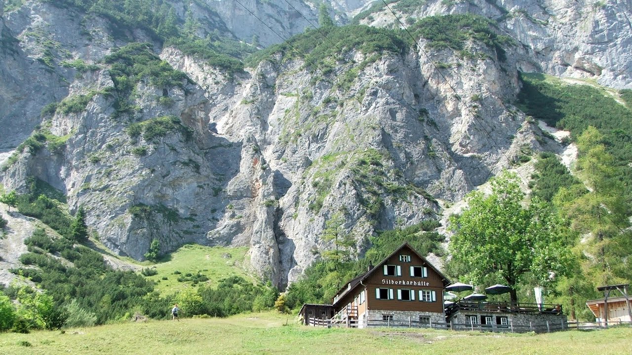
Siega via ferrata Silberkar Gorge, Ramsau am Dachstein The Siega via ferrata, categorized as a C/D level of difficulty, is perhaps the least interesting of the three via ferrata routes in the Silberkar Gorge (Silberkarklamm). This doesn't mean that it's not good, just that the other two are even better.
Borov Kamak waterfall Zgorigrad, Vratsa 305.4 km away. The Vratsa eco-trail starts from the village of Zgorigrad, located 6 km from the city of Vratsa in Bulgaria, and ends at the Parshevitza hut. It is also known as the Zgorigradska or Borov Kamak eco-trail.
Other destinations
Gornjak via ferrata and Kudelinovs fortress Zdrelo 190.3 km away. Difficulty level C/D, total length: 400 m, height difference: 330 m, year of construction: 2019, total length of the route to Kudelinov's fortress: 1100 m. Access to the via ferrata is free.
[ Top ↑ ]
Copyright © 2003-2026 Trekkingklub and friends. Reproduction of any text, picture or video from this website, either in printed or electronic form, is prohibited without prior written permission. Website made with love  in Miercurea Ciuc.