Tourist attractions near Negresti (Malovat, Mehedinti county, Romania)
Photos of nearby places


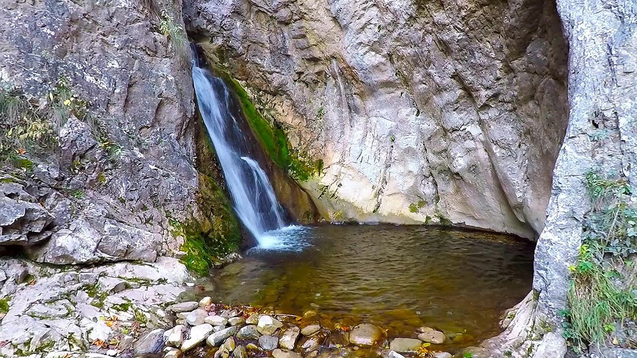
Beusnita waterfall (8 photos) 82 km away. Cascada Beusnita, located in the Caras-Severin county, is one of the most impressive waterfalls in the Anina Mountains. The water falling from a height of approximately 15 m, into a clearing in the middle of the forest, creates a uniquely picturesque landscape.

Natural bridge next to the Banita Stone Quarry (12 photos) 92.9 km away. Although the Banita Stone Bridge is not far from the road that passes through the village, it is located beyond the railway line, so its approach is a bit cumbersome. We can go around the railway line on Carierei Street, and then we have to walk a few meters from the stone quarry.

Parangul Mare peak (16 photos) 94.3 km away. Chamois saddle (Saua Caprelor), Carja mountain shelter (Refugiul Carja) - Carja peak (Varful Carja) - Stoienita peak (Varful Stoienita) - Gemanarea - Parangul Mare peak.

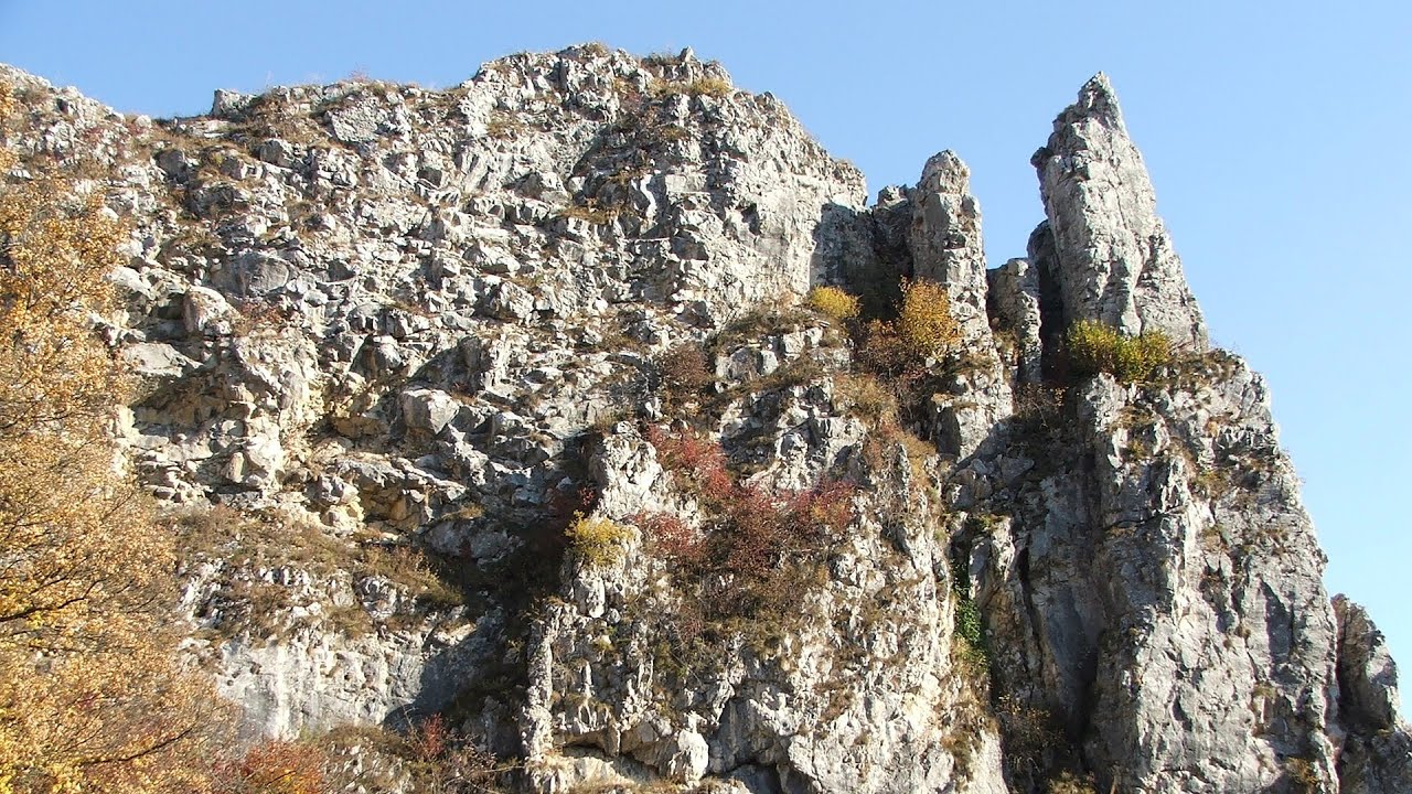
Banita Gorge - Banita (16 photos) 94.9 km away. The approximately 250 m long gorge, similar to the Corcoaia Gorge, is truly spectacular. According to assumptions, it was formed by the collapse of a cave passage ceiling, and then the erosion formed spectacular karst formations in the limestone.

Womens Cave - Parang Mountains (11 photos) 95.2 km away. The Cave of Women (Pestera Muierii, Pestera Muierilor) is located at the southern foot of the Parang Mountains, in the area of Baia de Fier in Gorj County. There are several climbing routes established on the rocks above the cave and on the other side of the road.

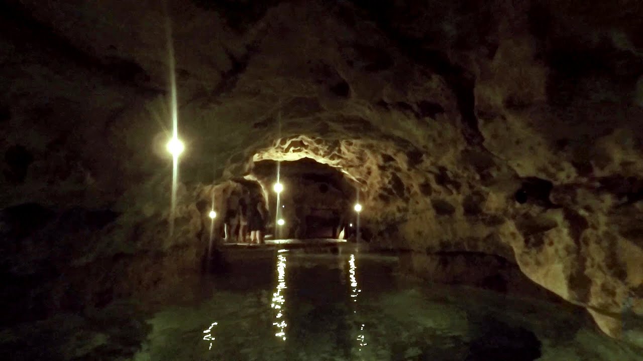
Boli Cave - Banita (20 photos) 95.5 km away. The main cave passage is approximately 460 m long, with an entrance portal that is 10 m high and 20 m wide at its base. In the 1960s, bridges were built over the underground stream flowing through the cave.

Ledge path of the chamois - Cheii Gorge (40 photos) 124.2 km away. Ledge path of the chamois (Brana Caprelor) - Cheii Gorge (Cheile Cheii).

Doabra Snail Shells - Brezoi (12 photos) 137 km away. Doabra Valley - Calinesti-Brezoi forest - Lotru Valley, Cozia National Park

Circular hiking tour in Cozia Mountain (48 photos) 141.4 km away. Arutela - Turnu monastery - Rosiei Rocks - Turneanu ridge - Cozia peak - Stone portal - Stanisoara monastery - Gardului waterfall.

Chamois saddle - Fagaras Mountains (12 photos) 177.1 km away. Chamois saddle (Saua Caprei) - Fagaras Mountains.

Goat Stone - Craiva, Trascau Mountains (18 photos) 178.5 km away. Goat Stone (Piatra Craivii, Piatra Craivei, Apulon) - Craiva, Trascau Mountains.

Stone of Cetea, Horse Pit - Trascau (16 photos) 184.3 km away. Stone of Cetea, Horse Pit (The pit cave from the Stone of Cetea) - Trascau Mountains.

Goats Ledge - Trascau Mountains (10 photos) 187.2 km away. Goats Ledge (Brana Caprei, Kecskék párkánya) - Trascau Mountains .

Dark Blue Bruises of the Ponor - Trascau Mountains (16 photos) 194.9 km away. The Dark Blue Bruises of the Ponor (Vanatarile Ponorului) is a polje-type protected area. Polje is a Slovenian word meaning plain, and it refers to a surface karst form.


Dark Blue Bruises of the Ponor, Bedeleu (24 photos) 197.8 km away. Dark Blue Bruises of the Ponor (Vanatarile Ponorului), Bedeleu - Trascau Mountains.

Balcony Clearing - Trascau Mountains (6 photos) 198.8 km away. Balcony Clearing (Erkély-tisztás, Balconul Sipotelor) - Trascau Mountains.


Aries valley - Trascau Mountains (10 photos) 199.8 km away. Aries (Golden) valley - Trascau Mountains.

Szekler Stone North - Trascau Mountains (8 photos) 205.8 km away. Szekler Stone North (Piatra Secuilor Nord) - Trascau Mountains.

Szekler Stone - Trascau Mountains (42 photos) 205.8 km away. Szekler Stone (Székely-kő, Piatra Secuilor) - Trascau Mountains.
[ Top ↑ ]
Videos of nearby places

Mill of the Devils - Tasna Gorge 38 km away. Mill of the Devils (Moara Dracilor) - Tasna Gorge (Cheile Tasnei). The Tasna Gorges are located in the Mehedinti Mountains, approximately 15 km from the resort of Baile Herculane.

The Wooden Ladders - The villages of Scarisoara and Inelet, Cerna valley 41.3 km away. Scarisoara and Inelet are small, isolated villages located in the mountainous region of Banat. They are situated on the right bank of the Cerna River, approximately 19 km away from the Baile Herculane resort.

Blasted Rock hanging path - Cerna Valley 41.5 km away. The Blasted Rock (Piatra Puscata) hanging path is located on the geographical right bank of the Cerna River, near the confluence of the Iuta stream, approximately 20 km from Baile Herculane. In this area, the presence of limestone formations has caused the valley to become narrower.

Corcoaia Gorge - Gorj county 50.5 km away. The Corcoaia Gorge is one of the most beautiful tourist attractions in the Cerna Valley. It can be reached by car, 43 km away from Baile Herculane, of which about 17 km is on a dusty gravel road.

Rudariei watermills - Eftimie Murgu 57.5 km away. I have visited the twenty-two wooden water mills with horizontal wheels, located in the valley of the Rudaria stream, mostly in the rain and under an umbrella. Some of them are still in use today.
Other places
Roman Baths Cetea, Trascau Mountains 184.3 km away. Roman Baths (Baile Romane) - Cetea, Trascau Mountains. Among the valleys of the Trascau Mountains, the Cetea Gorge best deserves the name of a crevice valley.

Acapulcos spur via ferrata 251.4 km away. Acapulco's spur (Pintenul lui Acapulco) via ferrata (B/C) - Montana Land, Suncuius.
Tapolca lake cave Balaton-felvidéki National Park 480.6 km away. The Tapolca lake cave is situated in the Balaton-felvidéki National Park. A modern visitor center has been constructed at its entrance, featuring ten rooms that highlight the unique characteristics of karst regions.
Via ferrata Dachstein Gams Krippenstein, Obertraun am Hallstättersee The Dachstein Gams is a new via ferrata route on Krippenstein. It has three parts: Himmeleck (A/B), Gams (C), and Nordwand (E).

Kossuth Rock Harghita Bath 293.3 km away. Kossuth Rock - Harghita Bath (Harghita-Bai), Harghita Mountains.

Preachers Rock Bodoc Mountains 284.8 km away. In the Bodoc Mountains, west-southwest from the Henter peak, we find a rock formation shaped like a mushroom by erosion, called Preacher's Rock. This 2-meter high rock probably got its name from the pagan Hungarian priests, who preached here in the past.
Roman bridge Nenkovo 382.9 km away. Along the Borovitsa River, near the village of Nenkovo, there is a Roman Bridge. It connects the two banks of the Borovitsa River.
Other destinations
Gornjak via ferrata and Kudelinovs fortress Zdrelo 109.5 km away. Difficulty level C/D, total length: 400 m, height difference: 330 m, year of construction: 2019, total length of the route to Kudelinov's fortress: 1100 m. Access to the via ferrata is free.
Lipovac via ferrata and monastery of Saint Stephen 145.6 km away. Difficulty level B, total length: 190 m, height difference: 90 m, year of construction: 2022. It is necessary to contact the PSK Brđanka club to obtain the key for the ladders at the entrance of the via ferrata.
[ Top ↑ ]
Copyright © 2003-2026 Trekkingklub and friends. Reproduction of any text, picture or video from this website, either in printed or electronic form, is prohibited without prior written permission. Website made with love  in Miercurea Ciuc.